Walnut Creek (California)
| Walnut Creek | |
|---|---|
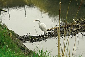 Secondary beaver dam on lower Walnut Creek provides happy hunting perch for a great egret. Courtesy Cheryl Reynolds, Worth a Dam, 2013 | |
 Location of the mouth of Walnut Creek in California | |
| Location | |
| Country | United States |
| State | California |
| Region | Contra Costa County |
| Cities | Walnut Creek, Pleasant Hill, Four Corners, Concord, Pacheco, Vine Hill, Mococo, Martinez |
| Physical characteristics | |
| Source | Confluence of Las Trampas and Tice Creeks |
| • location | Walnut Creek, California 375338N 1220335W |
| • coordinates | 37°53′38″N 122°3′35″W / 37.89389°N 122.05972°W[2] |
| • elevation | 144 ft (44 m) |
| Mouth | Suisun Bay |
• location | Martinez, California |
• coordinates | 38°1′27″N 122°4′13″W / 38.02417°N 122.07028°WCoordinates: 38°1′27″N 122°4′13″W / 38.02417°N 122.07028°W[2] |
• elevation | 2 ft (0.61 m) |
| Basin size | 146 sq mi (380 km2) |

The Walnut Creek mainstem is a 12.3-mile-long (19.8 km)[3] northward-flowing stream in northern California. The Walnut Creek watershed lies in central Contra Costa County, California and drains the west side of Mount Diablo and the east side of the East Bay Hills.[4] The Walnut Creek mainstem is now mostly a concrete or earthen flood control channel until it reaches Pacheco Creek[5] on its way to Suisun Bay. Walnut Creek was named for the abundant native Northern California walnut trees (Juglans hindsii) which lined its banks historically. The city of Walnut Creek, California was named for the creek when its post office was established in the 1860s.[1]
History[]
There are three bands of Bay Miwok Native Americans associated with early Walnut Creek, the stream for which the city of Walnut Creek is named:[6][7] the Saclan, whose territory extended through the hills east of present-day Oakland, Rossmoor, Lafayette, Moraga and Walnut Creek; the Volvon (also spelled Bolbon, Wolwon and Zuicun) near Mt. Diablo; and the Tactan located on the San Ramon Creek in Danville and Walnut Creek.
Today's Walnut Creek is located within the earlier site of four Mexican land grants. One of these land grants – measuring 18,000 acres (73 km2) – belonged to Juana Sanchez de Pacheco, who eventually passed the land down to her two grandsons. Ygnacio Sibrian, one of the grandsons, created the first roofed home in the valley in about 1850. The grant was called Rancho Arroyo de Las Nueces y Bolbones, named after the principal waterway, Arroyo de Las Nueces (Walnut Creek), as well as for the local group of indigenous Americans (Bolbones). The Arroyo de Las Nueces or Arroyo de Los Nogales referred to the plentiful Northern California walnut trees on its banks.
The first town settler was William Slusher, who built a dwelling on the bank of Walnut Creek, which was called "Nuts Creek" by the Americans in 1849.[8]
Watershed and course[]
The Walnut Creek watershed basin is 146 square miles (380 km2) and consists of five sub-watersheds: the Clayton Valley Drain, Pine Creek Watershed, San Ramon Creek Watershed, Las Trampas Creek Watershed, and Grayson Creek Watershed.[9] While the mainstem Walnut Creek flows through densely urbanized areas, the upper watersheds of its tributaries generally remain undeveloped open space. Las Trampas Creek drains 27 square miles (70 km2) of Lafayette, Orinda, Moraga, and unincorporated lands in the western Walnut Creek watershed. Lafayette Creek emerges from Lafayette Reservoir to join Las Trampas Creek in Lafayette. Tice Creek joins Las Trampas Creek from the right (heading downstream) to form the Walnut Creek mainstem. Next, San Ramon Creek joins the mainstem Walnut Creek underground near the intersection of Mount Diablo Boulevard and Broadway. The San Ramon Creek subwatershed begins at the northern border of the city of San Ramon's border with Danville and flows northwards through the San Ramon Valley. San Ramon Creek begins as Bollinger Creek, which drains the Las Trampas Regional Wilderness. After becoming San Ramon Creek, the two main tributaries of the 54 square miles (140 km2) San Ramon watershed are Green Valley Creek and Sycamore Creek, which drain the western slopes of Mount Diablo. The next tributary to the Walnut Creek mainstem is Pine Creek, which at 31 square miles (80 km2) is the second largest subwatershed in the basin. Pine Creek drains the west slopes of flows through Mount Diablo State Park, Diablo Foothills Regional Park, and Castle Rock Regional Recreational Area. It is joined by Galindo Creek downstream of Monument Boulevard in Concord, before it joins Walnut Creek. The 9 square miles (23 km2) Clayton Drain drains urbanized Concord through the Clayton Valley. It used to receive flows from Mount Diablo Creek before the latter was diverted into Seal Creek along the east side of the valley The drain enters the Walnut Creek channel just upstream of Highway 4. Lastly, Grayson Creek drains the eastern flank of the Briones Hills and its 23 square miles (60 km2) subwatershed includes Murderer’s Creek and Hidden Valley Creek. It joins Walnut Creek from the left just downstream of Highway 4. Shortly thereafter, Walnut Creek ends as it joins Pacheco Creek[5] from the right (heading downstream). From that confluence, Pacheco Creek flows north 4 miles (6.4 km) through the Concord Marsh into Suisun Bay.[9]
Ecology[]
Walnut Creek is one of the few San Francisco Bay Area coastal watersheds that has extant Chinook salmon (Oncorhynchus tshawytscha) spawning and rearing, in its lower watershed.[10] This is consistent with archeological records of both Chinook and coho salmon (Oncorhynchus kisutch) at CCO-309, a site dating to 1400-1500 C.E. about 20 kilometres (12 mi) upstream from Suisun Bay in the Tice Creek Valley in the Walnut Creek watershed.[11][12]
See also[]
- List of rivers in California
- List of watercourses in the San Francisco Bay Area
References[]
- ^ a b c Gudde, Erwin G. (1949). California Place Names: A Geographical Dictionary. Berkeley, California: University of California Press.
- ^ a b U.S. Geological Survey Geographic Names Information System: Walnut Creek
- ^ U.S. Geological Survey. National Hydrography Dataset high-resolution flowline data. The National Map, accessed October 20, 2020
- ^ Contra Costa Watershed Forum (November 1, 2003). Contra Costa County Watershed Atlas (PDF) (Report). Martinez, California: Contra Costa County Community Development Department. Retrieved October 29, 2020.CS1 maint: uses authors parameter (link)
- ^ a b U.S. Geological Survey Geographic Names Information System: Pacheco Creek
- ^ Forester, Maria (2006). The Bay Miwok of Contra Costa County (Report). Retrieved October 20, 2020.
- ^ Randall Milliken, Laurence H. Shoup, and Beverly R. Ortiz (June 1, 2009). Ohlone/Costanoan Indians of the San Francisco Peninsula and their Neighbors, Yesterday and Today (PDF) (Report). Golden Gate National Recreation Area, San Francisco, California: National Park Service. Retrieved October 20, 2020.CS1 maint: uses authors parameter (link)
- ^ History of Contra Costa County, California. Contra Costa County, California: Brooks-Sterling Company. 1882. p. 444.
- ^ a b Restoration Design Group, Rich Walkling (February 1, 2013). Walnut Creek Watershed Inventory (PDF) (Report). Walnut Creek Watershed Council. Retrieved October 20, 2020.CS1 maint: uses authors parameter (link)
- ^ Leidy, Robert A. (2007). Ecology, Assemblage Structure, Distribution, and Status of Fishes in Streams Tributary to the San Francisco Estuary, California, SFEI Contribution No. 530 (Report). San Francisco Estuary Institute. p. 194.
- ^ Kenneth W. Gobalet (1992). "Inland Utilization of Marine Fishes by Native Americans along the Central California Coast". Journal of California and Great Basin Anthropology. 14 (1): 72–84. Retrieved October 21, 2020.
- ^ Kenneth W. Gobalet, Peter D. Schulz, Thomas A. Wake, Nelson Siefkin (2004). "Archaeological Perspectives on Native American Fisheries of California, with Emphasis on Steelhead and Salmon". Transactions of the American Fisheries Society. 133: 801–833.CS1 maint: uses authors parameter (link)
See also[]
- Walnut Creek Watershed page, by the Contra Costa County Resource Conservation District
- Walnut Creek Watershed Council
- Contra Costa County Watershed Forum main page

- Rivers of the San Francisco Bay Area
- Rivers of Contra Costa County, California