Washington, Kansas
Washington, Kansas | |
|---|---|
City and County seat | |
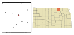 Location within Washington County and Kansas | |
 | |
| Coordinates: 39°49′1″N 97°3′9″W / 39.81694°N 97.05250°WCoordinates: 39°49′1″N 97°3′9″W / 39.81694°N 97.05250°W | |
| Country | United States |
| State | Kansas |
| County | Washington |
| Founded | 1860 |
| Incorporated | 1875 |
| Named for | George Washington |
| Area | |
| • Total | 1.01 sq mi (2.62 km2) |
| • Land | 0.97 sq mi (2.52 km2) |
| • Water | 0.04 sq mi (0.10 km2) |
| Elevation | 1,325 ft (404 m) |
| Population | |
| • Total | 1,131 |
| • Estimate (2019)[3] | 1,060 |
| • Density | 1,089.41/sq mi (420.58/km2) |
| Time zone | UTC-6 (CST) |
| • Summer (DST) | UTC-5 (CDT) |
| ZIP code | 66968 |
| Area code | 785 |
| FIPS code | 20-75825 [4] |
| GNIS ID | 472880 [5] |
| Website | washingtonks.net |

Washington is a city in, and the county seat of, Washington County, Kansas, United States.[6] As of the 2010 census, the city population was 1,131.[7]
History[]
Washington was established in spring 1860, and in the same year named county seat.[8] Until the end of the American Civil War it was protected by two stockaded buildings, the Washington Company House and Woolbert's Stockade Hotel.[9][10]
The first post office in Washington was established in November 1861.[11]
Geography[]
Washington is 39°N 97°W / 39°N 97°W (39.816877, -97.052503).[12] According to the United States Census Bureau, the city has a total area of 0.91 square miles (2.36 km2), of which 0.87 square miles (2.25 km2) is land and 0.04 square miles (0.10 km2) is water.[13]
Demographics[]
| Historical population | |||
|---|---|---|---|
| Census | Pop. | %± | |
| 1880 | 675 | — | |
| 1890 | 1,613 | 139.0% | |
| 1900 | 1,575 | −2.4% | |
| 1910 | 1,547 | −1.8% | |
| 1920 | 1,406 | −9.1% | |
| 1930 | 1,370 | −2.6% | |
| 1940 | 1,598 | 16.6% | |
| 1950 | 1,527 | −4.4% | |
| 1960 | 1,506 | −1.4% | |
| 1970 | 1,584 | 5.2% | |
| 1980 | 1,488 | −6.1% | |
| 1990 | 1,304 | −12.4% | |
| 2000 | 1,223 | −6.2% | |
| 2010 | 1,131 | −7.5% | |
| 2019 (est.) | 1,060 | [3] | −6.3% |
| U.S. Decennial Census | |||
2010 census[]
As of the census[2] of 2010, there were 1,131 people, 512 households, and 311 families living in the city. The population density was 1,300.0 inhabitants per square mile (501.9/km2). There were 582 housing units at an average density of 669.0 per square mile (258.3/km2). The racial makeup of the city was 97.8% White, 0.3% African American, 0.1% Native American, 0.2% Asian, 0.4% from other races, and 1.2% from two or more races. Hispanic or Latino of any race were 2.3% of the population.
There were 512 households, of which 26.0% had children under the age of 18 living with them, 52.3% were married couples living together, 6.1% had a female householder with no husband present, 2.3% had a male householder with no wife present, and 39.3% were non-families. 36.7% of all households were made up of individuals, and 18.9% had someone living alone who was 65 years of age or older. The average household size was 2.13 and the average family size was 2.76.
The median age in the city was 46.8 years. 21.8% of residents were under the age of 18; 4.7% were between the ages of 18 and 24; 20.9% were from 25 to 44; 26.7% were from 45 to 64; and 25.9% were 65 years of age or older. The gender makeup of the city was 47.1% male and 52.9% female.
2000 census[]
As of the census[4] of 2000, there were 1,223 people, 553 households, and 331 families living in the city. The population density was 1,395.3 people per square mile (536.6/km2). There were 644 housing units at an average density of 734.7 per square mile (282.6/km2). The racial makeup of the city was 98.94% White, 0.08% African American, 0.25% Native American, 0.25% from other races, and 0.49% from two or more races. Hispanic or Latino of any race were 0.57% of the population.
There were 553 households, out of which 24.1% had children under the age of 18 living with them, 51.9% were married couples living together, 5.2% had a female householder with no husband present, and 40.1% were non-families. 37.1% of all households were made up of individuals, and 19.7% had someone living alone who was 65 years of age or older. The average household size was 2.13 and the average family size was 2.81.
In the city, the population was spread out, with 21.1% under the age of 18, 4.9% from 18 to 24, 23.1% from 25 to 44, 23.0% from 45 to 64, and 28.0% who were 65 years of age or older. The median age was 46 years. For every 100 females, there were 89.0 males. For every 100 females age 18 and over, there were 84.9 males.
The median income for a household in the city was $30,529, and the median income for a family was $37,448. Males had a median income of $27,171 versus $17,938 for females. The per capita income for the city was $15,760. About 8.6% of families and 10.5% of the population were below the poverty line, including 13.1% of those under age 18 and 15.5% of those age 65 or over.
Education[]
The community is served by Washington County USD 108 public school district,[14] which formed in 2006 by the consolidation of North Central USD 221 and Washington USD 222.[15]
Notable people[]
- Charlie Becker, actor
- Bill Pannbacker, former member of the Kansas House of Representatives
See also[]
References[]
- ^ "2019 U.S. Gazetteer Files". United States Census Bureau. Retrieved July 24, 2020.
- ^ Jump up to: a b "U.S. Census website". United States Census Bureau. Retrieved 2012-07-06.
- ^ Jump up to: a b "Population and Housing Unit Estimates". United States Census Bureau. May 24, 2020. Retrieved May 27, 2020.
- ^ Jump up to: a b "U.S. Census website". United States Census Bureau. Retrieved 2008-01-31.
- ^ "US Board on Geographic Names". United States Geological Survey. 2007-10-25. Retrieved 2008-01-31.
- ^ "Find a County". National Association of Counties. Retrieved 2011-06-07.
- ^ "2010 City Population and Housing Occupancy Status". U.S. Census Bureau. Retrieved March 27, 2011.[dead link]
- ^ Blackmar, Frank Wilson (1912). Kansas: A Cyclopedia of State History, Volume 2. Standard Publishing Company. pp. 890.
- ^ Historical Plat Book of Washington County, Kansas (Chicago: J. S. Bird, 1882),p. 30.
- ^ "Washington County History," Washington County Register, July 12, 1935, Sec. 2, p. 6.
- ^ "Kansas Post Offices, 1828-1961, page 2". Kansas Historical Society. Archived from the original on October 9, 2013. Retrieved 27 June 2014.
- ^ "US Gazetteer files: 2010, 2000, and 1990". United States Census Bureau. 2011-02-12. Retrieved 2011-04-23.
- ^ "US Gazetteer files 2010". United States Census Bureau. Archived from the original on 2012-01-25. Retrieved 2012-07-06.
- ^ "USD 108 Map" (PDF). Kansas Department of Transportation. Retrieved 2020-04-29.
- ^ "School consolidations in Kansas for past decade". The Topeka Capital-Journal. 2011-07-24. Retrieved 2020-04-26.
Further reading[]
External links[]
| Wikimedia Commons has media related to Washington, Kansas. |
| hide Municipalities and communities of Washington County, Kansas, United States | ||
|---|---|---|
| Cities |  | |
| Unincorporated communities | ||
| Ghost towns | ||
| Footnotes | ‡This populated place also has portions in an adjacent county or counties | |
| ||
| Authority control |
|
|---|
- Cities in Washington County, Kansas
- Cities in Kansas
- County seats in Kansas
- 1860 establishments in Kansas Territory