Watsonville, California
Watsonville, California | |
|---|---|
City in California | |
| City of Watsonville[1] | |
 Downtown Watsonville in 2000 | |
 Flag  Seal | |
| Motto(s): "Opportunity through diversity; unity through cooperation!" | |
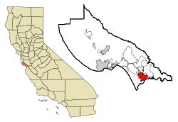 Location in Santa Cruz County and the state of California | |
 Watsonville, California Location in the United States | |
| Coordinates: 36°55′12″N 121°45′49″W / 36.92000°N 121.76361°WCoordinates: 36°55′12″N 121°45′49″W / 36.92000°N 121.76361°W | |
| Country | United States |
| State | California |
| County | Santa Cruz |
| Incorporated | March 30, 1868[2] |
| Government | |
| • Type | Council–manager[1] |
| Area | |
| • Total | 6.80 sq mi (17.62 km2) |
| • Land | 6.71 sq mi (17.37 km2) |
| • Water | 0.10 sq mi (0.25 km2) 1.42% |
| Elevation | 29 ft (9 m) |
| Population | |
| • Total | 51,199 |
| • Estimate (2019)[6] | 53,856 |
| • Density | 8,029.82/sq mi (3,100.33/km2) |
| Time zone | UTC-8 (Pacific) |
| • Summer (DST) | UTC-7 (PDT) |
| ZIP codes[7] | 95076, 95077 |
| Area code | 831[4] |
| FIPS code | 06-83668 |
| GNIS feature IDs | 1660138, 2412194 |
| Website | cityofwatsonville |

Watsonville is a city in Santa Cruz County, California, United States. The population was 51,199 according to the 2010 census.[8]
The Pajaro Valley, where Watsonville is located, has a climate that is around 60 to 70 °F (16 to 21 °C) throughout much of the year. This climate makes Watsonville an attractive coastal environment for the neighboring inland communities with very hot summers. The Pajaro Valley Unified School District has an attendance of about 18,000 students kindergarten through 12th grades. Predominantly Latino and Democratic, Watsonville is a self-designated sanctuary city.[9] Located on the central coast of California, the economy centers predominantly around farming and food processing.
History[]
Watsonville's land was first inhabited by an Indian tribe called the Costanoans. This tribe settled along the Pajaro Dunes since the land was fertile and useful for the cultivation of their plants and animals. In 1769, the Portolá expedition - first European explorers of the area - came to the area from the south, where soldiers described a big bird they saw near a large river. The story survived in the river's name, Rio del Pajaro (River of the Bird). The Pajaro River today forms a boundary of the city, and also divides Santa Cruz County from Monterey County.
The Portolá expedition continued through the area on its way north, camping at one of the lakes north of town for five nights, on October 10–14, 1769. Many of the expedition soldiers were suffering from scurvy, so progress was slow. While the sick recuperated, scouts led by Sergeant Ortega went ahead to find the best way forward. On the fifth day, Franciscan missionary Juan Crespi, traveling with the expedition, noted in his diary that, "This afternoon the explorers returned. The sergeant reported that he had gone ahead twelve leagues without getting any information of the harbor that we are looking for, and that he went to the foot of a high, white mountain range."[10]
During the October 10 march, the explorers first saw the Coast redwood tree (Spanish: palo colorado). A bronze plaque at Pinto Lake (now a city park) commemorates the event.[11] On October 15, the expedition continued to the northwest past today's community of Freedom, camping that night at Corralitos Lagoon.
The area became part of the Spanish colonial province of Las Californias, and in 1804 the northern part was split off to form Alta California. The area's pasture lands were assigned to the Spanish mission to the south, in Carmel. When Mexico gained independence, it took possession of Alta California. The Spanish missions were secularized in the 1830s, and the future Watsonville area became Rancho Bolsa del Pajaro, a land grant made to Sebastian Rodríguez in 1837. Under Mexico's more liberal land-ownership laws, immigration to the area from Europe and the United States increased.
In 1846–48, the Mexican-American War resulted in the cession of California from Mexico to the United States. In 1848, the California Gold Rush greatly accelerated immigration to California. Judge John H. Watson and D. S. Gregory laid out the town in 1852. The community was incorporated as the Town of Watsonville on or about March 30, 1868 and named after Judge Watson. The town became the City of Watsonville about 1889. The voters adopted a charter in 1903.[12]
The Watsonville Railway and Navigation Company operated an interurban railway to Port Watsonville on Monterey Bay where it connected with an overnight produce packet boat to San Francisco from 1904 to 1913.[13]
Economy[]

The main industries in Watsonville are construction, agriculture and manufacturing. Some of the largest companies headquartered in Watsonville are , Driscoll's, Martinelli's, Fox Racing Shox, Nordic Naturals, Graniterock, Granite Construction, West Marine, California Giant, A&I Transport Inc. and Orion Telescopes & Binoculars.[14]
Watsonville is known for the production of crops and goods in the agricultural business along the Northern Pacific Coast. The city's economy is dependent on its agro-business market and in the distribution of crops to different parts of the world. The crops that are fundamental to the economy include: strawberries, cauliflower, broccoli, lettuce, natural plants, and raspberries. Companies such as Driscoll's and California Giant spend around $280 million every year in the processing and transportation of fresh food to most cities in the area, such as San Jose, California, Castroville, California, and Santa Cruz, California where the numbers of these fruits and vegetables are insufficient for the demand of the people. The large investments by big corporations in the city and the labor force, which accounts for 75% of Latino workers, have helped the city to become ranked amongst the top most important farming cities in the United States for its agro-business market. Besides relying mainly on farming goods and practices, the economy also relies on other small private owned businesses in the city because of different industries such as: industries in the fields of electronics, service firms, non-agricultural stores, and other private owned restaurant in the area that contribute to the economy every year. The dominant industries that benefit the economy correspond to the labor forces in the field of construction, farming and manufacturing that account for the majority of the contribution to the labor force and stability of the community in the city.[15]
Top employers[]
According to the City of Watsonville's 2019 Comprehensive Annual Financial Report,[16] the top employers in the city are:
| # | Employer | # of Employees |
|---|---|---|
| 1 | Pajaro Valley Unified School District | 4,108 |
| 2 | Monterey Mushrooms Inc. | 870 |
| 3 | Watsonville Community Hospital | 591 |
| 4 | Granite Construction | 557 |
| 5 | Lakeside Organic Gardens LLC | 450 |
| 6 | City of Watsonville | 427 |
| 7 | Salud Para La Gente | 422 |
| 8 | S Martinelli & Co. | 290 |
| 9 | Fox Factory | 265 |
| 10 | West Marine Products | 247 |
Workforce[]
During Spanish and Mexican times, the Pajaro Valley was at first used as pastureland for the Carmel mission, then was divided up into several large ranchos, mainly raising cattle. In the middle 1800s, American, British, Irish and German immigrants began farming alongside the Californios. Later in that century and into the 1900s, new immigrant workers from China, Japan, Italy, Portugal, the Philippines, and Mexico accounted for the majority of the work force in the city. The new immigrants were important to the growth of the city because the fertile land needed personnel to perform jobs in the industries of farming and construction. These immigrants were able to shape the economy of the city through their labor and settlement in the city. They created more job openings as well as a market for new private owned businesses where these laborers had the opportunity to buy goods and other needed services. Large companies then turned their interest to the city because of the large number of workers and production of crops that could be achieved in a short period of time. When these agricultural companies settled along the boundaries of the city, they created more jobs increasing the population of the city. The market of agriculture served as the main foundation of the city because it was the industry that needed the most workers, this allowed for the creation of a larger market of agriculture where companies could transport large number of crops from city to city and even to different parts of the world. The city is ranked as the 21st largest city in the country with the most Latino workers that account for 75% of the total population in the city.[17]
In 1985, cannery workers in Watsonville went on strike for 18 months to protest a decrease in their wages and benefits. In the end, they won a new contract. The movement was led by primarily Latina Women, and was noted as a historic labor rights win for the Mexicano/Chicano community.[18]
Santa Cruz County and Monterey County work together to provide training for workers in new job skills that are needed in the industries of farming and construction in the city. Colleges in the area such as California State University, Monterey Bay, University of California, Santa Cruz, and Cabrillo College are important for shaping the training of new workers, these colleges have links with companies that expose students and workers to the real labor force. Since these close links exists between schools and labor companies in the city, the economy is able to create new jobs that stabilize the income and output of the community. The agricultural business is dependent on the contribution of college students and workers with their skills gathered through the training programs at institutions in Santa Cruz County and Monterey County. College students along with expert workers have created new ways of growing and processing food that are useful for the economy and the population of the city. The workforce has changed since the 20th century because companies have created new programs in the heart of the city that better prepare workers with the skills that are requires to perform different jobs in the city. These skills include basic sections in the usage of computers systems, Internet, and other programs that are needed by companies related to jobs in the farming, manufacturing, and construction industries. These programs also include job recruitment, job subsidies, and retention services that are important for the economy and the community.[15]
According to the California Employment Department,[19] the industry of employment in the Santa Cruz County consists of:
| Labor Industry | Percent as of March 2010 |
|---|---|
| Total all Industries | 90.8 |
| Total Farm | 4.5 |
| Total Non Farm | 86.3 |
| Goods Producing | 7.8 |
| Serving Producing | 78.5 |
Geography[]
Watsonville is located in the Monterey Bay area about 95 miles (153 km) south of San Francisco at the southern end of Santa Cruz County.[20]

According to the United States Census Bureau, the city has a total area of 6.8 square miles (18 km2), of which 6.7 square miles (17 km2) of it is land and 0.1 square miles (0.26 km2) of it (1.42%) is water.
Climate[]


The National Weather Service cooperative station at the Watsonville Waterworks reports cool, relatively wet winters and mild, dry summers. Fog and low overcast is common in the night and morning hours, especially in the summer when warmer air from inland areas mixes with the cool, moist air near Monterey Bay. Its Köppen classification is cool-summer mediterranean climate.[21]
January, normally the coldest month, has an average maximum of 59.9 °F (15.5 °C) and an average minimum of 38.5 °F (3.6 °C). September, normally the warmest month, has an average maximum of 73.2 °F (22.9 °C) and an average minimum of 51.7 °F (10.9 °C). There are an average of 4.9 days annually with highs of 90 °F (32 °C) or higher and an average of 13.5 days annually with lows of 32 °F (0 °C) or lower. Cool nights are common in the summer, due to the influence of chilly Monterey Bay. The record high temperature from the late 20th century onwards was 106 °F (41 °C) on October 2, 1980. However, previously a June day has been recorded as 110 °F (43 °C). The record low temperature from the late 20th century onwards was 12 °F (−11 °C) on December 22, 1990, although a 2 °F (−17 °C) low has been previously recorded.
Average annual rainfall is 22.42 inches (569 mm), with measurable precipitation falling on an average of 61 days each year. The wettest year on record was 1983 with 48.35 inches (1,228 mm) and the driest year was 1976 with 10.66 inches (271 mm). The most rainfall in one month was 15.99 inches (406 mm) in February 1998. The most rainfall in 24 hours was 5.93 inches (151 mm) on February 14, 2000. Although significant snowfall occurs several times a year on the higher mountains nearby, measurable snowfall is a rarity along Monterey Bay.[22] On February 26, 2011, there was slight snowfall in Watsonville, though it was such a small amount that it could not be measured.
| hideClimate data for Watsonville | |||||||||||||
|---|---|---|---|---|---|---|---|---|---|---|---|---|---|
| Month | Jan | Feb | Mar | Apr | May | Jun | Jul | Aug | Sep | Oct | Nov | Dec | Year |
| Record high °F (°C) | 82.0 (27.8) |
84.9 (29.4) |
95.0 (35.0) |
100.9 (38.3) |
99.0 (37.2) |
109.9 (43.3) |
105.1 (40.6) |
105.1 (40.6) |
105.1 (40.6) |
106.0 (41.1) |
93.0 (33.9) |
84.0 (28.9) |
109.9 (43.3) |
| Average high °F (°C) | 60.3 (15.7) |
62.6 (17.0) |
64.4 (18.0) |
66.7 (19.3) |
68.5 (20.3) |
71.2 (21.8) |
71.2 (21.8) |
71.6 (22.0) |
73.2 (22.9) |
72.0 (22.2) |
67.1 (19.5) |
61.2 (16.2) |
67.5 (19.7) |
| Daily mean °F (°C) | 49.3 (9.6) |
51.6 (10.9) |
53.2 (11.8) |
55.4 (13.0) |
57.7 (14.3) |
60.4 (15.8) |
61.3 (16.3) |
61.9 (16.6) |
61.9 (16.6) |
59.2 (15.1) |
54.3 (12.4) |
49.6 (9.8) |
56.3 (13.5) |
| Average low °F (°C) | 38.1 (3.4) |
40.6 (4.8) |
42.1 (5.6) |
44.1 (6.7) |
46.9 (8.3) |
49.6 (9.8) |
51.4 (10.8) |
52.0 (11.1) |
50.5 (10.3) |
46.6 (8.1) |
41.4 (5.2) |
38.1 (3.4) |
45.1 (7.3) |
| Record low °F (°C) | 1.9 (−16.7) |
23.0 (−5.0) |
24.1 (−4.4) |
21.9 (−5.6) |
26.1 (−3.3) |
30.9 (−0.6) |
32.0 (0.0) |
30.0 (−1.1) |
32.0 (0.0) |
21.9 (−5.6) |
21.9 (−5.6) |
12.0 (−11.1) |
1.9 (−16.7) |
| Average precipitation inches (mm) | 4.5 (115) |
3.9 (100) |
3.0 (77) |
1.5 (38) |
0.5 (12) |
0.2 (4) |
0.0 (1) |
0.0 (1) |
0.3 (8) |
1.0 (25) |
2.4 (61) |
4.2 (107) |
21.6 (548) |
| Average precipitation days | 10 | 9 | 9 | 5 | 3 | 1 | 0 | 1 | 1 | 4 | 6 | 9 | 58 |
| Source: [23] | |||||||||||||
Environmental features[]
The City of Watsonville has habitat areas that support the endangered species Santa Cruz Tarweed on the California coastal prairie ecosystem. Considerable population growth occurred since 1980, requiring preparation of a number of Environmental Impact Reports, with resultant development removing certain lands of the city from productive natural habitat.
Most of the coastal land adjacent to Watsonville is part of the Monterey Bay National Marine Sanctuary, a designation championed by former Congressman Leon Panetta. Heading away from the coast, the backdrop features the southern end of the Santa Cruz Mountains.
Another protected natural resource is the Watsonville wetlands. Also referred to as the Watsonville sloughs, they are a system of fresh water sloughs with open water and native vegetation which extend from the city to the ocean. This slough system is only one of a few remaining wetland areas of its kind in the California Coastal Region. Not only are the wetlands home to approximately nine species of fish and over 200 species of waterfowl, raptors and song birds,[24][25] but they are also a vital stopping off point on the Pacific Flyway for the thousands of migrating birds.
In 1990 both private and municipal organizations worked together to stop development and protect this important resource.[26] The Watsonville Wetlands Watch was established at that time with the task of restoring and protecting the slough's natural habit. "Watching the Watsonville Wetlands," a book published by the organization and written by Jerry Busch, Gary Kittleson and Christine Johnson-Lyons[27] tells the history and explains the importance of these wetland areas.
Recreation[]


Watsonville provides a wide variety of recreational opportunities including hiking, boating, festivals, sports, birdwatching, and beach access.
Strawberry Festival[]
Watsonville is home to the annual Strawberry Festival, which includes a wide variety of strawberry-based foods, live music, vendors, and rides.[28]
Air show[]
Watsonville Municipal Airport (WVI) is home to the annual Watsonville Fly-in and Air Show, which showcases both military and civilian aircraft and includes a small car show.[29]
Santa Cruz County Fairgrounds[]
Near the end of every summer, the Santa Cruz County fair has drawn visitors from across and outside the county to its many attractions including rides, food, art exhibits, flower exhibits, pony rides, petting zoos, dog shows, and live music performances, among other things.[30]
The fairgrounds also host a number of different events including car races at the Ocean Speedway, dog training programs, wedding receptions, the annual Santa Cruz County Science Fair, and the Scottish Renaissance Festival.[31]
Parks[]
The city maintains 28 unique parks, including a skate park, indoor soccer field, lake with boat rentals and RV camping, BBQ areas, handball courts, an art gallery, tennis courts, and volleyball courts.[32]
Watsonville Wetlands[]
Hiking trails are positioned throughout the city as well as a nature center provides the public with an intimate view of The Watsonville Wetlands.[33][34]
Pajaro River[]
A number of trail heads have been built throughout the city, which provide access to the Pajaro River and its tributaries via The Pajaro River Levee Trail Park. The levee trails are a popular spot for walking, running, and biking. In 2010 the City of Watsonville was awarded a $424,000 grant to create a public access point to the Pajaro River for canoes and kayaks, including a parking lot, trail and public restroom.[35][36]
Pinto Lake[]
The city operates one of two parks at Pinto Lake, which includes a small watercraft launch ramp, group picnic areas, an RV park, a Baseball field, Volleyball, children's playground, boat rentals, fishing, and bird watching. There have been many cases in which the water at Pinto Lake becomes a thick green due to different types of algae forming in the water. Due to these occurrences, the City of Watsonville has prohibited the eating of fish caught in Pinto Lake.[37] The second park at Pinto Lake is operated by The County of Santa Cruz and includes nature trails, disc golf, sports fields also home to the Monterey Bay Center of the California Conservation Corps.[38]
Pajaro Dunes[]
The Pajaro Dunes area of Watsonville attracts tourists to its high-end beachfront condos and timeshares.
In popular culture[]
The town was the location in which much of Killer Klowns From Outer Space, a cult classic, was filmed.
California writer Robert A. Heinlein set a part of his 1982 novel Friday at Pajaro Sands, near Watsonville. Scenes from the 1986 film Brotherhood of Justice were shot in Watsonville with Keanu Reeves and Kiefer Sutherland.[39]
The 1996 play Watsonville by Cherríe Moraga is set in the city.
In 2012, UC Santa Cruz students filmed a full-length documentary about Watsonville, titled Exit 426: Watsonville.[40]
The 2013, the mystery Strawberry Yellow by Naomi Hirahara, is set in Watsonville and features the deteriorating Redman Hirahara farmstead as "The Stem House."
Demographics[]
| Historical population | |||
|---|---|---|---|
| Census | Pop. | %± | |
| 1860 | 398 | — | |
| 1870 | 1,151 | 189.2% | |
| 1880 | 1,799 | 56.3% | |
| 1890 | 2,149 | 19.5% | |
| 1900 | 3,528 | 64.2% | |
| 1910 | 4,446 | 26.0% | |
| 1920 | 5,013 | 12.8% | |
| 1930 | 8,344 | 66.4% | |
| 1940 | 8,937 | 7.1% | |
| 1950 | 11,572 | 29.5% | |
| 1960 | 13,293 | 14.9% | |
| 1970 | 14,719 | 10.7% | |
| 1980 | 23,662 | 60.8% | |
| 1990 | 31,099 | 31.4% | |
| 2000 | 44,265 | 42.3% | |
| 2010 | 51,199 | 15.7% | |
| 2019 (est.) | 53,856 | [6] | 5.2% |
| U.S. Decennial Census[41] | |||
2010[]
The 2010 United States Census[42] reported that Watsonville had a population of 51,199. The population density was 7,547.7 people per square mile (2,914.2/km2). The racial makeup of Watsonville was 22,399 (43.7%) White, 358 (0.7%) African American, 629 (1.2%) Native American, 1,664 (3.3%) Asian, 40 (0.1%) Pacific Islander, 23,844 (46.6%) from other races, and 2,265 (4.4%) from two or more races. Hispanic or Latino of any race were 41,656 persons (81.4%).
The Census reported that 50,671 people (99.0% of the population) lived in households, 322 (0.6%) lived in non-institutionalized group quarters, and 206 (0.4%) were institutionalized.
There were 13,528 households, out of which 7,130 (52.7%) had children under the age of 18 living in them, 7,231 (53.5%) were opposite-sex married couples living together, 2,375 (17.6%) had a female householder with no husband present, 903 (6.7%) had a male householder with no wife present. There were 890 (6.6%) unmarried opposite-sex partnerships, and 107 (0.8%) same-sex married couples or partnerships. 2,466 households (18.2%) were made up of individuals, and 1,213 (9.0%) had someone living alone who was 65 years of age or older. The average household size was 3.75. There were 10,509 families (77.7% of all households); the average family size was 4.17.
The population was spread out, with 16,111 people (31.5%) under the age of 18, 6,001 people (11.7%) aged 18 to 24, 14,834 people (29.0%) aged 25 to 44, 10,014 people (19.6%) aged 45 to 64, and 4,239 people (8.3%) who were 65 years of age or older. The median age was 29.2 years. For every 100 females, there were 99.2 males. For every 100 females age 18 and over, there were 98.2 males.
There were 14,089 housing units at an average density of 2,077.0 per square mile (801.9/km2), of which 5,957 (44.0%) were owner-occupied, and 7,571 (56.0%) were occupied by renters. The homeowner vacancy rate was 1.9%; the rental vacancy rate was 2.5%. 21,365 people (41.7% of the population) lived in owner-occupied housing units and 29,306 people (57.2%) lived in rental housing units.
As reported by the 2007-2011 American Community Survey, the median income for a household in the city was $46,073, and the median income for a family was $49,550. Male full-time year-round workers had a median income of $31,758 versus $31,155 for females. The per capita income for the city was $16,407. About 18.6% of families and 20.4% of the population were below the poverty line, including 27.6% of those under age 18 and 15.6% of those age 65 or over. Therefore, although the median household income did rise significantly between 2000 and 2010 (unadjusted for inflation), the percentage of city residents experiencing poverty rose at a faster rate.
2000[]
As of the census[43] of 2000, there were 44,265 people, 11,381 households, and 8,865 families residing in the city. The population density was 6,969.4 people per square mile (2,691.5/km2). There were 11,695 housing units at an average density of 1,841.3 per square mile (711.1/km2). The racial makeup of the city was 43.00% White, 0.75% African American, 1.74% Native American, 3.29% Asian, 0.12% Pacific Islander, 45.92% from other races, and 5.18% from two or more races. Hispanic or Latino of any race were 75.12% of the population, with the majority of these being of Mexican origin.
Watsonville also has a large Asian-American presence consisting of Chinese, Japanese and Filipinos despite the fact that the percentage of city residents of Asian descent has dropped since 1960. The Chinese, Japanese and Filipinos had residential sections and opened many businesses to serve their customer base in town during the mid 20th century. The history of East Asians in Watsonville dates back to the late 19th century and are involved in the local agricultural industry. It is presumed that as a result of Japanese-American internment during WWII, local farm companies began to attract Mexican migrant labor to the area in higher numbers and the town's racial-ethnic composition became more Hispanic in the 1980s and 1990s.[citation needed] There was also medium-sized Sikh population in Watsonville during the late 1990s to early 2000s that were involved mostly in the trucking industry, but most have moved away to the Central Valley for cheaper housing.[citation needed]
There were 11,381 households, out of which 49.2% had children under the age of 18 living with them, 56.3% were married couples living together, 16.4% had a female householder with no husband present, and 22.1% were non-families. 17.6% of all households were made up of individuals, and 9.0% had someone living alone who was 65 years of age or older. The average household size was 3.84 and the average family size was 4.26.
In the city, the population was spread out, with 34.0% under the age of 18, 11.8% from 18 to 24, 30.5% from 25 to 44, 15.1% from 45 to 64, and 8.6% who were 65 years of age or older. The median age was 27 years. For every 100 females, there were 101.0 males. For every 100 females age 18 and over, there were 100.4 males.
The median income for a household in the city was $37,617, and the median income for a family was $40,293. Males had a median income of $26,701 versus $22,225 for females. The per capita income for the city was $13,205. About 15.4% of families and 19.1% of the population were below the poverty line, including 23.8% of those under age 18 and 8.8% of those age 65 or over.
Law and government[]


The City of Watsonville was incorporated on March 30, 1868.[2] It adopted its first charter in 1903. It adopted its present charter on February 16, 1960.[1] It uses the council–manager government model. The city is divided into seven districts, each of which elects a representative to the city council.[44] In turn, the mayor of Watsonville is not elected. Instead the office of mayor rotates annually in December.[44] As of 2018, the mayor is Francisco Estrada.[44]
Watsonville became a sanctuary city on April 11, 2017.[45]
Fluoridation[]
Watsonville does not practice water fluoridation. A proposal to fluoridate public water supplies narrowly failed a voter referendum in 2002, and the Martinelli beverage company has threatened to move a planned expansion elsewhere rather than use fluoridated water in its products. Conversely, local health-care professionals argue that the city is experiencing a tooth decay epidemic.[46]
After several years of legal wrangling,[46] Watsonville was cited in August 2010[47] for violating a California state law that requires fluoridating the water in a town of over 10,000 people when outside money becomes available.[48]
The Santa Cruz Sentinel reported that "[i]n a 4-3 vote [on September 28, 2010], the City Council approved a contract for a $1.6 million grant from the California Dental Association Foundation to design and build a fluoridation system and operate it for two years."[49]
Eventually, the California Dental Association Foundation notified the City that it would be too expensive to fluoridate the city's water supply. In the absence of funding from an outside source, there is no state requirement and the city's water supply remains un-fluoridated.
State and federal representation[]
In the California State Legislature, Watsonville is in the 17th Senate District, represented by Democrat John Laird, and in the 30th Assembly District, represented by Democrat Robert Rivas.[50]
In the United States House of Representatives, Watsonville is in California's 20th congressional district, represented by Democrat Jimmy Panetta.[51]
Crime[]
Watsonville has 65 police officers and 68 authorized positions. Its current mayor is Francisco Estrada, and its police chief is David Honda.[9]
In comparison to nearby incorporated cities, overall crime index is 24.1% lower than Santa Cruz, 15.4% lower than Salinas, and 38.4% higher than Gilroy.[4][52][53]
Media[]
Television[]
The Monterey/Salinas metro area is served by a variety of local television stations, and is the 124th-largest designated market area (DMA) in the U.S., with 222,900 homes:
- Channel 8: KSBW — (NBC; ABC on DT2) — Salinas
- Channel 23: KMUV-LD — (Telemundo) — Monterey/Salinas/Santa Cruz (Simulcast of KSTS 48)
- Channel 25: KQET — (PBS) — Watsonville (Simulcast of San Francisco's KQED)
- Channel 33: KDJT-CD — (Telefutura) — Salinas/Monterey
- Channel 35: KCBA — (Fox) — Salinas
- Channel 43: KMCE-LD — (Azteca América) — Monterey/Salinas
- Channel 46: KION — (CBS) — Salinas
- Channel 67: KSMS-TV — (Univision) — Monterey
Radio[]
- KAZU, 90.3 FM
- KSCO, 1080 AM
- KLVM, 88.9 FM
- KZSC, 88.1 FM
- KHIP, 104.3 FM
- KAPU, 104.7 FM
- KPIG-FM, 107.5 FM
- KWAV, 96.9 FM
- KDON, 102.5 FM
Newspapers[]
- Watsonville Register-Pajaronian
Education[]
Public schools[]
Public schools in Watsonville fall under the jurisdiction of the Pajaro Valley Unified School District.[54]
Elementary schools[]
- Freedom Elementary School: Grades K-5
- Amesti Elementary School: Grades K-5
- Ann Soldo Elementary School: Grades K-5
- Bradley Elementary School: Grades K-6
- Calabasas Elementary School: Grades K-6
- H. A. Hyde Elementary School: Grades K-5
- T. S. MacQuiddy Elementary School: Grades K-5
- Mintie White Elementary School: Grades K-5
- Ohlone Elementary School: Grades K-5
- Starlight Elementary School: Grades K-5
- Radcliff Elementary School: Grades K-5
- Landmark Elementary School: Grades K-5
- Hall District Elementary School: Grades K-5
- Salsipuedes Elementary school: Grades K-5 (Currently Alianza Charter School: Grades K-8)
Middle schools[]
- E. A. Hall Middle School: Grades 6-8
- Lakeview Middle School: Grades 6-8
- Pajaro Middle School: Grades 6-8
- Rolling Hills Middle School: Grades 6-8
- Cesar E. Chavez Middle School: Grades 6-8
- Solano Summit Academy: Grades 6-8
High schools[]
- Watsonville High School: Grades 9-12
- New School Community Day: Grades 9-12
- Pajaro Valley High School: Grades 9-12
- Renaissance High School: Grades 10-12
- Sequoia High Schools: Grades 6-12
- Esquela Quetzal: Grades 9-12
- El Nido: Grades 9-12
- Freedom Community High School: Grades 9-12
- La Manzana: Grades 9-12
Charter[]
All charter schools in Watsonville are under the jurisdiction of the Pajaro Valley Unified School District.
- Diamond Technology Institute: Grades 9-12
- Alianza Charter School: Grades K-8 {Formerly Salsipuedes Elementary school: Grades K-5}
- Linscott Charter School: Grades K-8
- Pacific Coast Charter School: Grades K-12
- Watsonville Charter School of the Arts: Grades K-6
- Ceiba College Preparatory Academy: Grades 6–8, and 9-12. (High School serves 9th grade only in 2011–12, adding a grade each year through 2015).
Private[]
- Green Valley Christian School: Grades K-8
- Moreland Notre Dame: Grades K-8
- Monte Vista Christian: Grades 6-12
- Monterey Bay Academy: Grades 9-12
- Mount Madonna School: Grades Pre-K-12
- Potter's House Community Christian School:K-12
- St. Francis Central Coast Catholic High School: Grades 9-12
- Salesian Elementary and Junior High: Grades Pre-K-8
Community College[]
- Cabrillo College: Watsonville Branch
Graduate School[]
- College of Ayurveda and Yoga
Notable people[]
- Donald Barnhouse, Christian preacher, pastor, theologian, radio pioneer, and writer
- Annie Law (died 1889), Conchologist[55]
- Laurie R. King, Author
- Charlene Pryer, Baseball Player
- Ty Sambrailo, Football Player
- Todd Souza, racing driver
- Ken Sears, Professional Basketball Player
- Cody Webb, American Motorcycle Racer
- Adrián Zamora, Basketball player
Sister cities[]
Watsonville's sister cities are:[56]
 Cavtat, Croatia
 Jocotepec, Mexico
 Kawakami, Japan
 Pinghu, China
 San Pedro Masahuat, El Salvador
- Tangancícuaro, Mexico
Gallery[]


See also[]
References[]
- ^ Jump up to: a b c "Charter of the City of Watsonville". Code Publishing Company. Retrieved January 24, 2015.
- ^ Jump up to: a b "California Cities by Incorporation Date". California Association of Local Agency Formation Commissions. Archived from the original (Word) on November 3, 2014. Retrieved August 25, 2014.
- ^ "2019 U.S. Gazetteer Files". United States Census Bureau. Retrieved July 1, 2020.
- ^ Jump up to: a b c "Watsonville City Data". Website. City Data. Retrieved April 8, 2011.
- ^ "Watsonville (city) QuickFacts". United States Census Bureau. Archived from the original on December 26, 2011. Retrieved February 18, 2015.
- ^ Jump up to: a b "Population and Housing Unit Estimates". United States Census Bureau. May 24, 2020. Retrieved May 27, 2020.
- ^ "ZIP Code(tm) Lookup". United States Postal Service. Retrieved November 23, 2014.
- ^ Data Access and Dissemination Systems (DADS). "American FactFinder - Results". Factfinder2.census.gov.[dead link]
- ^ Jump up to: a b "Watsonville-Santa Cruz JACL Holds Candlelight Vigil in Observance of Feb. 19," Pacific Citizen, March 10–23, 2017, p. 9.
- ^ Bolton, Herbert E. (1927). Fray Juan Crespi: Missionary Explorer on the Pacific Coast, 1769-1774. HathiTrust Digital Library. pp. 208–209. Retrieved April 1, 2014.
- ^ Koch, Margaret (1973). Santa Cruz County: Parade of the Past. Fresno, CA: Valley Press. p. 11. ISBN 9780913548165.
- ^ Overmeyer, Kurt. "Watsonville Growing Opportunities". growinwatsonville.com. Overmeyer Kurt. Retrieved February 11, 2015.
- ^ Fabing, H.W. (1966). "Watsonville Transportation Company". The Western Railroader. 29 (322): 1–15.
- ^ "Watsonville Economic Development". cityofwatsonville.org. Retrieved February 10, 2015.
- ^ Jump up to: a b Overmeyer, Kurt. "Watsonville Growing Opportunities". growinwatsonville.com. Retrieved February 11, 2015.
- ^ "City of Watsonville Comprehensive Annual Financial Report, Fiscal Year Ended June 30, 2019". City of Watsonville, California, USA. Retrieved June 5, 2020.
- ^ "Watsonville Economical Growth". cityofwatsonville.org. City of Watsonville California. Retrieved February 11, 2015.
- ^ Tal (1987). "Victory at Watsonville". Off Our Backs. 17 (5): 19. JSTOR 25795722.
- ^ "Employment Development Department". CA.gov. State of California. Retrieved February 13, 2015.
- ^ "City of Watsonville". Ci.watsonville.ca.us.
- ^ "Watsonville, California Climate Summary". Weatherbase. Retrieved June 2, 2015.
- ^ "Central California". Wrcc.dri.edu.
- ^ "Watsonville, California Temperature Averages". Weaterbase. Retrieved June 2, 2015.
- ^ "The Watsonville Sloughs". Website. Watsonville Wetlands Watch. Retrieved April 8, 2011.
- ^ "Wildlife". Wetlands Website. Wetlands of Watsonville. Retrieved April 8, 2011.
- ^ Santa Cruz Sentinel: "Conservation victory for Watsonville sloughs", 09/22/2009
- ^ Busch, Jerry. "Watching Watsonville Wetlands". Self-published by Watsonville Wetlands watch, Freedom, California. ISBN 0-9679463-0-1
- ^ "Strawberry Festival - City of Watsonville, CA". Mbsf.com.
- ^ "Watsonville Fly-in and Air Show". Airshow Website. Watsonville Air Show. Retrieved April 8, 2011.
- ^ "Archived copy". Archived from the original on July 30, 2010. Retrieved June 7, 2010.CS1 maint: archived copy as title (link)
- ^ "Scottish Renaissance Festival". Scottish Renaissance Festival of Santa Cruz. Retrieved April 16, 2011.
- ^ "Parks". Parks and Rec Website. City of Watsonville. Retrieved April 8, 2011.
- ^ "Wetland Trails". Wetland Website. Wetlands of Watsonville. Retrieved April 8, 2011.
- ^ "Wetlands". Wetlands Website. Wetlands of Watsonville. Retrieved April 8, 2011.
- ^ Public Works, Watsonville. "River Access". City Website. Retrieved April 8, 2011.
- ^ J. Chown. "City awarded grant to improve river access". Register Pajaronian. Archived from the original on July 19, 2011. Retrieved April 8, 2011.
- ^ "Pinto Lake". Pinto Lake Website. City of Watsonville. Retrieved April 8, 2011.
- ^ "CCC Monterey Bay Center". Ccc.ca.gov. Retrieved August 12, 2018.
- ^ "IMDb: Most Popular Titles With Location Matching "Watsonville, California, USA"". IMDb.
- ^ "Documentary by 20 UCSC students to premiere at SC Film Festival". UC Santa Cruz News.
- ^ "Census of Population and Housing". Census.gov. Retrieved June 4, 2015.
- ^ "2010 Census Interactive Population Search: CA - Watsonville city". U.S. Census Bureau. Retrieved July 12, 2014.
- ^ "U.S. Census website". United States Census Bureau. Retrieved January 31, 2008.
- ^ Jump up to: a b c "Watsonville City Government - City Council". cityofwatsonville.org. Retrieved December 19, 2014.
- ^ "Watsonville City Council passes sanctuary city ordinance". Santacruzsentinel.com. Retrieved May 16, 2018.
- ^ Jump up to: a b Chawkins, Steve (February 15, 2010). "Anger fuels water-fluoridation debate in Watsonville, Calif". Los Angeles Times.
- ^ Bay City News (August 20, 2010). "Teeth Are Not as Clean as They Should be in Watsonville". Bay City News. KNTV. Retrieved April 23, 2011.
- ^ "WAIS Document Retrieval". Leginfo.ca.gov.
- ^ Jones, Donna (September 29, 2010). "Watsonville to be the county's first to fluoridate water". Santa Cruz Sentinel. Archived from the original on March 19, 2012. Retrieved April 23, 2011.
- ^ "Statewide Database". UC Regents. Archived from the original on February 1, 2015. Retrieved October 22, 2014.
- ^ "California's 20th Congressional District - Representatives & District Map". Civic Impulse, LLC.
- ^ "Gilroy City Data". Website. City Data. Retrieved April 8, 2011.
- ^ "Santa Cruz City Data". Website. City Data.
- ^ "Pajaro Valley Unified School District". Pvusd.net. Archived from the original on March 31, 2008. Retrieved August 12, 2018.
- ^ "Annie E. Law". The Nautilus: 132–133.
- ^ "Sister Cities". cityofwatsonville.org. City of Watsonville. Retrieved January 13, 2021.
External links[]
| Wikimedia Commons has media related to Watsonville, California. |
| Wikivoyage has a travel guide for Watsonville. |
- Official website
- Santa Cruz Wiki — The People's Guide to Santa Cruz County, California.
- Santa Cruz County Conference & Visitors Council — Watsonville Visitor Information
- Watsonville Public Library
- Watsonville Community Connections
- Santa Cruz County History
- City of Watsonville at the Wayback Machine (archived January 10, 1998)
| show Municipalities and communities of Santa Cruz County, California, United States |
|---|


| show Authority control |
|---|
- Watsonville, California
- Cities in Santa Cruz County, California
- Incorporated cities and towns in California
- Populated places established in 1868
- 1868 establishments in California