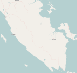
Way Kanan Regency
Way Kanan Regency
Kabupaten Way Kanan | |
|---|---|
 Way Kanan River Camp | |
 Coat of arms | |
 Location within Lampung | |
| Coordinates: 4°26′49″S 104°31′39″E / 4.4470°S 104.5275°E | |
| Country | Indonesia |
| Province | Lampung |
| Regency seat | |
| Government | |
| • Regent | Raden Adipati Surya |
| • Vice Regent | Edward Antony |
| Area | |
| • Total | 3,921.63 km2 (1,514.15 sq mi) |
| Population (2020 Census)[1] | |
| • Total | 493,575 |
| • Density | 130/km2 (330/sq mi) |
| Time zone | UTC+7 (IWST) |
| Area code | (+62) 723 |
| Website | waykanankab |
Way Kanan Regency is a regency (kabupaten) of Lampung Province, Sumatra, Indonesia. It has an area of 3,921.63 km² and had a population of 406,735 at the 2010 Census[2] and 493,575 at the 2020 Census.[3] The administrative centre lies at the town of .
Administrative districts[]
The regency is divided into fourteen districts (kecamatan), listed below with their areas and their populations at the 2010 Census[4] and the 2020 Census.[5]
| District | Area in km2 |
Population 2010 Census |
Population 2020 Census |
|---|---|---|---|
| Banjit | 331.60 | 42,270 | 45,945 |
| Baradatu | 152.03 | 37,757 | 43,787 |
| Gunung Labuhan | 115.22 | 26,906 | 31,044 |
| Kasui | 150.27 | 29,775 | 32,289 |
| Rebang Tangkas | 207.18 | 19,719 | 24,410 |
| Blambangan Umpu | 532.99 | 54,698 | 69,218 |
| Way Tuba | 206.25 | 20,400 | 25,274 |
| Negeri Agung | 562.98 | 32,572 | 38,253 |
| Bahuga | 138.22 | 9,631 | 11,422 |
| Buay Bahuga | 102.04 | 19,008 | 21,016 |
| Bumi Agung | 131.75 | 23,445 | 27,881 |
| Pakuan Retu | 580.34 | 37,188 | 44,709 |
| Negara Batin | 348.40 | 33,616 | 36,588 |
| Negeri Besar | 362.37 | 18,138 | 21,734 |
| Totals | 3,921.63 | 406,735 | 493,575 |
References[]
Categories:
- Regencies of Lampung
- Sumatra geography stubs


