West Lampung Regency
West Lampung Regency
Kabupaten Lampung Barat | |
|---|---|
 Coat of arms | |
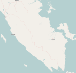
 Location within Lampung | |
| Coordinates: 5°08′56″S 104°11′35″E / 5.1490°S 104.1931°E | |
| Country | Indonesia |
| Province | Lampung |
| Regency seat | Liwa |
| Government | |
| • Regent | Parosil Mabsus |
| • Vice Regent | Mad Hasnurin |
| Area | |
| • Total | 2,116.59 km2 (817.22 sq mi) |
| Population (2020 Census)[1] | |
| • Total | 302,139 |
| • Density | 140/km2 (370/sq mi) |
| Time zone | UTC+7 (IWST) |
| Area code | (+62) 721 |
| Website | lampungbaratkab |


West Lampung Regency is a regency of Lampung Province, Sumatra, Indonesia. Until 2012 it had an area of 4,950.4 km² of which forests occupied some 57% of the total area (as of 2011).[2] It had a population of 418,560 people at the 2010 Census.
However, on 25 October 2012 the southwestern part of this area was separated from West Lampung Regency to form the new West Pesisir Regency (with its administrative centre at the town of Krui). The residual Lampung Barat Regency now covers an area of 2,116.59 km² and this area had a population of 277,296 at the 2010 Census and 302,139 at the 2020 Census.[3] The regency seat is at the town of Liwa.
Administrative Districts[]
West Lampung Regency consisted until 2012 of seventeen districts (kecamatan), but the southwestern eight districts were split off in 2012 to form the new Pesisir Barat (West Coast) Regency. Since that removal, six new districts have been created within the residual area of the Regency, by splitting existing districts. The areas and populations of the resulting fifteen districts at the 2010 Census[4] and the 2020 Census[5] are tabulated below. They are subdivided into 131 villages (rural desa and urban kelurahan), each administered by a lurah.[2]
| District | Area in km2 |
Population 2010 Census |
Population 2020 Census |
|---|---|---|---|
| Balik Bukit | 159.41 | 35,177 | 41,600 |
| Sukau | 146.07 | 26,800 | 24,760 |
| Lumbok Seminung | 98.88 | (a) | 8,030 |
| Belalau | 93.91 | 25,848 | 12,490 |
| Sekincau | 115.09 | 36,734 | 18,870 |
| Suoh | 150.22 | 42,590 | 18,450 |
| Batu Brak | 199.29 | 12,690 | 14,990 |
| Pagar Dewa | 197.71 | (a) | 17,350 |
| Batu Ketulis | 182.01 | (a) | 13,370 |
| Bandar Negeri | 267.23 | (a) | 24,630 |
| Sumber Jaya | 130.44 | 41,216 | 24,040 |
| Way Tenong | 129.70 | 42,117 | 34,790 |
| Gedung Surian | 76.06 | 14,124 | 16,640 |
| Kebun Tebu | 61.55 | (a) | 20,500 |
| Air Hitam | 108.12 | (a) | 11,630 |
| Totals | 2,116.59 | 277,296 | 302,139 |
Note: (a) new district aince 2012; its 2010 Census population is included in the figure for the existing district(s) from which it was cut out
Airport[]
In early October 2011, the runway tested has been done and the testers concluded that the airport is ready for operation. The airport laid in 50 hectares of land with a 974-meter-long runway, an apron, taxi way, administration building and 1,800 meter road leading to the airport and is located at Seray village, Pesisir Tengah district. It hopes of boosting tourism and precaution in cases of natural disaster.[6]
Dolphin conservation[]
Inline with traditional wisdom which prohibits people from catching dolphins, there are hundreds of dolphins surrounding Betuah Island and Banana Island with a tendency to increase in number year by year.[7]
Tanjung Setia Beach[]
Tanjung Setia Beach is face up to Indian Ocean, 273 kilometers from Bandar Lampung and takes 6 to 7 hours drive. The waves is 6 to 7 meters height and 200 meters long in June to August every year suitable for world surfers and is categorized same as Hawaii. Several kilometers from the beach we can found blue marlin up to 70 kilograms (170 centimeters).[8]
Gallery[]

Former emblem of West Lampung Regency, with the creation of West Pesisir Regency from its territory, this logo was deemed not reflecting the current reality and replaced in 2015.[9]
References[]
- ^ Badan Pusat Statistik, Jakarta, 2021.
- ^ Jump up to: a b "Profile of Regency of West Lampung". Indonesia Investment Coordinating Board. Retrieved 22 February 2011.
- ^ Badan Pusat Statistik, Jakarta, 2021.
- ^ Biro Pusat Statistik, Jakarta, 2011
- ^ Badan Pusat Statistik, Jakarta, 2021.
- ^ "Island in focus: New airport ready to serve West Lampung". October 10, 2011.
- ^ http://suaramerdeka.com/v1/index.php/read/cetak/2011/07/13/152385/15/Pesona-Ratusan-Lumba-lumba-Lampung-Barat
- ^ "Pantai Tanjung Setia, Mutiara Tersembunyi di Lampung". March 9, 2012.
- ^ "Logo Lampung Barat Yang Baru Resmi Dipakai". www.polpplampungbarat.com. Satpol PP Lampung Barat.
| show Regencies and cities of Lampung |
|---|
| show Authority control |
|---|
- West Lampung Regency
- Regencies of Lampung