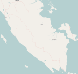
West Tulang Bawang Regency
West Tulang Bawang Regency
(Kabupaten Tulang Bawang Barat) | |
|---|---|
 | |
 Coat of arms | |
 Location within Lampung | |
| Coordinates: 4°26′23″S 105°02′40″E / 4.4398°S 105.0444°E | |
| Country | Indonesia |
| Province | Lampung |
| Regency seat | |
| Government | |
| • Regent | |
| • Vice Regent | |
| Area | |
| • Total | 1,201.15 km2 (463.77 sq mi) |
| Population (2020 Census)[1] | |
| • Total | 286,162 |
| • Density | 240/km2 (620/sq mi) |
| Time zone | UTC+7 (IWST) |
| Area code | (+62) 726 |
| Website | tulangbawangbaratkab |
West Tulang Bawang Regency (Indonesian: Kabupaten Tulung Bawang Barat) is a regency (kabupaten) of Lampung Province, Sumatra, Indonesia. It has an area of 1,201.15 km2 and had a population of 250,707 people at the 2010 Census[2] and 286,162 at the 2020 Census.[3] The regency seat is the town of .
Administrative districts[]
At the time of the 2010 Census the Regency comprised eight districts (kecamatan), but subsequently a ninth district - Batu Putih - was created from part of Gunung Terang District. The districts are listed below with their areas and their populations at the 2010 Census[4] and the 2020 Census.[5]
| District | Area in km2 |
Population 2010 Census |
Population 2020 Census |
|---|---|---|---|
| 237.50 | 29,969 | 33,231 | |
| 133.22 | 40,547 | 44,658 | |
| () |
274.93 | 76,559 | 86,351 |
| 99.65 | 5,131 | 6,781 | |
| 109.82 | 21,831 | 23,278 | |
| 72.90 | 30,228 | 19,472 | |
| Batu Putih | 69.01 | (a) | 16,655 |
| Gunung Agung | 127.64 | 28,057 | 33,079 |
| 76.48 | 18,385 | 22,657 | |
| Totals | 1,201.15 | 250,707 | 286,162 |
Note@ (a) the 2010 population of Batu Putih District was included in the figure for Gunung Terang District, from which it was subsequently cut out.
References[]
Categories:
- Regencies of Lampung
- Sumatra geography stubs


