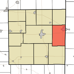
Wayne Township, Randolph County, Indiana
Wayne Township | |
|---|---|
 | |
| Coordinates: 40°09′52″N 84°51′22″W / 40.16444°N 84.85611°WCoordinates: 40°09′52″N 84°51′22″W / 40.16444°N 84.85611°W | |
| Country | United States |
| State | Indiana |
| County | Randolph |
| Government | |
| • Type | Indiana township |
| Area | |
| • Total | 39.74 sq mi (102.9 km2) |
| • Land | 39.7 sq mi (103 km2) |
| • Water | 0.04 sq mi (0.1 km2) |
| Elevation | 1,112 ft (339 m) |
| Population (2010) | |
| • Total | 4,611 |
| • Density | 116.1/sq mi (44.8/km2) |
| Time zone | UTC-5 (Eastern (EST)) |
| • Summer (DST) | UTC-4 (EDT) |
| Area code(s) | 765 |
| FIPS code | 18-81890[2] |
| GNIS feature ID | 454039 |

Wayne Township is one of eleven townships in Randolph County, Indiana. As of the 2010 census, its population was 4,611 and it contained 2,195 housing units.[3]
History[]
Wayne Township was established in 1838.[4]
Geography[]
According to the 2010 census, the township has a total area of 39.74 square miles (102.9 km2), of which 39.7 square miles (103 km2) (or 99.90%) is land and 0.04 square miles (0.10 km2) (or 0.10%) is water.[3]
Cities and towns[]
Unincorporated towns[]
- Bartonia at 40°06′55″N 84°51′04″W / 40.1153245°N 84.8510732°W
- Harrisville at 40°11′05″N 84°52′54″W / 40.1847681°N 84.8816304°W
- Haysville Corner at 40°10′50″N 84°49′33″W / 40.1806021°N 84.8257955°W
- South Salem at 40°09′04″N 84°50′28″W / 40.1511577°N 84.8410734°W
(This list is based on USGS data and may include former settlements.)
References[]
- ^ "US Board on Geographic Names". United States Geological Survey. 2007-10-25. Retrieved 2008-01-31.
- ^ "U.S. Census website". United States Census Bureau. Retrieved 2008-01-31.
- ^ a b "Population, Housing Units, Area, and Density: 2010 - County -- County Subdivision and Place -- 2010 Census Summary File 1". United States Census. Archived from the original on 2020-02-12. Retrieved 2013-05-10.
- ^ Tucker, E. (1882). History of Randolph County, Indiana: With Illustrations and Biographical Sketches of Some of Its Prominent Men and Pioneers : to which are Appended Maps of Its Several Townships. A.L. Klingman. p. 49.
External links[]
Places adjacent to Wayne Township, Randolph County, Indiana | |
|---|---|
Municipalities and communities of Randolph County, Indiana, United States | ||
|---|---|---|
| Cities | ||
| Towns | ||
| Townships | ||
| Unincorporated communities | ||
| ||
This Randolph County, Indiana location article is a stub. You can help Wikipedia by . |
Categories:
- Townships in Randolph County, Indiana
- Townships in Indiana
- Central Indiana geography stubs