Weida (White Elster)
This article does not cite any sources. (April 2008) |
| Weida | |
|---|---|
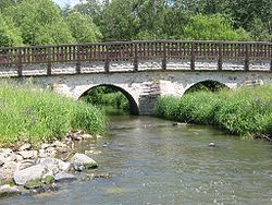 The Weida in Lawitz | |
| Location | |
| Country | Germany |
| State | Thuringia |
| Physical characteristics | |
| Source | |
| • location | near Pausa |
| • elevation | 500 m (1,600 ft) |
| Mouth | |
• location | White Elster |
• coordinates | 50°47′44″N 12°5′21″E / 50.79556°N 12.08917°ECoordinates: 50°47′44″N 12°5′21″E / 50.79556°N 12.08917°E |
| Length | 57 km (35 mi) |
| Basin features | |
| Progression | White Elster→ Saale→ Elbe→ North Sea |

The Weida (German: [ˈvaɪdaː] (![]() listen)) is a non-navigable river in eastern Thuringia, Germany, left tributary of the White Elster. Most of its course is situated in the district of Greiz.
listen)) is a non-navigable river in eastern Thuringia, Germany, left tributary of the White Elster. Most of its course is situated in the district of Greiz.
The Weida's source is near Pausa in Saxony; it then flows through the Thuringian Highland passing Zeulenroda-Triebes and through the eponymous Weida. It then feeds into the White Elster near Wünschendorf/Elster. Its tributaries include the Auma and the .
| Authority control |
|---|
This Greiz district location article is a stub. You can help Wikipedia by . |
Categories:
- Tributaries of the White Elster
- Rivers of Thuringia
- Rivers of Germany
- Greiz district geography stubs
- Thuringia river stubs