Wellersburg, Pennsylvania
Wellersburg, Pennsylvania | |
|---|---|
Borough | |
 Entering Wellersburg from Maryland | |
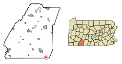 Location of Wellersburg in Somerset County, Pennsylvania. | |
 Wellersburg Location of Wellersburg in Somerset County, Pennsylvania. | |
| Coordinates: 39°43′51″N 78°51′05″W / 39.73083°N 78.85139°WCoordinates: 39°43′51″N 78°51′05″W / 39.73083°N 78.85139°W | |
| Country | United States |
| State | Pennsylvania |
| County | Somerset |
| Settled | 1830 |
| Incorporated | 1857 |
| Government | |
| • Type | Borough Council |
| Area | |
| • Total | 0.81 sq mi (2.10 km2) |
| • Land | 0.81 sq mi (2.10 km2) |
| • Water | 0.00 sq mi (0.00 km2) |
| Population (2010) | |
| • Total | 181 |
| • Estimate (2019)[2] | 171 |
| • Density | 211.11/sq mi (81.49/km2) |
| Time zone | UTC-5 (Eastern (EST)) |
| • Summer (DST) | UTC-4 (EDT) |
| Zip code | 15564 |
| Area code(s) | 814 |
| FIPS code | 42-82128 |

Wellersburg is a borough in Somerset County, Pennsylvania, United States. It is part of the Johnstown, Pennsylvania, Metropolitan Statistical Area. The population was 181 at the 2010 census.

Geography[]
Wellersburg is located at 39°43′51″N 78°51′05″W / 39.730947°N 78.851465°W.[3] The borough is located at the extreme southern end of Southampton Township, along its border with Maryland. Pennsylvania Route 160 passes through Wellersburg as it runs between the Maryland border to the south and Southampton Township to the north.
According to the United States Census Bureau, the borough has a total area of 0.8 square miles (2.1 km2), all of it land.
Demographics[]
| Historical population | |||
|---|---|---|---|
| Census | Pop. | %± | |
| 1860 | 465 | — | |
| 1870 | 290 | −37.6% | |
| 1880 | 226 | −22.1% | |
| 1890 | 183 | −19.0% | |
| 1900 | 158 | −13.7% | |
| 1910 | 193 | 22.2% | |
| 1920 | 247 | 28.0% | |
| 1930 | 315 | 27.5% | |
| 1940 | 357 | 13.3% | |
| 1950 | 369 | 3.4% | |
| 1960 | 303 | −17.9% | |
| 1970 | 266 | −12.2% | |
| 1980 | 265 | −0.4% | |
| 1990 | 213 | −19.6% | |
| 2000 | 176 | −17.4% | |
| 2010 | 181 | 2.8% | |
| 2019 (est.) | 171 | [2] | −5.5% |
| Sources:[4][5][6] | |||
At the 2000 census there were 176 people in 84 households, including 51 families, in the borough. The population density was 223.4 people per square mile (86.0/km2). There were 90 housing units at an average density of 114.2 per square mile (44.0/km2). The racial makeup of the borough was 98.86% White, and 1.14% from two or more races.[5] Of the 84 households 15.5% had children under the age of 18 living with them, 45.2% were married couples living together, 10.7% had a female householder with no husband present, and 38.1% were non-families. 36.9% of households were one person and 17.9% were one person aged 65 or older. The average household size was 2.10 and the average family size was 2.63.
The age distribution was 15.9% under the age of 18, 6.8% from 18 to 24, 28.4% from 25 to 44, 27.3% from 45 to 64, and 21.6% 65 or older. The median age was 44 years. For every 100 females there were 83.3 males. For every 100 females age 18 and over, there were 87.3 males.
The median household income was $21,111 and the median family income was $23,750. Males had a median income of $24,688 versus $18,750 for females. The per capita income for the borough was $14,495. About 4.3% of families and 5.4% of the population were below the poverty line, including none of those under the age of eighteen or sixty five or over.
References[]
- ^ "2019 U.S. Gazetteer Files". United States Census Bureau. Retrieved July 28, 2020.
- ^ a b "Population and Housing Unit Estimates". United States Census Bureau. May 24, 2020. Retrieved May 27, 2020.
- ^ "US Gazetteer files: 2010, 2000, and 1990". United States Census Bureau. 2011-02-12. Retrieved 2011-04-23.
- ^ "Census of Population and Housing". U.S. Census Bureau. Retrieved 11 December 2013.
- ^ a b "U.S. Census website". United States Census Bureau. Retrieved 2008-01-31.
- ^ "Incorporated Places and Minor Civil Divisions Datasets: Subcounty Resident Population Estimates: April 1, 2010 to July 1, 2012". Population Estimates. U.S. Census Bureau. Retrieved 11 December 2013.
| Wikimedia Commons has media related to Wellersburg, Pennsylvania. |
Municipalities and communities of Somerset County, Pennsylvania, United States | ||
|---|---|---|
| Boroughs |  | |
| Townships | ||
| CDPs | ||
| Unincorporated communities |
| |
| Footnotes | ‡This populated place also has portions in an adjacent county or counties | |
| ||
- Boroughs in Somerset County, Pennsylvania
- Populated places established in 1830
- 1857 establishments in Pennsylvania