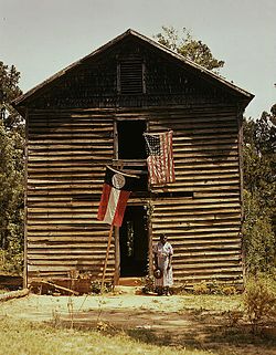
White Plains, Georgia
White Plains, Georgia | |
|---|---|
 | |
 Location in Greene County and the state of Georgia | |
| Coordinates: 33°28′37″N 83°2′18″W / 33.47694°N 83.03833°WCoordinates: 33°28′37″N 83°2′18″W / 33.47694°N 83.03833°W | |
| Country | United States |
| State | Georgia |
| County | Greene |
| Government | |
| • Mayor | Dock Shelnut |
| Area | |
| • Total | 5.21 sq mi (13.50 km2) |
| • Land | 5.17 sq mi (13.38 km2) |
| • Water | 0.05 sq mi (0.13 km2) |
| Elevation | 690 ft (211 m) |
| Population (2020) | |
| • Total | 239 |
| • Density | 46.27/sq mi (17.87/km2) |
| Time zone | UTC-5 (Eastern (EST)) |
| • Summer (DST) | UTC-4 (EDT) |
| ZIP code | 30678 |
| Area code(s) | 706 |
| FIPS code | 13-82692[2] |
| GNIS feature ID | 0356635[3] |

White Plains is a city in Greene County, Georgia, United States. The population was 284 at the 2010 census.[4]
History[]
The Georgia General Assembly incorporated White Plains in 1834.[5] According to tradition, White Plains was so named on account of their white sandy soil.[6]
Geography[]
White Plains is located in southeastern Greene County at 33°28′37″N 83°2′18″W / 33.47694°N 83.03833°W (33.477002, -83.038404).[7] The southeast border of the city follows the Hancock County line. Georgia State Route 15 (Old Greensboro Road) passes through the center of town, leading north 6 miles (9.7 km) to Siloam and south 15 miles (24 km) to Sparta. Greensboro, the Greene County seat, is 12 miles (19 km) to the northwest via State Route 15.
According to the United States Census Bureau, White Plains has a total area of 4.7 square miles (12.2 km2), of which 0.04 square miles (0.1 km2), or 1.02%, is water.[4]
Demographics[]
| Historical population | |||
|---|---|---|---|
| Census | Pop. | %± | |
| 1870 | 374 | — | |
| 1880 | 459 | 22.7% | |
| 1890 | 510 | 11.1% | |
| 1900 | 290 | −43.1% | |
| 1910 | 407 | 40.3% | |
| 1920 | 479 | 17.7% | |
| 1930 | 406 | −15.2% | |
| 1940 | 364 | −10.3% | |
| 1950 | 359 | −1.4% | |
| 1960 | 273 | −24.0% | |
| 1970 | 236 | −13.6% | |
| 1980 | 231 | −2.1% | |
| 1990 | 286 | 23.8% | |
| 2000 | 283 | −1.0% | |
| 2010 | 284 | 0.4% | |
| 2020 | 239 | −15.8% | |
| U.S. Decennial Census[8] | |||
As of the census[2] of 2000, there were 283 people, 108 households, and 72 families residing in the city. The population density was 61.5 people per square mile (23.8/km2). There were 126 housing units at an average density of 27.4 per square mile (10.6/km2). The racial makeup of the city was 55.83% White and 44.17% African American. Hispanic or Latino of any race were 3.18% of the population.
There were 108 households, out of which 32.4% had children under the age of 18 living with them, 41.7% were married couples living together, 23.1% had a female householder with no husband present, and 33.3% were non-families. 26.9% of all households were made up of individuals, and 13.9% had someone living alone who was 65 years of age or older. The average household size was 2.62 and the average family size was 3.28.
In the city, the population was spread out, with 25.8% under the age of 18, 9.9% from 18 to 24, 31.1% from 25 to 44, 21.9% from 45 to 64, and 11.3% who were 65 years of age or older. The median age was 35 years. For every 100 females, there were 87.4 males. For every 100 females age 18 and over, there were 85.8 males.
The median income for a household in the city was $33,906, and the median income for a family was $36,136. Males had a median income of $22,143 versus $15,781 for females. The per capita income for the city was $12,328. About 16.3% of families and 24.6% of the population were below the poverty line, including 36.6% of those under the age of eighteen and 20.9% of those 65 or over.
References[]
- ^ "2020 U.S. Gazetteer Files". United States Census Bureau. Retrieved December 18, 2021.
- ^ a b "U.S. Census website". United States Census Bureau. Retrieved 2008-01-31.
- ^ "US Board on Geographic Names". United States Geological Survey. 2007-10-25. Retrieved 2008-01-31.
- ^ a b "Geographic Identifiers: 2010 Demographic Profile Data (G001): White Plains city, Georgia". American Factfinder. U.S. Census Bureau. Retrieved November 29, 2016.[dead link]
- ^ "White Plains". GeorgiaGov. Retrieved 29 June 2019.
- ^ Krakow, Kenneth K. (1975). Georgia Place-Names: Their History and Origins (PDF). Macon, GA: Winship Press. p. 252. ISBN 0-915430-00-2.
- ^ "US Gazetteer files: 2010, 2000, and 1990". United States Census Bureau. 2011-02-12. Retrieved 2011-04-23.
- ^ "Census of Population and Housing". Census.gov. Retrieved June 4, 2015.
Municipalities and communities of Greene County, Georgia, United States | ||
|---|---|---|
| Cities |
|  |
| Towns |
| |
| Unincorporated communities | ||
| Ghost towns | ||
| Footnotes | ‡This populated place also has portions in an adjacent county or counties | |
| ||
- Cities in Georgia (U.S. state)
- Cities in Greene County, Georgia