Whittle Glacier
| Whittle Glacier | |
|---|---|
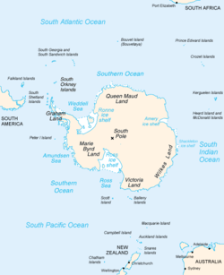 Map of Antarctica, with Wilkes Land slightly to the right | |
 Location of Whittle Glacier in Antarctica | |
| Type | short channel |
| Location | Wilkes Land |
| Coordinates |  66°22′00″S 114°13′00″E / 66.36667°S 114.21667°E / -66.36667; 114.21667 66°22′00″S 114°13′00″E / 66.36667°S 114.21667°E / -66.36667; 114.21667 |
| Thickness | unknown |
| Terminus | Whittle Glacier Tongue |
| Status | unknown |
Whittle Glacier ( WikiMiniAtlas66°22′S 114°13′E / 66.367°S 114.217°E / -66.367; 114.217) is a short channel glacier flowing northeast to Colvocoresses Bay and terminating in a small glacier tongue 6 nautical miles (11 km; 6.9 mi) northwest of Williamson Glacier. Delineated from air photos taken by U.S. Navy Operation Highjump (1946–47), and named by Advisory Committee on Antarctic Names (US-ACAN) for Dr. , Assistant Surgeon on the sloop Vincennes of the United States Exploring Expedition (1838–42) under Lieutenant Charles Wilkes.
Whittle Glacier Tongue ( WikiMiniAtlas
See also[]
- List of glaciers in the Antarctic
- Glaciology
References[]
![]() This article incorporates public domain material from the United States Geological Survey document: "Whittle Glacier". (content from the Geographic Names Information System)
This article incorporates public domain material from the United States Geological Survey document: "Whittle Glacier". (content from the Geographic Names Information System) ![]()
Glaciers | |||||||
|---|---|---|---|---|---|---|---|
| Types |
| ||||||
| Anatomy |
| ||||||
| Processes |
| ||||||
| Measurements |
| ||||||
| Volcanic relations | |||||||
| Landforms |
| ||||||
| |||||||
Glaciers in the Antarctic | |
|---|---|
|
Glaciers of Wilkes Land | |
|---|---|
|
This article about a glacier in Wilkes Land is a stub. You can help Wikipedia by . |
- v
- t
- Glaciers of Wilkes Land
- Wilkes Land geography stubs
- Antarctica glacier stubs
- Articles with short description
- Short description matches Wikidata
- Coordinates on Wikidata
- Wikipedia articles incorporating text from the USGS Geographic Names Information System
- All stub articles