Widdowson Glacier
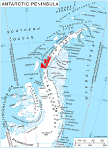
Widdowson Glacier ( WikiMiniAtlas66°43′S 65°46′W / 66.717°S 65.767°W / -66.717; -65.767) is a glacier situated between Drummond and McCance Glaciers and flowing into Darbel Bay south of Sokol Point, on the west coast of Graham Land.
The glacier was photographed by Hunting Aerosurveys Ltd. in 1955–57, and mapped from these photos by the Falkland Islands Dependencies Survey (FIDS). Named by the United Kingdom Antarctic Place-Names Committee (UK-APC) for of the Dept. of Experimental Medicine, Cambridge, joint author of of Foods, a fundamental work containing all the quantitative data required for calculating expedition ration requirements other than vitamins.
![]() This article incorporates public domain material from the United States Geological Survey document: "Widdowson Glacier". (content from the Geographic Names Information System)
This article incorporates public domain material from the United States Geological Survey document: "Widdowson Glacier". (content from the Geographic Names Information System) ![]()
Glaciers in the Antarctic | |
|---|---|
|
Glaciers of Graham Land | |
|---|---|
| Antarctic Peninsula |
|
| Adelaide Island |
|
| James Ross Island |
|
| Palmer Archipelago |
|
| Trinity Peninsula |
|
This article about a glacier in Loubet Coast is a stub. You can help Wikipedia by . |
- v
- t
- Glaciers of Loubet Coast
- Graham Land glacier stubs
- Loubet Coast geography stubs
- Coordinates on Wikidata
- Wikipedia articles incorporating text from the USGS Geographic Names Information System
- All stub articles