Windsor, Quebec
Windsor | |
|---|---|
City | |
 | |
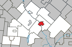 Location within Le Val-Saint-François RCM | |
 Windsor Location in southern Quebec | |
| Coordinates: 45°34′N 72°00′W / 45.567°N 72.000°WCoordinates: 45°34′N 72°00′W / 45.567°N 72.000°W[1] | |
| Country | Canada |
| Province | Quebec |
| Region | Estrie |
| RCM | Le Val-Saint-François |
| Constituted | December 29, 1999 |
| Government | |
| • Mayor | Sylvie Bureau |
| • Federal riding | Richmond—Arthabaska |
| • Prov. riding | Richmond |
| Area | |
| • Total | 15.00 km2 (5.79 sq mi) |
| • Land | 14.56 km2 (5.62 sq mi) |
| Population | |
| • Total | 5,419 |
| • Density | 372.2/km2 (964/sq mi) |
| • Pop 2011-2016 | |
| • Dwellings | 2,422 |
| Time zone | UTC−05:00 (EST) |
| • Summer (DST) | UTC−04:00 (EDT) |
| Postal code(s) | J1S 2L7 |
| Area code(s) | 819 |
| Highways | |
| Website | www |

Windsor is a town of 5,300 people, part of the Le Val-Saint-François Regional County Municipality in the Estrie region of Quebec, Canada, of which it is the seat.
Windsor is perhaps best known for its ultra-modern Domtar fine paper plant.
History[]
Apart from the Abenaki Indian camps in this area in the 1600s, Windsor was unpopulated until the early 19th century, when Governor General Prescott granted a tract of land to Joseph Brown to thank him for his service to the Crown. In 1876, when French-Canadian colonist Michel Cloutier acquired land, a rift grew between Francophones and Anglophones, with one side locating in the Township municipality and the other in the village of Windsor Mills. Windsor Mills was elevated to town status in 1899, and took its current name in 1914. The name originates from the village of Berkshire, where Windsor Castle, built ca. 1344 at the request of King Edward III, is located. While most of Windsor's economy is built on the pulp and paper industry and textile manufacturing, there are also some worthy attractions. This includes the Poudrière de Windsor, which manufactured black explosive powder in Canada around 1864.
During World War II the Royal Canadian Air Force built and operated No. 4 Elementary Flying Training School as part of the British Commonwealth Air Training Plan[4] near Windsor. The school opened on 34 June 1940 and closed on 25 August 1944. The airfield was located southwest of the town near 45°31′00″N 072°02′12″W / 45.51667°N 72.03667°W.[5] A film, "Knights with Wings",[6] about flight training in the BCATP, was filmed at the flying school at Windsor Mills. "An RCAF Pilot's Story 1939-1945: the Memoirs of Ernest E. Allen", recounts some of his experiences learning to fly at Windsor Mills in 1940-41.[7]
On December 29, 1999, the village municipality of Saint-Grégoire-de-Greenlay was merged into the town of Windsor.
Demographics[]
Population[]
|
| |||||||||||||||||||||||||||
| Population amounts prior to 1999 are total of Windsor V and Saint-Grégoire-de-Greenlay VL. 2011 population count based on 2016 correction amendment. Source: Statistics Canada[3][8] | ||||||||||||||||||||||||||||
Language[]
Mother tongue (2011)[9]
| Language | Population | Pct (%) |
|---|---|---|
| French only | 5,120 | 96.1% |
| English only | 165 | 3.1% |
| English and French | 35 | 0.7% |
| Non-official languages | 10 | 0.2% |
See also[]
- List of cities in Quebec
References[]
- ^ Reference number 67322 of the Commission de toponymie du Québec (in French)
- ^ Jump up to: a b Geographic code 42088 in the official Répertoire des municipalités (in French)
- ^ Jump up to: a b c "(Code 2442088) Census Profile". 2016 census. Statistics Canada. 2017.
- ^ Hatch, F. J. (1983). The Aerodrome of Democracy: Canada and the British Commonwealth Air Training Plan, 1939-1945 (PDF). Ottawa: Directorate of History, Department of National Defence. p. 206. ISBN 0-660-11443-7.
- ^ Air Navigation Edition Ottawa-Montreal (Map) (September 1942 ed.). Cartography by Hydrographic and Map Service. Canada Department of Mines and Resources, Surveys and Engineering Branch.
- ^ see "Knights with Wings," YouTube https://www.youtube.com/watch?v=nqoVnJPBJak; see also Eastern Townships Archives Portal, "Item P001 - Knights with Wings, R.C.A.F. flight school, Windsor Mills, Quebec", Eastern Townships Resource Centre. https://www.townshipsarchives.ca/knights-with-wings-r-c-f-flight-school-windsor-mills-quebec
- ^ http://www.doralholdings.com/eallen/
- ^ 1996, 2001, 2006, 2011 census
- ^ "(Code 2442088) Census Profile". 2011 census. Statistics Canada. 2012.
External links[]
![]() Media related to Windsor, Quebec at Wikimedia Commons
Media related to Windsor, Quebec at Wikimedia Commons
| show Adjacent Municipal Subdivisions |
|---|
| hide | |
|---|---|
| Cities & Towns | |
| Municipalities | |
| Townships | |
| Villages | |
| |
| show Authority control |
|---|
- Windsor, Quebec
- Cities and towns in Quebec
- World War II sites in Canada
- Military history of Canada during World War II