Winterville, Georgia
Winterville, Georgia | |
|---|---|
| Nickname(s): The Marigold Capital of Georgia, the Friendship City[1] | |
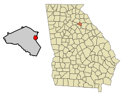 Location in Clarke County and the state of Georgia | |
| Coordinates: 33°58′0″N 83°16′54″W / 33.96667°N 83.28167°WCoordinates: 33°58′0″N 83°16′54″W / 33.96667°N 83.28167°W | |
| Country | United States |
| State | Georgia |
| County | Clarke |
| Incorporated | 1904[1] |
| Area | |
| • Total | 2.65 sq mi (6.85 km2) |
| • Land | 2.62 sq mi (6.78 km2) |
| • Water | 0.03 sq mi (0.07 km2) |
| Elevation | 801 ft (244 m) |
| Population (2010) | |
| • Total | 1,122 |
| • Estimate (2019)[5] | 1,237 |
| • Density | 472.14/sq mi (182.32/km2) |
| Time zone | UTC-5 (Eastern (EST)) |
| • Summer (DST) | UTC-4 (EDT) |
| ZIP code | 30683 |
| Area code(s) | 706 |
| FIPS code | 13-83728[3] |
| GNIS feature ID | 0356645[4] |
| Website | cityofwinterville.com |

Winterville is a city in Clarke County, Georgia, United States. Since 1991, Winterville has been the only municipality located wholly within Athens-Clarke County. The population was 1,122 at the 2010 census.[6]
History[]
The community was named after John Winter, a railroad official.[7] Winterville was incorporated in 1904.[8]
Since 1991, when the city of Athens abandoned its city charter to form the unified government of Athens-Clarke County, Winterville has been the only municipality located wholly within Athens-Clarke County.
Geography[]
Winterville is located at 33°58′00″N 83°16′54″W / 33.966720°N 83.281669°W,[9] a 6-mile (10 km)–drive from the University of Georgia.[1] According to the United States Census Bureau, the city has a total area of 2.7 square miles (6.9 km2), all land.
Demographics[]
| Historical population | |||
|---|---|---|---|
| Census | Pop. | %± | |
| 1910 | 465 | — | |
| 1920 | 504 | 8.4% | |
| 1930 | 432 | −14.3% | |
| 1940 | 503 | 16.4% | |
| 1950 | 453 | −9.9% | |
| 1960 | 497 | 9.7% | |
| 1970 | 551 | 10.9% | |
| 1980 | 621 | 12.7% | |
| 1990 | 876 | 41.1% | |
| 2000 | 1,068 | 21.9% | |
| 2010 | 1,122 | 5.1% | |
| 2019 (est.) | 1,237 | [5] | 10.2% |
| U.S. Decennial Census[10] | |||
This section needs to be updated. (June 2014) |
At the 2010 census, there were 1,122 people in 485 households, including 318 families, in the city. The population density was 431.5 people per square mile (162.6/km2). There were 529 housing units at an average density of 203.5 per square mile (76.7/km2). The racial makeup of the city was 73.35% White, 21.84% African American, 0.36% Asian, 0.27% Native American, 3.57% from other races, and 0.62% from two or more races. Hispanic or Latino people of any race were 5.26% of the population.
Of the 485 households 28.9% had children under the age of 18 living with them, 47.8% were married couples living together, 14.2% had a female householder with no husband present, and 34.4% were non-families. 28.7% of households were one person and 13.2% were one person aged 65 or older. The average household size was 2.31 and the average family size was 2.84.
The age distribution was 21.6% under the age of 18, 6.9% from 18 to 24, 26.2% from 25 to 44, 20.3% from 45 to 64, and 16.0% 65 or older. The median age was 41.2 years. For every 100 females, there were 94 males. For every 100 females age 18 and over, there were 87 males.
As of the 2014 American Community Survey, the median household income was $51,500, and the median family income was $69,167. Males had a median income of $21,667 versus $27,083 for females. The per capita income for the city was $29,108. About 11.5% of families and 12.9% of the population were below the poverty line, including 18.7% of those under age 18 and 6.9% of those age 65 or over.
As of the census[3] of 2000,[needs update] there were 1,068 people in 409 households, including 299 families, in the city. The population density was 403.2 people per square mile (155.6/km2). There were 432 housing units at an average density of 163.1 per square mile (62.9/km2). The racial makeup of the city was 78.93% White, 18.26% African American, 1.03% Asian, 0.37% Native American, 0.66% from other races, and 0.75% from two or more races. Hispanic or Latino people of any race were 1.78% of the population.
Of the 409 households 35.2% had children under the age of 18 living with them, 55.0% were married couples living together, 14.7% had a female householder with no husband present, and 26.7% were non-families. 20.0% of households were one person and 7.3% were one person aged 65 or older. The average household size was 2.52 and the average family size was 2.91.
The age distribution was 24.5% under the age of 18, 6.3% from 18 to 24, 33.0% from 25 to 44, 23.7% from 45 to 64, and 12.5% 65 or older. The median age was 37 years. For every 100 females, there were 88 males. For every 100 females age 18 and over, there were 81.5 males.
The median household income was $47,727 and the median family income was $51,667. Males had a median income of $37,100 versus $25,000 for females. The per capita income for the city was $18,693. About 3.5% of families and 5.3% of the population were below the poverty line, including 5.4% of those under age 18 and 9.3% of those age 65 or over.
Notable people[]
In the late 1980s, members of the neo-psychedelia rock band Butthole Surfers lived in Winterville, where they recorded their infamous third full-length LP, Locust Abortion Technician in a tiny two-bedroom home studio they rented during the summer of 1986. [11]
References[]
- ^ Jump up to: a b c d History of Winterville from the City of Winterville website. Retrieved 2014-06-19.
- ^ "2019 U.S. Gazetteer Files". United States Census Bureau. Retrieved July 9, 2020.
- ^ Jump up to: a b "U.S. Census website". United States Census Bureau. Retrieved 2008-01-31.
- ^ "US Board on Geographic Names". United States Geological Survey. 2007-10-25. Retrieved 2008-01-31.
- ^ Jump up to: a b "Population and Housing Unit Estimates". United States Census Bureau. May 24, 2020. Retrieved May 27, 2020.
- ^ "Profile of General Population and Housing Characteristics: 2010 Demographic Profile Data (DP-1): Winterville city, Georgia". United States Census Bureau. Retrieved October 10, 2012.
- ^ Krakow, Kenneth K. (1975). Georgia Place-Names: Their History and Origins (PDF). Macon, GA: Winship Press. p. 255. ISBN 0-915430-00-2.
- ^ Acts and Resolutions of the General Assembly of the State of Georgia. Clark & Hines, State Printers. 1904. p. 724.
- ^ "US Gazetteer files: 2010, 2000, and 1990". United States Census Bureau. 2011-02-12. Retrieved 2011-04-23.
- ^ "Census of Population and Housing". Census.gov. Retrieved June 4, 2015.
- ^ Bevis, M. (August 2012). "The Weirdest Man In Show Business: Gibby Haynes Targets New Orleans". Antigravity Magazine. Retrieved 2014-06-19.
There was a rumor floating around in the ‘80s that the Surfers had moved to Athens, Georgia for a very specific reason. It was Winterville, but yeah we lived in Georgia.
Further reading[]
- Foley, Emma; Quinn, Mary (2014). Winterville, Georgia : A classic railroad town. Winterville, Georgia: Self-published by Emma Foley & Mary Quinn. ISBN 9781633180024.
External links[]
- History of Winterville from the City of Winterville website
 Media related to Winterville, Georgia at Wikimedia Commons
| show Municipalities and communities of Clarke County, Georgia, United States |
|---|

| show Authority control |
|---|
- Cities in Georgia (U.S. state)
- Cities in Clarke County, Georgia
- Athens – Clarke County metropolitan area