Wonogiri Regency
Wonogiri Regency
Kabupaten Wonogiri | |
|---|---|
 Coat of arms | |
| Motto(s): Sabda Sakti Nugrahaning Praja ((in Javanese): The Holy Word of Sacrifice) | |
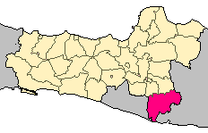 Location of Wonogiri Regency in Central Java | |
| Coordinates: 7°55′S 111°03′E / 7.917°S 111.050°ECoordinates: 7°55′S 111°03′E / 7.917°S 111.050°E | |
| Country | Indonesia |
| Province | Central Java |
| Founded | May 19, 1741 |
| Capital | |
| Government | |
| • Regent | Joko Sutopo |
| • Vice-Regent | Edy Santosa, S.H. |
| Area | |
| • Total | 1,822.36 km2 (703.62 sq mi) |
| • Water | 567.2 km2 (219.0 sq mi) |
| Elevation | 140 m (460 ft) |
| Population (2020 Census) | |
| • Total | 1,096,138 |
| • Density | 600/km2 (1,600/sq mi) |
| [1] | |
| Demonym(s) | Wonogiren, Wonogirian, Bocah Wonogiri |
| Demographics | |
| • Ethnic groups | Javanese, Chinese, European |
| • Religion | Islam, Christianity, Hinduism, Buddhism and traditional Javanese beliefs (in Purwantoro) |
| • Languages | Indonesian, Javanese |
| Time zone | UTC+7 (WIB) |
| ZIP code | 576xx |
| Area code(s) | +62 273 |
| Vehicle registration | AD |
| Website | wonogirikab.go.id |

Wonogiri Regency is a regency (kabupaten) in the southeastern part of Central Java province in Indonesia. It covers an area of 1,822.36 km2, and its population was 928,904 at the 2010 Census[2] and 1,096,138 at the 2020 Census.[3] The capital and largest town is Wonogiri, around 33 km southeast of the large Central Java metropolis of Surakarta.
Administrative districts[]
Wonogiri Regency is divided into twenty-five administrative districts (Indonesian: kecamatan), tabulated below with their areas and their populations at the 2010 Census[4] and the 2020 Census.[5] The table also includes the number of administrative villages (rural desa and urban kelurahan) in each district and its post code.
| Name | Area in km2 |
Pop'n Census 2010 |
Pop'n Census 2020 |
No. of vill. |
Post code |
|---|---|---|---|---|---|
| Pracimantoro | 142.14 | 58,892 | 65,414 | 18 | 57664 |
| Paranggupito (a) | 64.75 | 16,533 | 17,760 | 8 | 57679 |
| Girotontro | 61.63 | 19,285 | 20,465 | 7 | 57678 |
| Giriwoyo | 100.60 | 35,883 | 38,953 | 16 | 57675 |
| Batuwarno | 51.65 | 16,907 | 17,889 | 8 | 57674 |
| Karangtengah | 84.59 | 22,031 | 23,579 | 5 | 57677 |
| Tirtomoyo | 93.01 | 48,652 | 54,001 | 14 | 57672 |
| Nguntoronadi | 80.41 | 22,648 | 24,715 | 11 | 57671 |
| Baturetno | 89.10 | 44,320 | 47,711 | 13 | 57673 |
| Eromoko | 120.36 | 40,544 | 43,957 | 15 | 57663 |
| Wuryantoro | 72.61 | 25,476 | 26,491 | 8 | 57661 |
| Manyaran | 81.64 | 33,868 | 35,930 | 7 | 57662 |
| Selogiri | 50.18 | 37,830 | 46,474 | 11 | 57652 |
| Wonogiri (district) |
82.92 | 77,271 | 86,437 | 15 | 57611 -57615 |
| Ngadirojo | 93.26 | 52,831 | 59,643 | 11 | 57681 |
| Sidoharjo | 57.20 | 39,332 | 42,831 | 12 | 57682 |
| Jatiroto | 62.77 | 35,623 | 41,230 | 15 | 57692 |
| Kismantoro | 69.86 | 35,505 | 40,200 | 10 | 57696 |
| Purwantoro (b) | 59.53 | 48,048 | 55,885 | 15 | 57695 |
| Bulukerto | 40.52 | 28,854 | 33,793 | 10 | 57697 |
| Puhpelem | 31.62 | 18,947 | 21,144 | 6 | 57698 |
| Slogohimo | 64.15 | 45,107 | 52,378 | 17 | 57694 |
| Jatisrono | 50.03 | 56,133 | 63,196 | 17 | 57691 |
| Jatipurno | 55.46 | 30,699 | 37,532 | 11 | 57693 |
| Girimarto | 62.37 | 37,685 | 45,569 | 14 | 57683 |
| Totals | 1,822.36 | 928,904 | 1,096,138 | 294 |
Notes: (a) Paranggupito District includes the whole of the Regency's sea coast (off the southern coast of Java). (b) Purwantoro District forms a salient stretching eastwards into East Java Province.
Agriculture[]
Wonogiri Regency is an area of agriculture and plantation, so most of people in the regency work as farmers. Generally, all areas of the regency produce much agriculture and plantation output. Casava, cacao, and cashew are examples of the plantation output that are relatively good. Wonogiri also has many special foods. They include nasi tiwul, emping, bakso, mie ayam, gudangan, etc.[6]
Topography[]
Most of Wonogiri Regency's area is rocky and hilly due to its location on the highlands. Since these highlands are of the karst type, many caves can easily be found in Wonogiri Regency and at least 41 caves have been discovered so far starting with the famous , at Pracimantoro, , at Giritontro and including many unnamed caves all over the regency.
Wonogiri Regency also has a dam called Gajah Mungkur Dam which has three main functions; as a power plant to produce Hydroelectricity; to provide water for rice fields around Bengawan Solo River through irrigation programs; and for tourism. The dam has created a reservoir covering 83 km2 which lies 6 km south of Wonogiri town..

Tourism[]
Items of tourist in|Bengawan Solo]] [[terest include:
- Gajah Mungkur Dam (Waduk Gajah Mungkur)
- in Paranggupito District
- in Paranggupito District
- in Tirtomoyo District
- in Wonogiri District
- in Pracimantoro District
- in Slogohimo District
- in Jatisrono District
- at Jatipurno
- Paragliding (Indonesian: Gantole) sports site nearby Gajah Mungkur dam
- Off-Roading nearby Gajah Mungkur dam
- in Wonogiri District
- a small mountain in Wonogiri District
- at Ngadiroyo, Nguntoronadi District
- at Ngadiroyo, Nguntoronadi District

Transportation[]
- Wonogiri railway station
- Giri Adipura bus terminal
References[]
- ^ Badan Pusat Statistik, Jakarta, 2021.
- ^ Biro Pusat Statistik, Jakarta, 2011.
- ^ Badan Pusat Statistik, Jakarta, 2021.
- ^ Biro Pusat Statistik, Jakarta, 2011.
- ^ Badan Pusat Statistik, Jakarta, 2021.
- ^ in addition Wonogiri popular with their Jamu (traditional Medicine) such as Air Mancur, which is located near terminal of bus in Wonokarto, Wonogiri.beside those in recent year *2017, The special product of fruit is melon, it is very popular and developed by the Wonogiri government "Kembangkan Pariwisata, Disbudparpora Gandeng ASITA", , accessed Oktober 2011
| show Regencies and cities of Central Java |
|---|

| show Authority control |
|---|
- Regencies of Central Java
- Solo River