Wyndmere, North Dakota
Wyndmere, North Dakota | |
|---|---|
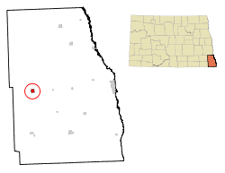 Location of Wyndmere, North Dakota | |
| Coordinates: 46°15′51″N 97°7′53″W / 46.26417°N 97.13139°WCoordinates: 46°15′51″N 97°7′53″W / 46.26417°N 97.13139°W | |
| Country | United States |
| State | North Dakota |
| County | Richland |
| Government | |
| • Mayor | Nathan Brandt |
| Area | |
| • Total | 0.86 sq mi (2.23 km2) |
| • Land | 0.86 sq mi (2.23 km2) |
| • Water | 0.00 sq mi (0.00 km2) |
| Elevation | 1,056 ft (322 m) |
| Population | |
| • Total | 429 |
| • Estimate (2019)[2] | 406 |
| • Density | 472.09/sq mi (182.24/km2) |
| Time zone | UTC-6 (Central (CST)) |
| • Summer (DST) | UTC-5 (CDT) |
| ZIP code | 58081 |
| Area code(s) | 701 |
| FIPS code | 38-87740 |
| GNIS feature ID | 1035254[4] |
| Website | www |

Wyndmere (/ˈwaɪnmɪər/ WYN-meer) is a city in Richland County, North Dakota, United States. The population was 429 at the 2010 census.[5] Wyndmere was founded in 1883 and named after Windermere in England.[6] It is part of the Wahpeton, ND–MN Micropolitan Statistical Area.
Geography[]
Wyndmere is located at 46°15′51″N 97°7′53″W / 46.26417°N 97.13139°W (46.264182, -97.131413).[7]
According to the United States Census Bureau, the city has a total area of 0.88 square miles (2.28 km2), all land.[8]
Demographics[]
| Historical population | |||
|---|---|---|---|
| Census | Pop. | %± | |
| 1910 | 439 | — | |
| 1920 | 570 | 29.8% | |
| 1930 | 521 | −8.6% | |
| 1940 | 499 | −4.2% | |
| 1950 | 627 | 25.7% | |
| 1960 | 644 | 2.7% | |
| 1970 | 516 | −19.9% | |
| 1980 | 550 | 6.6% | |
| 1990 | 501 | −8.9% | |
| 2000 | 533 | 6.4% | |
| 2010 | 429 | −19.5% | |
| 2019 (est.) | 406 | [2] | −5.4% |
| U.S. Decennial Census[9] 2018 Estimate[10] | |||
2010 census[]
As of the census[3] of 2010, there were 429 people, 192 households, and 117 families living in the city. The population density was 487.5 inhabitants per square mile (188.2/km2). There were 226 housing units at an average density of 256.8 per square mile (99.2/km2). The racial makeup of the city was 95.6% White, 0.2% Native American, 0.2% Asian, 2.6% from other races, and 1.4% from two or more races. Hispanic or Latino of any race were 6.1% of the population.
There were 192 households, of which 27.1% had children under the age of 18 living with them, 52.6% were married couples living together, 4.2% had a female householder with no husband present, 4.2% had a male householder with no wife present, and 39.1% were non-families. 35.9% of all households were made up of individuals, and 13.6% had someone living alone who was 65 years of age or older. The average household size was 2.23 and the average family size was 2.86.
The median age in the city was 43.6 years. 25.4% of residents were under the age of 18; 4.1% were between the ages of 18 and 24; 22.4% were from 25 to 44; 29.4% were from 45 to 64; and 18.9% were 65 years of age or older. The gender makeup of the city was 53.6% male and 46.4% female.
2000 census[]
As of the census of 2000, there were 533 people, 214 households, and 144 families living in the city. The population density was 608.7 people per square mile (233.9/km2). There were 247 housing units at an average density of 282.1 per square mile (108.4/km2). The racial makeup of the city was 97.56% White, 0.19% Native American, 0.19% Asian, 1.31% from other races, and 0.75% from two or more races. Hispanic or Latino of any race were 1.31% of the population.
There were 214 households, out of which 35.5% had children under the age of 18 living with them, 57.5% were married couples living together, 5.1% had a female householder with no husband present, and 32.7% were non-families. 27.1% of all households were made up of individuals, and 12.6% had someone living alone who was 65 years of age or older. The average household size was 2.49 and the average family size was 3.06.
In the city, the population was spread out, with 28.5% under the age of 18, 6.8% from 18 to 24, 27.6% from 25 to 44, 19.9% from 45 to 64, and 17.3% who were 65 years of age or older. The median age was 38 years. For every 100 females, there were 105.0 males. For every 100 females age 18 and over, there were 102.7 males.
The median income for a household in the city was $42,143, and the median income for a family was $45,833. Males had a median income of $32,054 versus $22,000 for females. The per capita income for the city was $15,288. About 1.4% of families and 5.8% of the population were below the poverty line, including 6.9% of those under age 18 and 6.5% of those age 65 or over.
Notable people[]
- Orin D. Haugen, World War II era Army Colonel[11]
- Chuck Klosterman, journalist
- Hans Langseth, owner of the longest beard recorded
References[]
- ^ "2019 U.S. Gazetteer Files". United States Census Bureau. Retrieved July 27, 2020.
- ^ Jump up to: a b "Population and Housing Unit Estimates". United States Census Bureau. May 24, 2020. Retrieved May 27, 2020.
- ^ Jump up to: a b "U.S. Census website". United States Census Bureau. Retrieved June 14, 2012.
- ^ "US Board on Geographic Names". United States Geological Survey. October 25, 2007. Retrieved January 31, 2008.
- ^ "2010 Census Redistricting Data (Public Law 94-171) Summary File". American FactFinder. United States Census Bureau. Retrieved May 2, 2011.[dead link]
- ^ Wick, Douglas A. "Wyndmere (Richland County)". North Dakota Place Names. Retrieved 3 May 2011.
- ^ "US Gazetteer files: 2010, 2000, and 1990". United States Census Bureau. February 12, 2011. Retrieved April 23, 2011.
- ^ "US Gazetteer files 2010". United States Census Bureau. Archived from the original on February 20, 2011. Retrieved June 14, 2012.
- ^ United States Census Bureau. "Census of Population and Housing". Retrieved October 31, 2013.
- ^ "Population Estimates". United States Census Bureau. Retrieved June 16, 2019.
- ^ Col. Orin D. "Hard Rock" Haugen
External links[]
| show Municipalities and communities of Richland County, North Dakota, United States |
|---|

| show Authority control |
|---|
- Cities in Richland County, North Dakota
- Cities in North Dakota
- Populated places established in 1899
- Wahpeton micropolitan area