Yangpyeong County
Yangpyeong
양평군 | |
|---|---|
County | |
| Korean transcription(s) | |
| • Hangul | 양평군 |
| • Hanja | 楊平郡 |
| • Revised Romanization | Yangpyeong-gun |
| • McCune-Reischauer | Yangp'yŏng kun |
 Flag Emblem of Yangpyeong | |
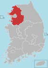
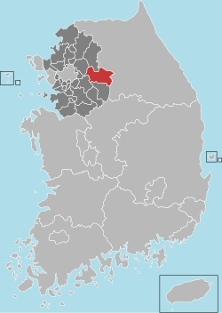 Location in South Korea | |
| Country | |
| Region | Sudogwon |
| Administrative divisions | 1 eup, 11 myeon |
| Area | |
| • Total | 877.76 km2 (338.91 sq mi) |
| Population (September 2016) | |
| • Total | 112,577 |
| • Density | 128.26/km2 (332.2/sq mi) |
| • Dialect | Gyeonggi |
Yangpyeong County (Yangpyeong-gun) is a county in Gyeonggi Province, South Korea.
| Yangpyeong | ||||||||||||||||||||||||||||||||||||||||||||||||||||||||||||
|---|---|---|---|---|---|---|---|---|---|---|---|---|---|---|---|---|---|---|---|---|---|---|---|---|---|---|---|---|---|---|---|---|---|---|---|---|---|---|---|---|---|---|---|---|---|---|---|---|---|---|---|---|---|---|---|---|---|---|---|---|
| Climate chart (explanation) | ||||||||||||||||||||||||||||||||||||||||||||||||||||||||||||
| ||||||||||||||||||||||||||||||||||||||||||||||||||||||||||||
| ||||||||||||||||||||||||||||||||||||||||||||||||||||||||||||
Climate[]
| Climate data for Yangpyeong (1981–2010, extremes 1971–present) | |||||||||||||
|---|---|---|---|---|---|---|---|---|---|---|---|---|---|
| Month | Jan | Feb | Mar | Apr | May | Jun | Jul | Aug | Sep | Oct | Nov | Dec | Year |
| Record high °C (°F) | 13.6 (56.5) |
19.6 (67.3) |
24.4 (75.9) |
31.2 (88.2) |
34.4 (93.9) |
36.5 (97.7) |
37.6 (99.7) |
40.1 (104.2) |
33.4 (92.1) |
30.1 (86.2) |
25.5 (77.9) |
17.6 (63.7) |
40.1 (104.2) |
| Average high °C (°F) | 2.3 (36.1) |
5.7 (42.3) |
11.5 (52.7) |
19.1 (66.4) |
24.1 (75.4) |
27.9 (82.2) |
29.5 (85.1) |
30.0 (86.0) |
26.2 (79.2) |
20.1 (68.2) |
11.8 (53.2) |
4.4 (39.9) |
17.9 (64.2) |
| Daily mean °C (°F) | −3.4 (25.9) |
−0.5 (31.1) |
5.0 (41.0) |
11.9 (53.4) |
17.3 (63.1) |
21.8 (71.2) |
24.7 (76.5) |
24.8 (76.6) |
19.9 (67.8) |
12.8 (55.0) |
5.5 (41.9) |
−1.2 (29.8) |
11.7 (53.1) |
| Average low °C (°F) | −8.5 (16.7) |
−6.2 (20.8) |
−0.9 (30.4) |
4.9 (40.8) |
10.9 (51.6) |
16.5 (61.7) |
20.8 (69.4) |
21.0 (69.8) |
15.2 (59.4) |
7.4 (45.3) |
0.3 (32.5) |
−6.1 (21.0) |
6.5 (43.7) |
| Record low °C (°F) | −32.6 (−26.7) |
−23.5 (−10.3) |
−14.0 (6.8) |
−7.2 (19.0) |
0.0 (32.0) |
4.9 (40.8) |
12.0 (53.6) |
9.7 (49.5) |
0.8 (33.4) |
−5.8 (21.6) |
−15.4 (4.3) |
−24.8 (−12.6) |
−32.6 (−26.7) |
| Average precipitation mm (inches) | 20.6 (0.81) |
27.5 (1.08) |
45.1 (1.78) |
71.8 (2.83) |
101.9 (4.01) |
155.7 (6.13) |
429.4 (16.91) |
350.0 (13.78) |
180.8 (7.12) |
41.4 (1.63) |
37.8 (1.49) |
16.6 (0.65) |
1,478.6 (58.21) |
| Average precipitation days (≥ 0.1 mm) | 6.5 | 5.0 | 7.2 | 7.5 | 8.3 | 9.7 | 14.8 | 15.3 | 8.3 | 5.8 | 6.9 | 6.3 | 101.6 |
| Average relative humidity (%) | 66.5 | 61.8 | 59.3 | 57.3 | 65.1 | 70.5 | 78.9 | 78.9 | 77.0 | 74.9 | 70.4 | 68.4 | 69.1 |
| Mean monthly sunshine hours | 172.6 | 175.2 | 208.5 | 215.4 | 232.6 | 208.0 | 163.1 | 184.9 | 187.3 | 198.6 | 159.7 | 164.9 | 2,291 |
| Percent possible sunshine | 55.3 | 58.1 | 54.9 | 54.6 | 52.7 | 47.1 | 36.5 | 42.3 | 50.7 | 56.3 | 51.0 | 54.0 | 50.8 |
| Source: Korea Meteorological Administration[2][3][4] (percent sunshine)[5] | |||||||||||||
Korean War[]
Yangpyeong includes the village of Jipyeong, which was a Korean War battle site.
Sister cities[]
 Gangbuk-gu, South Korea
- Songpa-gu, South Korea
Culture[]
Natural Monument[]
- Yongmunsa Ginkgo (Natural Monument No. 30)
Movie[]
- Introduction of Architecture (2012)
Region festival[]
- Clear Water Love Festival (Every May–June)
- World Outdoor Performance Festival (Every August)
- Yangpyeong Ginkgo Festival (Every October)
- Yangpyeong Lee Bong-ju Marathon (Every June)
- Han River Riders Gran Fondo (Every Fall)
Attraction[]
- Dumulmeori : dumulmeori that a pure Korean of yangsuri formed one by meeting South Han River and the North Han River is a favorite place for lovers
- Semiwon
- South Han River Bike Trail
Notable people[]
- Lee Soo-geun — is a South Korean comedian
- Choung Byoung-gug — is a South Korean politician, Member of South Korean National Assembly.(Yeoju-Yangpyeong)
- JooE - Member of Momoland
See also[]
References[]
- ^ "평년값자료(1981–2010)". Korea Meteorological Administration. Retrieved 2011-05-03.
- ^ "평년값자료(1981–2010) 양평(202)". Korea Meteorological Administration. Retrieved 2011-11-19.
- ^ "기후자료 극값(최대값) 전체년도 일최고기온 (℃) 최고순위, 양평(202)". Korea Meteorological Administration. Retrieved 2015-04-21.
- ^ "기후자료 극값(최대값) 전체년도 일최저기온 (℃) 최고순위, 양평(202)". Korea Meteorological Administration. Retrieved 2015-04-21.
- ^ "Climatological Normals of Korea" (PDF). Korea Meteorological Administration. 2011. p. 499 and 649. Archived from the original (PDF) on 7 December 2016. Retrieved 9 February 2017.
External links[]

Categories:
- Yangpyeong County
- Counties of Gyeonggi Province