Yellowhead Highway
  | |
|---|---|
| Trans-Canada Highway | |
| Route information | |
| Length | 2,859 km[1] (1,777 mi) |
| History | |
| Major junctions | |
| |
| Location | |
| Provinces | British Columbia, Alberta, Saskatchewan, Manitoba |
| Highway system | |
| National Highway System Trans-Canada Highway | |

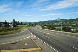
The Yellowhead Highway (French: Route Yellowhead) is a major interprovincial highway in Western Canada that runs from Winnipeg to Graham Island off the coast of British Columbia via Saskatoon and Edmonton. It stretches across the four western Canadian provinces of British Columbia, Alberta, Saskatchewan, and Manitoba and is part of the Trans-Canada Highway system and the larger National Highway System, but should not be confused with the more southerly, originally-designated Trans-Canada Highway. The highway was officially opened in 1970.[4] Beginning in 1990, the green and white Trans-Canada logo was used to designate the roadway.[3]
The highway is named for the Yellowhead Pass, the route chosen to cross the Canadian Rockies. The pass and the highway are named after a fur trader and explorer named Pierre Bostonais. He had yellow streaks in his hair, and was nicknamed "Tête Jaune" (Yellowhead). Almost the entire length of the highway is numbered as 16, except for the section in Manitoba that is concurrent with Trans-Canada Highway 1.
The highway number "16" is also the number given to a branch of the Trans-Canada in New Brunswick; Route 16. However, the numeric designation is strictly coincidental, and New Brunswick Route 16 is not part of the Yellowhead.
Route description[]
| km[1] | mi | |
|---|---|---|
| BC | 1,170 | 730 |
| AB | 634 | 394 |
| SK | 689 | 428 |
| MB | 366 | 227 |
| Total | 2,859 | 1,777 |
British Columbia and Alberta[]

In the west, the highway begins at Masset, British Columbia, on Haida Gwaii, heading south along Graham Island for 101 km (63 mi) to Skidegate. It then connects via a 172 km (107 mi) ferry route to Prince Rupert, then passes southeastward for 724 km (450 mi) through to Prince George, before travelling another 268 km (167 mi) eastward through to Tête Jaune Cache.[1]
A spur of the Yellowhead Highway, Highway 5, also known as the Southern Yellowhead Highway, connects the main highway at Tête Jaune Cache midway between the Alberta-British Columbia border and Prince George.[1] The highway continues past Kamloops before following the Coquihalla Highway to Hope. Unlike Highway 16, route 5 is not branded as being part of the Trans-Canada system and retains the original Yellowhead signage (whereas Highway 16 uses the Trans-Canada Highway logo).
The highway enters Alberta through the Rocky Mountains near Jasper, 100 km (62 mi) from Tête Jaune Cache, passes through Edmonton 366 km (227 mi) further east, and travels another 250 km (160 mi) before entering Saskatchewan at Lloydminster.[1] The highest point on the highway, at 1,163.9 m (3,819 ft), is Obed Summit near Obed, Alberta.[5]
Saskatchewan and Manitoba[]
The highway travels southeast for 282 km (175 mi) to Saskatoon, passing through North Battleford about halfway in between. From Saskatoon, the Yellowhead Highway continues its southeastern journey through the province for 329 km (204 mi) to Yorkton. The highway continues for another 90 km (56 mi) from Yorkton and enters Manitoba 16 km (9.9 mi) northwest of Russell.[1]
Within Manitoba, the highway travels 273 km (170 mi) before meeting the main Trans-Canada Highway near Portage la Prairie, Manitoba, where it ends its Highway 16 designation. It then overlaps the TCH into Winnipeg as an unnumbered highway. Officially, the eastern end of the Yellowhead Highway is at the corner of Portage Avenue and Main Street in Winnipeg. The total length of the Yellowhead Highway, including ferries, is 2,960 km (1,840 mi).[1]
History[]
The main Yellowhead Highway has been designated as Highway 16 for its entire length since 1977. Prior to this, only the Alberta and British Columbia portions of the highway were designated with this number. The Manitoba portion from the Trans-Canada Highway 10 km (6.2 mi) west of Portage la Prairie to the Saskatchewan border was designated as PTH 4 (redesignated PTH 16 in 1977), while the Saskatchewan portion (which was redesignated as Highway 16 in 1976) had two numbers designated. From the Manitoba border to Saskatoon, the highway was designated as Highway 14 while the portion from Saskatoon to Lloydminster and the Alberta border was designated as Highway 5. Prior to the opening of the Yellowhead Highway, Highways 5 and 14 both ran the width of Saskatchewan; the respective eastern and western portions of these highways retain their original designations. Prior to the highway retaining the number 16 designation, a very small section of the highway along Idylwyld Drive in Saskatoon was not designated with a number, as Highway 14 redirected on to 22 Street and Highway 5 would redirect on to Idylwyld Drive from 23 Street. Currently, the Yellowhead Highway remains unnumbered between Winnipeg and PTH 16, although it shares the roadway with PTH 1.[1]
While the beginnings of the Yellowhead highway can be traced back to 1819 when Iroquois Metis Pierre Bostonais, nicknamed Tête Jaune/Yellow Head, was engaged by the Hudson Bay Trading Company to guide them westward through the Rocky Mountains, the impetus for the building of the highway began in 1921 when a group from Edmonton formed to advocate for a drive-able road from Edmonton to Jasper/ Tête Jaune. In 1936 the advocacy was formalized with the formation of the Yellowhead Highway Association which later, in 1947, was reformed as the Trans-Canada Highway System Association and a submission was made to Prime Minister Mackenzie King to advocate for the construction of the highway. The Association was renamed the Trans Canada Yellowhead Highway Association (TCYHA) in 2000 to better reflect its roots. The iconic Yellowhead Highway signage seen along the highways is trademarked to the TCYHA. The Yellowhead Highway was officially opened in Western Canada in 1970; in 1978 all four Western Provinces agreed to use #16 for the highway. In 1986, the Yellowhead highway received the designation of a Trans Canada Highway with Highway #5 in BC, from Tête Jaune to Hope, remaining named just the Yellowhead Highway.

The Highway 5 in British Columbia used to be designated as part of the Yellowhead Highway only between Tête Jaune Cache and Kamloops, with Highway 5 south of Kamloops being signed with the standard BC highway shield.[6] In the 2000s, route markers along the Coquihalla Highway were changed to reflect Yellowhead Highway 5.
See also[]
- Trans-Canada Highway
- Numbered highways in Canada
- Highway of Tears murders
References[]
- ^ a b c d e f g h Google (January 4, 2017). "Yellowhead Highway in Canada" (Map). Google Maps. Google. Retrieved January 4, 2017.
- ^ "The Trans-Canada Highway: Backgrounder". Transport Canada. January 4, 2012. Archived from the original on August 5, 2016. Retrieved January 5, 2017.
- ^ a b See the following official road maps:
- Infrastructure and Transportation. The Province of Manitoba Official Highway Map (Map) (1989-1990 ed.). Province of Manitoba.
- Infrastructure and Transportation. The Province of Manitoba Official Highway Map (Map) (1990-1991 ed.). Province of Manitoba.
- Saskatchewan Highways and Transportation. Saskatchewan Official Highway Map (Map) (1989 ed.). Province of Saskatchewan.
- Saskatchewan Highways and Transportation. Saskatchewan Official Highway Map (Map) (1990 ed.). Province of Saskatchewan.
- Alberta Tourism. Alberta Official Road Map (Map) (1989 ed.). Province of Alberta.
- Alberta Tourism. Alberta Official Road Map (Map) (1990 ed.). Province of Alberta.
- ^ Jasper National Park - History - The Yellowhead Highway
- ^ Road sign at Obed Summit at 53°31′44″N 117°16′16″W / 53.52897°N 117.27124°W
- ^ Tourism British Columbia. Super, Natural British Columbia Road Map & Parks Guide (Map) (1997 ed.). Davenport Maps Ltd. §§ L-9, M-9.

External links[]
| Wikivoyage has a travel guide for Yellowhead Highway. |
Route map:
| ( • help)
|
Portions of the Trans-Canada Highway system | ||
|---|---|---|
| British Columbia | 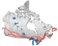 | |
| Alberta | ||
| Saskatchewan | ||
| Manitoba | ||
| Ontario | ||
| Quebec | ||
| New Brunswick | ||
| Prince Edward Island | ||
| Nova Scotia | ||
| Newfoundland | ||
| ||
- Yellowhead Highway