Yesler Way
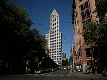 Yesler Way at 1st Avenue, looking east from the bottom of the hill. | |||
| Former name(s) | Mill Street[1] | ||
|---|---|---|---|
| Namesake | Henry Yesler | ||
| Maintained by | Seattle Department of Transportation | ||
| Length | 2.2 mi[2] (3.5 km) | ||
| Location | Seattle | ||
| West end | Alaskan Way at Colman Dock | ||
| Major junctions | Broadway at Yesler Terrace | ||
| East end | Leschi Park | ||
Yesler Way is an east–west street in Seattle named for Henry Yesler. East–west streets in Seattle south of Yesler Way are prefixed "South";[3] avenues are suffixed with "South" as they cross Yesler Way.[4] The street originates at Alaskan Way on the downtown Seattle waterfront and runs east through Yesler Terrace, the Central District, and Leschi to just east of 32nd Avenue, where the arterial route switches to Lake Dell Avenue. A short residential segment of East Yesler Way, which it turns into east of Broadway, exists to the west of Lake Washington Boulevard.
History[]

The line today followed by Yesler Way originally served to demarcate a place where two conflicting surveying efforts met. In the 1850s Arthur Denny and David Maynard, each working independently using different methods, created plats for the settlement that did not neatly overlay. To eventually settle the claims, the two plats were split along this line, with the southern portion following Maynard's east-west layout and the northern portion following the Denny approach of following the coastline.[5] With the line established, a street formed. When freshly cut logs were sent down the steep street, the street was referred to as Skid Road, which became genericized as Skid Row in other cities.[6]
The street was renamed to Yesler Way and later paved by Patrick J. McHugh in 1903.[7]

References[]
- ^ Dorpat, Paul (October 8, 2015). "Check out Seattle's building boom of 1883". The Seattle Times. Retrieved December 5, 2015.
- ^ Google (December 5, 2015). "Yesler Way" (Map). Google Maps. Google. Retrieved December 5, 2015.
- ^ Crowley, Walt; Dorpat, Paul (1998). "Navigating Downtown". National Trust Guide, Seattle: America's Guide for Architecture and History Travelers. New York: John Wiley & Sons. p. 22. ISBN 978-0-471-18044-9. LCCN 97-34627. OCLC 37527608. OL 687664M.
avenues south of Yesler Way are followed by 'South' ... Streets south of Yesler Way bear the prefix 'South'
- ^ Durham, Scott (May 31, 2010). "Key to Central District street addresses". Central District News. Seattle. Archived from the original on September 28, 2015. Retrieved December 5, 2015.
The north/south streets become suffixed with 'South' when they are south of Yesler Way ... East/west streets that are south of Yesler Way are prefixed with 'South'
- ^ "Plats filed for Town of Seattle on May 23, 1853. - HistoryLink.org".
- ^ Morrison, Patt (March 24, 1987). "Original 'Skid Road': Homeless Add a Sad Note to Gentrified Seattle Area". Los Angeles Times. ISSN 0458-3035. Archived from the original on October 25, 2015. Retrieved December 5, 2015.
Yesler Way—the nation's original 'Skid Row' ... Skid Road was christened here in the 1850s, when logs were 'skidded' by horses, mules or oxen down the steep, timber‑lined path to Henry Yesler's thriving sawmill on Elliott Bay.
- ^ Conover, C. T. (December 14, 1959). "P. J. McHugh Paved Many Of Seattle's First Streets". The Seattle Times. p. 21.
External links[]
 Media related to Yesler Way, Seattle at Wikimedia Commons
This Washington (state) road-related article is a stub. You can help Wikipedia by . |
- Streets in Seattle
- Western United States road stubs
- Washington (state) transportation stubs