Yilan City
This article needs additional citations for verification. (August 2015) |
Yilan
宜蘭市 Giran, I-ran | |
|---|---|
| Yilan City | |
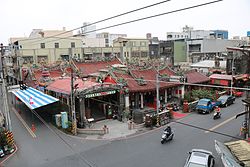 Temple in Yilan City | |
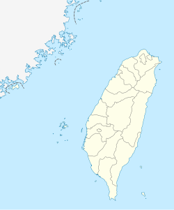 Yilan Location in the Republic of China (Taiwan) | |
| Coordinates: 24°45′N 121°45′E / 24.750°N 121.750°ECoordinates: 24°45′N 121°45′E / 24.750°N 121.750°E | |
| Country | |
| County | |
| Urban villages (里) | 38[1] |
| Government | |
| • Mayor | (江聰淵) |
| Area | |
| • Total | 29.87 km2 (11.53 sq mi) |
| Population (July 2018) | |
| • Total | 95,905 |
| • Density | 3,200/km2 (8,300/sq mi) |
| Time zone | UTC+8 (National Standard Time) |
| Postal code | 260 |
| Website | www |

| Yilan City | |||
|---|---|---|---|
| Traditional Chinese | 宜蘭市 | ||
| |||
Yilan City (Mandarin pinyin: yí lán shì;[2] Hokkien POJ: Gî-lân-chhī) is a county-administered city and the county seat of Yilan County, Taiwan. The city lies on the north side of the Lanyang River.
History[]
The Yilan Plain in which the city is located has historically been referred to as Kapalan (Chinese: 蛤仔難; Pe̍h-ōe-jī: Kap-á-lān),[3] Kapsulan (蛤仔蘭; Kap-chú-lân; also 甲子蘭), Komalan (噶瑪蘭; Kat-má-lán), etc. These names, as well as that of Yilan itself, were given to the sites by the Kavalan tribe of Taiwanese aborigines. Later arrivals included Han Chinese settlers during the Qing Dynasty in China (1802) and settlers from Okinawa during Taiwan's Japanese era (1895-1945).
Qing Dynasty[]
In 1810 under Qing dynasty rule, a formal administration office was established at Wuwei (五圍) and "Komalan Subprefecture" (噶瑪蘭廳; Kat-má-lán Thiaⁿ) was at the present day location of Yilan City. Construction of the city wall was completed a year later. After a few years once the basic infrastructure was ready, the city assumed the political, economical, cultural and educational center for the Lanyang Plain. In 1878, Komalan was a large rice production area commonly called Kapsulan, and became a district called Gilan Hsien.[4] It was one of the three new districts that constituted the new Taipeh Prefecture.
Empire of Japan[]

According to the 1904 census, the population of Giran town was about 15,000.[5]
Republic of China[]

After the handover of Taiwan from Japan to the Republic of China on 25 October 1945, Yilan City was created in January 1946 as a county-administered city the county seat of the newly created Yilan County and continue to become the political, economical and cultural centers of the region.[6]
Geography[]

Yilan City is located on Lanyang Plain with an average altitude of 7.38 meters above sea level.[7]
Climate[]
Yilan City experiences a humid subtropical climate (Köppen: Cfa) with mild winters and hot, humid summers.
| showClimate data for Yilan |
|---|
Administrative divisions[]
Yilan City consists of 38 villages and 478 neighborhoods, including:[1][9]
- Baili (擺厘里), Beijin (北津里), Beimen (北門里), Caiyuan (菜園里), Chenggong (成功里), Cian (慈安里), Daxin (大新里), Fuguo (負郭里), Fuxing (復興里), Jianjun (建軍里), Jianye (建業里), Jiaobai (茭白里), Jinshi (進士里), Kaixuan (凱旋里), Liming (黎明里), Meizhou (梅洲里), Minquan (民權里), Minzu (民族里), Nanjin (南津里), Nanmen (南門里), Nanqiao (南橋里), Qijie (七結里), Qizhang (七張里), Shennong (神農里), Siyuan (思源里), Taishan (泰山里), Dongcun (東村里), Dongmen/Tungmen (東門里), Wenhua (文化里), Xiaolian (孝廉里), Xiaodong (小東里), Ximen (西門里), Xinmin (新民里), Xinsheng (新生里), Xindong (新東里), Yanping (延平里), Zhongshan (中山里) and Zhongxing (中興里)
Government institutions[]
Tourist attractions[]
- Former Yilan Prison
- Memorial Hall of Founding of Yilan Administration
- Yilan Brick Kiln
- Yilan Distillery Chia Chi Lan Wine Museum
- Yilan Literary Museum
- Yilan Museum of Art
Transportation[]

Yilan City is accessible by Yilan Station of the Taiwan Railways.
References[]
- ^ Jump up to: a b 各里里長 [Village leaders] (in Chinese). Yilan City Office. Retrieved 2017-02-21.
宜蘭市總里數 :38里,鄰數:478
- ^ 教育部重編國語辭典修訂本 (in Chinese). Retrieved 23 November 2019.
字詞 【宜蘭市】 注音 ㄧˊ ㄌㄢˊ ㄕˋ 漢語拼音 yí lán shì
- ^ "Entry #40193 (蛤仔難)". 臺灣閩南語常用詞辭典 [Dictionary of Frequently-Used Taiwan Minnan]. (in Chinese and Hokkien). Ministry of Education, R.O.C. 2011.
- ^ Davidson, James W. (1903). The Island of Formosa, Past and Present. London and New York: Macmillan. p. 211. OCLC 1887893. OL 6931635M.
- ^ Takekoshi (1907), p. 200.
- ^ "Discovery Center of YiLan - Yilan City Office". Ilancity.gov.tw. Retrieved 2014-05-25.
- ^ Jump up to: a b 認識宜蘭市 [Get to Know Yilan City]. ilancity.gov.tw (in Chinese). Yilan City Office. Retrieved 2017-02-21.
- ^ 宜蘭縣宜蘭市 現住人口數按性別及年歲分 [Resident Population Figures by Gender and Age, Yilan City, Yilan County] (PDF). ilhhr.e-land.gov.tw (in Chinese). Yilan City Household Registration Office. December 2016. Retrieved 2017-02-21.
- ^ "2018 Local Elections". Central Election Commission. Retrieved 23 November 2019.
Shennong Vil. Minquan Vil. Jinshi Vil. Nanqiao Vil. Jianye Vil. Nanjin Vil. Kaixuan Vil. Liming Vil. Tungcun Vil. Yanping Vil. Qizhang Vil. Cian Vil. Xinmin Vil. Tungmen Vil. Xiaotung Vil. Caiyuan Vil. Xiaolian Vil. Xinsheng Vil. Jiaobai Vil. Beijin Vil. Meizhou Vil. Beimen Vil. Zhongshan Vil. Ximen Vil. Nanmen Vil. Fuguo Vil. Minzu Vil. Jianjun Vil. Siyuan Vil. Wenhua Vil. Fuxing Vil. Chenggong Vil. Xintung Vil. Qijie Vil. Taishan Vil. Daxin Vil. Zhongxing Vil. Baili Vil.
Bibliography[]
- Takekoshi, Yosaburō (1907). Japanese rule in Formosa. London, New York, Bombay and Calcutta: Longmans, Green, and co. OCLC 753129. OL 6986981M.
External links[]
| Wikimedia Commons has media related to Yilan City. |
| Wikivoyage has a travel guide for Yilan. |
| show Cities and townships of Yilan County |
|---|
| show Authority control |
|---|
- ^ Sarah Shair-Rosenfield (November 2020). "Taiwan combined" (PDF). The University of North Carolina at Chapel Hill. Retrieved 29 May 2021.
- County-administered cities of Taiwan
- Populated places in Yilan County, Taiwan