Yomogita
Yomogita
蓬田村 | |
|---|---|
Village | |
 Yomogita village hall | |
 Flag  Seal | |
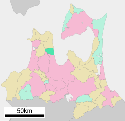 Location of Yomogita in Aomori Prefecture | |
 Yomogita | |
| Coordinates: 40°58′18.4″N 140°39′21.7″E / 40.971778°N 140.656028°ECoordinates: 40°58′18.4″N 140°39′21.7″E / 40.971778°N 140.656028°E | |
| Country | Japan |
| Region | Tōhoku |
| Prefecture | Aomori |
| District | Higashitsugaru |
| Area | |
| • Total | 80.84 km2 (31.21 sq mi) |
| Population (March 31, 2020) | |
| • Total | 2,740 |
| • Density | 34/km2 (88/sq mi) |
| Time zone | UTC+9 (Japan Standard Time) |
| City symbols | |
| • Tree | Japanese black pine |
| • Flower | Rosa rugosa |
| • Bird | Whooper swan |
| Phone number | 0174-27-2111 |
| Address | 1-3 Shiooshi, Yomogita-mura, Higashitsugaru-gun, Aomori-ken 030-1211 |
| Website | Official website |

Yomogita (蓬田村, Yomogita-mura) is a village located in Aomori Prefecture, Japan and a part of the Aomori metropolitan area.[1] As of 31 March 2020, the village had an estimated population of 2740 in 1147 households,[2] and a population density of 34 persons per km2. The total area of the village is 80.84 square kilometres (31.21 sq mi).
Geography[]
Yomogita is in Higashitsugaru District of Aomori Prefecture, and occupies a portion of the eastern coastline of Tsugaru Peninsula, facing Mutsu Bay.
Neighbouring municipalities[]
- Aomori Prefecture
- Aomori
- Goshogawara
- Sotogahama
- Nakadomari
Climate[]
The village has a cold humid continental climate (Köppen Cfb) characterized by warm short summers and long cold winters with heavy snowfall. The average annual temperature in Yomogita is 10.1 °C. The average annual rainfall is 1266 mm with September as the wettest month. The temperatures are highest on average in August, at around 23.1 °C, and lowest in January, at around -1.8 °C.[3]
Demographics[]
Per Japanese census data,[4] the population of Yomogita peaked in the 1950s and has been in decline since. It is now less than it was a century ago.
| Year | Pop. | ±% |
|---|---|---|
| 1920 | 3,601 | — |
| 1930 | 3,844 | +6.7% |
| 1940 | 4,196 | +9.2% |
| 1950 | 5,429 | +29.4% |
| 1960 | 5,435 | +0.1% |
| 1970 | 4,771 | −12.2% |
| 1980 | 4,360 | −8.6% |
| 1990 | 4,052 | −7.1% |
| 2000 | 3,480 | −14.1% |
| 2010 | 3,271 | −6.0% |
History[]
The area around Yomogita was controlled by the Tsugaru clan of Hirosaki Domain during the Edo period. After the Meiji Restoration, it was formed into a village on April 1, 1889 with the establishment of the modern municipalities system.
Economy[]
The economy of Yomogita is heavily dependent on agriculture (rice and tomatoes) and commercial fishing. Some of the locally caught seafood include sea urchin roe, sea cucumber, scallops, abalone and squid.
Education[]
Yomogita has one public elementary school and one public junior high school operated by the village government. The village does not have a high school
Transportation[]
Railway[]
![]() East Japan Railway Company (JR East) - Tsugaru Line
East Japan Railway Company (JR East) - Tsugaru Line
Highway[]
Noted people from Yomogita[]
- Hiroyuki Takei, manga artist
References[]
- ^ "2010 Metropolitan Employment Map". University of Tokyo. Retrieved 6 July 2020.
- ^ official home page (in Japanese)
- ^ Yomogita climate data
- ^ Yomogita population statistics
External links[]
![]() Media related to Yomogita, Aomori at Wikimedia Commons
Media related to Yomogita, Aomori at Wikimedia Commons
- Official website (in Japanese)
| show Authority control |
|---|
- Villages in Aomori Prefecture
- Populated coastal places in Japan
- Yomogita, Aomori
- Aomori metropolitan area