
Yorkletts
| Yorkletts | |
|---|---|
 | |
 Yorkletts Location within Kent | |
| OS grid reference | TR0963 |
| District | |
| Shire county | |
| Region | |
| Country | England |
| Sovereign state | United Kingdom |
| Post town | Whitstable |
| Postcode district | CT5 |
| Dialling code | 01227 |
| Police | Kent |
| Fire | Kent |
| Ambulance | South East Coast |
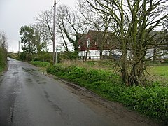
Yorkletts is a settlement two miles south of Whitstable in Kent in South East England.[1] At the 2011 Census the settlement was included in the Seasalter ward of the City of Canterbury Council, and it is one of the smaller villages in the City of Canterbury.[2]
Yorkletts is home to the large Woodland Trust site, Victory Woods, with views over the North Sea.
References[]
- ^ Ordnance Survey: Landranger map sheet 179 Canterbury & East Kent (Dover & Margate) (Map). Ordnance Survey. 2013. ISBN 9780319228784.
- ^ Canterbury City Council - Rural Settlement Hierarchy Study 2011 https://www.canterbury.gov.uk/planning-and-building/local-planning-policies/current-local-plan-evidence-base-strategies/
External links[]
![]() Media related to Yorkletts at Wikimedia Commons
Media related to Yorkletts at Wikimedia Commons

This Kent location article is a stub. You can help Wikipedia by . |
Categories:
- Villages in Kent
- Kent geography stubs