Yount, Missouri
Yount, Missouri | |
|---|---|
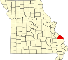 Location of Perry County, Missouri | |
| Coordinates: 37°36′19″N 90°02′20″W / 37.60528°N 90.03889°WCoordinates: 37°36′19″N 90°02′20″W / 37.60528°N 90.03889°W | |
| Country | United States |
| State | Missouri |
| County | Perry |
| Township | Saint Mary’s |
| Elevation | 623 [1] ft (190 m) |
| Time zone | UTC-6 (Central (CST)) |
| • Summer (DST) | UTC-5 (CDT) |
| ZIP code | 63775 |
| Area code(s) | 573 |
| FIPS code | 29-81394 [2] |
| GNIS feature ID | 753014 [2] |

Yount is an unincorporated settlement in Saint Mary's Township in Perry County, Missouri.
History[]
Yount was established in 1886 as Yount's Store, and was named for Henry Yount,[3] a merchant and storekeeper, as well as a postmaster and county judge. The name was shortened to Yount in 1888.[4] The post office operated in Yount from 1887 until 1954.[5]
Mt. Pisca Lutheran church was founded in Yount in 1852 and continued until 1868. In that same year (1868) the church became the Mt. Zion Lutheran church which existed until 1974.
Geography[]
Yount is located 17 miles southwest of Perryville, Missouri.[6]
References[]
- ^ cartographic.info http://cartographic.info/usa/map.php?id=753014
- ^ a b Roadside Thoughts.com http://www.roadsidethoughts.com/mo/yount-misc.htm
- ^ Eaton, David Wolfe (1917). How Missouri Counties, Towns and Streams Were Named. The State Historical Society of Missouri. pp. 338.
- ^ State Historical Society of Missouri: Perry County http://shs.umsystem.edu/manuscripts/ramsay/ramsay_perry.html
- ^ Missouri Postal History http://www.missouripostalhistory.org/pe157pe.htm
- ^ A Directory of Towns, Villages, and Hamlets Past and Present of Perry County, Missouri http://thelibrary.org/lochist/moser/perrypl.html
Municipalities and communities of Perry County, Missouri, United States | ||
|---|---|---|
| Cities |  | |
| Village | ||
| Townships | ||
| CDPs | ||
| Other communities | ||
| Abandoned villages | ||
| Footnotes | ‡This populated place also has portions in an adjacent county or counties | |
| ||
This Perry County, Missouri state location article is a stub. You can help Wikipedia by . |
Categories:
- Unincorporated communities in Perry County, Missouri
- Unincorporated communities in Missouri
- Southeast Missouri geography stubs