Água Clara
This article may be expanded with text translated from the corresponding article in Portuguese. (February 2018) Click [show] for important translation instructions.
|
Água Clara | |
|---|---|
 Flag  Coat of arms | |
 Location in Mato Grosso do Sul state | |
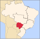
 Água Clara Location in Brazil | |
| Coordinates: 20°26′52″S 52°52′40″W / 20.44778°S 52.87778°WCoordinates: 20°26′52″S 52°52′40″W / 20.44778°S 52.87778°W | |
| Country | Brazil |
| Region | Central-West |
| State | Mato Grosso do Sul |
| Government | |
| • Mayor | (PDT, 2017 - 2020) |
| Area | |
| • Total | 11,031 km2 (4,259 sq mi) |
| Population (2020 [1]) | |
| • Total | 15,776 |
| • Density | 1.4/km2 (3.7/sq mi) |
| Time zone | UTC−4 (AMT) |

Água Clara is a municipality located in the Brazilian state of Mato Grosso do Sul. Its population was 15,776 (2020) and its area is 11,031 km2 (4,259 sq mi).
Geography[]
The municipality of Água Clara is located in the south of the Midwest region of Brazil. It is located at latitude 20º26'53 ” south and longitude 52º52'40” west. It has just over 14 thousand inhabitants. It is 204 km from the state capital (Campo Grande) and 868 km from the federal capital (Brasília).
References[]
Capital: Campo Grande | |||||||||
| Mesoregion Centro Norte de Mato Grosso do Sul |
|  | |||||||
| Mesoregion Leste de Mato Grosso do Sul |
| ||||||||
| Mesoregion Pantanal Sul Mato-Grossense |
| ||||||||
| Mesoregion Sudoeste de Mato Grosso do Sul |
| ||||||||
This Mato Grosso do Sul, Brazil location article is a stub. You can help Wikipedia by . |
Categories:
- Municipalities in Mato Grosso do Sul
- Mato Grosso do Sul geography stubs