Anaurilândia
Anaurilândia | |
|---|---|
 Flag | |
 Location in Mato Grosso do Sul state | |
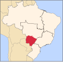
 Anaurilândia Location in Brazil | |
| Coordinates: 22°11′16″S 52°43′04″W / 22.18778°S 52.71778°WCoordinates: 22°11′16″S 52°43′04″W / 22.18778°S 52.71778°W | |
| Country | Brazil |
| Region | Central-West |
| State | Mato Grosso do Sul |
| Area | |
| • Total | 3,396 km2 (1,311 sq mi) |
| Population (2020 [1]) | |
| • Total | 9,076 |
| • Density | 2.7/km2 (6.9/sq mi) |
| Time zone | UTC−4 (AMT) |

Anaurilândia is a municipality located in the Brazilian state of Mato Grosso do Sul. Its population was 9,076 (2020) and its area is 3,396 km². The town was founded by Jan Antonín Baťa, the king of shoes.
Anaurilândia is a small settlement is surrounded by agricultural land and on the northside of the Rio Parana. MS-395 is a paved single lane highway that pass through the town and connects with another Bata town, Bataiporã.
Other towns in Brazil linked to Bata:
- Mariápolis
- Bataguassu
- Batatuba
- Bataiporã
See also[]
References[]
Capital: Campo Grande | |||||||||
| Mesoregion Centro Norte de Mato Grosso do Sul |
|  | |||||||
| Mesoregion Leste de Mato Grosso do Sul |
| ||||||||
| Mesoregion Pantanal Sul Mato-Grossense |
| ||||||||
| Mesoregion Sudoeste de Mato Grosso do Sul |
| ||||||||
This Mato Grosso do Sul, Brazil location article is a stub. You can help Wikipedia by . |
Categories:
- Municipalities in Mato Grosso do Sul
- Bata Corporation
- Mato Grosso do Sul geography stubs