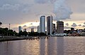
Mato Grosso do Sul
show This article may be expanded with text translated from the corresponding article in Portuguese. (April 2011) Click [show] for important translation instructions. |
Mato Grosso do Sul | |
|---|---|
| Estado de Mato Grosso do Sul State of Mato Grosso do Sul | |
 Flag  Coat of arms | |
| Anthem: Hino de Mato Grosso do Sul | |
 Location of State of Mato Grosso do Sul in Brazil | |
| Country | |
| Founded | October 11, 1977 |
| Capital and Largest City | Campo Grande |
| Government | |
| • Governor | Reinaldo Azambuja (PSDB) |
| • Vice Governor | Murilo Zauith (DEM) |
| • Senators | Nelsinho Trad (PSD) Simone Tebet (MDB) Soraya Thronicke (PSL) |
| Area | |
| • Total | 357,124.962 km2 (137,886.719 sq mi) |
| Area rank | 6th |
| Population (2007)[1] | |
| • Total | 2,449,024 |
| • Estimate (2019) | 2,778,986 |
| • Rank | 21st |
| • Density | 6.9/km2 (18/sq mi) |
| • Density rank | 20th |
| Demonym(s) | Sul-mato-grossense or Mato-grossense-do-sul |
| GDP | |
| • Year | 2010 estimate |
| • Total | R$ 38.484,74 (17th) |
| • Per capita | R$ 10,599 (11th) |
| HDI | |
| • Year | 2017 |
| • Category | 0.766[2] – high (11th) |
| Time zone | UTC-4 (BRT-1) |
| Postal Code | 79000-000 to 79990-000 |
| ISO 3166 code | BR-MS |
| Website | ms.gov.br |
Mato Grosso do Sul (Portuguese pronunciation: [ˈmatu ˈɡɾosu du ˈsuw] (![]() listen)[3]) is one of the Midwestern states of Brazil. Neighboring Brazilian states are (from north clockwise) Mato Grosso, Goiás, Minas Gerais, São Paulo and Paraná. It also borders the countries of Paraguay, to the southwest, and Bolivia, to the west. The economy of the state is largely based on agriculture and cattle-raising. Crossed in the south by the Tropic of Capricorn, Mato Grosso do Sul generally has a warm, sometimes hot, and humid climate, and is crossed by numerous tributaries of the Paraná River. The state has 1,3% of the Brazilian population and is responsible for 1,5% of the Brazilian GDP.
listen)[3]) is one of the Midwestern states of Brazil. Neighboring Brazilian states are (from north clockwise) Mato Grosso, Goiás, Minas Gerais, São Paulo and Paraná. It also borders the countries of Paraguay, to the southwest, and Bolivia, to the west. The economy of the state is largely based on agriculture and cattle-raising. Crossed in the south by the Tropic of Capricorn, Mato Grosso do Sul generally has a warm, sometimes hot, and humid climate, and is crossed by numerous tributaries of the Paraná River. The state has 1,3% of the Brazilian population and is responsible for 1,5% of the Brazilian GDP.
The state is also known for its natural environment, and is a destination for domestic and international tourism. The Pantanal lowlands cover 12 municipalities and presents a variety of flora and fauna, with forests, natural sand banks, savannahs, open pasture, fields and bushes. The city Bonito, in the mountain of Bodoquena, has prehistoric caves, natural rivers, waterfalls, swimming pools and the Blue Lake cave.
The name Mato Grosso do Sul is Portuguese for "Southern Thick Bush"; the name is inherited from its northern neighbour state of Mato Grosso, of which it was part until the 1970s. It is not uncommon for people to mistakenly refer to Mato Grosso do Sul as simply "Mato Grosso". Other names that were proposed, at the time of the split and afterwards, include "Pantanal" (a reference to its best known geographical feature) and "Maracaju" (a reference to the Maracaju Mountain Range that crosses the state from north to south).
Geography[]
Climate[]

Mato Grosso do Sul has humid subtropical and tropical climates. The average annual rainfall is 1471.1 mm. January is the warmest month, with mean maximum of 34 °C (93.2 °F) and minimum of 24 °C (75.2 °F) and more rain; July experiences the coldest temperatures, with mean maximum of 25 °C (77 °F) and minimum of -2,0 °C (28 °F) and sun.
Vegetation[]


The "cerrado" landscape is characterized by extensive savanna formations crossed by gallery forests and stream valleys. Cerrado includes various types of vegetation. Humid fields and "buriti" palm paths are found where the water table is near the surface. Alpine pastures occur at higher altitudes and mesophytic forests on more fertile soils. The "cerrado" trees have characteristic twisted trunks covered by a thick bark, and leaves which are usually broad and rigid. Many herbaceous plants have extensive roots to store water and nutrients. The plant's thick bark and roots serve as adaptations for the periodic fires which sweep the cerrado landscape. The adaptations protect the plants from destruction and make them capable of sprouting again after the fire.
The state is located in western Brazil, in a region mostly occupied by the inland marshes of the Pantanal. The highest elevation is the 1,065 m high Morro Grande.

History[]
The first peoples or indigenous peoples of Mato Grosso do Sul, particularly occupying the Nhande Ru Marangatu tropical rainforested area, are the Guarani-Kaiowá, first contacted by non-indigenous peoples in the 1800s.
In October 11, 1977, the state was created by dividing the state of Mato Grosso. Its status as a state went into full effect two years later on January 1, 1979. The new state also incorporated the former territory of and the northern part of the former territory of Iguaçu.
Demographics[]

According to the IBGE of 2008, there were 2,372,000 people residing in the state. The population density was 6.4 inhabitants/km2.
Urbanization: 84.7% (2006); Population growth: 1.7% (1991–2000); Houses: 689,000 (2006)[4]
The last PNAD (National Research for Sample of Domiciles) census revealed the following numbers: 1,157,000 White people (51.78%), 1,056,000 Brown (Multiracial) people (44.51%), 122,000 Black people (5.15%), 20,000 Amerindian people (0.84%), 15,000 Asian people (0.64%).[5]
In the Cerrado areas, mostly in the south, central and east, there is a predominance of Southern Brazilian farmers of Spanish, German, Portuguese, Italian and Slavic descent.
According to an autosomal DNA study from 2008, the ancestral composition of Mato Grosso do Sul is 73,60% European, 13,90% African and 12,40% Native American.[6] Additionally, according to a different 2013 DNA study, the ancestral composition of Mato Grosso do Sul is: 58.8% European, 25.9% Amerindian and 15.3% African ancestries, respectively.[7]
Largest cities[]
Largest cities or towns in Mato Grosso do Sul
(2011 census by the Brazilian Institute of Geography and Statistics)[8] | |||||||||
|---|---|---|---|---|---|---|---|---|---|
| Rank | Mesoregion | Pop. | Rank | Mesoregion | Pop. | ||||
 Campo Grande 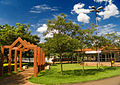 Dourados |
1 | Campo Grande | 796 252 | 11 | Maracaju | 38 264 |  Corumbá  Três Lagoas | ||
| 2 | Dourados | 198 421 | 12 | Amambai | 35 133 | ||||
| 3 | Corumbá | 104 317 | 13 | Coxim | 32 258 | ||||
| 4 | Três Lagoas | 103 536 | 14 | Rio Brilhante | 31 279 | ||||
| 5 | Ponta Porã | 79 173 | 15 | Caarapó | 26 155 | ||||
| 6 | Naviraí | 47 173 | 16 | Miranda | 25 794 | ||||
| 7 | Nova Andradina | 46 368 | 17 | Jardim | 24 484 | ||||
| 8 | Aquidauana | 45 781 | 18 | Anastácio | 23 939 | ||||
| 9 | Sidrolândia | 43 563 | 19 | Bela Vista | 23 290 | ||||
| 10 | Paranaíba | 40 329 | 20 | Ivinhema | 22 395 | ||||
Economy[]
The service sector is the largest component of GDP at 46.1%, followed by the industrial sector at 22.7%. Agriculture represents 31.2%, of GDP (2004). Mato Grosso do Sul exports: soybean 34.9%, pork and chicken 20.9%, beef 13.7%, ores 8%, leather 7.4%, timber 5.1% (2002).
Share of the Brazilian economy: 1% (2005).

According to data from 2020, if Mato Grosso do Sul were a country, it would be the world's fifth largest producer of oilseeds.[9] In 2020, Mato Grosso do Sul was the 5th biggest grain producer in the country, with 7.9%.[10] In soy, produced 10.5 million tons in 2020, one of the largest producing states in Brazil, around 5th place.[11] It's the 4th largest producer of sugarcane, with around 49 million tons harvested in the 2019/20 harvest.[12][10] In 2019, Mato Grosso do Sul was also one of the largest producer of maize in the country with 10,1 million tons.[13] In cassava production, Brazil produced a total of 17.6 million tons in 2018. Mato Grosso do Sul was the 6th largest producer in the country, with 721 thousand tons.[14]
The state has the 4th largest cattle herd in Brazil, with a total of 21.4 million head of cattle.[15] The state is a major exporter of beef, but also poultry and pork. In poultry farming, the state had, in 2017, a flock of 22 million birds.[16] In pork, in 2019, Mato Grosso do Sul slaughtered more than 2 million animals. The state occupies the 7th Brazilian position in pig farming, moving towards becoming the 4th largest Brazilian producer in the coming years.[17]
In 2017, Mato Grosso do Sul had 0.71% of the national mineral participation (6th place in the country). Mato Grosso do Sul had production of iron (3.1 million tons at a value of R$ 324 million) and manganese (648 thousand tons at a value of R$ 299 million).[18]
Mato Grosso do Sul had an industrial GDP of R $ 19.1 billion in 2017, equivalent to 1.6% of the national industry. It employs 122,162 workers in the industry. The main industrial sectors are: Public Utility Industrial Services, such as Electricity and Water (23.2%), Construction (20.8%), Food (15.8%), Pulp and Paper (15.1%) and Petroleum Derivatives and Biofuels (12.5%). These 5 sectors concentrate 87.4% of the state's industry.[19]
In the city of Três Lagoas, the production of paper and cellulose is considerable. Mato Grosso do Sul recorded growth above the national average in the production of cellulose, reached the mark of 1 million hectares of planted eucalyptus, expanded its industrial park in the sector and consolidated itself as the largest exporter of the product in the country in the first quarter of 2020. Between 2010 and 2018, production in the south of Mato Grosso increased by 308%, reaching 17 million cubic meters of round wood for paper and cellulose in 2018. In 2019, Mato Grosso do Sul reached the leadership of exports in the product in the country, with 9.7 million tons traded: 22.20% of the total Brazilian pulp exports that year.[20]
Miscellaneous facts[]
Vehicles: 835,259 (June 2009); Mobile phones: 2.407 million (July/2009); Telephones: 471,000 (April 2007); Cities: 78 (2007)[21]
Education[]

There are more than 44 universities in whole state of Mato Grosso do Sul.[22]
Educational institutions[]
- Universidade Federal de Mato Grosso do Sul (UFMS) (Federal University of Mato Grosso do Sul)
- Universidade Estadual de Mato Grosso do Sul (Uems) (State University of Mato Grosso do Sul)
- Universidade Federal da Grande Dourados (UFGD) (Federal University of Dourados Region)
- Universidade Católica Dom Bosco (UCDB) (Dom Bosco Catholic University)
- Universidade para o Desenvolvimento do Estado e da Região do Pantanal (Uniderp) (University for the Development of the State and Region of the Pantanal)
Culture[]

Campo Grande Film Festival[]
It's a film festival held annually in the months of January and February and has been arranged since 2004. It focuses on the independent cinema presenting Brazilian films and foreign films as well. It also presents regional films and short films. As of 2011 the festival is suspended.
Bonito's Winter Festival[]
"Festival de Inverno de Bonito" (Bonito Winter Festival) is held every year for a week during July or August, with music performances and ecological videos, theatre, folklore and fine arts exhibitions.
Pantanal Micareta[]
Aquidauana's biggest event is the Pantanal Micareta, which attracts thousands of tourists to Dr. Sabino Avenue, annually.
Tourism and recreation[]


Bonito[]
Concentrations of lime in the soil around the area where Bonito is located is responsible for the transparency of the waters and for the existence of a wide variety of geological formations. Local activities include diving in caverns, observing the underwater fauna and walking along trails in the forest.[citation needed] Places like Gruta Lago Azul (Blue Lake Cave) and the Fazenda Estancia Mimosa, Aquario Natural (Natural Aquarium), and the rivers Sucuri, Prata, and Formoso, are popular.[citation needed]
South Pantanal[]
The Pantanal is an ecological destination in the heart of Brazil.[citation needed] It is the largest flooded lowland on the planet and the third largest environmental reserve in the world. It is home to one of the richest ecosystems ever found to date,[citation needed] with periodically flooded seasonal forests. It displays the largest concentration of neo-tropical fauna, including several endangered species – mammals, reptiles and fish – and it also serves as habitat for a variety of native birds, as well as those migrating from other areas in the Americas. The Pantanal is one of the best places in Brazil for flora and fauna observation and for fishing – permitted only between March and October – due to its abundance of animals.[citation needed] It has a total area of 230,000 square kilometres, covering 12 townships in the States of Mato Grosso and Mato Grosso do Sul. To the North, there are the Paracis, Azul and Roncador mountains. To the East, the Maracaju Mountain Range. To the South, the Dodoquena Mountain Range. And, to the West, the Paraguayan and Bolivian swamps. The Pantanal is so diverse that researchers subdivided it in sub-regions. Each "Pantanal" – North and South – has its own natural features, activities and ideal period for visitation.
Infrastructure[]
International Airports[]

- Campo Grande - The operation of Campo Grande International Airport is shared with the Campo Grande Air Base. The airport has two runways. Construction of the main runway, made of concrete, began in 1950 and was finished in 1953. The passenger terminal was concluded in 1964, and in 1967 concrete aprons were built for both military and civilian aircraft. As commercial aviation demand grew, it became necessary to widen the civil aircraft apron, which was completed 12 years after its construction. The airport has been administered by Infraero since 1975.
- Corumbá - Corumbá International Airport, located just 3 km (1.86 mi) from the city center, was opened on September 21, 1960, the city's anniversary. Built on a land plot of 290 hectares and at an elevation of 140 meters above sea, it has an asphalt runway measuring 1660 x 30 meters, with one of its thresholds reinforced with concrete for an additional 60 meters. Corumbá International Airport has been administered by Infraero since February 1975.
- Ponta Porã - Ponta Porã International Airport is also administered by Infraero.
Other airports[]
- Dourados Regional Airport
- Bonito Airport
Highways[]

Flag[]
Mato Grosso do Sul's flag was designed by Mauro Michael Munhoz. A white stripe divides an upper left green corner from a bottom right blue space with a yellow star. White symbolizes hope, green is an allusion to the state's rich flora, blue represents its vast sky, while the yellow star adds balance, force and serenity. The star on the flag is Alphard, the brightest star in the constellation Hydra.
See also[]
- Brazil
- Pantanal jaguar
References[]
- ^ "IBGE". Retrieved 23 May 2015.
- ^ "Radar IDHM: evolução do IDHM e de seus índices componentes no período de 2012 a 2017" (PDF) (in Portuguese). PNUD Brasil. Retrieved 18 April 2019.
- ^ In Brazilian Portuguese. The European Portuguese pronunciation is [ˈmatu ˈɣɾosu ðu ˈsuɫ].
- ^ Source: PNAD.
- ^ Tabela 262 - População residente, por cor ou raça, situação e sexo (PDF) (in Portuguese). Mato Grosso do Sul, Brazil: IBGE. 2008. ISBN 85-240-3919-1. Retrieved 2010-01-18.
- ^ "Untitled Document" (PDF). Archived from the original on 6 July 2011. Retrieved 23 May 2015.
- ^ Revisiting the Genetic Ancestry of Brazilians Using Autosomal AIM-Indels
- ^ "Estimativas da população residente nos municípios brasileiros com data de referência em 1º de julho de 2011" [Estimates of the Resident Population of Brazilian Municipalities as of July 1, 2011] (in Portuguese). Brazilian Institute of Geography and Statistics. 30 August 2011. Archived from the original (PDF) on 31 August 2011. Retrieved 31 August 2011.
- ^ MS deve registrar maior safra de soja da história e produção pode chegar a mais de 11 milhões de toneladas
- ^ Jump up to: a b IBGE prevê safra recorde de grãos em 2020
- ^ Produção de 10 milhões de toneladas confirma safra recorde de soja em Mato Grosso do Sul
- ^ Goiás é o segundo maior produtor de cana-de-açúcar do País
- ^ Produção de milho em MS pode chegar a mais de 10 milhões de toneladas
- ^ Produção brasileira de mandioca em 2018
- ^ Com quarto maior rebanho bovino do país, MS recebe evento para debater todos os elos da cadeia produtiva
- ^ Com um rebanho de 22 milhões de aves, setor avícola gera 8,8 mil empregos diretos em MS
- ^ MS caminha para se tornar o 4º maior produtor de suínos do país
- ^ Algumas Gemas Clássicas
- ^ Industry Profile of Mato Grosso do Sul
- ^ MS se consolida como maior exportador de celulose do país
- ^ Source: IBGE.
- ^ OnLine - Hospedagens e Desenvolvimento de Web Sites. "Faculdades reconhecidas pelo MEC, Vestibular, Apostilas, Universitário, Profissão, Professor". Ser Universitário. Retrieved 23 May 2015.
External links[]
 Definitions from Wiktionary
 Media from Wikimedia Commons
 News from Wikinews
 Quotations from Wikiquote
 Texts from Wikisource
 Textbooks from Wikibooks
 Travel guide from Wikivoyage
 Resources from Wikiversity
- (in Portuguese) Official Website
- (in English) Tourism Website
| show Authority control |
|---|
Coordinates: 20°26′34″S 54°38′45″W / 20.44278°S 54.64583°W

- Mato Grosso do Sul
- States of Brazil
- States and territories established in 1979