Évette-Salbert
Évette-Salbert | |
|---|---|
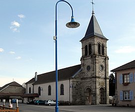 Saint-Claude Church | |
 Coat of arms | |
show Location of Évette-Salbert | |
 Évette-Salbert | |
| Coordinates: 47°40′33″N 6°47′56″E / 47.6758°N 6.7989°ECoordinates: 47°40′33″N 6°47′56″E / 47.6758°N 6.7989°E | |
| Country | France |
| Region | Bourgogne-Franche-Comté |
| Department | Territoire de Belfort |
| Arrondissement | Belfort |
| Canton | Valdoie |
| Intercommunality | Grand Belfort |
| Government | |
| • Mayor (2021–2026) | Laurent Demesy[1] |
| Area 1 | 9.16 km2 (3.54 sq mi) |
| Population (Jan. 2018)[2] | 2,044 |
| • Density | 220/km2 (580/sq mi) |
| Time zone | UTC+01:00 (CET) |
| • Summer (DST) | UTC+02:00 (CEST) |
| INSEE/Postal code | 90042 /90350 |
| Elevation | 382–474 m (1,253–1,555 ft) |
| 1 French Land Register data, which excludes lakes, ponds, glaciers > 1 km2 (0.386 sq mi or 247 acres) and river estuaries. | |


Évette-Salbert is a commune in the Territoire de Belfort department in Bourgogne-Franche-Comté in northeastern France.
See also[]
| Wikimedia Commons has media related to Évette-Salbert. |
References[]
- ^ "Répertoire national des élus: les maires". data.gouv.fr, Plateforme ouverte des données publiques françaises (in French). 9 August 2021.
- ^ "Populations légales 2018". INSEE. 28 December 2020.
External links[]
- Official website (in French)
This Territoire de Belfort geographical article is a stub. You can help Wikipedia by . |
Categories:
- Communes of the Territoire de Belfort
- Territoire de Belfort geography stubs