2019 Yamagata earthquake
 | |
| UTC time | 2019-06-18 13:22:20 |
|---|---|
| ISC event | 615958611 |
| USGS-ANSS | ComCat |
| Local date | June 18, 2019 |
| Local time | 10:22 p.m. JST |
| Magnitude | 6.4 Mw
(USGS) 6.7 MJMA (JMA) |
| Depth | 10 km (6 mi) |
| Epicenter | 38°38′06″N 139°27′14″E / 38.635°N 139.454°ECoordinates: 38°38′06″N 139°27′14″E / 38.635°N 139.454°E |
| Type | Reverse fault |
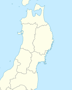
| Areas affected | Ishikawa Prefecture, Miyagi Prefecture, Niigata Prefecture, Yamagata Prefecture, and southern Akita Prefecture[1] |
| Max. intensity | VII (Very strong) JMA 6+ |
| Tsunami | Yes (up to 10 cm (4 in))[2][3] |
| Casualties | 26 injured |

An earthquake measuring 6.4 Mw struck primarily the Hokuriku region centered on Tsuruoka, Yamagata in Japan, on 18 June 2019 at 10:22 p.m. JST (13:22 UTC).[4][5][2][3] A tsunami warning was also issued.[2][3] The event has been officially called the Yamagata-ken Oki jishin (山形県沖地震, "Yamagata Offshore Earthquake").[1]
Geology[]
The northwestern side of Honshu lies on the southeastern margin of the Sea of Japan, an area of oceanic crust created by back-arc spreading from the late Oligocene to middle Miocene. The extensional tectonics associated with the spreading formed a series of N-S trending extensional faults and associated basins. The crust in this area is subjected to east-west compression associated with the convergent boundary between the Amur Plate and the Okhotsk Plate[A]. As a result of this strain, the north-south trending extensional faults are reactivated in a reverse sense.[6] The 1964 Niigata earthquake, the 1983 Sea of Japan earthquake, and the 1993 Hokkaidō earthquake were all a result of similar processes.[7]
Damage and effects[]
The magnitude 6.4 earthquake triggered a tsunami advisory for three prefectures in Japan.[8][5] A tsunami with a height of 10 cm was reported in Niigata.[9] The earthquake damaged a total of 149 homes in Akita, Niigata, and Yamagata prefectures.[10]
Casualties[]
26 people were reported to be injured, mostly by fallen debris.[11]
Transportation[]
Sections of the Nihonkai-Tōhoku Expressway and Yamagata Expressway were closed by the East Nippon Expressway Company. National Route 345 was blocked by fallen debris in Murakami.[12]
Utilities[]
Tohoku Electric Power announced that a blackout occurred in parts of Yamagata and Niigata prefectures because of the earthquake, with 1000 customers impacted in Tsuruoka and 200 customers impacted in Sakata.[13] Gas services were interrupted in Niigata Prefecture as a safety measure.[14]
Seismic intensity[]

This chart describes the maximum perceived shaking using the Japan Meteorological Agency seismic intensity scale, or Shindo scale, for the earthquake throughout the impacted area.
| JMA seismic level (Shindo scale) |
Prefecture | City or municipality name |
|---|---|---|
| 6+ | Niigata | Murakami |
| 6- | Yamagata | Atsumigawa, Tsuruoka |
| 5+ | Atsumi, Tsuruoka, Michidamachi, Tsuruoka | |
| 5- | Niigata | Nagaoka, Kashiwazaki, Aga |
| Yamagata | Other areas in Tsuruoka, Sakata, Ōkura, Mikawa | |
| Akita | Yurihonjō |
See also[]
References[]
Explanatory notes
- ^ These minor plates are arguably part of the Eurasian Plate and North American Plate, respectively.
Citations
- ^ Jump up to: a b "山形県沖を震源とする地震による被害及び消防機関等の対応状況(第8報)" (PDF) (in Japanese). 19 June 2019. Retrieved 20 June 2019.
- ^ Jump up to: a b c "Japan earthquake: Strong quake strikes off northwestern Japan, triggers tsunami warning". KGO-TV San Francisco. Associated Press. June 18, 2019. Archived from the original on June 21, 2019. Retrieved June 21, 2019.
- ^ Jump up to: a b c Byrne, Kevin; Leister, Eric (June 19, 2019). "Magnitude 6.4 earthquake strikes near Japan's west coast, causes injuries and damage". AccuWeather, Inc. AccuWeather. Archived from the original on June 21, 2019. Retrieved June 21, 2019.
- ^ "M 6.4 - 33km WSW of Tsuruoka, Japan". earthquake.usgs.gov. Retrieved 2019-06-18.
- ^ Jump up to: a b "新潟県で震度6強 山形県で震度6弱" [Niigata Prefecture has a seismic intensity of 6 high. Yamagata Prefecture has a seismic intensity of 6 low]. NHK.or.jp (in Japanese). 2019-06-18. Retrieved 2019-06-18.
- ^ "震源は「日本海東縁ひずみ集中帯」 逆断層型、繰り返し発生 新潟震度6強" (in Japanese). Mainichi Shimbun. 18 June 2019. Retrieved 20 June 2019.
- ^ Sato, H.; Yoshida T.; Takaya I.; Sato T.; Ikeda Y. & Umino N. (2004). "Late Cenozoic tectonic development of the back arc region of central northern Honshu, Japan, revealed by recent deep seismic profiling". Journal of the Japanese Association for Petroleum Technology. 69 (2): 145–154. doi:10.3720/japt.69.145. ISSN 0370-9868. Archived from the original on 2 March 2012. Retrieved 10 June 2010.
- ^ "Earthquake rocks Japan; tsunami advisory issued". 2019-06-18. Retrieved 2019-06-18.
- ^ "Tsunami Information (tsunami observations)". Retrieved 19 June 2019.
- ^ "山形県沖を震源とする地震による被害及び消防機関等の対応状況(第11報)" (PDF) (in Japanese). 24 June 2019. Retrieved 29 June 2019.
- ^ "At least 26 injured in earthquake in Japan's northwest". The Japan Times Online. 2019-06-19. ISSN 0447-5763. Retrieved 2019-06-19.
- ^ "山形と新潟、地震で高速道路に規制 日本海東北道、山形道で一部通行止め" (in Japanese). Fukui Shimbun. 19 June 2019. Archived from the original on 15 September 2019. Retrieved 19 June 2019.
- ^ "新潟や山形で1000戸以上停電 新潟震度6強" (in Japanese). Mainichi Shimbun. 19 June 2019. Retrieved 19 June 2019.
- ^ "「ガス止まった」と報告相次ぐ 北陸ガス 新潟震度6強" (in Japanese). The Sankei News. 19 June 2019. Retrieved 19 June 2019.
- ^ "地震情報(各地の震度に関する情報)" (in Japanese). JMA. 18 June 2019. Archived from the original on 19 June 2019. Retrieved 2019-06-19.
External links[]
- The International Seismological Centre has a bibliography and/or authoritative data for this event.
- 2019 earthquakes
- 2019 in Japan
- History of Niigata Prefecture
- History of Yamagata Prefecture
- June 2019 events in Japan
- Earthquakes of the Reiwa period