A588 road
 | |
|---|---|
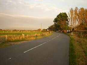 A588 at Mill House Bridge between Cockerham and Pilling | |
| Route information | |
| Length | 20 mi (32 km) |
| Major junctions | |
| SW end | |
| |
| NE end | |
| Road network | |
The A588 is a road in England, which runs from Poulton-le-Fylde to Lancaster in Lancashire. It is the main route serving the Over Wyre areas of the Fylde.
The road runs a total distance of 20 miles (32 km), in a roughly north-easterly direction, and is largely rural in character. It begins at a junction with the A586 in Poulton-le-Fylde (53°50′37″N 2°59′32″W / 53.8436°N 2.9922°W), and runs 1 mile (2 km) north-east, as Breck Road, to meet the A585 eastbound at the River Wyre roundabout. After sharing with the A585 as Mains Lane for 0.5 miles (0.8 km), it turns north (left) away from the A585, crossing the River Wyre at Shard Bridge, the last crossing of the river before its estuary. From here the road winds through the Over-Wyre villages of Hambleton, Stalmine and Pilling and across the marshy land that abuts the Cockerham Sands portion of Morecambe Bay. At Cockerham, almost 12 miles (19 km) from Shard Bridge, the road turns to the left, and, as Lancaster Road, runs a further 6 miles (10 km) north into Lancaster, eventually terminating as it joins the A6 by the Royal Lancaster Infirmary (54°02′30″N 2°47′49″W / 54.0416°N 2.7969°W).
 WikiMiniAtlas
A roads in Zone 5 of the Great Britain road numbering scheme | ||
|---|---|---|
Coordinates: 53°56′46″N 2°51′45″W / 53.9460°N 2.8625°W
This England road or road transport-related article is a stub. You can help Wikipedia by . |
- Roads in England
- Roads in Lancashire
- The Fylde
- England road stubs