A53 road
 | |
|---|---|
 | |
 | |
| Route information | |
| Length | 55.1 mi (88.7 km) |
| History | 1920s (Constructed) |
| Major junctions | |
| North end | Buxton 53°15′33″N 1°54′24″W / 53.259216°N 1.906576°W |
| South end | Shrewsbury 52°44′48″N 2°43′03″W / 52.746671°N 2.717386°W |
| Location | |
| Primary destinations | Leek Stoke-on-Trent Newcastle-under-Lyme |
| Road network | |

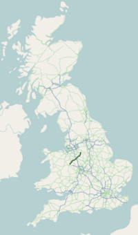
The A53 is a primary route in the English Midlands, that runs from Buxton in Derbyshire to Shrewsbury in Shropshire.
Route of Road[]
The A53 begins in the centre of Buxton off the A6 road, before meeting the A515 road at a roundabout. Out of the town, it has a junction with the A54 road (to Congleton) before continuing in a south-westerly direction. It crosses the border into the county of Staffordshire, and after leaving the Peak District travels through the town of Leek. It meets the A523 road (to Macclesfield) and the A520 road (to Stone). It crosses the Caldon Canal and travels through the Stoke-on-Trent conurbation, including Hanley and Newcastle-under-Lyme, where it meets a number of major routes such as the A50 road (to Derby), the A500 "D-Road," the Winchester-Salford A34 and the A525 road (to Whitchurch). It crosses the M6 motorway and goes through the village of Ashley. It crosses the border into Shropshire, and bypasses the town of Market Drayton, and passes the Müller factory. It meets the A41 road (to Wolverhampton) at a roundabout, then meets the A442 road (to Telford). It goes through the village of Shawbury, before it terminates at its junction with the A49 road, 3 miles (4.8 km) north-east of Shrewsbury town centre at Battlefield.
The road is single carriageway apart from a 1-mile (1.6 km) section of dual carriageway between the A500 and Stoke-on-Trent City Centre (Hanley).
Road safety[]
The A53 has been reported as a high risk road for several years. According to a report done by the Road Safety Foundation for the European Road Assessment Programme (EuroRAP), the A53 is one of the most dangerous roads in the UK.[1]
In June 2008, a 12-mile (19 km) stretch of the A53 between Leek and Buxton was named as the most dangerous road in the West Midlands.[2][3] This single carriageway stretch had fourteen fatal and serious injury collisions between 2003 and 2005, and was rated as red—the second highest risk band—in the EuroRAP report publish by the Road Safety Foundation. The challenging character of this section of road makes it attractive to motorcyclists.
References[]
- ^ "'Most dangerous' roads revealed". bbc.com. 25 June 2007.
- ^ Highest risk road sections in each UK Government Office Region (2004–2006) Archived 10 February 2012 at the Wayback Machine
- ^ A53 IS WEST MIDLAND'S MOST DANGEROUS ROAD[permanent dead link]
External links[]
| Wikimedia Commons has media related to A53 road (England). |
Route map:
| ( • help)
|
A roads in Zone 5 of the Great Britain road numbering scheme | ||
|---|---|---|
- Roads in England
- Roads in Derbyshire
- Transport in Shropshire
- Transport in Staffordshire
- Transport in Stoke-on-Trent