A Line (Los Angeles Metro)
| A Line | |||||||||||||||||||||||||||||||||||||||||||||||||||||||||||||||||||||||||||||||||||||||||||||||||||||||||||||||||||||||||||||||||||||||||||||||||||||||||||||||||||||||||||||||||||||||||||||||||||||||||||||||||||||||||||||||||||||||||||||||||||||||||||||||||||
|---|---|---|---|---|---|---|---|---|---|---|---|---|---|---|---|---|---|---|---|---|---|---|---|---|---|---|---|---|---|---|---|---|---|---|---|---|---|---|---|---|---|---|---|---|---|---|---|---|---|---|---|---|---|---|---|---|---|---|---|---|---|---|---|---|---|---|---|---|---|---|---|---|---|---|---|---|---|---|---|---|---|---|---|---|---|---|---|---|---|---|---|---|---|---|---|---|---|---|---|---|---|---|---|---|---|---|---|---|---|---|---|---|---|---|---|---|---|---|---|---|---|---|---|---|---|---|---|---|---|---|---|---|---|---|---|---|---|---|---|---|---|---|---|---|---|---|---|---|---|---|---|---|---|---|---|---|---|---|---|---|---|---|---|---|---|---|---|---|---|---|---|---|---|---|---|---|---|---|---|---|---|---|---|---|---|---|---|---|---|---|---|---|---|---|---|---|---|---|---|---|---|---|---|---|---|---|---|---|---|---|---|---|---|---|---|---|---|---|---|---|---|---|---|---|---|---|---|---|---|---|---|---|---|---|---|---|---|---|---|---|---|---|---|---|---|---|---|---|---|---|---|---|---|---|---|---|---|---|---|
 | |||||||||||||||||||||||||||||||||||||||||||||||||||||||||||||||||||||||||||||||||||||||||||||||||||||||||||||||||||||||||||||||||||||||||||||||||||||||||||||||||||||||||||||||||||||||||||||||||||||||||||||||||||||||||||||||||||||||||||||||||||||||||||||||||||
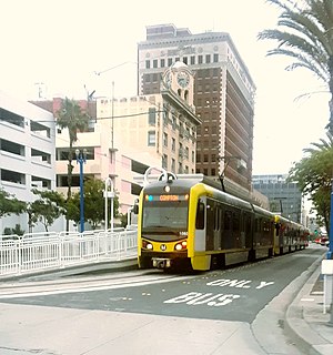 P3010 train at Downtown Long Beach | |||||||||||||||||||||||||||||||||||||||||||||||||||||||||||||||||||||||||||||||||||||||||||||||||||||||||||||||||||||||||||||||||||||||||||||||||||||||||||||||||||||||||||||||||||||||||||||||||||||||||||||||||||||||||||||||||||||||||||||||||||||||||||||||||||
| Overview | |||||||||||||||||||||||||||||||||||||||||||||||||||||||||||||||||||||||||||||||||||||||||||||||||||||||||||||||||||||||||||||||||||||||||||||||||||||||||||||||||||||||||||||||||||||||||||||||||||||||||||||||||||||||||||||||||||||||||||||||||||||||||||||||||||
| Other name(s) | Blue Line (1990–2019) | ||||||||||||||||||||||||||||||||||||||||||||||||||||||||||||||||||||||||||||||||||||||||||||||||||||||||||||||||||||||||||||||||||||||||||||||||||||||||||||||||||||||||||||||||||||||||||||||||||||||||||||||||||||||||||||||||||||||||||||||||||||||||||||||||||
| Status | In service | ||||||||||||||||||||||||||||||||||||||||||||||||||||||||||||||||||||||||||||||||||||||||||||||||||||||||||||||||||||||||||||||||||||||||||||||||||||||||||||||||||||||||||||||||||||||||||||||||||||||||||||||||||||||||||||||||||||||||||||||||||||||||||||||||||
| Owner | |||||||||||||||||||||||||||||||||||||||||||||||||||||||||||||||||||||||||||||||||||||||||||||||||||||||||||||||||||||||||||||||||||||||||||||||||||||||||||||||||||||||||||||||||||||||||||||||||||||||||||||||||||||||||||||||||||||||||||||||||||||||||||||||||||
| Line number | 801 | ||||||||||||||||||||||||||||||||||||||||||||||||||||||||||||||||||||||||||||||||||||||||||||||||||||||||||||||||||||||||||||||||||||||||||||||||||||||||||||||||||||||||||||||||||||||||||||||||||||||||||||||||||||||||||||||||||||||||||||||||||||||||||||||||||
| Termini | Downtown Long Beach 7th Street/Metro Center | ||||||||||||||||||||||||||||||||||||||||||||||||||||||||||||||||||||||||||||||||||||||||||||||||||||||||||||||||||||||||||||||||||||||||||||||||||||||||||||||||||||||||||||||||||||||||||||||||||||||||||||||||||||||||||||||||||||||||||||||||||||||||||||||||||
| Stations | 22 | ||||||||||||||||||||||||||||||||||||||||||||||||||||||||||||||||||||||||||||||||||||||||||||||||||||||||||||||||||||||||||||||||||||||||||||||||||||||||||||||||||||||||||||||||||||||||||||||||||||||||||||||||||||||||||||||||||||||||||||||||||||||||||||||||||
| Website | Metro A Line | ||||||||||||||||||||||||||||||||||||||||||||||||||||||||||||||||||||||||||||||||||||||||||||||||||||||||||||||||||||||||||||||||||||||||||||||||||||||||||||||||||||||||||||||||||||||||||||||||||||||||||||||||||||||||||||||||||||||||||||||||||||||||||||||||||
| Service | |||||||||||||||||||||||||||||||||||||||||||||||||||||||||||||||||||||||||||||||||||||||||||||||||||||||||||||||||||||||||||||||||||||||||||||||||||||||||||||||||||||||||||||||||||||||||||||||||||||||||||||||||||||||||||||||||||||||||||||||||||||||||||||||||||
| Type | Light rail | ||||||||||||||||||||||||||||||||||||||||||||||||||||||||||||||||||||||||||||||||||||||||||||||||||||||||||||||||||||||||||||||||||||||||||||||||||||||||||||||||||||||||||||||||||||||||||||||||||||||||||||||||||||||||||||||||||||||||||||||||||||||||||||||||||
| System | Los Angeles Metro Rail | ||||||||||||||||||||||||||||||||||||||||||||||||||||||||||||||||||||||||||||||||||||||||||||||||||||||||||||||||||||||||||||||||||||||||||||||||||||||||||||||||||||||||||||||||||||||||||||||||||||||||||||||||||||||||||||||||||||||||||||||||||||||||||||||||||
| Rolling stock | Trains run in 2–3 car consists | ||||||||||||||||||||||||||||||||||||||||||||||||||||||||||||||||||||||||||||||||||||||||||||||||||||||||||||||||||||||||||||||||||||||||||||||||||||||||||||||||||||||||||||||||||||||||||||||||||||||||||||||||||||||||||||||||||||||||||||||||||||||||||||||||||
| Daily ridership | 63,008 (Oct. 2018; avg. weekday)[1] | ||||||||||||||||||||||||||||||||||||||||||||||||||||||||||||||||||||||||||||||||||||||||||||||||||||||||||||||||||||||||||||||||||||||||||||||||||||||||||||||||||||||||||||||||||||||||||||||||||||||||||||||||||||||||||||||||||||||||||||||||||||||||||||||||||
| Ridership | 22,383,828 (2017)[1] | ||||||||||||||||||||||||||||||||||||||||||||||||||||||||||||||||||||||||||||||||||||||||||||||||||||||||||||||||||||||||||||||||||||||||||||||||||||||||||||||||||||||||||||||||||||||||||||||||||||||||||||||||||||||||||||||||||||||||||||||||||||||||||||||||||
| History | |||||||||||||||||||||||||||||||||||||||||||||||||||||||||||||||||||||||||||||||||||||||||||||||||||||||||||||||||||||||||||||||||||||||||||||||||||||||||||||||||||||||||||||||||||||||||||||||||||||||||||||||||||||||||||||||||||||||||||||||||||||||||||||||||||
| Opened | July 14, 1990 | ||||||||||||||||||||||||||||||||||||||||||||||||||||||||||||||||||||||||||||||||||||||||||||||||||||||||||||||||||||||||||||||||||||||||||||||||||||||||||||||||||||||||||||||||||||||||||||||||||||||||||||||||||||||||||||||||||||||||||||||||||||||||||||||||||
| Technical | |||||||||||||||||||||||||||||||||||||||||||||||||||||||||||||||||||||||||||||||||||||||||||||||||||||||||||||||||||||||||||||||||||||||||||||||||||||||||||||||||||||||||||||||||||||||||||||||||||||||||||||||||||||||||||||||||||||||||||||||||||||||||||||||||||
| Line length | 22.0 mi (35.4 km)[2] | ||||||||||||||||||||||||||||||||||||||||||||||||||||||||||||||||||||||||||||||||||||||||||||||||||||||||||||||||||||||||||||||||||||||||||||||||||||||||||||||||||||||||||||||||||||||||||||||||||||||||||||||||||||||||||||||||||||||||||||||||||||||||||||||||||
| Number of tracks | 2 | ||||||||||||||||||||||||||||||||||||||||||||||||||||||||||||||||||||||||||||||||||||||||||||||||||||||||||||||||||||||||||||||||||||||||||||||||||||||||||||||||||||||||||||||||||||||||||||||||||||||||||||||||||||||||||||||||||||||||||||||||||||||||||||||||||
| Character | Mostly at-grade in private right-of-way, with some street-running, elevated and underground sections. | ||||||||||||||||||||||||||||||||||||||||||||||||||||||||||||||||||||||||||||||||||||||||||||||||||||||||||||||||||||||||||||||||||||||||||||||||||||||||||||||||||||||||||||||||||||||||||||||||||||||||||||||||||||||||||||||||||||||||||||||||||||||||||||||||||
| Track gauge | 4 ft 8+1⁄2 in (1,435 mm) (standard gauge) | ||||||||||||||||||||||||||||||||||||||||||||||||||||||||||||||||||||||||||||||||||||||||||||||||||||||||||||||||||||||||||||||||||||||||||||||||||||||||||||||||||||||||||||||||||||||||||||||||||||||||||||||||||||||||||||||||||||||||||||||||||||||||||||||||||
| Electrification | 750 V DC overhead catenary (overhead rigid rail; tunnel only)[3] | ||||||||||||||||||||||||||||||||||||||||||||||||||||||||||||||||||||||||||||||||||||||||||||||||||||||||||||||||||||||||||||||||||||||||||||||||||||||||||||||||||||||||||||||||||||||||||||||||||||||||||||||||||||||||||||||||||||||||||||||||||||||||||||||||||
| Operating speed | 55 mph (89 km/h) | ||||||||||||||||||||||||||||||||||||||||||||||||||||||||||||||||||||||||||||||||||||||||||||||||||||||||||||||||||||||||||||||||||||||||||||||||||||||||||||||||||||||||||||||||||||||||||||||||||||||||||||||||||||||||||||||||||||||||||||||||||||||||||||||||||
| |||||||||||||||||||||||||||||||||||||||||||||||||||||||||||||||||||||||||||||||||||||||||||||||||||||||||||||||||||||||||||||||||||||||||||||||||||||||||||||||||||||||||||||||||||||||||||||||||||||||||||||||||||||||||||||||||||||||||||||||||||||||||||||||||||
The A Line (formerly the Blue Line)[4][5] is a 22.0-mile (35.4 km) light rail line running north–south between Los Angeles and Long Beach, California, passing through Downtown Los Angeles, South Los Angeles, Watts, Willowbrook, Compton, Rancho Dominguez, and Long Beach in Los Angeles County. It is one of six lines in the Metro Rail system. Opened in 1990, it is the system's oldest and third-busiest line with an estimated 22.38 million boardings per year as of December 2017. It is operated by the Los Angeles County Metropolitan Transportation Authority.[6]
The A Line passes near the cities of Vernon, Huntington Park, South Gate, Lynwood, and Carson. The famous Watts Towers art installation is visible from the train tracks near 103rd Street station. The under-construction Regional Connector will directly link this line to Union Station and into the San Gabriel Valley along the current route of the L Line.
Service description[]

Route description[]
The A Line runs 22.0 miles (35.4 km) between Downtown Los Angeles and Downtown Long Beach and has 22 stations.[2]
The line's northern terminus is the underground 7th Street/Metro Center station, after rising to street level, trains run south along Flower Street, sharing tracks with the E Line. Passengers can connect to the bus rapid transit J Line at 7th Street/Metro Center, Pico, and Grand stations. The A and E Lines diverge at Flower Street and Washington Boulevard just south of downtown Los Angeles. Here the A Line turns east on Washington Boulevard before turning south on Long Beach Avenue where it enters the former Pacific Electric right-of-way. This historic rail corridor has four tracks, with two used by Metro Rail trains and two by freight trains. There are some elevated sections as this private right of way cuts through more densely populated areas. Passengers can connect with the C Line at the Willowbrook station. Just south of Willow station, A Line trains exit the rail corridor and follow Long Beach Boulevard into the city of Long Beach, where trains travel through the Long Beach Transit Mall while making a loop using 1st Street, Pacific Avenue and 8th Street.
Hours of operation[]
Trains run between approximately 4:45 a.m. and 1:00 a.m. the following morning.[7] On Friday and Saturday evenings, trains are extended until 2:00 a.m. of the following morning. First and last train times are as follows:
To/From Long Beach
- Northbound
- First Train to 7th Street/Metro Center: 4:46 a.m.
- Last Train to 7th Street/Metro Center: 12:03 a.m. (2:07 a.m. on Friday and Saturday evenings)
- Southbound
- First Train to Long Beach: 5:00 a.m.
- Last Train to Long Beach: 1:01 a.m. (2:05 a.m. on Friday and Saturday evenings)
Of note, some trains operate at later or earlier times due to the A Line making the turnaround in Downtown Long Beach.
Headways[]
Trains on the A Line operate every six minutes during peak hours Monday through Friday.[8] They operate every twelve minutes during the daytime weekdays and all day on the weekends after approximately 9 a.m. (with a 15-minute headway early Saturday and Sunday mornings). Night service consists of ten-minute headways.
Originally[when?] during peak hours, every other train served only the stations between Willow and 7th Street/Metro Center to decrease the headway on that portion of the route. Willow was chosen because of its proximity to the storage yard and because it was the last southbound station with a park-and-ride lot. In the evening rush hour, riders saw some trains destined to "Willow" and others to "Long Beach". Consequently, those riders destined to Long Beach had to exit at Willow Station and wait for the next train, which would terminate at the Downtown Long Beach Station. This was discontinued after the New Blue Improvements Project was completed in 2019, with all trains now serving the full route from end to end.[9]
Speed[]
The A Line takes 53 minutes[7] to travel its 22.0 mile (35.4 km) length,[2] at an average speed of 24.9 miles per hour (40.1 km/h) over its length.
Ridership[]
When the line began operation in 1990, it was projected to have a daily ridership of 5,000.[10] However, it performed much better than expected, with daily ridership reaching 12,000 passengers within the first months of service and reaching 32,000 by the end of the first year of service.[10]
As of October 2018, the line had an average weekday ridership of 63,008, and Saturday and Sunday boardings of 30,579 and 30,314, respectively.[1] In 2017, the line saw a total of 22.38 million boardings.
History[]

Much of the current A Line follows the route of the Pacific Electric Railway's Long Beach interurban line; service on the route ended in 1961. The line initially opened as the Blue Line on Saturday, July 14, 1990, at a cost of US$877 million (equivalent to $1.74 billion in 2020 adjusted for inflation),[2] and ran from Willow to Pico. In 1991, it was extended south to Downtown Long Beach and north to 7th St/Metro Center.
A mass transit extension to Pasadena was originally conceived as the "Red Line Eastside extension" and as the "Pasadena Blue Line." However, in 1998, voters passed a ballot measure which banned the use of sales tax revenue for subway projects.[11] As a result, the proposed extension opened as the Gold Line in 2003.
From 1999 to 2001, the Blue Line underwent an US$11 million project to lengthen 19 of its platforms so that they could accommodate three-car trains.[12]
In 2014, Metro announced the "New Blue Improvements Project" to renovate and modernize the system. In 2019, half the line was closed for five months each (10 months in total), with Metro providing bus shuttle service to compensate for the lack of rail service. Metro officially reopened the line on November 2, 2019, rebranding it as the A Line.[4][5][13]
Future developments[]
Regional Connector Transit Project[]
Metro is currently constructing the Regional Connector, a light rail subway tunnel in Downtown Los Angeles that will connect the A and E Lines to the L Line and allow a seamless "one-seat ride" between the A and E Lines' current terminus at 7th Street/Metro Center and Union Station. When this project is completed, the A, E, and L Lines will be simplified into the following configuration:[14]
- A Line
- The northeastern segment of the L Line (north of Little Tokyo/Arts District) will serve as an extension to current A Line
- This combined line will become world's longest[failed verification] light rail line at over 49 miles (79 km) long,[15] surpassing the 67 km (42 mi) Coast Tram in Belgium[16]
- The Gold Line Foothill Extension will also be absorbed into the A Line, extending it a further 17.9 miles (28.8 km) to Montclair upon completion
- E Line
- The southern portion of the current L Line to East L.A. will be combined with current E Line, which will keep the E Line name but use the L Line's current gold color on maps
- The E Line will not connect to Union Station
The groundbreaking for the construction of the Regional Connector Transit Corridor took place on September 30, 2014, and it is expected to be in public service in 2022.
Foothill Extension[]
The Gold Line Foothill Extension is the ongoing second phase of the original Gold Line; it aims to extend service to the "Foothill Cities" and into San Bernardino County. The next segment to Pomona is expected to open in 2025, by which time the A Line will have been routed through the Regional Connector to serve the new terminus.
Current issues[]
Capacity limits[]

The line often operates at capacity, and various options to increase capacity have been considered, such as four-car trains or more frequent trains. Both have problems: it would be difficult or impossible to lengthen some of the station platforms, and the number of trains already causes delays for other vehicles at level crossings. Thus it may not be possible to increase A Line ridership without an extremely expensive grade-separation project, either by elevation, by an entrenchment method similar to that used by the nearby Alameda Corridor freight rail "expressway", or by building another parallel transit corridor to relieve capacity strains from the A Line. When the Regional Connector project linking A and E Line tracks with the L Line tracks in Little Tokyo is completed, this may result in even more capacity problems, with ridership expected to grow even more once the connector is open for service.
Safety at level crossings[]

Over 120 motorists and pedestrians have been killed at A Line level crossings since 1990 and there have been more than 800 collisions,[17][18] making the line easily the country's deadliest and most collision-prone rail line.[19]

In 1998, the MTA commissioned Booz Allen Hamilton, Inc. to evaluate the cause of Blue Line collisions and recommend affordable solutions. The study reported the high ridership (over 70,000 per day) was a contributor:
The MBL has one of the highest ridership counts for light rail lines in the Country. This factor is perhaps the most important contributor to the grade crossing accident rate. The high ridership results in increased pedestrian traffic near stations as compared to other light rail systems. In addition, although MTA Operations does not allow high passenger loads dictate safe operations, there is pressure to maintain travel times and headway schedule requirements (e.g., passenger trip from Los Angeles to Long Beach in less than one hour).
Other contributing factors identified were the high population density leading to more pedestrian and vehicular traffic around the tracks, diverse varied socio-economic community around the line that creates literacy and language difficulties for public education campaigns, driver frustration due to the slow traffic speeds around the line that leads to more risk taking behavior, and the shared right-of-way with freight traffic in the fastest running section from Washington station to Willow station, where trains operate at a maximum of 55 mph (89 km/h) between stations.
The collision rate has declined somewhat following the installation of four-quadrant gates at some crossings where the A Line shares the right-of-way with freight rail between Willowbrook station and Artesia station. The gates prevent drivers from going around lowered gates. In addition, cameras along some problem intersections issue traffic tickets when drivers go around gates.
Station listing[]
The following is the complete list of stations, from north to south.
| Station | Date opened | City/Neighborhood | Major connections and notes[20][21] |
|---|---|---|---|
| 7th Street/Metro Center | February 14, 1991 | Downtown Los Angeles | |
| Pico | July 14, 1990 | ||
| Grand/LATTC | |||
| San Pedro Street | South Los Angeles | ||
| Washington | |||
| Vernon | |||
| Slauson | |||
| Florence | Florence-Graham | Park and ride: 116 stalls | |
| Firestone | |||
| 103rd Street/Watts Towers | Watts | Park and ride: 64 stalls | |
| Willowbrook | Willowbrook | Park and ride: 234 stalls | |
| Compton | Compton | ||
| Artesia | Park and ride: 288 stalls | ||
| Del Amo | Carson | Park and ride: 362 stalls | |
| Wardlow | Long Beach | Park and ride: 139 stalls | |
| Willow Street | Park and ride: 927 stalls | ||
| Pacific Coast Highway | |||
| Anaheim Street | |||
| 5th Street (southbound only) |
September 1, 1990 | ||
| 1st Street (southbound only) |
|||
| Downtown Long Beach (northbound only) |
|||
| Pacific Avenue (northbound only) |
Operations[]
On Metro Rail Operations' internal timetables, the A Line is called line 801.
Maintenance facilities[]
The A Line is operated out of the Division 11 Yard (208th Street Yard) located at 4350 East 208th Street. This yard stores the fleet used on the A Line. It is also where heavy maintenance is done on the fleet. The Yard is located between Del Amo and Wardlow stations. Trains get to this yard via a wye junction on the southbound tracks. Northbound trains can enter and exit the yard via the cross tracks on the north and south side of the junction.
Rolling stock[]
The A Line uses two different types of rolling stock from Siemens, and Kinkisharyo.
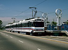
When the Blue Line first opened in 1990, the line had 54 Nippon Sharyo P865 light rail vehicles, numbered 100–153. These cars wore a unique livery consisting of several blue stripes and a single red stripe, reflecting the Blue Line's color designation and its Pacific Electric Red Car heritage.
In 2000, Metro transferred all 15 Nippon Sharyo P2020 (Numbered 154-168) light rail vehicles from the Green Line to the Blue Line fleet. These light rail vehicles were nearly identical to the older P865 model, but were about five years newer and originally had an automated control panel for automatic train operation in each cab.[22]
In 2012, Metro transferred some Siemens P2000 light rail vehicles from the Gold Line to the Blue Line fleet.
In 2017, the Blue Line received 78 Kinkisharyo P3010 light rail vehicles, the first new fleet of vehicles for the line since it opened in 1990. As the P3010 fleet was introduced, Metro gradually retired all of the remaining P865 light rail vehicles, the original vehicles used on the line. In 2021, the final deliveries of the P3010s resulted to the 15 P2020 railcars to also retire as Metro has no more room for the aging vehicles.
A Line vehicles are maintained and stored at the Division 11 yard in Long Beach between Del Amo and Wardlow stations. This facility has capacity for storing and maintaining 86 light rail cars.
By the time of the Regional Connector opening in 2022, it is expected that Division 21 in Elysian Park, and Division 24 in Monrovia will be acquired for A Line service as the A and L lines will merge into one route.
References[]
- ^ Jump up to: a b c "Interactive Estimated Ridership Stats". Los Angeles County Metropolitan Transit Authority. November 15, 2018. Retrieved December 3, 2018.
- ^ Jump up to: a b c d "Facts at a Glance". Los Angeles County Metropolitan Transit Authority. November 18, 2013. Retrieved November 16, 2013.
- ^ "Installing new overhead conductor rail in DTLA". Retrieved July 30, 2019.[permanent dead link]
- ^ Jump up to: a b Fonseca, Ryan (September 25, 2019). "Ignore Those 'Line A' Signs. Metro's Blue Line Will Reopen As The 'A Line'". laist.com. Southern California Public Radio. Archived from the original on September 26, 2019. Retrieved September 26, 2019.
- ^ Jump up to: a b "Light rail to Long Beach will reopen soon — but it won't be called the Blue Line". Los Angeles Times. October 17, 2019. Retrieved October 18, 2019.
- ^ "Metro Ridership". isotp.metro.net. Retrieved April 14, 2019.
- ^ Jump up to: a b "Blue line timetable" (PDF). Los Angeles County Metropolitan Transit Authority. December 15, 2013. Retrieved January 15, 2013.
- ^ "Metro Bus & Rail System Map" (PDF). Los Angeles County Metropolitan Transit Authority. December 2013. Retrieved January 15, 2014.
- ^ https://thesource.metro.net/2019/11/01/full-a-line-blue-line-service-between-dtla-and-long-beach-begins-saturday/
- ^ Jump up to: a b Curiel, Socorro C. (1991). "Los Angeles County Transportation Commission Joins SHPE Strategic Technical Employment Program (STEP)". Society of Hispanic Professional Engineers. Hispanic Engineer. Career Communications Group, Inc. (Fall 1991): 20. Retrieved November 19, 2013.
- ^ "Anti-Subway Funding Measure Wins Easily". Los Angeles Times. November 4, 1998. Retrieved September 15, 2019.
- ^ "MTA Starts 3-Car Train Service on Busy Metro Blue Line". www.metro.net. Retrieved January 22, 2020.
- ^ "A Line". www.metro.net. Retrieved November 18, 2019.
- ^ "The most anticipated transit projects opening in time for the 2028 LA Olympics". Curbed LA. Retrieved November 25, 2018.
- ^ Broverman, Neal (October 7, 2016). "Metro's Regional Connector Will Change Everything Los Angeles Magazine". Los Angeles Magazine. Retrieved August 14, 2019.
- ^ "The Coastal Tram". The Belgian Coast. Retrieved August 14, 2019.
- ^ Nelson, Laura (March 28, 2015). "Metro light rail crash near USC renews debate on rail safety". Los Angeles Times. Retrieved October 20, 2015.
- ^ "Summary of Blue Line Train/Vehicle and Train/Pedestrian Accidents". Los Angeles County Metropolitan Transportation Authority. June 2007.
- ^ "Light rail fatalities, 1990–2002". American Public Transportation Association. May 20, 2005. Retrieved May 12, 2010.
- ^ "Metro A Line (Blue)". www.metro.net. Retrieved July 23, 2020.
- ^ "Metro Parking Lots by Line". www.metro.net. Retrieved July 23, 2020.
- ^ "Archived copy". Archived from the original on October 25, 2007. Retrieved October 22, 2007.CS1 maint: archived copy as title (link)
External links[]
| Wikimedia Commons has media related to LACMTA A Line. |
Route map:

| ( • help)
|
- Los Angeles County Metropolitan Transportation Authority
- Blue Line homepage
- Blue Line schedule
- Blue Line connections overview
- A History of the Blue Line: A Light Rail Success Story by the Transit Coalition
- Killing Time on the Ghetto Blue from the LA Weekly
- Delivery of The First Metro Blue Line Vehicle
| show |
|---|

- A Line (Los Angeles Metro)
- Los Angeles Metro Rail lines
- Light rail in California
- Public transportation in Los Angeles
- Public transportation in Los Angeles County, California
- Transportation in Long Beach, California
- South Los Angeles
- Railway lines opened in 1990
- 1990 establishments in California