E Line (Los Angeles Metro)
| E Line | ||||||||||||||||||||||||||||||||||||||||||||||||||||||||||||||||||||||||||||||||||||||||||||||||||||||||||||||||||||||||||||||||||||||||||||||||||||||||||||||||||||||||||||||||||||||||||||||||||||||||||||||||||||||||||||||||||||||||||||||||||||||||||||||||||||||||||||||||||||||||||||||||||||||||||||||||||||||||||||||||||||||||||||||||||||||||||||||||||||||||||||||||||||||||||||||||||||||||||||||||||||||||||||||||||||||||||||||||||||||||||||||||||||||||||||||||||||||||||||||||||||||||||||||||||||||||||||||||||||||||||||||||||||||||||||||||||||||||||||||||||||||||||||||||||||||||||||||||||||||||||||||||||||||||||||||||||||||||||||||||||||||||||||||||||||||||||||||||||||||||||||||||||||||||||||||||||||||||||||||||||||||||||||||||||||||||||||||||||||||||||||||||||||||||||||||||||||||||||||||||||||||||||||||
|---|---|---|---|---|---|---|---|---|---|---|---|---|---|---|---|---|---|---|---|---|---|---|---|---|---|---|---|---|---|---|---|---|---|---|---|---|---|---|---|---|---|---|---|---|---|---|---|---|---|---|---|---|---|---|---|---|---|---|---|---|---|---|---|---|---|---|---|---|---|---|---|---|---|---|---|---|---|---|---|---|---|---|---|---|---|---|---|---|---|---|---|---|---|---|---|---|---|---|---|---|---|---|---|---|---|---|---|---|---|---|---|---|---|---|---|---|---|---|---|---|---|---|---|---|---|---|---|---|---|---|---|---|---|---|---|---|---|---|---|---|---|---|---|---|---|---|---|---|---|---|---|---|---|---|---|---|---|---|---|---|---|---|---|---|---|---|---|---|---|---|---|---|---|---|---|---|---|---|---|---|---|---|---|---|---|---|---|---|---|---|---|---|---|---|---|---|---|---|---|---|---|---|---|---|---|---|---|---|---|---|---|---|---|---|---|---|---|---|---|---|---|---|---|---|---|---|---|---|---|---|---|---|---|---|---|---|---|---|---|---|---|---|---|---|---|---|---|---|---|---|---|---|---|---|---|---|---|---|---|---|---|---|---|---|---|---|---|---|---|---|---|---|---|---|---|---|---|---|---|---|---|---|---|---|---|---|---|---|---|---|---|---|---|---|---|---|---|---|---|---|---|---|---|---|---|---|---|---|---|---|---|---|---|---|---|---|---|---|---|---|---|---|---|---|---|---|---|---|---|---|---|---|---|---|---|---|---|---|---|---|---|---|---|---|---|---|---|---|---|---|---|---|---|---|---|---|---|---|---|---|---|---|---|---|---|---|---|---|---|---|---|---|---|---|---|---|---|---|---|---|---|---|---|---|---|---|---|---|---|---|---|---|---|---|---|---|---|---|---|---|---|---|---|---|---|---|---|---|---|---|---|---|---|---|---|---|---|---|---|---|---|---|---|---|---|---|---|---|---|---|---|---|---|---|---|---|---|---|---|---|---|---|---|---|---|---|---|---|---|---|---|---|---|---|---|---|---|---|---|---|---|---|---|---|---|---|---|---|---|---|---|---|---|---|---|---|---|---|---|---|---|---|---|---|---|---|---|---|---|---|---|---|---|---|---|---|---|---|---|---|---|---|---|---|---|---|---|---|---|---|---|---|---|---|---|---|---|---|---|---|---|---|---|---|---|---|---|---|---|---|---|---|---|---|---|---|---|---|---|---|---|---|---|---|---|---|---|---|---|---|---|---|---|---|---|---|---|---|---|---|---|---|---|---|---|---|---|---|---|---|---|---|---|---|---|---|---|---|---|---|---|---|---|---|---|---|---|---|---|---|---|---|---|---|---|---|---|---|---|---|---|---|---|---|---|---|---|---|---|---|---|---|---|---|---|---|---|---|---|---|---|---|---|---|---|---|---|---|---|---|---|---|---|---|---|---|---|---|---|---|---|---|---|---|---|---|---|---|---|---|---|---|---|---|---|---|---|---|---|---|---|---|---|---|---|---|---|---|---|---|---|---|---|---|---|---|---|---|---|---|---|---|---|---|---|---|---|---|---|---|---|---|---|---|---|---|---|---|---|---|---|---|---|---|---|---|---|---|---|---|---|---|---|---|---|---|---|---|---|---|---|---|---|---|---|---|---|---|---|---|---|---|---|---|---|---|---|---|---|---|---|---|---|---|---|---|---|---|---|---|---|---|---|---|---|---|---|---|---|---|---|---|---|---|---|---|---|---|---|---|---|---|---|---|---|---|---|---|---|---|---|---|---|---|---|---|---|---|---|---|---|---|---|---|---|---|---|---|---|---|---|---|---|---|---|---|---|---|---|---|---|---|---|---|
 | ||||||||||||||||||||||||||||||||||||||||||||||||||||||||||||||||||||||||||||||||||||||||||||||||||||||||||||||||||||||||||||||||||||||||||||||||||||||||||||||||||||||||||||||||||||||||||||||||||||||||||||||||||||||||||||||||||||||||||||||||||||||||||||||||||||||||||||||||||||||||||||||||||||||||||||||||||||||||||||||||||||||||||||||||||||||||||||||||||||||||||||||||||||||||||||||||||||||||||||||||||||||||||||||||||||||||||||||||||||||||||||||||||||||||||||||||||||||||||||||||||||||||||||||||||||||||||||||||||||||||||||||||||||||||||||||||||||||||||||||||||||||||||||||||||||||||||||||||||||||||||||||||||||||||||||||||||||||||||||||||||||||||||||||||||||||||||||||||||||||||||||||||||||||||||||||||||||||||||||||||||||||||||||||||||||||||||||||||||||||||||||||||||||||||||||||||||||||||||||||||||||||||||||||
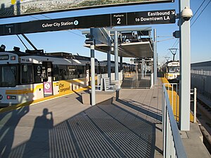 Two P865/P2020 trains at Culver City station | ||||||||||||||||||||||||||||||||||||||||||||||||||||||||||||||||||||||||||||||||||||||||||||||||||||||||||||||||||||||||||||||||||||||||||||||||||||||||||||||||||||||||||||||||||||||||||||||||||||||||||||||||||||||||||||||||||||||||||||||||||||||||||||||||||||||||||||||||||||||||||||||||||||||||||||||||||||||||||||||||||||||||||||||||||||||||||||||||||||||||||||||||||||||||||||||||||||||||||||||||||||||||||||||||||||||||||||||||||||||||||||||||||||||||||||||||||||||||||||||||||||||||||||||||||||||||||||||||||||||||||||||||||||||||||||||||||||||||||||||||||||||||||||||||||||||||||||||||||||||||||||||||||||||||||||||||||||||||||||||||||||||||||||||||||||||||||||||||||||||||||||||||||||||||||||||||||||||||||||||||||||||||||||||||||||||||||||||||||||||||||||||||||||||||||||||||||||||||||||||||||||||||||||||
| Overview | ||||||||||||||||||||||||||||||||||||||||||||||||||||||||||||||||||||||||||||||||||||||||||||||||||||||||||||||||||||||||||||||||||||||||||||||||||||||||||||||||||||||||||||||||||||||||||||||||||||||||||||||||||||||||||||||||||||||||||||||||||||||||||||||||||||||||||||||||||||||||||||||||||||||||||||||||||||||||||||||||||||||||||||||||||||||||||||||||||||||||||||||||||||||||||||||||||||||||||||||||||||||||||||||||||||||||||||||||||||||||||||||||||||||||||||||||||||||||||||||||||||||||||||||||||||||||||||||||||||||||||||||||||||||||||||||||||||||||||||||||||||||||||||||||||||||||||||||||||||||||||||||||||||||||||||||||||||||||||||||||||||||||||||||||||||||||||||||||||||||||||||||||||||||||||||||||||||||||||||||||||||||||||||||||||||||||||||||||||||||||||||||||||||||||||||||||||||||||||||||||||||||||||||||
| Other name(s) | Expo Line (2012–2019) | |||||||||||||||||||||||||||||||||||||||||||||||||||||||||||||||||||||||||||||||||||||||||||||||||||||||||||||||||||||||||||||||||||||||||||||||||||||||||||||||||||||||||||||||||||||||||||||||||||||||||||||||||||||||||||||||||||||||||||||||||||||||||||||||||||||||||||||||||||||||||||||||||||||||||||||||||||||||||||||||||||||||||||||||||||||||||||||||||||||||||||||||||||||||||||||||||||||||||||||||||||||||||||||||||||||||||||||||||||||||||||||||||||||||||||||||||||||||||||||||||||||||||||||||||||||||||||||||||||||||||||||||||||||||||||||||||||||||||||||||||||||||||||||||||||||||||||||||||||||||||||||||||||||||||||||||||||||||||||||||||||||||||||||||||||||||||||||||||||||||||||||||||||||||||||||||||||||||||||||||||||||||||||||||||||||||||||||||||||||||||||||||||||||||||||||||||||||||||||||||||||||||||||||
| Owner | ||||||||||||||||||||||||||||||||||||||||||||||||||||||||||||||||||||||||||||||||||||||||||||||||||||||||||||||||||||||||||||||||||||||||||||||||||||||||||||||||||||||||||||||||||||||||||||||||||||||||||||||||||||||||||||||||||||||||||||||||||||||||||||||||||||||||||||||||||||||||||||||||||||||||||||||||||||||||||||||||||||||||||||||||||||||||||||||||||||||||||||||||||||||||||||||||||||||||||||||||||||||||||||||||||||||||||||||||||||||||||||||||||||||||||||||||||||||||||||||||||||||||||||||||||||||||||||||||||||||||||||||||||||||||||||||||||||||||||||||||||||||||||||||||||||||||||||||||||||||||||||||||||||||||||||||||||||||||||||||||||||||||||||||||||||||||||||||||||||||||||||||||||||||||||||||||||||||||||||||||||||||||||||||||||||||||||||||||||||||||||||||||||||||||||||||||||||||||||||||||||||||||||||||
| Line number | 806 | |||||||||||||||||||||||||||||||||||||||||||||||||||||||||||||||||||||||||||||||||||||||||||||||||||||||||||||||||||||||||||||||||||||||||||||||||||||||||||||||||||||||||||||||||||||||||||||||||||||||||||||||||||||||||||||||||||||||||||||||||||||||||||||||||||||||||||||||||||||||||||||||||||||||||||||||||||||||||||||||||||||||||||||||||||||||||||||||||||||||||||||||||||||||||||||||||||||||||||||||||||||||||||||||||||||||||||||||||||||||||||||||||||||||||||||||||||||||||||||||||||||||||||||||||||||||||||||||||||||||||||||||||||||||||||||||||||||||||||||||||||||||||||||||||||||||||||||||||||||||||||||||||||||||||||||||||||||||||||||||||||||||||||||||||||||||||||||||||||||||||||||||||||||||||||||||||||||||||||||||||||||||||||||||||||||||||||||||||||||||||||||||||||||||||||||||||||||||||||||||||||||||||||||
| Termini | Downtown Santa Monica 7th Street/Metro Center | |||||||||||||||||||||||||||||||||||||||||||||||||||||||||||||||||||||||||||||||||||||||||||||||||||||||||||||||||||||||||||||||||||||||||||||||||||||||||||||||||||||||||||||||||||||||||||||||||||||||||||||||||||||||||||||||||||||||||||||||||||||||||||||||||||||||||||||||||||||||||||||||||||||||||||||||||||||||||||||||||||||||||||||||||||||||||||||||||||||||||||||||||||||||||||||||||||||||||||||||||||||||||||||||||||||||||||||||||||||||||||||||||||||||||||||||||||||||||||||||||||||||||||||||||||||||||||||||||||||||||||||||||||||||||||||||||||||||||||||||||||||||||||||||||||||||||||||||||||||||||||||||||||||||||||||||||||||||||||||||||||||||||||||||||||||||||||||||||||||||||||||||||||||||||||||||||||||||||||||||||||||||||||||||||||||||||||||||||||||||||||||||||||||||||||||||||||||||||||||||||||||||||||||
| Stations | 19 | |||||||||||||||||||||||||||||||||||||||||||||||||||||||||||||||||||||||||||||||||||||||||||||||||||||||||||||||||||||||||||||||||||||||||||||||||||||||||||||||||||||||||||||||||||||||||||||||||||||||||||||||||||||||||||||||||||||||||||||||||||||||||||||||||||||||||||||||||||||||||||||||||||||||||||||||||||||||||||||||||||||||||||||||||||||||||||||||||||||||||||||||||||||||||||||||||||||||||||||||||||||||||||||||||||||||||||||||||||||||||||||||||||||||||||||||||||||||||||||||||||||||||||||||||||||||||||||||||||||||||||||||||||||||||||||||||||||||||||||||||||||||||||||||||||||||||||||||||||||||||||||||||||||||||||||||||||||||||||||||||||||||||||||||||||||||||||||||||||||||||||||||||||||||||||||||||||||||||||||||||||||||||||||||||||||||||||||||||||||||||||||||||||||||||||||||||||||||||||||||||||||||||||||
| Service | ||||||||||||||||||||||||||||||||||||||||||||||||||||||||||||||||||||||||||||||||||||||||||||||||||||||||||||||||||||||||||||||||||||||||||||||||||||||||||||||||||||||||||||||||||||||||||||||||||||||||||||||||||||||||||||||||||||||||||||||||||||||||||||||||||||||||||||||||||||||||||||||||||||||||||||||||||||||||||||||||||||||||||||||||||||||||||||||||||||||||||||||||||||||||||||||||||||||||||||||||||||||||||||||||||||||||||||||||||||||||||||||||||||||||||||||||||||||||||||||||||||||||||||||||||||||||||||||||||||||||||||||||||||||||||||||||||||||||||||||||||||||||||||||||||||||||||||||||||||||||||||||||||||||||||||||||||||||||||||||||||||||||||||||||||||||||||||||||||||||||||||||||||||||||||||||||||||||||||||||||||||||||||||||||||||||||||||||||||||||||||||||||||||||||||||||||||||||||||||||||||||||||||||||
| Type | Light rail | |||||||||||||||||||||||||||||||||||||||||||||||||||||||||||||||||||||||||||||||||||||||||||||||||||||||||||||||||||||||||||||||||||||||||||||||||||||||||||||||||||||||||||||||||||||||||||||||||||||||||||||||||||||||||||||||||||||||||||||||||||||||||||||||||||||||||||||||||||||||||||||||||||||||||||||||||||||||||||||||||||||||||||||||||||||||||||||||||||||||||||||||||||||||||||||||||||||||||||||||||||||||||||||||||||||||||||||||||||||||||||||||||||||||||||||||||||||||||||||||||||||||||||||||||||||||||||||||||||||||||||||||||||||||||||||||||||||||||||||||||||||||||||||||||||||||||||||||||||||||||||||||||||||||||||||||||||||||||||||||||||||||||||||||||||||||||||||||||||||||||||||||||||||||||||||||||||||||||||||||||||||||||||||||||||||||||||||||||||||||||||||||||||||||||||||||||||||||||||||||||||||||||||||
| System | Los Angeles Metro Rail | |||||||||||||||||||||||||||||||||||||||||||||||||||||||||||||||||||||||||||||||||||||||||||||||||||||||||||||||||||||||||||||||||||||||||||||||||||||||||||||||||||||||||||||||||||||||||||||||||||||||||||||||||||||||||||||||||||||||||||||||||||||||||||||||||||||||||||||||||||||||||||||||||||||||||||||||||||||||||||||||||||||||||||||||||||||||||||||||||||||||||||||||||||||||||||||||||||||||||||||||||||||||||||||||||||||||||||||||||||||||||||||||||||||||||||||||||||||||||||||||||||||||||||||||||||||||||||||||||||||||||||||||||||||||||||||||||||||||||||||||||||||||||||||||||||||||||||||||||||||||||||||||||||||||||||||||||||||||||||||||||||||||||||||||||||||||||||||||||||||||||||||||||||||||||||||||||||||||||||||||||||||||||||||||||||||||||||||||||||||||||||||||||||||||||||||||||||||||||||||||||||||||||||||
| Rolling stock | Kinki Sharyo P3010 running in 2–3 car consists | |||||||||||||||||||||||||||||||||||||||||||||||||||||||||||||||||||||||||||||||||||||||||||||||||||||||||||||||||||||||||||||||||||||||||||||||||||||||||||||||||||||||||||||||||||||||||||||||||||||||||||||||||||||||||||||||||||||||||||||||||||||||||||||||||||||||||||||||||||||||||||||||||||||||||||||||||||||||||||||||||||||||||||||||||||||||||||||||||||||||||||||||||||||||||||||||||||||||||||||||||||||||||||||||||||||||||||||||||||||||||||||||||||||||||||||||||||||||||||||||||||||||||||||||||||||||||||||||||||||||||||||||||||||||||||||||||||||||||||||||||||||||||||||||||||||||||||||||||||||||||||||||||||||||||||||||||||||||||||||||||||||||||||||||||||||||||||||||||||||||||||||||||||||||||||||||||||||||||||||||||||||||||||||||||||||||||||||||||||||||||||||||||||||||||||||||||||||||||||||||||||||||||||||
| Daily ridership | 61,957 (October 2018; avg. weekday)[1] | |||||||||||||||||||||||||||||||||||||||||||||||||||||||||||||||||||||||||||||||||||||||||||||||||||||||||||||||||||||||||||||||||||||||||||||||||||||||||||||||||||||||||||||||||||||||||||||||||||||||||||||||||||||||||||||||||||||||||||||||||||||||||||||||||||||||||||||||||||||||||||||||||||||||||||||||||||||||||||||||||||||||||||||||||||||||||||||||||||||||||||||||||||||||||||||||||||||||||||||||||||||||||||||||||||||||||||||||||||||||||||||||||||||||||||||||||||||||||||||||||||||||||||||||||||||||||||||||||||||||||||||||||||||||||||||||||||||||||||||||||||||||||||||||||||||||||||||||||||||||||||||||||||||||||||||||||||||||||||||||||||||||||||||||||||||||||||||||||||||||||||||||||||||||||||||||||||||||||||||||||||||||||||||||||||||||||||||||||||||||||||||||||||||||||||||||||||||||||||||||||||||||||||||
| History | ||||||||||||||||||||||||||||||||||||||||||||||||||||||||||||||||||||||||||||||||||||||||||||||||||||||||||||||||||||||||||||||||||||||||||||||||||||||||||||||||||||||||||||||||||||||||||||||||||||||||||||||||||||||||||||||||||||||||||||||||||||||||||||||||||||||||||||||||||||||||||||||||||||||||||||||||||||||||||||||||||||||||||||||||||||||||||||||||||||||||||||||||||||||||||||||||||||||||||||||||||||||||||||||||||||||||||||||||||||||||||||||||||||||||||||||||||||||||||||||||||||||||||||||||||||||||||||||||||||||||||||||||||||||||||||||||||||||||||||||||||||||||||||||||||||||||||||||||||||||||||||||||||||||||||||||||||||||||||||||||||||||||||||||||||||||||||||||||||||||||||||||||||||||||||||||||||||||||||||||||||||||||||||||||||||||||||||||||||||||||||||||||||||||||||||||||||||||||||||||||||||||||||||||
| Opened | April 28, 2012 | |||||||||||||||||||||||||||||||||||||||||||||||||||||||||||||||||||||||||||||||||||||||||||||||||||||||||||||||||||||||||||||||||||||||||||||||||||||||||||||||||||||||||||||||||||||||||||||||||||||||||||||||||||||||||||||||||||||||||||||||||||||||||||||||||||||||||||||||||||||||||||||||||||||||||||||||||||||||||||||||||||||||||||||||||||||||||||||||||||||||||||||||||||||||||||||||||||||||||||||||||||||||||||||||||||||||||||||||||||||||||||||||||||||||||||||||||||||||||||||||||||||||||||||||||||||||||||||||||||||||||||||||||||||||||||||||||||||||||||||||||||||||||||||||||||||||||||||||||||||||||||||||||||||||||||||||||||||||||||||||||||||||||||||||||||||||||||||||||||||||||||||||||||||||||||||||||||||||||||||||||||||||||||||||||||||||||||||||||||||||||||||||||||||||||||||||||||||||||||||||||||||||||||||
| Completed | May 20, 2016 | |||||||||||||||||||||||||||||||||||||||||||||||||||||||||||||||||||||||||||||||||||||||||||||||||||||||||||||||||||||||||||||||||||||||||||||||||||||||||||||||||||||||||||||||||||||||||||||||||||||||||||||||||||||||||||||||||||||||||||||||||||||||||||||||||||||||||||||||||||||||||||||||||||||||||||||||||||||||||||||||||||||||||||||||||||||||||||||||||||||||||||||||||||||||||||||||||||||||||||||||||||||||||||||||||||||||||||||||||||||||||||||||||||||||||||||||||||||||||||||||||||||||||||||||||||||||||||||||||||||||||||||||||||||||||||||||||||||||||||||||||||||||||||||||||||||||||||||||||||||||||||||||||||||||||||||||||||||||||||||||||||||||||||||||||||||||||||||||||||||||||||||||||||||||||||||||||||||||||||||||||||||||||||||||||||||||||||||||||||||||||||||||||||||||||||||||||||||||||||||||||||||||||||||
| Technical | ||||||||||||||||||||||||||||||||||||||||||||||||||||||||||||||||||||||||||||||||||||||||||||||||||||||||||||||||||||||||||||||||||||||||||||||||||||||||||||||||||||||||||||||||||||||||||||||||||||||||||||||||||||||||||||||||||||||||||||||||||||||||||||||||||||||||||||||||||||||||||||||||||||||||||||||||||||||||||||||||||||||||||||||||||||||||||||||||||||||||||||||||||||||||||||||||||||||||||||||||||||||||||||||||||||||||||||||||||||||||||||||||||||||||||||||||||||||||||||||||||||||||||||||||||||||||||||||||||||||||||||||||||||||||||||||||||||||||||||||||||||||||||||||||||||||||||||||||||||||||||||||||||||||||||||||||||||||||||||||||||||||||||||||||||||||||||||||||||||||||||||||||||||||||||||||||||||||||||||||||||||||||||||||||||||||||||||||||||||||||||||||||||||||||||||||||||||||||||||||||||||||||||||||
| Line length | 15.2 mi (24.5 km)[2] | |||||||||||||||||||||||||||||||||||||||||||||||||||||||||||||||||||||||||||||||||||||||||||||||||||||||||||||||||||||||||||||||||||||||||||||||||||||||||||||||||||||||||||||||||||||||||||||||||||||||||||||||||||||||||||||||||||||||||||||||||||||||||||||||||||||||||||||||||||||||||||||||||||||||||||||||||||||||||||||||||||||||||||||||||||||||||||||||||||||||||||||||||||||||||||||||||||||||||||||||||||||||||||||||||||||||||||||||||||||||||||||||||||||||||||||||||||||||||||||||||||||||||||||||||||||||||||||||||||||||||||||||||||||||||||||||||||||||||||||||||||||||||||||||||||||||||||||||||||||||||||||||||||||||||||||||||||||||||||||||||||||||||||||||||||||||||||||||||||||||||||||||||||||||||||||||||||||||||||||||||||||||||||||||||||||||||||||||||||||||||||||||||||||||||||||||||||||||||||||||||||||||||||||
| Number of tracks | 2 | |||||||||||||||||||||||||||||||||||||||||||||||||||||||||||||||||||||||||||||||||||||||||||||||||||||||||||||||||||||||||||||||||||||||||||||||||||||||||||||||||||||||||||||||||||||||||||||||||||||||||||||||||||||||||||||||||||||||||||||||||||||||||||||||||||||||||||||||||||||||||||||||||||||||||||||||||||||||||||||||||||||||||||||||||||||||||||||||||||||||||||||||||||||||||||||||||||||||||||||||||||||||||||||||||||||||||||||||||||||||||||||||||||||||||||||||||||||||||||||||||||||||||||||||||||||||||||||||||||||||||||||||||||||||||||||||||||||||||||||||||||||||||||||||||||||||||||||||||||||||||||||||||||||||||||||||||||||||||||||||||||||||||||||||||||||||||||||||||||||||||||||||||||||||||||||||||||||||||||||||||||||||||||||||||||||||||||||||||||||||||||||||||||||||||||||||||||||||||||||||||||||||||||||
| Character | Mostly at-grade in private right-of-way, with some underground, street-running, elevated and trench sections | |||||||||||||||||||||||||||||||||||||||||||||||||||||||||||||||||||||||||||||||||||||||||||||||||||||||||||||||||||||||||||||||||||||||||||||||||||||||||||||||||||||||||||||||||||||||||||||||||||||||||||||||||||||||||||||||||||||||||||||||||||||||||||||||||||||||||||||||||||||||||||||||||||||||||||||||||||||||||||||||||||||||||||||||||||||||||||||||||||||||||||||||||||||||||||||||||||||||||||||||||||||||||||||||||||||||||||||||||||||||||||||||||||||||||||||||||||||||||||||||||||||||||||||||||||||||||||||||||||||||||||||||||||||||||||||||||||||||||||||||||||||||||||||||||||||||||||||||||||||||||||||||||||||||||||||||||||||||||||||||||||||||||||||||||||||||||||||||||||||||||||||||||||||||||||||||||||||||||||||||||||||||||||||||||||||||||||||||||||||||||||||||||||||||||||||||||||||||||||||||||||||||||||||
| Track gauge | 4 ft 8+1⁄2 in (1,435 mm) standard gauge | |||||||||||||||||||||||||||||||||||||||||||||||||||||||||||||||||||||||||||||||||||||||||||||||||||||||||||||||||||||||||||||||||||||||||||||||||||||||||||||||||||||||||||||||||||||||||||||||||||||||||||||||||||||||||||||||||||||||||||||||||||||||||||||||||||||||||||||||||||||||||||||||||||||||||||||||||||||||||||||||||||||||||||||||||||||||||||||||||||||||||||||||||||||||||||||||||||||||||||||||||||||||||||||||||||||||||||||||||||||||||||||||||||||||||||||||||||||||||||||||||||||||||||||||||||||||||||||||||||||||||||||||||||||||||||||||||||||||||||||||||||||||||||||||||||||||||||||||||||||||||||||||||||||||||||||||||||||||||||||||||||||||||||||||||||||||||||||||||||||||||||||||||||||||||||||||||||||||||||||||||||||||||||||||||||||||||||||||||||||||||||||||||||||||||||||||||||||||||||||||||||||||||||||
| Electrification | 750 V DC overhead catenary (overhead rigid rail in Flower tunnel)[3] | |||||||||||||||||||||||||||||||||||||||||||||||||||||||||||||||||||||||||||||||||||||||||||||||||||||||||||||||||||||||||||||||||||||||||||||||||||||||||||||||||||||||||||||||||||||||||||||||||||||||||||||||||||||||||||||||||||||||||||||||||||||||||||||||||||||||||||||||||||||||||||||||||||||||||||||||||||||||||||||||||||||||||||||||||||||||||||||||||||||||||||||||||||||||||||||||||||||||||||||||||||||||||||||||||||||||||||||||||||||||||||||||||||||||||||||||||||||||||||||||||||||||||||||||||||||||||||||||||||||||||||||||||||||||||||||||||||||||||||||||||||||||||||||||||||||||||||||||||||||||||||||||||||||||||||||||||||||||||||||||||||||||||||||||||||||||||||||||||||||||||||||||||||||||||||||||||||||||||||||||||||||||||||||||||||||||||||||||||||||||||||||||||||||||||||||||||||||||||||||||||||||||||||||
| Operating speed | 55 mph (89 km/h) | |||||||||||||||||||||||||||||||||||||||||||||||||||||||||||||||||||||||||||||||||||||||||||||||||||||||||||||||||||||||||||||||||||||||||||||||||||||||||||||||||||||||||||||||||||||||||||||||||||||||||||||||||||||||||||||||||||||||||||||||||||||||||||||||||||||||||||||||||||||||||||||||||||||||||||||||||||||||||||||||||||||||||||||||||||||||||||||||||||||||||||||||||||||||||||||||||||||||||||||||||||||||||||||||||||||||||||||||||||||||||||||||||||||||||||||||||||||||||||||||||||||||||||||||||||||||||||||||||||||||||||||||||||||||||||||||||||||||||||||||||||||||||||||||||||||||||||||||||||||||||||||||||||||||||||||||||||||||||||||||||||||||||||||||||||||||||||||||||||||||||||||||||||||||||||||||||||||||||||||||||||||||||||||||||||||||||||||||||||||||||||||||||||||||||||||||||||||||||||||||||||||||||||||
| ||||||||||||||||||||||||||||||||||||||||||||||||||||||||||||||||||||||||||||||||||||||||||||||||||||||||||||||||||||||||||||||||||||||||||||||||||||||||||||||||||||||||||||||||||||||||||||||||||||||||||||||||||||||||||||||||||||||||||||||||||||||||||||||||||||||||||||||||||||||||||||||||||||||||||||||||||||||||||||||||||||||||||||||||||||||||||||||||||||||||||||||||||||||||||||||||||||||||||||||||||||||||||||||||||||||||||||||||||||||||||||||||||||||||||||||||||||||||||||||||||||||||||||||||||||||||||||||||||||||||||||||||||||||||||||||||||||||||||||||||||||||||||||||||||||||||||||||||||||||||||||||||||||||||||||||||||||||||||||||||||||||||||||||||||||||||||||||||||||||||||||||||||||||||||||||||||||||||||||||||||||||||||||||||||||||||||||||||||||||||||||||||||||||||||||||||||||||||||||||||||||||||||||||
The E Line (formerly the Expo Line from 2012–2019) is a 15.2 mi (24.5 km) light rail line that runs between Downtown Los Angeles and Santa Monica. It is one of the six lines in the Metro Rail system, and is operated by the Los Angeles County Metropolitan Transportation Authority (Metro). The line opened in 2012.
The E Line largely follows the right-of-way of the former Pacific Electric Santa Monica Air Line. Passenger service ended in 1953; freight-only service ended by March 1988. Several E Line stations are built in the same location as Air Line stations, although no original station structures have been reused.[4]
Originally named the Expo Line after Exposition Boulevard, along which it runs for most of its route,[5][6] the line was renamed the E Line in late 2019, while retaining the aqua-colored line and icons used to designate it on maps.[7] When the Regional Connector is complete in 2022, the current E Line will be joined with the Eastside portion of the L (formerly Gold) Line to create an extended E Line, which will become colored yellow on maps.[8]

Service description[]
Hours of operation[]
The E Line operates from 3:27 a.m. to 1:00 a.m.[9]
Headways[]
As of December 2020, trains run every 12 minutes during peak hours and every 20 minutes during the evening.[9]
Speed[]
Maximum speed on the route is 55 mph (89 km/h): speeds within Downtown Los Angeles and Downtown Santa Monica are reduced.[10] The E Line takes 46 minutes[9] to travel its 15.2 mi (24.5 km) length,[2] at an average speed of 19.8 mph (31.9 km/h) over its length.
Station listing[]
The following is the complete list of stations, from west to east:
| Station | Date opened | City/Neighborhood | Major Connections and Notes[11][12] |
|---|---|---|---|
| Downtown Santa Monica | May 20, 2016 | Santa Monica | |
| 17th Street/Santa Monica College | Park and ride: 65 spaces | ||
| 26th Street/Bergamot | |||
| Expo/Bundy | West Los Angeles | Park and ride: 217 spaces | |
| Expo/Sepulveda | Park and ride: 260 spaces | ||
| Westwood/Rancho Park | Rancho Park | ||
| Palms | Palms | ||
| Culver City | June 20, 2012 | Culver City | |
| La Cienega/Jefferson | April 28, 2012 | West Adams | Park and ride: 494 spaces |
| Expo/La Brea | |||
| Farmdale | June 20, 2012 | ||
| Expo/Crenshaw | April 28, 2012 | Jefferson Park | Park and ride: 450 spaces |
| Expo/Western | Exposition Park | ||
| Expo/Vermont | |||
| Expo Park/USC | University Park | ||
| Jefferson/USC | |||
| LATTC/Ortho Institute | North University Park | ||
| Pico | July 14, 1990 | Downtown Los Angeles | |
| 7th Street/Metro Center | February 15, 1991 |
Ridership[]
| Year | Ridership | %± |
|---|---|---|
| 2012 | 4,141,440 | — |
| 2013 | 8,659,229 | 109.1% |
| 2014 | 9,818,027 | 13.4% |
| 2015 | 9,834,541 | 0.2% |
| 2016 | 13,376,428 | 36% |
| 2017 | 19,030,229 | 42.3% |
| 2018 | 19,413,884 | 2% |
| 2019 | 18,269,068 | -5.9% |
| 2020 | 8,308,144 | -54.5% |
| 2021 | 7,939,241 | -4.4% |
| Source: Metro[13] | ||
History[]


The E Line largely follows right of way used by the Los Angeles and Independence Railroad steam railroad, built in 1875,[14] which was converted by Pacific Electric to electric traction and operated as the Santa Monica Air Line by 1920,[15] providing both freight and passenger service between Los Angeles and Santa Monica. Passenger service ended in 1953, and freight service stopped in 1988.[16]
Local advocacy groups including Friends 4 Expo Transit[17] supported the successful passage of Proposition C in 1990, which allowed the purchase of the entire right-of-way from Southern Pacific by Metro. In 2000, an urban art group known as Heavy Trash placed signs advertising a fictional "Aqua Line". The signs, with the text "Coming Soon", showed a subway route extending along Wilshire to the ocean, with 10 station stops. Although the campaign was a hoax, it demonstrated newfound support and revealed the frustrations surrounding the lack of rail service connecting Santa Monica and the Westside with Downtown Los Angeles.[18][non-primary source needed] Metro released a Major Investment Study in 2000 which compared bus rapid transit and light rail transit options along what was now known as the "Mid-City/Exposition Corridor".[19]
Construction[]
An independent agency, the Exposition Metro Line Construction Authority, was given the authority to plan, design and construct the line by state law in 2003. After construction of the second phase was completed, the line was handed over on January 15, 2016, to the Los Angeles County Metropolitan Transportation Authority.[20]
The line was built in two phases; the first phase comprised the 8.6-mile (13.8 km)[2][21] section between Downtown Los Angeles and Culver City. Construction began in early 2006 and most stations opened to the public on April 28, 2012.[21][22] The Culver City and Farmdale stations opened on June 20, 2012.[21][23]
Design and construction on the 6.6-mile (10.6 km)[2] portion between Culver City and Santa Monica started in September 2011. Testing along the phase 2 segment began on April 6, 2015,[24] and the segment opened on May 20, 2016.[25]
Proposed developments[]
Regional Connector Transit Project[]
The Regional Connector is an under-construction light-rail subway corridor through Downtown Los Angeles that is to connect the current A and E Lines to the current L Line, and to allow a seamless one-seat ride between the A and E Lines' current 7th Street/Metro Center terminus and Union Station.[26]
Once the Regional Connector is completed, the alignment of the L (formerly Gold) Line will be split into two parts at Little Tokyo/Arts District station station, with the portion north of this station joined to the A Line, extending it to connect Long Beach with Azusa. The alignment east of Little Tokyo/Arts District station will be assigned to the E Line, extending it to connect Santa Monica and East Los Angeles directly. At this time, the L Line will cease to exist as a separate line.
In 2019, Metro began using a renaming system where each rail and bus rapid transit line receives a letter and color. As a result, the Expo Line became the E Line in 2019, and will be recolored from aqua to yellow upon completion of the Regional Connector.[27][28][8]
The groundbreaking for the project took place on September 30, 2014, and the alignment is expected to be in public service by mid 2022.[29]
Eastside Transit Corridor[]
The Eastside Transit Corridor is a project to extend from the former L Line's terminus at Atlantic station eastward to Lambert station in Whittier. Partially funded by Measure M, construction is programmed to start in 2029 with service beginning in 2035,[30] though the project may be accelerated for the 2028 Summer Olympics.
Operations[]

Maintenance facilities[]
Previously, the light rail vehicles used on the E Line were maintained at the division 11 yard in Long Beach, California, the same maintenance facility that is used by the A Line. However, the new division 14 yard, located east of Stewart Street and north of Exposition Boulevard[31] in the vicinity of the 26th Street/Bergamot station in Santa Monica, was opened with the completion of Phase 2.
Rolling stock[]
Compatible with the rest of Metro's light-rail network, the E Line shares standard Metro light rail vehicles (Kinki Sharyo P3010) with the A Line. Metro estimates that it has 47 light rail cars to provide service on the E Line under the peak-hour assumption of 3-car trains running at 6-minute headways.
Bikeway[]
The E Line Bikeway parallels the route of the light rail line, and includes a mixture of bike lanes on Exposition Boulevard and off-street paths alongside the rail tracks.[32]
Incidents[]
- On November 29, 2018, a pedestrian was struck and killed. The man had been attempting to cross the tracks.[33]
- On January 15, 2019, a passenger fell from the platform, between the cars, and was dragged to death. They "have not yet been able to identify the individual as pieces of the victim's body are spread out."[34]
- On May 2, 2019, a man climbed a nearby construction crane and jumped to his death at the Expo/Sepulveda station, landing on the tracks and halting transportation temporarily.
References[]
- ^ "Ridership Statistics". Los Angeles County Metropolitan Transit Authority. Retrieved March 18, 2017.
- ^ a b c d "Expo Line project fact sheet" (PDF). Los Angeles County Metropolitan Transportation Authority. 2012. Retrieved October 6, 2013.
- ^ Chen, Anna (July 30, 2019). "Installing new overhead conductor rail in DTLA". Retrieved July 30, 2019.
- ^ Hawthorne, Christopher (May 20, 2016). "Why the Expo Line to Santa Monica marks a rare kind of progress in American cities". Los Angeles Times. Retrieved July 12, 2016.
- ^ Epstein, Joel (April 12, 2016). "How the Expo Line Got to Santa Monica". Huffington Post. Retrieved November 16, 2017.
- ^ "The Guide to the Metro Expo Line: Downtown L.A. to Santa Monica". Discover Los Angeles. Retrieved November 16, 2017.
- ^ http://media.metro.net/documents/line-806_1571341545.pdf
- ^ a b Fonseca, Ryan (September 25, 2019). "Ignore Those 'Line A' Signs. Metro's Blue Line Will Reopen As The 'A Line'". laist.com. Southern California Public Radio. Archived from the original on September 26, 2019. Retrieved September 26, 2019.
- ^ a b c "E Line (Expo) timetable" (PDF). Los Angeles County Metropolitan Transportation Authority. December 13, 2020. Retrieved May 2, 2021.
- ^ Hymon, Steve (November 22, 2011). "Our first ride on the Expo Line". The Source. Los Angeles County Metropolitan Transportation Authority. Retrieved March 31, 2015.
- ^ "Metro E Line (Expo)". www.metro.net. Retrieved July 23, 2020.
- ^ "Metro Parking Lots by Line". www.metro.net. Retrieved July 23, 2020.
- ^ "Metro Ridership". Metro.net. Los Angeles County Metropolitan Transportation Authority. February 2020. Retrieved February 12, 2021.
- ^ "First Train of the Los Angeles and Independence Railroad". Volume 5, Number 20. Los Angeles Herald. October 19, 1875.
- ^ "Santa Monica Air Line". Electric Railway Historical Association of Southern California.
- ^ Morgenthaler, Anne (March 14, 1988). "End of the Line: The last train out of SM blows a final whistle". Santa Monica Outlook.
- ^ "The Expo Line". friends4expo.org. Archived from the original on August 7, 2017. Retrieved August 7, 2017.
- ^ "Heavy Trash: Aqua Line". Retrieved October 11, 2010.
- ^ "Mid City Westside Transit Draft EIS/EIR: 1.0 History, purpose and need" (PDF). Los Angeles County Metropolitan Transportation Authority.
- ^ "About Expo Overview". Archived from the original on August 7, 2017.
- ^ a b c "L.A. Metro – Facts at a Glance". Los Angeles County Metropolitan Transportation Authority. June 13, 2013. Retrieved June 28, 2013.
- ^ Weikel, Dan; Bloomekatz, Ari (April 27, 2012). "Expo Line launches rail service push to Westside". Los Angeles Times. Retrieved July 15, 2017.
- ^ "Two more Expo Line stations to open June 20". Los Angeles Times. June 5, 2012. Retrieved October 6, 2013.
- ^ Nunez, Jennifer (April 9, 2015). "Testing begins on LA Expo Line phase 2". International Railway Journal. Retrieved May 25, 2015.
- ^ Zeller, Heidi (March 30, 2015). "Art for the Expo Line: installation at Expo/Sepulveda Station". The Source. Los Angeles County Metropolitan Transportation Authority. Retrieved March 31, 2015.
- ^ "Regional Connector Transit Corridor (project website)". Los Angeles County Metropolitan Transportation Authority. March 19, 2015. Retrieved March 31, 2015.
- ^ "PowerPoint: Metro staff proposal to rename rail and BRT lines". TheSource. Steve Hymon. April 7, 2015. Retrieved April 7, 2015.
- ^ "LA Metro Could Switch Rail Line Names From Colors To Letters". Curbed Los Angeles. Curbed Staff. April 3, 2015. Retrieved April 3, 2015.
- ^ Nelson, Laura J. (May 12, 2019). "L.A. Metro's downtown subway project may not open until mid-2022". Los Angeles Times. Retrieved May 12, 2019.
- ^ Hymon, Steve (November 8, 2016). "Measure M project descriptions". Metro. The Source. Retrieved August 15, 2020.
- ^ Hymon, Steve (March 21, 2012). "Expo Line Maintenance Facility". The Source. Los Angeles County Metropolitan Transportation Authority (Metro). Retrieved August 19, 2019.
- ^ Kavanagh, Gary (December 2013). "State of Expo Phase II Bikeway Corridor, & the Biggest Remaining Concerns". Santa Monica Next. Retrieved May 25, 2015.
- ^ "Expo Line Train Fatally Hits Pedestrian Near USC". Daily Trojan. November 29, 2018. Retrieved August 19, 2019.
- ^ Hall, Matthew (January 15, 2019). "Train Kills Pedestrian at 17th Street Station". Santa Monica Daily Press. Retrieved August 19, 2019.
External links[]
| Wikimedia Commons has media related to LACMTA E Line. |
Route map:
| ( • help)
|
- Los Angeles County Metropolitan Transportation Authority (Metro)
- BuildExpo (Exposition Metro Line Construction Authority)
- Extensive Collection of Construction Photos
- Expo Phase I Construction Drive By on YouTube
- Los Angeles Metro Expo Line – Phase II Tour, Part 1 on YouTube
| Services |
|  | ||||||||||||
|---|---|---|---|---|---|---|---|---|---|---|---|---|---|---|
| Stations | ||||||||||||||
| Bus lanes | ||||||||||||||
| Capital projects | ||||||||||||||
| Fleet | ||||||||||||||
| Other information | ||||||||||||||
- E Line (Los Angeles Metro)
- Los Angeles Metro Rail lines
- Light rail in California
- Public transportation in Los Angeles
- Public transportation in Los Angeles County, California
- Central Los Angeles
- South Los Angeles
- Westside (Los Angeles County)
- Railway lines opened in 2012
- Rail trails in California
- 2012 establishments in California