History of Los Angeles Metro Rail and Busway
The history of the Los Angeles Metro Rail and Busway system begins in the early 1970s, when the traffic-choked region began planning a rapid transit system. The first dedicated busway opened along the 10 freeway in 1973, and the region's first light rail line, the Blue Line (now the A Line) opened in 1990. Today the system includes over 160 miles (260 km) of heavy rail, light rail, and bus rapid transit lines, with multiple new lines under construction as of 2019.
Precursors: Red Cars, Yellow Cars, and the "Hollywood Subway" (1901–1969)[]
In the first half of the 20th century, Southern California had an extensive privately owned rail transit network with over 1,000 miles (1,600 km) of track, operated by Pacific Electric ("Red Cars"") and Los Angeles Railway ("Yellow Cars"). By 1917, increasing automobile traffic led to ever worse congestion on Downtown Los Angeles streets, and city leaders started discussing the need for a system of subway tunnels for the Red Cars to use under and around downtown. Tunnels would connect Downtown in two directions: north to Glendale and Burbank, Hollywood, and the San Fernando Valley; and west to Vineyard Junction from where trains continued to Santa Monica on one line, and to Venice and Redondo Beach on the other.[1] In 1923, the city proposed a large central subway station under Pershing Square, to be the hub of what a system with tunnels to the north, west, south and east, thus removing all Red Cars (but not the intra-city Yellow Cars) from downtown streets.[2][3] The proposed system was further worked out in a comprehensive transit plan by Kelker, DeLeuw & Co. commissioned by the city and county.[4]
The northern tunnel was built and opened in 1925 as the Belmont Tunnel, better known as the "Hollywood Subway", through which the Glendale–Burbank, Hollywood and Valley Red Car lines ran until closing in the 1950s. The Subway Terminal Building was built as its downtown terminus, and envisioned as the hub of a much more extensive subway system. The western tunnel or "Vineyard Subway" was never built, but in 1917, Arthur Letts and other business leaders formed a "Subway Rapid Transit Association" and spent $3.5 million ($70.7 million in 2020 adjusted for inflation) to buy a partial right-of-way for one through the Wilshire Center area.[5] None of the other subway tunnels ever came to fruition.[6]
From 1927, revenue shortfall caused Pacific Electric to begin replacing lightly used rail lines with buses. During World War II, the system briefly returned to profitability due to gasoline rationing and troop movement, but after the war Pacific Electric once again maintained an operating deficit, and the rail system was slowly dismantled in what became known as the Great American streetcar scandal. In 1958, the remnants of the privately owned rail and bus systems were consolidated into a government agency known as the Los Angeles Metropolitan Transit Authority or MTA.
The removal of the system continued, and by 1963 the remaining rail lines had been completely removed and replaced with bus service. In the following decades, growing traffic congestion led to increased public support for the return of rail transit.
In 1954, Coverdale & Colpitts delivered a report to the LAMTA outlining a 45-mile (72 km) elevated monorail line running from Long Beach to Panorama City, including a two-mile (3.2 km) tunnel beneath Downtown Los Angeles.[7]
Early planning for a rail revival (1970s–1980s)[]
Beginning in the 1970s, a variety of factors, including environmental concerns, an increasing population and the price of gasoline led to calls for mass transit other than buses. In 1976, the State of California formed the Los Angeles County Transportation Commission to coordinate the Southern California Rapid Transit District (SCRTD)'s efforts with the area's municipal transit systems and take over planning of countywide transportation systems. The SCRTD planned for a heavy rail subway, while the Los Angeles County Transportation Commission (LACTC) developed plans for a light rail system.

In 1980 voters passed Proposition A, a half-cent sales tax for a regional transit system. The measure succeeded after proposals in 1968 and 1974 had failed. The ballot named seven transit corridors:
| 1980 Ballot Corridor | Built as | Planned project |
|---|---|---|
| San Fernando Valley | Orange Line BRT | East San Fernando Valley LRT |
| West Los Angeles | Purple Line | Purple Line Extension Sepulveda Pass Transit Corridor |
| South Central Los Angeles / Long Beach |
Silver Line BRT (Harbor Transitway) Blue Line |
|
| South Bay / Harbor | Green Line | Southern Extension to South Bay |
| Century Freeway Corridor | Green Line | |
| Santa Ana Freeway Corridor | [a] | |
| San Gabriel Valley | Gold Line |
- ^ As of 2020 there are no light or rapid rail projects planned for the corridor. Metro contributes to Metrolink and Pacific Surfliner services
The Wilshire subway line was the "cornerstone" of the system, according to former SCRTD planning director Gary Spivak. Los Angeles County Supervisor Kenneth Hahn was the author of the proposition, declaring, "I'm going to put the trains back."[8] Caltrans surveyed the condition of former Pacific Electric lines in 1982.[9]
1985–1990: Construction begins[]
The initial plan for the RTD's heavy rail subway settled on a route that would travel west from Downtown Los Angeles along Wilshire Blvd. to Fairfax Avenue, then turn north along Fairfax to the San Fernando Valley. Construction began on the Los Angeles County Metro Rail system in 1985. But that year, a methane explosion destroyed a Ross Dress for Less clothing store near Fairfax and Third Street, and while the disaster was unrelated to subway construction, Congressman Henry Waxman worked to legally designate a large part of Mid-Wilshire as a "methane zone".[10] This zone stretched on either side of Wilshire Boulevard from Hancock Park to west of Fairfax (through areas of his district where subway opposition was strongest).
Congress passed the ban in 1986, but due in part to last-minute lobbying by RTD president Nick Patsaouras, compromise was reached between Waxman and Representative Julian Dixon. The deal allowed funding to go through as long as it did not fund construction that passed through the Wilshire corridor. With a Wilshire corridor alignment prohibited, a new route was chosen north up Vermont, the next-highest projected ridership corridor, to Hollywood. The compromise allowed a one-mile (1.6 km) stub on Wilshire between Vermont and Western.[11][12]
The route north from Vermont Avenue was originally proposed to be elevated, and would have required the purchase and demolition of one or more of the hospitals located near the corner of Vermont and Sunset Boulevard, in order for trains to make the turn west onto Sunset continuing on elevated tracks, a major impact upon the community. In addition, the owners of TV and radio stations, and recording studios, further west along Sunset (at that time KTLA, KTTV and KCBS were among several broadcast and post-production facilities and music recording studios located along the stretch of Sunset Boulevard) proposed as the route. They strongly protested, claiming that the vibrations and noise from passing trains would interfere with their sensitive microphones and recording equipment. The SCRTD later proposed to put trains underground along Sunset to mollify the media owners' concerns, but those same business interests strongly maintained that even underground trains would create sufficient vibrations to negatively impact their facilities, and vowed to file suit to prevent any rail line along their stretch of Sunset Boulevard.
By then, new rounds of Federal money were available, and then-SCRTD CEO, Allen Pegg, announced that the transit agency was very confident that sufficient funding for an entirely underground line, now proposed to travel under Hollywood Boulevard to avoid conflicts with the studios on Sunset, could be secured. The line would then turn north along Highland Avenue to Universal City and North Hollywood. A stop at Hollywood Bowl was determined not to have enough year-round ridership to meet FTA formulas for Federal funding, just one of the reasons for not building a station there. The FTA approved the all-subway route, turning from Vermont onto Hollywood Boulevard and then subsequently under the Cahuenga Pass towards North Hollywood, and funding was broken into two phases in order to spread the cost over time, making it more likely to be approved by Federal Congress.
Building awareness of the new Metro Red Line required a massive public relations and advertising campaign. Several agencies were awarded contracts to supply information, create signage and billboards, and produce radio, newspaper and television advertising. Coronado Communications, in alliance with sub-contractor Pangea Corporation, worked out a creative strategy to communicate to the Latino, Korean and Chinese communities. Under the direction of Coronado Communications' Fernando Oaxaca[13] and Pangea's , the campaign reached the target audience months before the Metro opened by utilizing traditional media and hosting special minority community events.
Meanwhile, two intersecting light rail lines were also under construction: One largely along disused north-south Pacific Electric right-of-way through South Los Angeles, and, beginning in 1987, another built in conjunction with the new east-west Century Freeway. The freeway had been planned—and fiercely opposed—for more than a decade. As part of the consent decree signed by Caltrans in 1972 to allow construction, provisions were made for a transit corridor (without designating the type) in the freeway's median. In the original Metro Rail master plan of the early 1980s, this corridor was designated as a light rail line. Though Mayor Tom Bradley and other politicians intended this east-west line to be fully automated, the technology was not fully implemented, and the two light rail lines ended up sharing common rolling stock.[14]
In 1988, the SCRTD and the LACTC formed a third entity under which all rail construction would be consolidated.
1990–1991: The Blue Line[]
This section needs expansion. You can help by . (October 2018) |

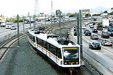
While the subway was a highly anticipated project, the LACTC's light rail Blue Line (later renamed the A Line in 2019) became the first local rail transit line in Los Angeles since the closure of the Pacific Electric in 1965. It was first opened to the public on July 14, 1990, running largely along an abandoned Pacific Electric right-of-way. The initial light rail segment cost US $877 million ($1.74 billion in 2020 adjusted for inflation).[15] Design and construction was managed by the Rail Construction Corporation, now a subsidiary of Metro.[16]
The initial segment was largely at-grade, running between Pico station in Downtown Los Angeles to Anaheim Street station in Long Beach. A loop through downtown Long Beach opened on September 1, 1990. On February 14, 1991, the line was extended further to its current northern terminus at the 7th Street/Metro Center station. In 1993, the 7th St/Metro Center station would become a transfer station, allowing riders to connect with the heavy rail subway Red Line.
1993: The Red Line opens[]

In 1993, the SCRTD and the LACTC were finally merged into the Los Angeles County Metropolitan Transportation Authority (LACMTA), now branded as Metro. That year, the new agency finally opened its underground subway, dubbed the Red Line. The first segment was designated MOS-1, consisted of five stations from Union Station to Westlake/MacArthur Park, and opened on January 30, 1993.[17]
1995: The Green Line opens[]
The line along I-105, designated the Green Line, began service in 1995 at the cost $718 million ($1.22 billion in 2020 adjusted for inflation). One of its purposes when plans for it were drawn up in the 1980s was to serve the aerospace and defense industries in the El Segundo area. But by 1995, the Cold War was over, and the aerospace sector was hemorrhaging jobs. Furthermore, during the 1980s, the bedroom communities in the Gateway Cities region of southeastern Los Angeles County were rapidly losing their population of middle-class aerospace workers (primarily whites and blacks), a process that radically accelerated in the early 1990s. The working-class and poor Hispanics who filled the vacuum generally had no connection to the aerospace sector. This rationale for Green Line construction was a principal argument cited by the Bus Riders Union when it contended that the MTA was focusing its efforts on serving middle-class whites and not working-class minorities. As a result, ridership has been below projected estimates.
The Green Line's western alignment was originally planned and partially constructed to connect with LAX, but the airport was planning a major renovation during the line's construction. Los Angeles World Airports wanted the connection to LAX to be integrated with this construction, but there were concerns from the Federal Aviation Administration that the overhead lines of the rail line would interfere with the landing paths of airplanes.[18] In addition, citizens of neighboring communities to LAX opposed the expansion of the airport.[citation needed] Taxi and limousine drivers and owners of parking lots surrounding LAX feared that a train operating to LAX would create competition,[citation needed] as there is ample free parking at numerous points along the Green Line. As a compromise, a free shuttle from Aviation/LAX Station transports riders to LAX terminals. Today, passengers on the Green Line can see the provision for the LAX extension—two concrete ramp stubs west of the Aviation/LAX station. These stubs are now being put into service as part of the Crenshaw Line.
1996–2000: The Red Line is completed[]
As construction on the Red Line subway continued in 1995, a sinkhole appeared on Hollywood Boulevard, barely missing several workers and causing damage to buildings on the street. Subway construction was halted until the situation could be resolved. The contractor, Shea-Kiewit-Kenny, was replaced with a new contractor, Tutor Saliba.[19]
MOS-2 opened in two segments. Three new stations between Westlake/MacArthur Park and Wilshire/Western opened in 1996,;[20] and five new stations from Wilshire/Vermont to Hollywood/Vine opened in 1999.[21] At this point the Red Line operated in two branches, with shared service between MacArthur Park and Union Station; the branch to Wilshire/Western was eventually designated as the "Purple Line" in 2006, and in 2019, as the D Line, with the North Hollywood Red Line redesignated as the B Line.
In 1998, in part in response to the perceived mismanagement of Red Line construction, Los Angeles County Supervisor Zev Yaroslavsky sponsored Los Angeles County Proposition A, the MTA Reform and Accountability Act of 1998, to ban the use of Los Angeles County revenue from existing sales taxes for subway tunneling, which voters approved. Yaroslavsky stated that local money could be used to cover subway-related costs, as long as it was not used directly for tunneling.[22]
MOS-3, which added new stations and extended the Red Line from Hollywood/Vine to its current terminus at North Hollywood, opened in 2000.[23] Litigation over an illegally awarded contract to build the Hollywood/Highland station and tunnels took more time to resolve than the actual construction.[24]
During construction, 2,000 fossils were discovered, including 64 extinct species of fish, the tusk of an Ice Age elephant and the bones of an ancient longhorn bison, a report funded by the MTA found. The report was authored by paleontologist Bruce Lander of Paleo Environmental Associates in Irvine. Lander worked with a team of 28 scientists during construction of the Metro Rail Red Line. Fossil evidence showed that tens of thousands of years ago, ground sloths, horses, elephants and camels roamed among redwood trees in what is now Los Angeles, according to an MTA summary of the 300-page report. The scientists also found evidence of a great flood in the San Fernando Valley 9,000 years ago that swept away trees. Among the 64 extinct species of marine fish 39 had never before been discovered, the report said. The scientists found bones of an American mastodon, a western camel and a Harlan's ground sloth. They found wood and pollen of land plants including incense cedar and coast redwood trees, and bones of birds, shrews, cottontail rabbits, gophers, mice and kangaroo rats. Some of the fossils are as much as 16.5 million years old.[25]
During construction there were allegations of corruption and safety issues, including cost overruns and tunnel walls having thicknesses less than specified or required by law.[26]
Even relatively early, ridership began to outpace original plans for the system: the Blue Line was originally operated by two-car trains, but proved more popular than expected and 19 platforms were lengthened to accommodate three-car trains in 2002–2003 at a cost of US$11 million ($15.5 million in 2020 adjusted for inflation).[citation needed]
2003: The Gold Line opens to Pasadena[]
Meanwhile, plans had been underway for some time for rail transit connecting Downtown Los Angeles with Pasadena and the San Gabriel Valley.[27] The initial route largely followed the former right-of-way of the Atchison, Topeka and Santa Fe Railway (the Pasadena Subdivision),[28] along which inter-city passenger trains like the Southwest Chief and the Desert Wind had operated until Amtrak service was re-routed along the Southern Transcon to San Bernardino via Fullerton in the early 1990s.[29]
Initial plans were to tunnel the Blue Line north and east from its terminus at 7th Street/Metro Center through Downtown Los Angeles to Union Station, from where it would continue onward to Pasadena. But with the project only around 11% complete, the 1998 passage of the ballot measure banning the use of sales tax revenue for subway tunnelling denied Metro the funding necessary for the underground portion of the project.
Congressman Adam Schiff subsequently authored a bill that created a separate authority to continue work on the mostly above-ground section connecting Union Station to Pasadena, and construction began again in 2000. The first segment, dubbed the Gold Line, opened between Union Station and Sierra Madre Villa on July 26, 2003.[30][31]
The Gold Line implemented limited stop service in 2006 and 2007, but this was eventually replaced by overall speed improvements in 2007. A noise barrier was constructed along the route in South Pasadena between the Mission and Fillmore stations to address noise complaints from South Pasadena residents between April 2007 and July 2007 during track construction.[30][32][33]
2005: Orange Line opens[]
In 1991, Metro acquired the former Southern Pacific Railroad Burbank Branch railbed through the San Fernando Valley. This line had seen passenger rail service from 1904 to 1920, with stations at several locations including North Hollywood and Van Nuys, and Pacific Electric Red Car service from North Hollywood to Van Nuys again from 1938 to 1952.[34] Transit planners envisioned an extension of the Metro Red Line subway as the most natural use for the corridor because the purchased right-of-way began at North Hollywood station.
L.A. Mayor Richard Riordan suggested converting the right of way to an open trench — "Some way to get it out of the ground" — to save costs compared to the use of deep-burrow tunnel boring machines (TBM) while still addressing neighborhood objections to an elevated line. However, local community groups fiercely opposed such alternatives and, in fact, any rail construction that was not completely underground. In particular, the local Orthodox Jewish community, which the line would bisect, resisted an above-ground line; because Shabbat prohibits driving or using electricity from sundown Friday through Saturday, those travelling to synagogue are compelled to walk and, while not backed by any studies, local community leaders claimed they would be exposed to greater potential danger by crossing the line on foot, especially at night. Groups were organized and funded by the community to oppose anything but a subway.[35][36]
In response, California state Senator Alan Robbins introduced legislation which prohibited the use of the corridor for "any form of rail transit other than a deep bore subway located at least 25 feet below ground." The legislation was passed in 1991 during what was called "the days of LA anti-rail zealotry".[37][38][39] (The law would eventually be repealed in 2014.[40])
However, the passage of Proposition A in 1998 also cut off funding for a potential subway line in the corridor. With both subway and light rail now legally prohibited, but with growing political pressure to use the former railbed for "something," the last available option was a busway. This proposal was also opposed by neighborhood groups; however, since it was not prohibited by Robbins's law, it moved forward.
Construction began on the bus rapid transit line in September 2002. During construction, the contractor experienced several delays: a dead body was found tucked in a barrel along the alignment, and toxic soil had to be removed. In July 2004, an appeal by a local citizens' group known as C.O.S.T. (Citizens Organized for Smart Transit) was successful in convincing the California Court of Appeal to order a temporary halt to construction, claiming a network of Metro Rapid bus lines should have been studied as a possible alternative to the Metro Orange Line. The legal maneuver did not stop the project, but the 30-day delay cost taxpayers about $70,000 per day ($2.1 million total) to hold workers and equipment while the matter was resolved. The lawsuit was eventually thrown out of court by Los Angeles County Superior Court Judge David P. Yaffe, who also ordered C.O.S.T. members to pay $37,415.81 ($52,638 in 2020 adjusted for inflation) to the MTA for document-preparation work related to the case.[41]

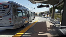
The route was eventually designated the Orange Line, after the citrus groves in the area. It was listed on Metro Rail system maps and mirrored its "honor system," with riders expected to have bought a ticket; there was no ticket validation or fare collection box on board.[42] The route opened on October 29, 2005, between North Hollywood and Warner Center, at a final cost of $324 million ($23 million per mile) ($429 million and $30.5 million in 2020 adjusted for inflation).[43] Within two years, capacity demands led to Metro deploying 65-foot (20 m) buses The agency had to receive a special waiver from Caltrans to operate the bus for testing purposes, since current state law only allows the operation of buses 60 feet (18 m) or shorter.[44] 65-foot (20 m) buses have a seating capacity of 66 passengers and can accommodate 100 passengers.[45]
2008: Measure R[]
In the 2008 election, Los Angeles County voters approved Measure R with 67.22% of the vote, just over the two-thirds majority required by the state of California to raise local taxes.[46] The initiative provided sales tax revenue for transportation projects, including subway tunnelling, and will result in the construction or expansion of a dozen rail lines in the county.[47]
2009: Gold Line Eastside Extension[]

On November 15, 2009, Metro opened the first phase of the Gold Line Eastside Extension.[48][49][50] The project extended the Gold Line from Union Station to Atlantic Boulevard near Monterey Park.[51][52][53] The extended route serves Little Tokyo, Arts District, Boyle Heights and East Los Angeles.[54] The project added eight stations, two of which (Mariachi Plaza and Soto) are underground stations, only the second set of subway stations in the light rail portion of the Metro Rail system (after the 7th Street/Metro Center station).[55]
2009: Freeway busways become the Silver Line[]

Express bus service along the San Bernardino Freeway has been provided by the El Monte Busway since 1973. In the 1990s, a similar facility, the Harbor Transitway, was built along the Harbor Freeway. In 1993, Metro's Scheduling and Operations Planning department issued a report on what it called a "Dual Hub High Occupancy Vehicle Transitway." The report suggested that when the Harbor Transitway opened in 1995, it should be served by a "high speed, high capacity service" that would also serve the El Monte Busway. Existing express routes that traveled on the two facilities would be truncated to end at one of two hubs (El Monte station and the Harbor Gateway Transit Center) where passengers would transfer to a bus that would take them the rest of the way to Downtown LA.
In the end, Metro decided to adopt another proposal in the report, increasing service on the existing Harbor Freeway express lines and operating each as independent routes. Because most of the freeway express buses traveling on the El Monte Busway and Harbor Transitway served the needs of commuters, service was frequent along the corridors during the weekday peak hours, but infrequent during other times.
When the Harbor Transitway opened in 1995 it was seen as a white elephant. The route stopped a mile short of Downtown LA and the stations, being close to freeway traffic, were criticized as being noisy, polluted and appeared uninviting.[56] Planners had projected that 65,200 passengers would travel along the Harbor Transitway each day, but after 10 years ridership fell far below those predictions, with the route seeing just 3,000 passengers per weekday in 2004.[56] Starting in the early 2000s Metro tried to increase ridership on the two corridors by branding them as a part of the burgeoning Metro Rail system. The El Monte Busway was added to maps using a silver color, while the Harbor Transitway was added in bronze.
In 2007, Foothill Transit introduced the Silver Streak as a "single hub" service along the El Monte busway. Several Foothill Transit routes were truncated at El Monte station and passengers transferred to frequent, high capacity Silver Streak buses. The line was deemed a success.
In 2008, Metro once again looked at the concept of linking the El Monte Busway and the Harbor Transitway with a "Dual Hub Bus Rapid Transit" route.[57] After several months of study the Metro voted to introduce the service as the Silver Line in summer 2009. Five Metro Express lines were truncated to terminate at either Harbor Gateway Transit Center or the El Monte station, where passengers would transfer to the Silver Line to continue into Downtown Los Angeles.[58]
Metro also studied drastically changing the fare structure on the route. Previously, passengers on freeway express routes would pay zone fares up to $3.95 based on distance travelled. To encourage ridership, Metro looked into charging the same flat base fare ($1.50 at the time) used on Metro Rail, the Metro Orange Line, and Metro Local routes. The plan encountered heavy opposition from Foothill Transit who worried the low fares would reduce ridership on its more expensive Silver Streak service.[59] In the end Metro set a flat-rate fare of $2.45, which was more than the base fare used on the rest of the system, but 30¢ cheaper than the Silver Streak. The fare fight delayed the opening of the Silver Line several months.
The line eventually opened in December 2009 and carried 6,200 passengers a day during the first month, similar to the combined ridership of the express routes the Silver Line replaced.[60] Service operated half-hourly during the mid-day hours and hourly at night and on weekends. Over the next two years, ridership steadily increased to 11,000 daily passengers in October 2011.[60] Encouraged by the results Metro continued to improve headways, operating buses every 15 minutes during the mid-day hours and every 40 minutes on Saturday.[60]
2012: Expo Line Initial Segment[]

The next Metro Rail line built followed the right-of-way first opened in 1875[61] as the steam-powered Los Angeles and Independence Railroad to bring mining ore to ships in Santa Monica harbor and as a passenger excursion train to the beach—first independently and later after purchase by the Southern Pacific Railroad in 1877. When the Santa Monica harbor closed to shipping traffic in 1909 the line was leased to Pacific Electric, which converted it to electric traction. By 1920 the line was called the Santa Monica Air Line,[62] providing electric-powered freight and passenger service between Los Angeles and Santa Monica. Electrically-powered passenger service stopped in 1953 but diesel-powered freight deliveries to warehouses along the route continued until March 11, 1988.[63]
While Southern Pacific maintained ownership of the right-of-way, after 1988 it no longer used or maintained the rails. Portions of the right-of-way were leased for use as storage facilities, parking lots, impound lots, and various businesses, but no permanent structures were built.[64] The abandonment of the line spurred concerns within the community to prevent the line from being sold off piecemeal—destroying one of the few remaining intact rail corridors within Los Angeles County. Advocacy groups including Friends 4 Expo Transit[65] supported the successful passage of Proposition C in 1990, which allowed the purchase of the entire right-of-way from Southern Pacific by Metro (LACTC).
In 1998, Metro successfully lobbied the federal government to use funding that had been allocated for but not spent on the Red Line for a project along the Expo right-of-way project to the Mid-City district of Los Angeles. Metro then released a Major Investment Study in 2000 which compared bus rapid transit and light rail transit options along what was now known as the "Mid-City/Exposition Corridor".[66] Construction began in mid-2006.[67] The line was originally dubbed the "Aqua Line";[68] later it was redesignated the "Expo Line," though the line retained the aqua color.
An independent agency, the Exposition Metro Line Construction Authority, was given the authority to plan, design, and construct the line by state law in 2003. The first phase comprised the 8.6-mile (13.8 km)[69][70] section between Downtown Los Angeles and Culver City. Construction began in early 2006 and most stations opened to the public on April 28, 2012.[70][71] The Culver City and Farmdale stations opened on June 20, 2012.[70][72]
2012: Orange Line Chatsworth Extension[]
On June 23, 2009 construction began on a four-mile (6.4 km) extension of the Orange Line busway from Canoga northward to the Metrolink station in Chatsworth. Metro's board approved the plan on September 28, 2006, and it was completed in 2012 at a cost of $215 million ($242 million in 2020 adjusted for inflation).[73][74][75] This continues to follow the abandoned SP Burbank Branch roadbed. Revenue service opened on June 30, 2012.[76]
When the Chatsworth extension of the Metro Orange Line opened on June 30, 2012, several different service patterns used the busway network, including a peak-hour shuttle between Chatsworth and Warner Center. To provide service on these shuttles, several NABI 45-foot (14 m) Compo buses were assigned to the Metro Orange Line. In 2018, Warner Center, which was the only stop on the line outside the dedicated busway, was removed from the Orange Line, with a frequent local shuttle service connecting it to Canoga; subsequently Orange Line buses only travelled along the busway, with alternate short turn buses at peak hours stopping at Canoga.
2012–2015: Silver Line improvements[]
Metro ExpressLanes improvements[]
Major improvements to the Silver Line were made as part of the Metro ExpressLanes project to convert the El Monte Busway and the Harbor Transitway from lanes reserved for buses and high occupancy vehicles into high occupancy toll lanes that allow solo drivers to pay a toll to use lanes. Federal funding and some of the tolls collected were used to both refurbish the aging stations used by the Silver Line and improve frequencies on the route. The most drastic change happened at the crowded, 37-year-old El Monte Station which was demolished in 2010 and entirely rebuilt.[60] The new station opened in October 2012 with more bus bays, staffed information counters, restrooms, improved lighting and security.
Stations along the Harbor Transitway were improved between early 2011 and late 2012 with the addition of real time arrival signs, new wayfinding signage, improved lighting and sound proofing.[60] The Harbor Gateway Transit Center also received bathrooms and a substation for LA County Sheriff's deputies who now exclusively patrol Silver Line facilities.[60]
Stations along the El Monte Busway were the last to be improved, each closing for a month in early 2015. During the closure staircases were replaced and new wayfinding signage, real-time arrival signs and improved lighting were installed.
Along the street-running portion of the Silver Line in Downtown Los Angeles, LADOT added bus priority to traffic lights to improve on-time performance in Downtown Los Angeles. This work was completed by October 31, 2012.[77]
Starting in 2012, toll revenue used to improve service during peak hours was further improved with buses arriving as often as every 4 minutes, Saturday service frequency was improved to 20 minutes and to 30 minutes on Sundays. Sunday frequency was further improved to 20 minutes in December 2013.[78]
Silver 2 Silver[]
As feared by Foothill Transit officials, the 30¢ higher fares on the Silver Streak meant passengers along the El Monte Busway often opted to ride the Silver Line to save money. That led to Silver Line buses operating at capacity during peak hours, with the larger Silver Streak buses being under-utilized. To address the problem a new reciprocal fare program between Metro and Foothill Transit called "Silver 2 Silver" was introduced as part of a one-year trial in October 2012.[79][80] Fares on the Silver Streak were lowered match the price of the Silver Line and passengers with a valid pass may ride either route between Downtown Los Angeles and the El Monte Station.[81] Toll funding from the Metro ExpressLanes was used to reimburse Foothill Transit for the cost difference. In October 2013 a review of the program deemed it a success and made it permanent.
Extension to San Pedro and express service[]
While many freeway express lines on the Harbor Transitway were truncated after the introduction of the Silver Line, a notable exception was Metro Express Line 450X. Considered one of Metro's "premium express" routes, buses made very limited stops between Downtown Los Angeles and the Harbor Gateway Transit Center, skipping most of the stations along the Harbor Transitway. The route initially only ran during weekday peak hours, but was later extended to San Pedro and operated as a shuttle service between the Harbor Gateway Transit Center and San Pedro during off-peak hours and weekends.
In December 2015, Metro combined the Silver Line and Metro Express 450X. During off-peak hours and weekends some Silver Line trips traveled to San Pedro, and during weekday peak periods a Silver Line Express route, designated as Line 950X, operated between San Pedro and El Monte, skipping most of the stations along the Harbor Transitway. The change gave passengers a one-seat ride to San Pedro during the off-peak periods and created more Silver Line service on the El Monte Busway.
However, due to overcrowding on Silver Line buses during the peak period, the Silver Line Express buses began stopping at Manchester and Slauson stations in December 2016. With only two stations were skipped for a two-minute time savings.[82] Metro discontinued Silver Line Express service completely in June 2017. Subsequently, the Silver Line had two service patterns: Line 910, which followed the original route between El Monte and Harbor Gateway, and Line 950, which continued beyond Harbor Gateway to San Pedro.[83]
2016: Gold Line Foothill Extension from Pasadena to Azusa[]
The Gold Line Foothill Extension project is a multistage project to extended the Gold Line beyond Pasadena into the northeastern part of Los Angeles county and into San Bernardino County.[84] The first stage, called Phase 2A,[nb 1] running from Sierra Madre Villa station in Pasadena to APU/Citrus College station in Azusa, opened on March 5, 2016.
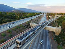
The construction of this segment involved replacing a steel railroad bridge at the point where the Atchison, Topeka and Santa Fe right-of-way departed from I-210 in Arcadia. Caltrans deemed the structure unsafe following the 1994 Northridge earthquake, and it was replaced by a new structure known as the Gold Line Bridge,[85] designed by Minnesota artist Andrew Leicester. The woven-basket look of the bridge's support columns emulate the famed woven baskets of the native Gabrielino/Tongva of the San Gabriel Valley while the underbelly of the bridge is supposed to evoke a Western diamondback rattlesnake.[86]
Phase 2A also included the construction of a 27-acre (11 ha)[87] new maintenance and operations facility in the city of Monrovia for servicing and storing up to 84 light rail vehicles[88][89]
2016: Expo Line Santa Monica Extension[]
Metro conducted study on the Expo Phase 2 from 2007 to 2009 and approved the project in 2010, with planned opening to Santa Monica in early 2016. The Expo Construction Authority officially handed over control of the Expo Phase II track to L.A. Metro for the county transit agency to begin pre-revenue train testing on January 15, 2016.[90] This phase was opened on May 20, 2016.[91]
Design and construction on the 6.6-mile (10.6 km)[69] portion between Culver City and Santa Monica started in September 2011. Testing along the phase 2 segment began on April 6, 2015,[92] and the segment opened on May 20, 2016.[93]
After construction was completed, the line was handed over on January 15, 2016, to the Los Angeles County Metropolitan Transportation Authority for testing and operation.[94] The line opened on May 20 of that year.[95]
2014–2019: New Blue, new line names[]
A six-year, $1.2 billion ($1.31 billion in 2020 adjusted for inflation) overhaul of the Blue Line began in late 2014 with several months of projects to refurbish several stations that were completed in July 2015.[96] The next major improvement came to the rolling stock on the line, which included $130 million to refurbish older light rail vehicles and $739 million to purchase 78 new vehicles.[97]
The final phase of improvements began in 2019, where large sections of the line were closed for months as crews replaced tracks and overhead wiring, upgraded signal systems, refurbished aerial rail bridges (including the elevated Slauson, Firestone, and Del Amo stations), and completely rebuilt Willowbrook/Rosa Parks station. The section of the line south of Willowbrook was closed for most of the first half of the year, and the section north of that was closed most of the second half; the second closure also affected the downtown portion of the Expo Line for several months. During the closure, the Regional Connector tunnels were connected to 7th St/Metro Center.[98] Willowbrook/Rosa Parks station was closed during the entire project due to the large amount of work being conducted.[99][100][101]
When the Blue Line reopened on November 2, 2019, it was redubbed the A Line, while retaining its blue coloring on maps.[102][103] This was the beginning of a process under which Metro Rail and Busway lines would begin to be identified by a letter name rather than the previous system of colors. The Expo Line began to be referred to as the E Line at the same time.[104] Soon after, the Red Line became the B Line, the Green Line became the C Line, the Purple Line became the D Line, the Gold Line became the L Line, the Orange Line became the G Line, and the Silver Line became the J Line.
References[]
- ^ "Open Campaign for a Subway". Los Angeles Times. January 17, 1917. p. 14 (part II, page 2).
- ^ "Pacific Electric Accepts Subway Terminal Plan". Los Angeles Times. March 17, 1923.
- ^ "Benefits of Proposed Subway System Told". Los Angeles Times. May 27, 1923.
- ^ REPORT AND RECOMMENDATIONS ON A COMPREHENSIVE RAPID TRANSIT PLAN FOR THE CITY AND COUNTY OF LOS ANGELES (PDF). Kelker, DeLeuw & Co. 1925. Retrieved June 20, 2020.
- ^ "L. A. Subway Body Organized by Merchants: $3,500,000 Right of Way from Fourth Street Station to Vineyard Acquired". Los Angeles Evening Express. January 17, 1917.
- ^ William-Ross, Lindsay (July 12, 2008). "LAistory: The 1925 "Hollywood Subway"". Last. Retrieved June 20, 2020.
- ^ "Anyone for Monorail?" (PDF). Fortune. July 1954. Retrieved 1 September 2020.
- ^ Berkowitz, Eric (August 18, 2005). "The Subway Mayor". L.A. Weekly. Retrieved October 12, 2013.
- ^ "1981 Inventory of Pacific Electric Routes" (PDF). Caltrans. February 1982. Retrieved 3 June 2020.
- ^ Rep. Henry Waxman - Issues and Legislation - Los Angeles Metro Rail. Waxman, Henry. Archived March 26, 2009, at the Wayback Machine
- ^ "Metro riders guide". Los Angeles County Metropolitan Transportation Authority. Archived from the original on January 24, 2007.
- ^ Connell, Rich (January 9, 1986). "RTD Unveils New Metro Rail Plans : More Debate Expected Over Routes Designed to Skirt Gas-Danger Areas". Los Angeles Times.
- ^ Woo, Elaine (June 3, 2004). "Fernando Oaxaca, 76; Founder of Republican Latino Group". Los Angeles Times.
- ^ DAVID WILLMAN (January 11, 1993). "Vision of Automated Green Line Fading : Transportation: After spending $60 million for the driverless system, officials are seeking $5 million to modify it to carry conventionally operated cars". Los Angeles Times.
- ^ "Facts at a Glance". Los Angeles County Metropolitan Transit Authority. November 18, 2013. Retrieved November 16, 2013.
- ^ Curiel, Socorro C. (1991). "Los Angeles County Transportation Commission Joins SHPE Strategic Technical Employment Program (STEP)". Society of Hispanic Professional Engineers. Hispanic Engineer. Career Communications Group, Inc. (Fall 1991): 20. Retrieved November 19, 2013.
- ^ Katches, Mark (January 31, 1993). "Red Line Rolls to Raves – It's Smooth Railing As L.A. Subway Opens". Los Angeles Daily News.
- ^ Maddaus, Gene (January 9, 2008). "Why Green Line stopped short of LAX". Los Angeles Daily News. Retrieved September 2, 2016.
- ^ GORDON, LARRY; KENNEDY, J. MICHAEL (June 23, 1995). "Street Vanishes in Subway Sinkhole : MTA: Burst water main weakens earth above tunnel, causing half a block of Hollywood Boulevard to collapse" – via LA Times.
- ^ Bloom, David (May 22, 1996). "MTA Unveils New Downtown Line". Los Angeles Daily News.
- ^ Hiestand, Jesse (June 13, 1999). "Hollywood Subway Picks Up Rave Reviews". Los Angeles Daily News.
- ^ Greater West Los Angeles Chamber of Commerce. Business Monthly, January 2006. Retrieved February 14, 2007. Archived January 3, 2007, at the Wayback Machine
- ^ Sheppard, Harrison (June 18, 2000). "End of the Line". Los Angeles Daily News.
- ^ Kajima/Ray Wilson v. MTA (2000) 1 P.3d 63, 96 Cal. Rptr. 2d 747, 23 Cal. 4th 305
- ^ "Encyclopedic Report Details Numerous Subway Fossil Finds". Metro. December 5, 2000. Archived from the original on March 25, 2014. Retrieved March 25, 2014.
- ^ "Los Angeles Asks: Is Subway Safe?". The New York Times. September 12, 1993.
- ^ Freemark, Yonah (March 26, 2010). "Los Angeles' Gold Line Foothill Extension Approved for Funding, Will Begin Construction Later this Year". The Transport Politic. Retrieved 12 March 2016.
- ^ Hawthorne, Christopher (May 20, 2016). "Why the Expo Line to Santa Monica marks a rare kind of progress in American cities". Los Angeles Times. Retrieved 12 July 2016.
- ^ Rasmussen, Cecilia (July 13, 2003). "Pasadena's Gold Line Will Travel a History-Laden Route". Los Angeles Times. Retrieved 19 January 2016.
- ^ Jump up to: a b Streeter, Kurt (June 19, 2003). "Gold Line Is Set to Open July 26". Los Angeles Times. Retrieved 14 March 2016.
- ^ Lund, Dr. Hollie & Willson, Dr. Richard W. (April 2005), The Pasadena Gold Line: Development Strategies, Location Decisions, and Travel Characteristics along a New Rail Line in the Los Angeles Region (PDF), San Jose, CA: Mineta Transportation Institute
- ^ "Metro Gold Line Trains Now Run Faster, More Frequently". LACMTA. November 3, 2006. Retrieved 16 November 2013.
- ^ Hymon, Steve (June 21, 2011). "More frequent Gold Line and Silver Line service begins soon". The Source. LACMTA. Retrieved 16 November 2013.
- ^ "Burbank Branch History Archived 2010-08-26 at the Wayback Machine, by Bruce Petty, Los Angeles River Railroads, retrieved December 5, 2010
- ^ "Is a Busway the Valley Way?; The region's Orange Line is ready to roll but some wonder if it will do much to curtail traffic.", by Amanda Covarrubias, The Los Angeles Times, page A1, October 18, 2005
- ^ "Hahn Tiptoes in Front of Buses, Is Flattened.", by Steve Lopez, The Los Angeles Times, July 27, 2001
- ^ Broverman, Neal (February 4, 2014). "State Could be About to Repeal Ban on Light Rail in the Valley". LA Curbed. Retrieved 16 October 2015.
- ^ "Legal arguments against the busway".
- ^ "Public utilities code section 130250-130265". Archived from the original on 2012-12-12.
- ^ Broverman, Neal (July 8, 2014). "It's Now Legal to Build Light Rail in the San Fernando Valley". LA Curbed. Retrieved 16 October 2015.
- ^ Liu, Caitlin; and Times Staff Writers (March 13, 2003). "Valley Busway Opponents Told to Reimburse MTA". Los Angeles Times.
- ^ Liu, Caitlin (2005-10-26). "Road Is Paved for Valley Busway's Opening Day". Los Angeles Times. Retrieved 2020-02-01.
- ^ "Crashes Heighten Busway Concerns", by Amanda Covarrubias, Caitlin Liu, and Times Staff Writers, Los Angeles Times, November 03, 2005
- ^ Doyle, Sue. (2007-01-26). "Bigger buses to hit the Orange Line". The Daily News.
- ^ Rong-Gong Lin (2007-08-25). "MTA super-sizes bus service". Los Angeles Times.
- ^ Hymon, Steve (30 October 2008). "A Closer Look at Half-Cent Sales Tax Hike, Measure R". Los Angeles Times.
- ^ Bloomekatz, Ari (May 15, 2011). "Los Angeles County is poised to accelerate its rail projects". Los Angeles Times. Retrieved 6 February 2013.
- ^ Bloomekatz, Ari B. (November 13, 2009). "Q&A : Gold Line links downtown and East L.A. : The 6-mile light-rail extension, which cost $898 million, will open Sunday with free rides and entertainment". Los Angeles Times. Retrieved 14 March 2016.
- ^ Bloomekatz, Ari B. (December 21, 2011). "L.A.'s historic 1st Street bridge reopens after 3-year closure". Los Angeles Times. Retrieved 14 March 2016.
- ^ Becerra, Hector (June 16, 2009). "Making the Eastside safe for Gold Line light rail extension". Los Angeles Times. Retrieved 14 March 2016.
- ^ Becerra, Hector (April 24, 2009). "MTA approves Spanish name for Gold Line light rail Eastside extension". Los Angeles Times. Retrieved 14 March 2016.
- ^ Liu, Caitlin (November 26, 2005). "School in Light-Rail's Path a Study in Complexity of Transit Planning". Los Angeles Times. Retrieved 14 March 2016.
- ^ Becerra, Hector (September 12, 2009). "Glitches and finishing touches on Gold Line extension to East L.A." Los Angeles Times. Retrieved 14 March 2016.
- ^ Chong, Jia-Rui (October 1, 2005). "Growing Pains Along the Gold Line". Los Angeles Times. Retrieved 14 March 2016.
- ^ Sampson, Rich. "Two Rail Lines, One Mission: Connecting Southern California" (PDF). RAIL Magazine (22). Washington, DC: Community Transportation Association of America. Archived from the original (PDF) on 6 October 2016. Retrieved 14 March 2016.
- ^ Jump up to: a b Weikel, Dan (December 2, 2014). "A cleaned-up, safer Harbor Transitway puts more commuters on the bus". Los Angeles Times. Retrieved March 9, 2015.
- ^ "Dual Hub Bus Rapid Transit (BRT) El Monte Station to Artesia Transit Center" (PDF). 2008-11-20.
- ^ "SB910 Feb09 public hearing" (PDF). 2009-02-01.
- ^ "Line 910 fare structure" (PDF). 2009-10-15.
- ^ Jump up to: a b c d e f "Metro Silver Line Update Report" (PDF). 2012-01-19.
- ^ “First Train of the Los Angeles and Independence Railroad”. Volume 5, Number 20. © Los Angeles Herald, 1875. Newspaper. Los Angeles Herald. October 19, 1875.
- ^ "Santa Monica Air Line". Electric Railway Historical Association of Southern California.
- ^ Morgenthaler, Anne (March 14, 1988). "End of the Line: The last train out of SM blows a final whistle". Santa Monica Outlook.
- ^ Reed, Drew (November 11, 2014). "LA's streetcars: still shaping the city's development 50 years after closing". CityMetric.
- ^ "The Expo Line". friends4expo.org. Archived from the original on August 7, 2017. Retrieved August 7, 2017.
- ^ "Mid City Westside Transit Draft EIS/EIR: 1.0 History, purpose and need" (PDF). Los Angeles County Metropolitan Transportation Authority.
- ^ Nelson, Laura J. (December 16, 2013). "Residents living near Expo Line stations reduce car use, study shows". Los Angeles Times.
- ^ Pool, Bob (March 23, 2006). "MTA Squabbles Over Hue-Mongous Decision". The Los Angeles Times. Retrieved June 30, 2016.
- ^ Jump up to: a b "Expo Line project fact sheet" (PDF). Los Angeles County Metropolitan Transportation Authority. 2012. Retrieved October 6, 2013.
- ^ Jump up to: a b c "L.A. Metro - Facts at a Glance". Los Angeles County Metropolitan Transportation Authority. June 13, 2013. Retrieved June 28, 2013.
- ^ Weikel, Dan; Bloomekatz, Ari (April 27, 2012). "Expo Line launches rail service push to Westside". LA Times. Retrieved 15 July 2017.
- ^ "Two more Expo Line stations to open June 20". Los Angeles Times. June 5, 2012. Retrieved October 6, 2013.
- ^ Guccione, Jean. "MTA to Run Orange Line Busway to Chatsworth". Los Angeles Times. September 29, 2006. B1.
- ^ extension diagram
- ^ "Canoga Park-Chatsworth busway construction kickoff Wednesday" Archived 2011-06-28 at the Wayback Machine, Sue Doyle, Daily News, retrieved 6-23-2008
- ^ "Item 44 Program Management Project Budget and Schedule Status" (PDF). Metro. January 18, 2012. p. 3. Retrieved 2013-12-26.
- ^ "Metro Silver Line (service tab)".
- ^ "December 2013 Service Changes". 2013-11-22. Archived from the original on 2015-11-17. Retrieved 2018-10-18.
- ^ "Metro Silver Line and Foothill Silver Streak Riders Can Soon Ride Either Line, Using the Same Ticket and Paying the Same Fare". 2012-10-10.
- ^ "Silver 2 Silver Bus Program". 2012-10-12. Archived from the original on 2013-01-20. Retrieved 2018-10-18.
- ^ http://foothilltransit.org/lines-and-schedules/silver2silver/
- ^ http://thesource.metro.net/2016/12/05/metro-service-changes-go-into-effect-dec-11/
- ^ http://thesource.metro.net/2017/06/19/service-changes-go-into-effect-june-25-orange-line-and-silver-line-to-operate-around-the-clock/
- ^ Scauzillo, Steve (February 17, 2015). "Gold Line authority makes push for next extension from Azusa to Montclair". San Gabriel Valley Tribune. Retrieved 13 March 2016.
- ^ "Foothill Extension News" (PDF). Gold Line Foothill Construction Authority. December 2009. Retrieved 2010-09-21.[permanent dead link]
- ^ "Art of the Journey, The Foothill Gold Line" (PDF). Foothill Gold Line Construction Authority. Retrieved 24 August 2014.
- ^ "Press Release, Light Rail Maintenance Facility Approved" (PDF). Gold Line Foothill Construction Authority. January 19, 2011. Retrieved 2011-01-20.
- ^ Ed Reyes, L.A. City Council (December 16, 2009). "Letter to Ara Najarian, Chair of Metro Board" (PDF). Retrieved 2010-09-21.
- ^ "Project Overview and Status, presentation to the Design-Build Institute of America" (PDF). March 10, 2010. Retrieved 2010-09-21.[permanent dead link]
- ^ "Metro Takes Control of Expo Line to Begin Pre-Revenue Service | Santa Monica Next". www.santamonicanext.org. Retrieved January 29, 2016.
- ^ Hymon, Steve. "17 things to know about the Expo Phase 2 opening". Metro's The Source. LACMTA. Retrieved 25 February 2016.
- ^ Nunez, Jennifer (April 9, 2015). "Testing begins on LA Expo Line phase 2". International Railway Journal. Retrieved May 25, 2015.
- ^ Zeller, Heidi (March 30, 2015). "Art for the Expo Line: installation at Expo/Sepulveda Station". The Source. Los Angeles County Metropolitan Transportation Authority. Retrieved March 31, 2015.
- ^ "About Expo Overview". Archived from the original on August 7, 2017.
- ^ Hymon, Steve (February 25, 2016). "17 things to know about Expo 2 opening on May 20". The Source. Metro. Retrieved 2016-05-21.
- ^ Chen, Anna (July 22, 2015). "Station refurbishment work on the Blue Line completed". The Source. Retrieved September 13, 2015.
- ^ Hymon, Steve (January 8, 2014). "Metro Blue Line receiving a $1.2-billion overhaul". The Source. Retrieved May 30, 2015.
- ^ Ayala, Roberto (2019-08-09). "New time-lapse video: Regional Connector breaks through to the 7th St/Metro Center Station". The Source. Retrieved 2019-08-14.
- ^ "Metro Blue Line Improvements Project: Blue Line Bus Shuttle Service for South Closure, January 26 - late May 2019" (PDF). Los Angeles County Metropolitan Transit Authority (Metro). May 31, 2019. Retrieved May 26, 2019.
- ^ "Portion Of Metro Blue Line To Be Closed For 4 Months For $350M Project". 2019-01-23. Retrieved 2019-01-28.
- ^ Chen, Anna (April 29, 2019). "New Blue Improvements Project Update: Info About the North Closure Bus Shuttle Service". Los Angeles County Metropolitan Transit Authority (Metro). Retrieved May 26, 2019.
- ^ Fonseca, Ryan (September 25, 2019). "Ignore Those 'Line A' Signs. Metro's Blue Line Will Reopen As The 'A Line'". laist.com. Southern California Public Radio. Archived from the original on September 26, 2019. Retrieved September 26, 2019.
- ^ "Light rail to Long Beach will reopen soon — but it won't be called the Blue Line". Los Angeles Times. 2019-10-17. Retrieved 2019-10-18.
- ^ http://media.metro.net/documents/line-806_1571341545.pdf
- ^ The entire Foothill Extension is numbered Phase 2, with the original Union Station to Pasadena Gold Line segment being thought of as Phase 1. This is somewhat of a misnumbering, as the Gold Line Eastside Extension was built between these two phases, but long-range plans call for the Union Station to Montclair and Union Station to East Los Angeles branches to be run as separate lines.
| hide | ||||||||||||||
|---|---|---|---|---|---|---|---|---|---|---|---|---|---|---|
| Services |
|  | ||||||||||||
| Stations | ||||||||||||||
| Bus lanes | ||||||||||||||
| Capital projects | ||||||||||||||
| Fleet | ||||||||||||||
| Other information | ||||||||||||||
- Los Angeles Metro Rail
- Public transportation in Los Angeles County, California
- Passenger rail transportation in California
- Transportation in Los Angeles
- History of rapid transit