Akiha-ku, Niigata
Akiha-ku
秋葉区 | |
|---|---|
| Akiha Ward | |
 Niitsu Raiilway Museum | |
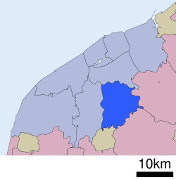 Location of Akiha-ku in Niigata City | |
 Akiha-ku | |
| Coordinates: 37°47′18.6″N 139°6′52.5″E / 37.788500°N 139.114583°E | |
| Country | Japan |
| Region | Kōshin'etsu, Hokuriku (Chūbu) |
| Prefecture | Niigata |
| City | Niigata |
| Area | |
| • Total | 95.38 km2 (36.83 sq mi) |
| Population (September 2018) | |
| • Total | 76,086 |
| • Density | 800/km2 (2,100/sq mi) |
| Time zone | UTC+9 (Japan Standard Time) |
| Address | 2009 Hodojima, Akiha-ku, Niigata-shi, Niigata-ken 956-8601 |
| Phone number | 0250-23-1000 |
| Website | Official website |


Akiha-ku (秋葉区, Akiha-ku) is one of the eight wards of Niigata City, Niigata Prefecture, in the Hokuriku region of Japan. As of 1 September 2018, the ward had an estimated population of 76,086 in 29,843 households [1] and a population density of 800 persons per km². The total area of the ward was 95.38 square kilometres (36.83 sq mi).
Geography[]
Akiha-ku is located in an inland region of north-central Niigata Prefecture. Both the Agano River and the Shinano River flow through the ward.
- Gallery
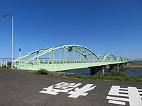
Agaura Bridge over the Agano River
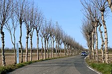
Manganji Hasagi Street

Niitsu River and Niitsu Library


Surrounding municipalities[]
- Niigata Prefecture
- Konan-ku, Niigata
- Minami-ku, Niigata
- Gosen
- Agano
- Tagami
History[]
The area of present-day Akiha-ku was part of ancient Echigo Province. The modern towns of Niitsu and Kosudo were established on April 1, 1889 within Nakakanbara District with the establishment of the municipalities system. Niitsu was raised to city status on January 1, 1951. The city of Niigata annexed Niitsu and Kosudo on March 21, 2005. Niigata became a government-designated city on April 1, 2007 and was divided into wards, with the new Akiha Ward consisting of the former city of Niitsu and former town of Kosudo.


Education[]
University[]
Primary and secondary education[]
Akiha-ku has 13 public elementary schools and six public middle schools operated by the Niigata city government. The ward has three public high schools operated by the Niigata Prefectural Board of Education.
Transportation[]
Railway[]
![]() JR East - Shin'etsu Main Line
JR East - Shin'etsu Main Line
![]() JR East - Ban'etsu West Line
JR East - Ban'etsu West Line
- Niitsu - Higashi-Niitsu - Shinseki - (Kita-Gosen)
![]() JR East - Uetsu Main Line
JR East - Uetsu Main Line
Highways[]
Points of interest[]
References[]
- ^ Niigata city official statistics[permanent dead link](in Japanese)
External links[]
![]() Media related to Akiha-ku, Niigata at Wikimedia Commons
Media related to Akiha-ku, Niigata at Wikimedia Commons
- Niigata city official website (in Japanese)
- Niigata Akiha-ku website (in Japanese)
- Niigata City Official Tourist Information (multilingual)
- Niigata Pref. Official Travel Guide (multilingual)
| hide | ||||
|---|---|---|---|---|
| Niigata |
| |||
| Special cities | ||||
| Cities | ||||
| Districts | ||||
- Wards of Niigata (city)