Tsunan
Tsunan
津南町 | |
|---|---|
Town | |
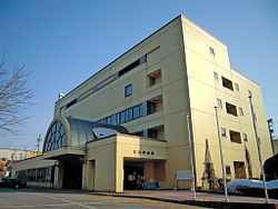 Tsunan town hall | |
 Flag  Seal | |
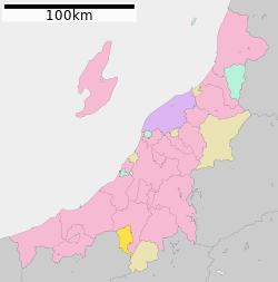 Location of Tsunan in Niigata | |
 Tsunan | |
| Coordinates: 37°0′51.4″N 138°39′9.1″E / 37.014278°N 138.652528°ECoordinates: 37°0′51.4″N 138°39′9.1″E / 37.014278°N 138.652528°E | |
| Country | Japan |
| Region | Chūbu (Kōshin'etsu) (Hokuriku) |
| Prefecture | Niigata |
| District | Nakauonuma |
| Area | |
| • Total | 170.21 km2 (65.72 sq mi) |
| Population (March 31, 2020) | |
| • Total | 9,349 |
| • Density | 55/km2 (140/sq mi) |
| Time zone | UTC+9 (Japan Standard Time) |
| Symbols | |
| • Tree | Paulownia tomentosa |
| • Flower | Chrysanthemum morifolium |
| • Bird | Japanese bush-warbler |
| Phone number | 025-765-3111 |
| Address | 585 Shimofunato, Tsunan-machi, Nakauonuma-gun, Niigata-ken 949-8201 |
| Website | Official website |


Tsunan (津南町, Tsunan-machi) is a town located in Niigata Prefecture, Japan. As of 1 July 2019, the town had an estimated population of 9,349 in 3480 households,[1] and a population density of 54.2 persons per km². The total area of the town was 170.21 square kilometres (65.72 sq mi).
Geography[]
Tsunan is located in southwestern Niigata Prefecture, in a mountainous area bordering northern Nagano Prefecture. The town is located on a river terrace of the Shinano River with the town hall at an elevation of 241 meters; however, much of the town area is mountainous, with Mount Naeba (2143 meters) is partly located within the town limits. Due to its geographical location between the Sea of Japan and the surrounding Japanese Alps, it has one of the highest annual snowfalls in Japan. There are numerous ski resorts within the region.
Surrounding municipalities[]
Climate[]
Tsunan has a Humid subtropical climate with continental influences (Köppen Cfa/Dfa) characterized by hot, wet summers and cold winters with heavy snowfall. The average annual temperature in Tsunan is 12.3 °C. The average annual rainfall is 1918 mm with September as the wettest month. The temperatures are highest on average in August, at around 25.4 °C, and lowest in January, at around 0.2 °C.[2]
| hideClimate data for Tsunan, Niigata (1981-2010) | |||||||||||||
|---|---|---|---|---|---|---|---|---|---|---|---|---|---|
| Month | Jan | Feb | Mar | Apr | May | Jun | Jul | Aug | Sep | Oct | Nov | Dec | Year |
| Average high °C (°F) | 1.7 (35.1) |
2.2 (36.0) |
5.7 (42.3) |
13.2 (55.8) |
19.8 (67.6) |
23.2 (73.8) |
26.5 (79.7) |
28.4 (83.1) |
23.6 (74.5) |
17.4 (63.3) |
11.4 (52.5) |
5.2 (41.4) |
14.9 (58.8) |
| Daily mean °C (°F) | −1.4 (29.5) |
−1.3 (29.7) |
1.7 (35.1) |
8.0 (46.4) |
14.4 (57.9) |
18.7 (65.7) |
22.2 (72.0) |
23.6 (74.5) |
19.2 (66.6) |
13.0 (55.4) |
7.0 (44.6) |
1.6 (34.9) |
10.6 (51.0) |
| Average low °C (°F) | −4.7 (23.5) |
−5.2 (22.6) |
−2.3 (27.9) |
3.3 (37.9) |
9.4 (48.9) |
14.8 (58.6) |
18.7 (65.7) |
19.8 (67.6) |
15.5 (59.9) |
9.0 (48.2) |
3.2 (37.8) |
−1.5 (29.3) |
6.7 (44.0) |
| Average precipitation mm (inches) | 235.9 (9.29) |
157.0 (6.18) |
116.8 (4.60) |
79.7 (3.14) |
102.2 (4.02) |
136.1 (5.36) |
184.4 (7.26) |
152.9 (6.02) |
177.2 (6.98) |
151.1 (5.95) |
164.2 (6.46) |
218.1 (8.59) |
1,875.6 (73.85) |
| Average snowfall cm (inches) | 443 (174) |
320 (126) |
208 (82) |
75 (30) |
4 (1.6) |
0 (0) |
0 (0) |
0 (0) |
0 (0) |
0 (0) |
27 (11) |
272 (107) |
1,349 (531.6) |
| Mean monthly sunshine hours | 68.6 | 82.4 | 113.6 | 166.8 | 181.2 | 140.3 | 138.8 | 174.7 | 119.6 | 123.4 | 105.5 | 84.9 | 1,499.8 |
| Source: Japan Meteorological Agency | |||||||||||||
Demographics[]
Per Japanese census data,[3] the population of Tsunan has declined steadily over the past 40 years and is now considerable less than it was a century ago.
| Year | Pop. | ±% |
|---|---|---|
| 1920 | 16,326 | — |
| 1930 | 18,751 | +14.9% |
| 1940 | 21,843 | +16.5% |
| 1950 | 21,684 | −0.7% |
| 1960 | 20,072 | −7.4% |
| 1970 | 16,092 | −19.8% |
| 1980 | 13,841 | −14.0% |
| 1990 | 12,955 | −6.4% |
| 2000 | 12,389 | −4.4% |
| 2010 | 10,881 | −12.2% |
History[]
The area of present-day Tsunan was part of ancient Echigo Province and was tenryō territory under the direct control of the Tokugawa shogunate in the Edo period. Following the Meiji restoration, the area was organised into various villages within Nakauonuma District, Niigata The town of Tsunan was established on January 1, 1955 by the merger of the villages of Tomaru, Kamigō, Ashigasaki, Akinari, Nakafukami and Shimofunato.
Government[]
Tsunan has a mayor-council form of government with a directly elected mayor and a unicameral city council of 14 members. Tsunan, together with the city of Tōkamachi, collectively contributes two member to the Niigata Prefectural Assembly. In terms of national politics, the town is part of of the lower house of the Diet of Japan.
Economy[]
The local economy is dominated by agriculture. The area is known for its rice, sake, tomatoes, sunflowers, and buckwheat noodles. The town is also within commuting distance of neighbouring Tōkamachi.
Education[]
Tsunan has three public elementary schools and one public middle school operated by the town government. There is one public high school operated by the Niigata Prefecture Board of Education.
Transportation[]
Railway[]
![]() JR East - Iiyama Line
JR East - Iiyama Line
Highway[]
Local attractions[]
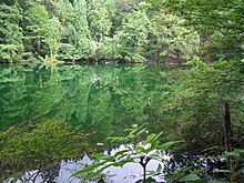
- Ryu-ga-kubo, one of the 100 Famous Springs of Japan
- Nishiotaki Dam
- Echigo-Tsumari Art Triennial
- Okinohara Site, Jomon period ruins, a National Historic Site
References[]
External links[]
 Media related to Tsunan, Niigata at Wikimedia Commons
- Official Website (in Japanese)
| show Authority control |
|---|
This Niigata Prefecture location article is a stub. You can help Wikipedia by . |
- Towns in Niigata Prefecture
- Tsunan, Niigata
- Niigata geography stubs