Tsubame, Niigata
Tsubame
燕市 | |
|---|---|
 Tsubame City Hall | |
 Flag  Seal | |
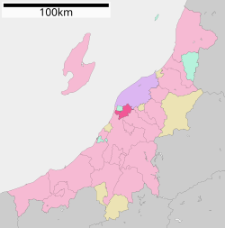 Location of Tsubame in Niigata Prefecture | |
 Tsubame | |
| Coordinates: 37°40′23.1″N 138°52′56″E / 37.673083°N 138.88222°ECoordinates: 37°40′23.1″N 138°52′56″E / 37.673083°N 138.88222°E | |
| Country | Japan |
| Region | Chūbu (Kōshin'etsu) (Hokuriku) |
| Prefecture | Niigata |
| Government | |
| • Mayor | Tsutomu Suzuki (since April 2010) |
| Area | |
| • Total | 110.96 km2 (42.84 sq mi) |
| Population (July 1, 2019) | |
| • Total | 77,382 |
| • Density | 700/km2 (1,800/sq mi) |
| Time zone | UTC+9 (Japan Standard Time) |
| Symbols | |
| • Tree | Sakura |
| • Flower | Salvia, Chrysanthemum, Verbena |
| Phone number | 0256-92-1111 |
| Address | 1-1 Yoshida-Hinode-cho, Tsubame-shi, Niigata-ken 959-0295 |
| Website | Official website |

Tsubame (燕市, Tsubame-shi) is a city located in Niigata Prefecture, Japan. As of 1 July 2019, the city had an estimated population of 77,382 in 29,406 households,[1] and a population density of 697 persons per km². The total area of the city was 110.96 square kilometres (42.84 sq mi).
Geography[]
Tsubame is located in the coastal plains of central Niigata Prefecture, but does not have a coastline on the Sea of Japan. The Shinano River flows through the city.
Surrounding municipalities[]
Climate[]
Tsubame has a Humid climate (Köppen Cfa) characterized by warm, wet summers and cold winters with heavy snowfall. The average annual temperature in Tsubame is 12.9 °C. The average annual rainfall is 2093 mm with September as the wettest month. The temperatures are highest on average in August, at around 26.12 °C, and lowest in January, at around 1.2 °C.[2]
Demographics[]
Per Japanese census data,[3] the population of Tsubame has remained relatively unchanged over the past 40 years.
| Census Year | Population |
|---|---|
| 1970 | 78,444 |
| 1980 | 82,984 |
| 1990 | 83,377 |
| 2000 | 84,297 |
| 2010 | 81,876 |
History[]
The area of present-day Tsubame was part of ancient Echigo Province and has been settled since prehistoric times. Under the Edo period Tokugawa shogunate, the town of Tsubame was part of the holdings of Murakami Domain and developed as a river port on the Shinano River. During the early Meiji period, the area was organised into Nishikanbara District, Niigata. The town of Tsubame was established on April 1, 1889 with the creation of the modern municipalities system. It was raised to city status on March 31, 1954 by merging with the neighbouring villages of Koike, Konakagawa and Matsunaga. On March 20, 2006 Tsubame absorbed the towns of Bunsui and Yoshida (both fromishikanbara District).
Government[]
Tsubame has a mayor-council form of government with a directly elected mayor and a unicameral city legislature of 24 members.
Economy[]
Tsubame was traditionally known for its copper ware and the production of kiseru (Japanese smoking pipes). In modern times, Tsubame is noted for its production of tableware and cutlery.
Education[]
Tsubame has 15 public elementary schools and five public middle schools operated by the city government. There are three public high schools operated by the Niigata Prefectural Board of Education, and the prefecture also operates one special education school.
Transportation[]
Railway[]
![]() JR East - Yahiko Line
JR East - Yahiko Line
- (Yahagi) - Yoshida - Nishi-Tsubame - Tsubame - (Tsubame-Sanjō)
![]() JR East - Echigo Line
JR East - Echigo Line
- Bunsui - Aōzu - Minami-Yoshida - Yoshida - Kita-Yoshida
Note: Although the nearest stop on the Jōetsu Shinkansen is called Tsubame-Sanjō Station, the station is physically located in the city of Sanjō and not in Tsubame.
Highway[]
Local attractions[]
- Mount Kugami / Kokujo Temple
Sister cities[]
 Sheboygan, Wisconsin, United States-since January 11, 1996
- Dundee, Michigan, US and Tsubame have an exchange program through their local middle school.
Notable People from Tsubame[]
- Chinami Nishimura (politician)
- Killer Khan (professional wrestler)
- Kiriko Nananan (manga artist)
References[]
External links[]
 Media related to Tsubame, Niigata at Wikimedia Commons
- Official Website (in Japanese)
| show Authority control |
|---|
- Tsubame, Niigata
- Cities in Niigata Prefecture