Alberta Highway 19
  Highway 625 | |||||||
|---|---|---|---|---|---|---|---|
 Highway 19
Highway 625 | |||||||
| Route information | |||||||
| Maintained by Alberta Ministry of Transportation | |||||||
| Highway 19 | |||||||
| Length | 12.27 km[1] (7.62 mi) | ||||||
| West end | |||||||
| East end | |||||||
| Highway 625 | |||||||
| Length | 20.24 km[2] (12.58 mi) | ||||||
| West end | |||||||
| Major intersections | |||||||
| East end | |||||||
| Location | |||||||
| Specialized and rural municipalities | Leduc County | ||||||
| Major cities | Beaumont, Edmonton | ||||||
| Towns | Devon, | ||||||
| Highway system | |||||||
|
| |||||||
| |||||||
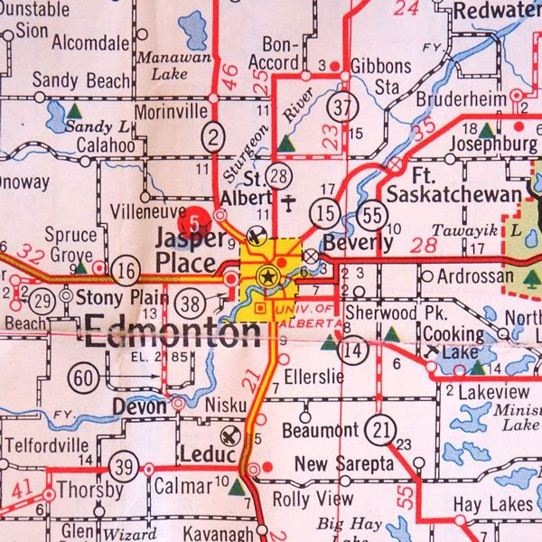
Highway 19 and Highway 625 are two provincial highways south of Edmonton in the Canadian province of Alberta that form a continuous east–west route connecting Highway 60 near Devon to Highway 21 east of Beaumont. Highway 19 was acquired by the City of Edmonton in the land annexation approved by the Province in 2019. Highway 19 passes north of the Edmonton International Airport and, in tandem with Highway 60, provides a southwest bypass of Edmonton between Highways 2 and 16. East of Highway 2, Highway 19 becomes Highway 625 and continues through Nisku Industrial Park. It intersects Highway 814 in before ending at Highway 21.
Alberta Transportation is planning to upgrade Highway 19 to a divided highway, and has long-term plans for similar upgrades to Highway 625.
Route description[]
Highway 19 runs for 12.27 km (7.62 mi). It begins at an intersection with Highway 60 as an eastern extension of Halicz-Gildehurst Road at the south end of Devon, proceeding east across Leduc County, intersecting several local roads and crossing Whitemud Creek, where it enters the city of Edmonton.[1] It passes north of Edmonton International Airport and becomes a divided highway before a partial cloverleaf interchange with Highway 2 shortly thereafter, marking the end of Highway 19.[3] East of the interchange the divided highway, now designated as Highway 625, continues as the main east–west thoroughfare through industrial and business areas of Nisku. At the east end of Nisku, the divided highway ends and the two-lane road continues east to an intersection with Highway 814 in Beaumont, providing an alternate route north into Edmonton. Further east, Highway 625 ends at Highway 21 (20.24 km (12.58 mi) from Highway 2) south of the hamlet of Looma, and continues in Leduc County as Township Road 504 to Ministik Lake.[2]
History[]
The original designation of Highway 19 was used for the route that connected Wetaskiwin to Westerose.[4] In the 1940s, Highway 19 was extended around Pigeon Lake, intersecting Highway 12 near the locality of Norbuck, south of Breton.[5] In the early 1960s, Highway 19 was realigned and continued due west from Westerose to Winfield,[6] but was renumbered to Highway 13 in the late 1960s, coinciding with the opening of Highway 2 realignment.[7]
The present-day alignment of Highway 19 was originally constructed as an all-weather gravel road (Township Road 504) that appeared on a 1956 Alberta road map linking Devon to Highway 2.[8] In the 1960s, the preferred route to connecting Beaumont to Highway 2 and Highway 21 was Township Road 510, located north of Beaumont;[9] however, as access was later consolidated and became more limited, Township Road 504 was selected as the preferred route. In c. 1974, the numbered secondary highway system appeared, which at the time was under the jurisdiction of the local rural municipality. The section of Township Road 504 between Highway 2 and Highway 21 being designated as Secondary Highway 625, while the section between Highway 2 and Devon was designated as Secondary Highway 919,[10] indicating a future upgrade to a provincially maintained, primary highway. The interchange at Nisku was opened in 1978,[11] and in 1982, Highway 919 was renumbered to Highway 19.[12] With the 2000 absorption of the secondary highways, Highway 625 became under provincial control.
Future[]
Twinning of Highway 19 from Highway 60 to Highway 2 is planned. The project includes eight intersection upgrades; two new bridges at Whitemud Creek; illumination at Highway 60 and airport access road; speed limit increase to 110 km/h (68 mph); and traffic signals at the airport access road intersection with a limit of 70 km/h (43 mph).[13] The twinned section from Range Road 253 to Highway 2 was completed in 2019. Twinning of the highway between Highway 60 and Range Road 261 is planned for 2021–2022.[14]
In conjunction with twinning of Highway 19, studies are underway to twin Highway 625 between Highway 2 and Highway 21.[13]
Major intersections[]
| Rural/specialized municipality | Location | km[3] | mi | Destinations | Notes | |||
|---|---|---|---|---|---|---|---|---|
| Leduc County | Devon | 0.0 | 0.0 | |||||
| Edmonton |
No major junctions | |||||||
| Leduc County | Nisku | 12.2 0.0 | 7.6 0.0 | Interchange; Hwy 2 exit 525 Access to Edmonton International Airport | ||||
| Beaumont | 8.9 | 5.5 | ||||||
| | 20.2 | 12.6 | Township Road 504 | |||||
1.000 mi = 1.609 km; 1.000 km = 0.621 mi
| ||||||||
References[]
- ^ a b "2015 Provincial Highway 1-216 Progress Chart" (PDF). Alberta Transportation. March 2015. Archived (PDF) from the original on April 10, 2016. Retrieved October 12, 2016.
- ^ a b "Provincial Highways 500 - 986 Progress Chart" (PDF). Alberta Transportation. March 2015. Retrieved December 26, 2016.
- ^ a b Google (October 28, 2016). "Highways 19 and 625 near Edmonton" (Map). Google Maps. Google. Retrieved October 28, 2016.
- ^ MacPherson (1940). "Road Map - Province of Alberta". Edmonton: Department of Public Works. Retrieved January 9, 2017.
- ^ "Shell Map of Montana | Southern Alberta". Shell Oil Company. 1951. Retrieved September 28, 2017.
- ^ Travel Alberta (1967). Alberta Official Road Map (Map). The Province of Alberta.
- ^ Travel Alberta (1970). Alberta Official Road Map (Map). The Province of Alberta.
- ^ "Shell Map of British Columbia, Alberta, Saskatchewan and Manitoba". Shell Oil Company. 1956. Retrieved January 9, 2017.
- ^ "Road Map". Alberta Highways. 1962. Retrieved January 25, 2017.
- ^ Travel Alberta (1974). Alberta Official Road Map (Map). The Province of Alberta.
- ^ Transportation Infrastructure Management System: Existing Structures in the Provincial Highway Corridor (PDF). Alberta Transportation (Report). Government of Alberta. September 28, 2012. p. 40. Retrieved September 29, 2017.
- ^ Travel Alberta (1982). Alberta Official Road Map (Map). The Province of Alberta.
- ^ a b "Edmonton & Area Provincial Highway Projects". Alberta Transportation. Retrieved December 29, 2010.
- ^ "Breaking ground on Highway 19 west twinning". Town of Devon. Retrieved March 31, 2021.
- Alberta provincial highways, 1–216 series
- Alberta provincial highways, 500/600 sub-series