Almond, North Carolina
Almond, North Carolina | |
|---|---|
Unincorporated community | |
 Almond, North Carolina | |
| Coordinates: 35°22′11″N 83°33′55″W / 35.36972°N 83.56528°WCoordinates: 35°22′11″N 83°33′55″W / 35.36972°N 83.56528°W | |
| Country | United States |
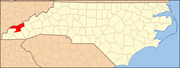
| State | North Carolina |
| County | Swain |
| Named for | Bud Almond[1] |
| Elevation | 1,722 ft (525 m) |
| Time zone | UTC-5 (Eastern (EST)) |
| • Summer (DST) | UTC-4 (EDT) |
| ZIP code | 28702 |
| Area code(s) | 828 |
| GNIS feature ID | 1018806[2] |


Almond is an unincorporated community in Swain County, North Carolina, United States. Almond is located on the Little Tennessee River and North Carolina Highway 28 7.9 miles (12.7 km) west-southwest of Bryson City.
History[]
Almond has a post office with ZIP code 28702, which opened on March 17, 1886.[3][4] The community was named for Bud Almond, who provided the land on which the town was founded.[2] At one time, Almond was a scheduled stop with a depot for the Southern Railway on the Murphy Branch.
During the construction of Fontana Dam, the post office, school, and railway depot located here were moved during 1943. Today, most of Almond is now covered by Fontana Lake.[5]
References[]
- ^ "North Carolina Gazetteer". Retrieved December 24, 2020.
- ^ Jump up to: a b "Almond". Geographic Names Information System. United States Geological Survey.
- ^ United States Postal Service (2012). "USPS - Look Up a ZIP Code". Retrieved 2012-02-15.
- ^ "Postmaster Finder - Post Offices by ZIP Code". United States Postal Service. Retrieved March 11, 2013.
- ^ Ellison, George (June 12, 2013). "First of the Floppy Disc: Almond School". Smoky Mountain News. Retrieved 2020-05-28.
| show Municipalities and communities of Swain County, North Carolina, United States |
|---|
| show Authority control |
|---|
Categories:
- Unincorporated communities in Swain County, North Carolina
- Unincorporated communities in North Carolina
- Western North Carolina geography stubs