Andale, Kansas
Andale, Kansas | |
|---|---|
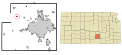 Location within Sedgwick County and Kansas | |
 | |
| Coordinates: 37°47′28″N 97°37′45″W / 37.79111°N 97.62917°WCoordinates: 37°47′28″N 97°37′45″W / 37.79111°N 97.62917°W | |
| Country | United States |
| State | Kansas |
| County | Sedgwick |
| Founded | 1880s |
| Incorporated | 1901 |
| Area | |
| • Total | 0.57 sq mi (1.49 km2) |
| • Land | 0.57 sq mi (1.49 km2) |
| • Water | 0.00 sq mi (0.00 km2) |
| Elevation | 1,434 ft (437 m) |
| Population | |
| • Total | 941 |
| • Density | 1,700/sq mi (630/km2) |
| Time zone | UTC-6 (CST) |
| • Summer (DST) | UTC-5 (CDT) |
| ZIP code | 67001 |
| Area code | 316, exchanges:444,445 |
| FIPS code | 20-01775[3] |
| GNIS ID | 473809[4] |
| Website | cityofandale.com |

Andale is a city in Sedgwick County, Kansas, United States. As of the 2020 census, the population of the city was 941.[2]
History[]
Andale was founded in the early 1880s.[5] The city's name is an amalgamation of the surnames of two families of pioneer settlers, the Andersons and Dales.[6]
Andale was a station and shipping point on the Missouri Pacific Railroad.[7]
Geography[]
Andale is located at 37°47′28″N 97°37′45″W / 37.79111°N 97.62917°W (37.791221, -97.629156).[8] According to the United States Census Bureau, the city has a total area of 0.57 square miles (1.48 km2), all of it land.[9]
Demographics[]
| Historical population | |||
|---|---|---|---|
| Census | Pop. | %± | |
| 1910 | 237 | — | |
| 1920 | 259 | 9.3% | |
| 1930 | 255 | −1.5% | |
| 1940 | 289 | 13.3% | |
| 1950 | 316 | 9.3% | |
| 1960 | 432 | 36.7% | |
| 1970 | 500 | 15.7% | |
| 1980 | 538 | 7.6% | |
| 1990 | 566 | 5.2% | |
| 2000 | 766 | 35.3% | |
| 2010 | 928 | 21.1% | |
| 2020 | 941 | 1.4% | |
| U.S. Decennial Census | |||
Andale is part of the Wichita, KS Metropolitan Statistical Area.
2010 census[]
As of the census[10] of 2010, there were 928 people, 290 households, and 236 families living in the city. The population density was 1,628.1 inhabitants per square mile (628.6/km2). There were 301 housing units at an average density of 528.1 per square mile (203.9/km2). The racial makeup of the city was 98.7% White, 0.2% from other races, and 1.1% from two or more races. Hispanic or Latino of any race were 2.3% of the population.
There were 290 households, of which 52.4% had children under the age of 18 living with them, 63.1% were married couples living together, 12.4% had a female householder with no husband present, 5.9% had a male householder with no wife present, and 18.6% were non-families. 17.2% of all households were made up of individuals, and 7.6% had someone living alone who was 65 years of age or older. The average household size was 3.20 and the average family size was 3.67.
The median age in the city was 27.2 years. 38.7% of residents were under the age of 18; 8.8% were between the ages of 18 and 24; 25.6% were from 25 to 44; 18.9% were from 45 to 64; and 8.1% were 65 years of age or older. The gender makeup of the city was 48.7% male and 51.3% female.
2000 census[]
As of the census[3] of 2000, there were 766 people, 241 households, and 186 families living in the city. The population density was 1,514.2 people per square mile (579.9/km2). There were 247 housing units at an average density of 488.3 per square mile (187.0/km2). The racial makeup of the city was 98.69% White, 0.13% Native American, 0.52% from other races, and 0.65% from two or more races. Hispanic or Latino of any race were 1.57% of the population.
There were 241 households, out of which 49.0% had children under the age of 18 living with them, 68.5% were married couples living together, 5.4% had a female householder with no husband present, and 22.8% were non-families. 20.3% of all households were made up of individuals, and 11.6% had someone living alone who was 65 years of age or older. The average household size was 3.18 and the average family size was 3.78.
In the city, the population was spread out, with 39.2% under the age of 18, 7.6% from 18 to 24, 27.3% from 25 to 44, 14.5% from 45 to 64, and 11.5% who were 65 years of age or older. The median age was 28 years. For every 100 females, there were 102.1 males. For every 100 females age 18 and over, there were 100.9 males.
The median income for a household in the city was $47,333, and the median income for a family was $53,702. Males had a median income of $40,909 versus $30,875 for females. The per capita income for the city was $17,439. About 2.7% of families and 1.1% of the population were below the poverty line, including none of those under age 18 and 6.8% of those age 65 or over.
Education[]
The community is served by Renwick USD 267 public school district. Andale has one high school and one elementary school. Andale High School is the home of the Andale Indians. The school colors are black and gold.[11]
Notable people[]
- B. J. Finney, football player
- Colton Haynes, model and actor.
References[]
- ^ "2019 U.S. Gazetteer Files". United States Census Bureau. Retrieved July 24, 2020.
- ^ a b "Profile of Andale, Kansas in 2020". United States Census Bureau. Archived from the original on November 14, 2021. Retrieved November 14, 2021.
- ^ a b "U.S. Census website". United States Census Bureau. Retrieved 2008-01-31.
- ^ "US Board on Geographic Names". United States Geological Survey. 2007-10-25. Retrieved 2008-01-31.
- ^ Kansas State Historical Society (1916). Biennial Report of the Board of Directors of the Kansas State Historical Society. Kansas State Printing Plant. pp. 285.
- ^ Bentley, Orsemus Hills (1910). History of Wichita and Sedgwick County, Kansas: Past and Present. Windmill Publications. p. 617.
- ^ Blackmar, Frank Wilson (1912). Kansas: A Cyclopedia of State History, Embracing Events, Institutions, Industries, Counties, Cities, Towns, Prominent Persons, Etc. Standard Publishing Company. pp. 69.
- ^ "US Gazetteer files: 2010, 2000, and 1990". United States Census Bureau. 2011-02-12. Retrieved 2011-04-23.
- ^ "US Gazetteer files 2010". United States Census Bureau. Archived from the original on 2012-01-25. Retrieved 2012-07-06.
- ^ "U.S. Census website". United States Census Bureau. Retrieved 2012-07-06.
- ^ "Andale High School". Archived from the original on 2013-10-02. Retrieved 2013-09-27.
Further reading[]
External links[]
| Wikimedia Commons has media related to Andale, Kansas. |
Municipalities and communities of Sedgwick County, Kansas, United States | ||
|---|---|---|
| Cities |  | |
| Unincorporated communities | ||
| Townships | ||
| Footnotes | †This community is designated a Census-Designated Place (CDP) by the United States Census Bureau. ‡This community also has portions in an adjacent county or counties. | |
| ||
- Cities in Kansas
- Cities in Sedgwick County, Kansas
- Wichita, KS Metropolitan Statistical Area
- Populated places established in the 1880s
- 1880s establishments in Kansas