Cheney, Kansas
Cheney, Kansas | |
|---|---|
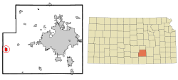 Location within Sedgwick County and Kansas | |
 | |
| Coordinates: 37°37′49″N 97°46′56″W / 37.63028°N 97.78222°WCoordinates: 37°37′49″N 97°46′56″W / 37.63028°N 97.78222°W | |
| Country | United States |
| State | Kansas |
| County | Sedgwick |
| Founded | 1883 |
| Incorporated | 1884 |
| Named for | Benjamin Cheney |
| Area | |
| • Total | 2.32 sq mi (6.00 km2) |
| • Land | 2.32 sq mi (6.00 km2) |
| • Water | 0.00 sq mi (0.00 km2) |
| Elevation | 1,388 ft (423 m) |
| Population | |
| • Total | 2,094 |
| • Estimate (2019)[3] | 2,167 |
| • Density | 934.86/sq mi (360.93/km2) |
| Time zone | UTC-6 (CST) |
| • Summer (DST) | UTC-5 (CDT) |
| ZIP code | 67025 |
| Area code | 316 |
| FIPS code | 20-12775[4] |
| GNIS ID | 473976[5] |
| Website | cheneyks.org |

Cheney /ˈtʃiːni/ is a city in Sedgwick County, Kansas, United States. As of the 2010 census, the city population was 2,094.[6]
History[]
Cheney was founded in August, 1883. It was named for Benjamin P. Cheney, stockholder of the Atchison, Topeka and Santa Fe Railway.[7][8]
Cheney was a station and shipping point on the Wichita & Pratt division of the Atchison, Topeka and Santa Fe Railway.[9]
The first post office in Cheney was established in September 1883.[10]
Geography[]
Cheney is located approximately 22 miles west of the outskirts of Wichita. According to the United States Census Bureau, the city has a total area of 1.99 square miles (5.15 km2), all of it land.[11]
Climate[]
The climate in this area is characterized by hot, humid summers and generally mild to cool winters. According to the Köppen Climate Classification system, Cheney has a humid subtropical climate, abbreviated "Cfa" on climate maps.[12]
Demographics[]
| Historical population | |||
|---|---|---|---|
| Census | Pop. | %± | |
| 1890 | 304 | — | |
| 1900 | 429 | 41.1% | |
| 1910 | 734 | 71.1% | |
| 1920 | 636 | −13.4% | |
| 1930 | 669 | 5.2% | |
| 1940 | 714 | 6.7% | |
| 1950 | 777 | 8.8% | |
| 1960 | 1,101 | 41.7% | |
| 1970 | 1,160 | 5.4% | |
| 1980 | 1,404 | 21.0% | |
| 1990 | 1,560 | 11.1% | |
| 2000 | 1,783 | 14.3% | |
| 2010 | 2,094 | 17.4% | |
| 2019 (est.) | 2,167 | [3] | 3.5% |
| U.S. Decennial Census | |||
2010 census[]
As of the census[2] of 2010, there were 2,094 people, 773 households, and 563 families residing in the city. The population density was 1,052.3 inhabitants per square mile (406.3/km2). There were 830 housing units at an average density of 417.1 per square mile (161.0/km2). The racial makeup of the city was 97.3% White, 0.3% African American, 0.5% Native American, 0.5% from other races, and 1.3% from two or more races. Hispanic or Latino of any race were 2.5% of the population.
There were 773 households, of which 40.6% had children under the age of 18 living with them, 55.5% were married couples living together, 11.3% had a female householder with no husband present, 6.1% had a male householder with no wife present, and 27.2% were non-families. 24.3% of all households were made up of individuals, and 12% had someone living alone who was 65 years of age or older. The average household size was 2.64 and the average family size was 3.12.
The median age in the city was 35.6 years. 30.8% of residents were under the age of 18; 6.5% were between the ages of 18 and 24; 25.6% were from 25 to 44; 22.7% were from 45 to 64; and 14.3% were 65 years of age or older. The gender makeup of the city was 48.3% male and 51.7% female.
2000 census[]
As of the census[4] of 2000, there were 1,783 people, 664 households, and 476 families residing in the city. The population density was 1,254.2 people per square mile (484.8/km2). There were 689 housing units at an average density of 484.7 per square mile (187.3/km2). The racial makeup of the city was 97.76% White, 0.67% Native American, 0.22% from other races, and 1.35% from two or more races. Hispanic or Latino of any race were 1.29% of the population.
There were 664 households, out of which 40.7% had children under the age of 18 living with them, 61.0% were married couples living together, 7.5% had a female householder with no husband present, and 28.3% were non-families. 26.4% of all households were made up of individuals, and 13.4% had someone living alone who was 65 years of age or older. The average household size was 2.60 and the average family size was 3.17.
In the city, the population was spread out, with 31.1% under the age of 18, 6.1% from 18 to 24, 29.5% from 25 to 44, 17.5% from 45 to 64, and 15.8% who were 65 years of age or older. The median age was 36 years. For every 100 females, there were 93.8 males. For every 100 females age 18 and over, there were 88.6 males.
The median income for a household in the city was $45,221, and the median income for a family was $51,591. Males had a median income of $40,313 versus $24,896 for females. The per capita income for the city was $18,783. About 0.6% of families and 2.0% of the population were below the poverty line, including 1.1% of those under age 18 and 1.6% of those age 65 or over.
Area events[]
- Sedgwick County Fair
Area attractions[]
Education[]
The community is served by Cheney USD 268 public school district, which operates three separate schools:
- Cheney High School
- Cheney Middle School
- Cheney Elementary School
Private schools
- St. Paul's Lutheran Church & School
The Cheney Cardinals have won the following Kansas State High School Championships:
- 1977 Boys Track and Field - Class 2A
- 1989 Girls Track and Field - Class 3A
- 1990 Girls Track and Field - Class 3A
- 1994 Boys Track and Field - Class 3A
- 2000 Boys Track and Field - Class 3A
- 2010 Girls Basketball - Class 4A
- 2013 Girl Golf - Class 3-2-1A
- 2014 Girls Track and Field - Class 3A
- 2020 Girls Basketball Forever four - Class 3A
- 2021 Girls Basketball - Class 3A
- 2021 Girls Softball - Class 3A
References[]
- ^ "2019 U.S. Gazetteer Files". United States Census Bureau. Retrieved July 24, 2020.
- ^ Jump up to: a b "U.S. Census website". United States Census Bureau. Retrieved 2012-07-06.
- ^ Jump up to: a b "Population and Housing Unit Estimates". United States Census Bureau. May 24, 2020. Retrieved May 27, 2020.
- ^ Jump up to: a b "U.S. Census website". United States Census Bureau. Retrieved 2008-01-31.
- ^ "US Board on Geographic Names". United States Geological Survey. 2007-10-25. Retrieved 2008-01-31.
- ^ "2010 City Population and Housing Occupancy Status". U.S. Census Bureau. Retrieved March 6, 2011.[dead link]
- ^ Kansas State Historical Society (1916). Biennial Report of the Board of Directors of the Kansas State Historical Society. Kansas State Printing Plant. pp. 285.
- ^ Gannett, Henry (1905). The Origin of Certain Place Names in the United States. Govt. Print. Off. pp. 78.
- ^ Blackmar, Frank Wilson (1912). Kansas: A Cyclopedia of State History, Embracing Events, Institutions, Industries, Counties, Cities, Towns, Prominent Persons, Etc. Standard Publishing Company. pp. 317.
- ^ "Kansas Post Offices, 1828-1961". Kansas Historical Society. Archived from the original on October 9, 2013. Retrieved 10 June 2014.
- ^ "US Gazetteer files 2010". United States Census Bureau. Archived from the original on 2012-01-25. Retrieved 2012-07-06.
- ^ "Cheney, Kansas Köppen Climate Classification (Weatherbase)". Weatherbase.
Further reading[]
External links[]
| Wikimedia Commons has media related to Cheney, Kansas. |
| hide Municipalities and communities of Sedgwick County, Kansas, United States | ||
|---|---|---|
| Cities |  | |
| Unincorporated communities | ||
| Townships | ||
| Footnotes | †This populated place is designated a Census-Designated Place (CDP) by the United States Census Bureau. ‡This populated place also has portions in an adjacent county or counties. | |
| ||
| show Authority control |
|---|
- Cities in Kansas
- Cities in Sedgwick County, Kansas
- Wichita, KS Metropolitan Statistical Area