Annandale, Virginia
Annandale, Virginia | |
|---|---|
 Suburban Annandale, 2015 | |
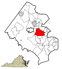 Location of Annandale in Fairfax County, Virginia | |
 Annandale, Virginia Location of Annandale in Fairfax County, Virginia | |
| Coordinates: 38°50′3″N 77°12′41″W / 38.83417°N 77.21139°WCoordinates: 38°50′3″N 77°12′41″W / 38.83417°N 77.21139°W | |
| Country | |
| State | |
| County | |
| Settled | 1685[1] |
| Named for | Annandale, United Kingdom |
| Area | |
| • Total | 7.86 sq mi (20.4 km2) |
| • Land | 7.86 sq mi (20.4 km2) |
| • Water | 0.0 sq mi (0.0 km2) |
| Elevation | 361 ft (110 m) |
| Population () | |
| • Total | 43,295 |
| • Density | 5,219.0/sq mi (2,015.1/km2) |
| Time zone | UTC−5 (Eastern (EST)) |
| • Summer (DST) | UTC−4 (EDT) |
| ZIP Code | 22003 |
| Area codes | 703, 571 |
| FIPS code | 51-01912[2] |
| GNIS feature ID | 1492474[3] |
| Website | www.annandale.va.us |


Annandale (/ˈænəndeɪl/)[4] is a census-designated place (CDP) in Fairfax County, Virginia.[5] The population of the CDP was 41,008 as of the 2010 United States Census.[2] It is home to the oldest and largest branch of the Northern Virginia Community College system, and to one of the D.C. area's Koreatowns.
Etymology[]
Annandale derives its name from Annandale in Scotland.[6]
Geography[]
Annandale is located at 38°50′3″N 77°12′41″W / 38.83417°N 77.21139°W (38.834134, −77.211277).[7] Annandale is mostly traversed by the Capital Beltway and Virginia State Route 236. The center of town is considered to be where Route 236, Columbia Pike, and Backlick Road meet around two miles (3 km) east of Interstate 495 on Route 236.
Annandale is bordered to the north by West Falls Church, to the east by Lake Barcroft and Lincolnia, to the south by North Springfield, and to the west by Wakefield and Woodburn. The CDP border follows Braddock Road to the south, Interstate 495 to the west, Holmes Run and U.S. Route 50 to the north, and Sleepy Hollow Road, Columbia Pike, and Little River Turnpike to the east.[8]
According to the United States Census Bureau, the CDP has a total area of 7.86 square miles (20.4 km2), all of it land. The area is part of the coastal plain located just east of the Fall Line separating the coastal plain of Virginia from the Piedmont. It is characterized by rolling hills, stream valleys, and heavy red clay soils.
The Annandale region is bisected by Accotink Creek, which in Colonial times was a primary link for ocean-going ships that would load tobacco and other goods where Little River Turnpike - Annandale's oldest road and the first toll road in America - crosses it. With the construction of the Springfield Dam in 1918, Lake Accotink was created to serve as a water source for World War I Army Camp A.A. Humphreys. In 1960, when the lake was no longer needed by the Army, the Fairfax County Park Authority leased the land and finally bought the site in 1965.[9] Today, Lake Accotink is a popular recreation area with bike trails, fishing and boat rentals.
Also along Accotink Creek runs the Fairfax Cross County Trail (CCT) which provides uninterrupted hiking, biking, running and cross-country skiing for 20 miles (32 km) in Annandale. The CCT meanders through parks and forests filled with deer, fox, geese and numerous species of native birds. In the spring, Accotink Creek is stocked with trout, and fishermen are often seen wading in its waters.
Demographics[]
| Historical population | |||
|---|---|---|---|
| Census | Pop. | %± | |
| 1970 | 27,405 | — | |
| 1980 | 49,524 | 80.7% | |
| 1990 | 50,975 | 2.9% | |
| 2000 | 54,994 | 7.9% | |
| 2010 | 41,008 | −25.4% | |
| 2013 (est.) | 42,008 | 2.4% | |
| * U.S. Decennial Census | |||
As of the 2010 census, there were 41,008 people, 14,184 households, and 9,790 families residing in the community. The sharp decrease in population from 54,994 in 2000 was due to the splitting off of the CDP's western portion to form the Wakefield and Woodburn CDPs. The population density in 2010 was 5,219.0 people per square mile (2,015.1/km2). There were 14,715 housing units at an average density of 1,872.1/sq mi (721.3/km2). The racial makeup of the community was 68.4% White, 24.6% Black, 8.6% Asian, 0.5% American Indian, 0.1% Pacific Islander, 11.6% from other races, and 4.1% from two or more races. Hispanics and Latinos of any race were 27.6% of the population.[2] Annandale is home to a large working-class White community, and is one of the few remaining areas in Fairfax County where the group has a notable presence.

There were 14,184 households, out of which 34.9% had children under the age of 18 living with them, 51.0% were married couples living together, 11.9% had a female householder with no husband present, and 31.0% were non-families. 23.1% of all households were made up of individuals, and 8.3% had someone living alone who was 65 years of age or older. The average household size was 2.87, and the average family size was 3.32.[2]
The age distribution of the community was 22.0% under the age of 18, 8.4% from 18 to 24, 30.1% from 25 to 44, 27.4% from 45 to 64, and 12.1% who were 65 years of age or older. The median age was 37.9 years. The gender makeup of the community was 49.4% male and 50.6% female.[2]
The median income for a household in the community was $75,871, and the median income for a family was $82,750. Males had a median income of $49,665 versus $44,303 for females. The community's per capita income was $35,146. About 5.2% of families and 7.5% of the population were below the poverty line, including 9.1% of those under age 18 and 8.1% of those age 65 or over.[2]
According to the 2009-2013 American Community Survey, the largest ancestry groups were:[10]
- 10.3% Vietnamese
- 8.6% African-American
- 8.3% Bolivian
- 7.7% Salvadoran
- 7.3% German
- 6.2% Irish
- 5.7% English
- 4.7% Korean
- 3.1% Italian
- 2.9% American
- 2.7% Peruvian
- 2.6% Arab
- 2.1% Guatemalan
- 1.9% Honduran
- 1.8% Scottish
- 1.8% Indian
- 1.7% Filipino
- 1.7% Chinese
- 1.6% Mexican
- 1.4% French
- 1.2% Polish
- 1.2% Puerto Rican
- 1.1% Norwegian
- 1.0% Russian
- 0.9% Hungarian
Economy[]
Corporate presence[]
- DynCorp Headquarters (uses a Mclean, Virginia postal address)[11]
- Noblis Headquarters (uses a Reston, Virginia postal address)[12]
- Former
- ENSCO, Inc. Headquarters (used a Falls Church, Virginia postal address)[13]
Koreatown[]
Downtown Annandale is also referred to as Koreatown[14] as there were roughly 929 South Korean-owned businesses as of 2006 and 67 South Korean-owned restaurants as of July 1, 2010 operating according to the GIANT Directory[15] for South Korean-owned and Korean-American businesses in the Washington Metropolitan Area. Most of these businesses cater primarily to South Korean expatriates,[16] but some have a diverse clientele.[17] County officials have sought to make Annandale more diverse by, in part, encouraging Korean businesses to include English in their signs.[18]
Education[]
Public schools[]
Educational institutions in Annandale include facilities operated by the Fairfax County Public Schools. Annandale High School, founded in 1954, is the main area public high school although Thomas Jefferson High School for Science and Technology, Falls Church High School, Woodson High School, and J. E. B. Stuart High School also take in small portions of Annandale. Other schools include Edgar Allan Poe Middle School, Annandale Terrace Elementary School, Braddock Elementary School, Belvedere Elementary School, Glasgow Middle School, Woodburn Elementary School, Camelot Elementary School, Columbia Elementary School, Canterbury Woods Elementary School (Wakefield CDP), and Wakefield Forest Elementary School.[19]
Annandale High School has one of the area's few International Baccalaureate Degree programs. Ensembles within the school's choral program have performed at the Kennedy Center in Washington, D.C., as well as many European venues.[20]
Private schools[]
Private Catholic schools in the Annandale area, of the Roman Catholic Diocese of Arlington, include Holy Spirit Catholic School (Wakefield CDP), St. Ambrose Catholic School, and St. Michael's Catholic School.
Private schools located in Annandale include Grasshopper Green, Kenwood School, Hope Montessori School, Montessori School of Northern Virginia, Oakwood School, Pinecrest School, and Westminster School.
Colleges and universities[]
The oldest and largest branch of the Northern Virginia Community College system is also located within Annandale and was founded in 1965. A focal point of "NOVA", a commonly used nickname of the community college, is the Richard J. Ernst Community Cultural Center which is a 66,000-square-foot (6,100 m2) facility containing a 525-seat, state-of-the-art theater with satellite downlink and video projection capability, an 11,000-square-foot (1,000 m2) gymnasium/exhibition hall, a light-filled atrium entrance and a two-story art gallery. The college opened with 761 students, and today has more than 75,000 students and 2,600 faculty and staff members, and has six permanent campus sites across Northern Virginia. The student body consists of people from more than 180 countries.[21]
As of the 2010 U.S. Census the U.S. Census Bureau defines the campus, which has an Annandale postal address, as being in the Wakefield CDP.[22][23] The bureau defined the campus as being in the Annandale CDP for the 1990 U.S. Census and the 2000 U.S. Census,[24] but in 2010 separated the area with the NVCC campus into a new CDP.
Public services[]
Fire department[]
The Fairfax County Fire & Rescue department staffs two stations in Annandale; downtown at Station 8, and in West Annandale, at Station 23, that operate within Annandale and surrounding areas within and around the county when needed. The Annandale Volunteer Fire Department (AVFD), a non-profit organization started in 1940,[25] owns and maintains stations 8 and 23. Through a partnership with Fairfax County, both stations are now staffed full-time with career personnel employed by Fairfax County. Volunteers also provide regular emergency services at both stations. Vehicles owned by AVFD display "Annandale Volunteer Fire Department" markings and include Medic 408, Medic 408B, Ambulance 408, Engine 408, Canteen 408, & Medic 423. Engine 423, Light and Air 423, Tower 408 and BC404 are owned by Fairfax County and marked as such. However, all vehicles have some type of "Annandale" on the exterior.
Public libraries[]
Fairfax County Public Library operates the George Mason Regional Library in the CDP.[26][27]
Recreational centers[]
The Audrey Moore RECenter (originally known as the Wakefield Recreation Center[28] when it opened in 1977), located in , houses an indoor pool measuring 76,000 square feet (7,100 m2) in size and a 50m x 25yd pool. The REC center offers more than 40 group fitness classes each week.[29]
Parks[]

Annandale has parks scattered across its geographical region and a number of them are maintained by the Fairfax County Park Authority. The following parks are located in Annandale: Mason District Park, The Wakefield Chapel Park, Turkeycock Run Stream Valley Park, Annandale Community Park, Ossian Hall Park, Kendale Woods Park, Mill Creek Park, Wilburdale Park, Broyhill Crest Park, Larchmont Park, Canterbury Woods Park, Hidden Oaks Nature Center (Fairfax County Government Park Authority), Pine Ridge High School Site Park, Camelot School Site Park, Oak Hill Park, Backlick Park, Willow Woods Park, Valley Crest Park, Long Branch Falls Park, Manassas Gap Park, Fairfax Hills Park, Masonville Park, Howery Field Park, Poe Terrace Park, Rose Lane Park, Indian Run Stream Valley Park, and Accotink Stream Valley Park.
The Wakefield Skate Park is also located within Wakefield Park. The skate park also offers skateboarding, BMX classes and camps for children of all ages and skills.[30]
Notable people[]
Notable individuals who were born in and/or have lived in Annandale include actor Mark Hamill;[31] country music performer Kelly Willis; Christopher McCandless, the subject of author Jon Krakauer's 1996 book, Into the Wild; and Fawn Hall, a notable figure in the Iran-Contra affair. Soccer goalkeeper Bill Hamid is from Annandale.
In popular culture[]
In the video game Fallout 3, the city is used as a location under the name of Andale. The city is inhabited by a group of inbred cannibals who proudly go by the title of the "Friendliest Town in the USA".
In 2016, a contentious video posted onto YouTube in 2014 about Annandale, Virginia resurfaced and reached over a million views[32] after the creator, named Angelo Mike, posted it onto Reddit himself.[33] In the video, Mike claims that Annandale is a "funnel for the dregs of society"[32] and points out its flaws with "striking images of filth, ruin, and a dead rat".[34] Although his intention was to create a lighthearted video in which Annandale residents could make fun of the city with him,[33] he has received criticism for misrepresenting the Washington, D.C. suburb.[35]
See also[]
References[]
- ^ Tom (October 18, 2013). "Why Is It Named Annandale?". Ghosts of D.C. Ghosts of Cities, LLC. Archived from the original on October 29, 2013. Retrieved October 29, 2013.
1685
- ^ Jump up to: a b c d e f "U.S. Census website". United States Census Bureau. Retrieved 2008-01-31.
- ^ "US Board on Geographic Names". United States Geological Survey. October 25, 2007. Retrieved January 31, 2008.
- ^ Annandale. Webster's New World College Dictionary (4th ed.). Houghton Mifflin Harcourt. 2010. Retrieved June 10, 2019.
- ^ "Annandale CDP, Virginia" (Archive). U.S. Census Bureau. Retrieved on April 2, 2015. "2010 CENSUS - CENSUS BLOCK MAP: Annandale CDP, VA"
- ^ Tom (October 18, 2013). "Why Is It Named Annandale?". Ghosts of D.C. Ghosts of Cities, LLC. Archived from the original on October 29, 2013. Retrieved October 29, 2013.
So, as to the origin of the name Annandale. The plantation name was no longer used to refer to the area and the community took on the name Annandale, after the Scottish village located at the mouth of the River Annan.
- ^ "US Gazetteer files: 2010, 2000, and 1990". United States Census Bureau. February 12, 2011. Retrieved April 23, 2011.
- ^ "TIGERweb". TIGER Web Viewer. United States Census Bureau. Retrieved December 14, 2019.
- ^ Camp A. A. Humphreys. In 1912, the War Department purchased a plot of land that had once been part of the Belvoir estate built by William Fairfax in 1741. The land was meant to serve as a summer camp and rifle range for the engineering corps stationed at nearby Washington Barracks in Washington, DC. With the outbreak of WWI, the camp was turned into a more permanent establishment and named Camp A. A. Humphreys, after a distinguished Civil War engineer. With plans to permanently move the Army Corps of Engineers there in 1919, a water source was needed. Springfield Dam. Originally known as the Springfield Dam, when it was first built in 1918, the dam created Lake Accotink as a safe, stable water source. The dam originally cost $100,000 to build and was contracted to the Amburson Construction Company. The reservoir it created covered 110 acres and was 23 feet deep. Because of siltation from storm water runoff, the lake has now shrunk in size. Today Camp A. A. Humphreys is known as Fort Belvoir. http://www.historicalmarkerproject.com/markers/HM4DB_the-origins-of-lake-accotink_West-Springfield-VA.html accessed 8/26/2015
- ^ Ancestry in Annandale, Virginia (Unincorporated Place), . Accessed May 24, 2018.
- ^ "Contact." DynCorp.
- ^ "Noblis: Locations". Archived from the original on November 29, 2014. Retrieved November 21, 2014.
- ^ "Office locations." ENSCO, Inc.
- ^ Silverman, Elissa (March 6, 2006). "More than Koreatown". The Washington Post. Retrieved July 1, 2010.
- ^ JPC & CO. "Welcome to Giant Directory". giantdirectory.com. Retrieved April 12, 2015.
- ^ Pan, Philip (May 16, 1999). "Now Entering Koreatown". The Washington Post. Retrieved August 16, 2019.
- ^ Ly, Phuong (June 25, 2006). "Kick Back in Koreatown". The Washington Post. Retrieved August 16, 2019.
check out Cafe Muse and its karaoke mikes, where so many non-Koreans are singing along
- ^ Williams, Sherell (May 21, 2012). "Annandale Chamber and Business Owners Aim to Improve Life in Annandale". patch.com. Retrieved August 16, 2019.
- ^ "NoVA School Rankings New Report". Retrieved July 1, 2010.
- ^ "IBO's Profile for Annandale High School". Retrieved July 1, 2010.
- ^ "About NOVA". Archived from the original on November 2, 2012. Retrieved November 8, 2012.
- ^ "2010 CENSUS - CENSUS BLOCK MAP: Wakefield CDP, VA" (PDF). U.S. Census Bureau. Retrieved December 5, 2020. - Compare campus addresses to the CDP map.
- ^ "Annandale Campus". Northern Virginia Community College. Retrieved December 5, 2020.
8333 Little River Turnpike, Annandale, VA 22003
- Address was the same in 2002 and in 1996 - Compare the physical location to the CDP map. - ^ 2000 Map: "CENSUS 2000 BLOCK MAP: ANNANDALE CDP" (PDF). U.S. Census Bureau. Retrieved December 5, 2020. - Pages 1 and 2.
1990 Map: index map. Annandale CDP is on pages 19, 20, 24, 25, and 26. - ^ "Annandale Volunteer Fire Department History". avfd.org. Archived from the original on March 20, 2015. Retrieved April 12, 2015.
- ^ "Library Branches." Fairfax County Public Library. Retrieved on October 21, 2009.
- ^ "Annandale CDP, Virginia Archived August 31, 2009, at the Wayback Machine." U.S. Census Bureau. Retrieved on October 21, 2009.
- ^ Royse, Pat (May 12, 1977). "Recreation complex opens in Annandale". The Washington Post. Retrieved January 16, 2018.
- ^ "Audrey Moore RECenter, Fairfax County Park Authority". Archived from the original on June 16, 2010. Retrieved July 1, 2010.
- ^ "FCPA:Wakefield Skate Park". Archived from the original on June 22, 2010. Retrieved July 1, 2010.
- ^ Mark Hamill (I) - Biography
- ^ Jump up to: a b Moyer, Justin Wm (May 18, 2016). "Annandale is for 'dregs of society,' viral video claims". Washington Post. ISSN 0190-8286. Retrieved November 6, 2017.
- ^ Jump up to: a b "A Conversation with the Mastermind Behind the Worst Suburban Tourism Video Ever". Esquire. May 18, 2016. Retrieved November 6, 2017.
- ^ Singal, Jesse. "Guy Whose 2014 Video About How Annandale Sucks Went Viral: It Still Sucks". Select All. Retrieved November 6, 2017.
- ^ Saed, Aseal. "Video slams Annandale". The A-Blast. Retrieved November 6, 2017.
Further reading[]
- Cho, David (March 13, 2005). "'Koreatown' Image Divides a Changing Annandale". The Washington Post. Retrieved February 9, 2014.
- Lartigue, Casey (June 19, 1999). "Signs of Insecurity". Cato Institute. Washington D.C.: Cato Institute. Archived from the original on May 15, 2007. Retrieved May 15, 2007.
- Tom (October 18, 2013). "Why Is It Named Annandale?". Ghosts of D.C. Ghosts of Cities, LLC. Archived from the original on October 29, 2013. Retrieved October 29, 2013.
External links[]
| Wikimedia Commons has media related to Annandale, Virginia. |
| Wikivoyage has a travel guide for Annandale (Virginia). |
- Official website
- Annandale Chamber of Commerce
- Flag of Annandale
- The Washington Post's Guide to Annandale, VA
| show |
|---|

| show Municipalities and communities of Fairfax County, Virginia, United States |
|---|

| show Authority control |
|---|
- Annandale, Virginia
- 1685 establishments in Virginia
- Census-designated places in Fairfax County, Virginia
- Census-designated places in Virginia
- Koreatowns in the United States
- Populated places established in 1685
- Washington metropolitan area