Appin
Appin
| |
|---|---|
 Appin village, at the seaward end of the Strath of Appin | |
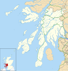 Appin Location within Argyll and Bute | |
| • Edinburgh | 133 miles |
| • London | 510 miles |
| Council area | |
| Country | Scotland |
| Sovereign state | United Kingdom |
| Post town | Appin |
| Postcode district | PA38 |
| Police | Scotland |
| Fire | Scottish |
| Ambulance | Scottish |
| UK Parliament | |
| Scottish Parliament | |
Appin (Scottish Gaelic: An Apainn) is a coastal district of the Scottish West Highlands bounded to the west by Loch Linnhe, to the south by Loch Creran, to the east by the districts of Benderloch and Lorne, and to the north by Loch Leven. It lies north-east to south-west, and measures 14 miles (23 km) in length by 7 miles (11 km) in breadth.[1] The name, meaning ‘abbey land’, in reference to Ligmore Abbey, is derived from the Middle Irish apdaine.[2]
The district is mainly in Argyll and Bute, with a coastal strip to the north, along Loch Leven, within the Argyll and Bute council area.
The scenery of the district is a combination of seascapes with rugged and mountainous country inland. Appin forms part of the Lynn of Lorn National Scenic Area, one of 40 in Scotland.[3] The principal hills are double peaks of Beinn a' Bheithir - 3,362 feet (1,025 m) and 3,284 feet (1,001 m) - and Creag Ghorm - 2,372 feet (723 m) - in the north, and Fraochaidh 2,883 feet (879 m), Meall Bàn 2,148 feet (655 m) and Beinn Mhic na Céisich 2,093 feet (638 m) near the western flank of Glen Creran. The chief rivers are the Coe and Laroch, flowing into Loch Leven, the Duror and Salachan flowing into Loch Linnhe, and the Iola and Creran flowing into Loch Creran.[1]

The leading industries are forestry and tourism, with lead mining and slate quarrying being of former importance, but the Glensanda superquarry, in Morvern on the opposite bank of Loch Linnhe also provides local employment. Ballachulish, Duror, , and Port Appin are the principal villages.
Appin was the country of a branch of the Stewarts.[1]
The A828 road runs along the coast of Appin. A passenger-only ferry to the island of Lismore runs from Port Appin. The district formerly had a railway, but the Caledonian Railway company's branch line from Connel to Ballachulish was closed in 1966.
Appin is where the Appin Murder took place in 1752.
Notable residents[]
- Elizabeth Macquarie (née Campbell), wife of the fifth governor of New South Wales, was born in the area. During his term the governor named the towns of Appin and Airds after his wife's birthplace and her family's estate respectively. The Female Orphan School in Parramatta is said to have been modelled on the estate's main house.[4]
References[]
- ^ a b c One or more of the preceding sentences incorporates text from a publication now in the public domain: Chisholm, Hugh, ed. (1911). "Appin". Encyclopædia Britannica. Vol. 2 (11th ed.). Cambridge University Press. p. 222.
- ^ Field, John (1980). Place-names of Great Britain and Ireland. Newton Abbot, Devon: David & Charles. p. 24. ISBN 0389201545. OCLC 6964610.
- ^ "National Scenic Areas" Archived 2017-03-11 at the Wayback Machine. SNH. Retrieved 30 Mar 2011.
- ^ "Female Orphan School and Historical Precinct, Parramatta Campus". Whitlam Institute. 2009. Archived from the original on 11 April 2010. Retrieved 28 April 2010.
External links[]
This Argyll and Bute location article is a stub. You can help Wikipedia by . |
- Geography of Argyll and Bute
- Geography of Highland (council area)
- Villages in Argyll and Bute
- Argyll and Bute geography stubs