Arran, Saskatchewan
Arran | |
|---|---|
Village | |
| Village of Arran | |
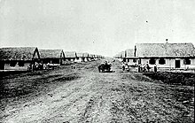
 Location of Arran in Saskatchewan | |
| Coordinates: 51°31′49″N 101°25′51″W / 51.5304°N 101.4307°W | |
| Country | Canada |
| Province | Saskatchewan |
| Region | Southeastern |
| Census division | 9 |
| Rural Municipality | Livingston |
| Government | |
| • Type | Arran Village Council |
| • Mayor | Brenda Holtkamp |
| Population (2011) | |
| • Total | 140 |
| • Density | 124.7/km2 (323/sq mi) |
| Time zone | CST |
| Postal code | S0A 0B0 |
| Area code(s) | 306 |


Arran (2016 population: 25) is a village in the Canadian province of Saskatchewan within the Rural Municipality of Livingston No. 331 and Census Division No. 9. The village is approximately 90 km northeast of the City of Yorkton and 10 km west of the Manitoba border. Arran is located on Highway 49.
History[]
The area around Arran was part of the "North Reserve", also known as "Thunder Hill Reserve", one of the block settlement areas allocated for the Doukhobor immigrants who arrived here in 1899 from Russia's Transcaucasian provinces.[1] Arran incorporated as a village on September 21, 1916.[2] The village was named after the Isle of Arran in Scotland.[3]
- Historic sites
- Ukrainian Orthodox Church of Ascension,[4] 9.5 kilometres southeast of Arran.
Demographics[]
In the 2016 Census of Population conducted by Statistics Canada, the Village of Arran recorded a population of 25 living in 14 of its 25 total private dwellings, a -60% change from its 2011 population of 40. With a land area of 0.69 km2 (0.27 sq mi), it had a population density of 36.2/km2 (93.8/sq mi) in 2016.[7]
In the 2011 Census of Population, the Village of Arran recorded a population of 40, a 0% change from its 2006 population of 40. With a land area of 0.69 km2 (0.27 sq mi), it had a population density of 58.0/km2 (150.1/sq mi) in 2011.[8]
Climate[]
| hideClimate data for Arran | |||||||||||||
|---|---|---|---|---|---|---|---|---|---|---|---|---|---|
| Month | Jan | Feb | Mar | Apr | May | Jun | Jul | Aug | Sep | Oct | Nov | Dec | Year |
| Record high °C (°F) | 7.2 (45.0) |
12.5 (54.5) |
13 (55) |
28.9 (84.0) |
38.5 (101.3) |
36.5 (97.7) |
36.5 (97.7) |
36.1 (97.0) |
35 (95) |
29 (84) |
18.3 (64.9) |
7 (45) |
38.5 (101.3) |
| Average high °C (°F) | −12.5 (9.5) |
−9.1 (15.6) |
−2.3 (27.9) |
8 (46) |
17.7 (63.9) |
22.1 (71.8) |
23.9 (75.0) |
22.9 (73.2) |
16.2 (61.2) |
8.8 (47.8) |
−3 (27) |
−11.3 (11.7) |
6.8 (44.2) |
| Daily mean °C (°F) | −18.4 (−1.1) |
−15.3 (4.5) |
−8.4 (16.9) |
1.9 (35.4) |
10.4 (50.7) |
15 (59) |
17.1 (62.8) |
15.8 (60.4) |
9.7 (49.5) |
3.2 (37.8) |
−7.6 (18.3) |
−16.6 (2.1) |
0.6 (33.1) |
| Average low °C (°F) | −24.2 (−11.6) |
−21.4 (−6.5) |
−14.4 (6.1) |
−4.2 (24.4) |
3 (37) |
7.8 (46.0) |
10.3 (50.5) |
8.7 (47.7) |
3.2 (37.8) |
−2.5 (27.5) |
−12.1 (10.2) |
−21.8 (−7.2) |
−5.6 (21.9) |
| Record low °C (°F) | −43.9 (−47.0) |
−44.5 (−48.1) |
−38.5 (−37.3) |
−30 (−22) |
−10 (14) |
−5 (23) |
0 (32) |
−2 (28) |
−8.9 (16.0) |
−23 (−9) |
−37 (−35) |
−44 (−47) |
−44.5 (−48.1) |
| Average precipitation mm (inches) | 19.1 (0.75) |
15.7 (0.62) |
26.4 (1.04) |
30.8 (1.21) |
40.5 (1.59) |
73.1 (2.88) |
77.6 (3.06) |
63.4 (2.50) |
55.9 (2.20) |
25.6 (1.01) |
20.1 (0.79) |
19.9 (0.78) |
468 (18.4) |
| Source: Environment Canada[9] | |||||||||||||
Education[]
Arran School opened on November 30, 1914 and closed on June 30, 1994.[10][11]
See also[]
- List of communities in Saskatchewan
- Villages of Saskatchewan
References[]
- ^ J.J. Kalmakoff Historical Doukhobor Maps - Saskatchewan Archived 2012-02-04 at the Wayback Machine
- ^ "Urban Municipality Incorporations". Saskatchewan Ministry of Government Relations. Archived from the original on October 15, 2014. Retrieved June 1, 2020.
- ^ Barry, Bill (September 2005). Geographic Names of Saskatchewan. Regina, Saskatchewan: People Places Publishing, Ltd. p. 25. ISBN 1-897010-19-2.
- ^ Ukrainian Orthodox Church of Ascension Archived March 12, 2016, at the Wayback Machine - Historic Register of Canada
- ^ "Saskatchewan Census Population" (PDF). Saskatchewan Bureau of Statistics. Archived from the original (PDF) on September 24, 2015. Retrieved May 31, 2020.
- ^ "Saskatchewan Census Population". Saskatchewan Bureau of Statistics. Retrieved May 31, 2020.
- ^ "Population and dwelling counts, for Canada, provinces and territories, and census subdivisions (municipalities), 2016 and 2011 censuses – 100% data (Saskatchewan)". Statistics Canada. February 8, 2017. Retrieved May 30, 2020.
- ^ "Population and dwelling counts, for Canada, provinces and territories, and census subdivisions (municipalities), 2011 and 2006 censuses (Saskatchewan)". Statistics Canada. June 3, 2019. Retrieved May 30, 2020.
- ^ Environment Canada Canadian Climate Normals 1971–2000, accessed 23 July 2010
- ^ Closure plaque
- ^ Closure sign
| show Places adjacent to Arran, Saskatchewan |
|---|
| show |
|---|
| show Division No. 9, Saskatchewan |
|---|

Coordinates: 51°53′04″N 101°43′07″W / 51.88444°N 101.71861°W
This article about a location in the Census Division No. 9 of Saskatchewan is a stub. You can help Wikipedia by . |
- Villages in Saskatchewan
- Livingston No. 331, Saskatchewan
- Division No. 9, Saskatchewan
- Saskatchewan Division No. 9 geography stubs