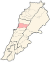
Ashqout
Ashqout
عشقوت | |
|---|---|
Municipality | |
 Ashqout Location within Lebanon | |
| Coordinates: 33°59′14″N 35°42′27″E / 33.987353°N 35.707626°ECoordinates: 33°59′14″N 35°42′27″E / 33.987353°N 35.707626°E | |
| Country | Lebanon |
| Governorate | Keserwan-Jbeil |
| District | Keserwan |
| Area | |
| • Total | 7.88 km2 (3.04 sq mi) |
| Elevation | 1,250 m (4,100 ft) |
| Time zone | UTC+2 (EET) |
| • Summer (DST) | UTC+3 (EEST) |
| Dialing code | +961 |
Ashqout (Arabic: عشقوت; also spelled Ashkout, Achqout, `Ashqut) is a town and municipality in the Keserwan District of the Keserwan-Jbeil Governorate of Lebanon. It is located 31 kilometers north of Beirut. Ashqout's average elevation is 1,000 meters above sea level and its total land area is 588 hectares.[1] Its inhabitants are predominantly Maronite Catholic, with Christians from other denominations in the minority.[2]
Ottoman tax records indicate Ashqout had 43 Christian households in 1523, 43 Christian households and seven bachelors in 1530, and 33 Christian households and 14 bachelors in 1543.[3]
The town has three schools, one public and two private, in the town, with a total of 739 students as of 2008.[1] The El-Hajj Hospital, which has 28 beds, is located in Ashqout.[1] It is the birthplace of Ahmad Faris Shidyaq (1804-1887) and the Maronite Patriarch Paul Peter Massad (1806–1890).
References[]
- ^ a b c "Aachqout". Localiban. Localiban. 2008-01-18. Retrieved 2009-07-24.
- ^ "Elections municipales et ikhtiariah au Mont-Liban" (PDF). Localiban. Localiban. 2010. p. 19. Archived from the original (pdf) on 2015-07-24. Retrieved 2016-02-12.
- ^ Bakhit 1972, p. 275.
Bibliography[]
- Bakhit, Muhammad Adnan Salamah (February 1972). The Ottoman Province of Damascus in the Sixteenth Century (PhD). School of Oriental and African Studies, University of London.
- Populated places in Keserwan District
- Maronite Christian communities in Lebanon
- Populated places in Lebanon

