Chahtoul-Jouret Mhad
Chahtoul-Jouret Mhad
جورة مهاد-شحتول | |
|---|---|
Municipality | |
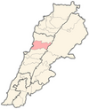
 Chahtoul-Jouret Mhad Location within Lebanon | |
| Coordinates: 34°1′57″N 35°43′14″E / 34.03250°N 35.72056°ECoordinates: 34°1′57″N 35°43′14″E / 34.03250°N 35.72056°E | |
| Country | |
| Governorate | Keserwan-Jbeil |
| District | Keserwan |
| Area | |
| • Total | 2.9 km2 (1.1 sq mi) |
| Elevation | 930 m (3,050 ft) |
| Time zone | UTC+2 (EET) |
| • Summer (DST) | UTC+3 (EEST) |
| Dialing code | +961 |

Chahtoul-Jouret Mhad (Arabic: جورة مهاد-شحتول; also spelled Shahtoul or Shahtul) is a municipality in the Keserwan District of the Keserwan-Jbeil Governorate, Lebanon. It consists of the villages of Chahtoul and Jouret Mhad. The municipality is located 32 kilometers north of Beirut. Its average elevation is 930 meters above sea level and its total land area is 290 hectares.[1]
Its inhabitants are predominantly Maronite Catholics.[2] The major families in Chahtoul include Ziadé, Salamé, Oueiss, Obeid, Kallassi, Najem, El-Khoury, Mnessa, Nader, Rizkalla. Some of these families, particularly in large numbers the families Salamé and Oueiss, migrated to the Qartaba area during the Ottoman Rule and the Great Famine of Mount Lebanon.
Chahtoul is the hometown of the Lebanese writer May Ziadeh. A statue of her is situated in the village. Chahtoul is in the Dioceses of Jounieh.
Landmarks[]
- Church of Saint-Joseph (town center)
- Saydet el-Kalaa Church and Lady's Holy Cave
References[]
- ^ "Aintoura (Kesrouane)". Localiban. Localiban. 2008-01-19. Retrieved 2016-02-12.
- ^ "Elections municipales et ikhtiariah au Mont-Liban" (PDF). Localiban. Localiban. 2010. p. 19. Archived from the original (pdf) on 2015-07-24. Retrieved 2016-02-12.
Capital: Jounieh | ||
| Towns and villages |
|  |
| Notable landmarks |
| |
- Populated places in Keserwan District
- Maronite Christian communities in Lebanon
- Populated places in Lebanon