Keserwan District
Keserwan District
قضاء كسروان | |
|---|---|
District | |
 Jounieh Bay | |
| Motto(s): "The Christians' Castle" | |
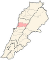
 Location in Lebanon | |
| Country | |
| Governorate | Keserwan-Jbeil |
| Capital | Jounieh |
| Area | |
| • Total | 336 km2 (130 sq mi) |
| Population | |
| • Total | 182,834 |
| • Density | 544/km2 (1,410/sq mi) |
| Time zone | UTC+2 (EET) |
| • Summer (DST) | UTC+3 (EEST) |
Keserwan District (Arabic: قضاء كسروان, transliteration: Qaḍā' Kisrawān) is a district (qadaa) in Keserwan-Jbeil Governorate, Lebanon, to the northeast of Lebanon's capital Beirut. The capital, Jounieh, is overwhelmingly Maronite Christian. The area is home to the Jabal Moussa Biosphere Reserve.
Etymology[]
The name of Keserwan is most probably that of a Persian clan named the Kesra, who were early Persian settlers of the region. Kesra (Arabicized version of Khosro) has always been a common Persian name. Keserwan is its plural form.[1]
Demographics[]
According to voter registration data, the population is overwhelmingly Christian–the highest percentage-wise in the nation–with 97.95% of voters being Christian.[2] Of those, Maronites are the predominant denomination, comprising 92.16% of all voters in the district. The remaining Christians are Greek Melkite Catholics (2.14%), "minority Christians" (1.26%), Orthodox Christians (0.89%), Armenian Orthodox Christians (0.72%), Armenian Catholics (0.66%), and Evangelicals (0.11%). The Muslim population (2.05%) are divided between Shi'as (1.80%), Sunnis (0.25%), and Alawis (0.01%).
The number of registered voters by sect is as follows (with a total of 94200):

- 86,044 Maronites
- 1,995 Greek Melkite Catholics
- 1,682 Shia Muslims
- 1,176 Minority Christians
- 832 Greek Orthodox Christians
- 668 Armenian Orthodox Christians
- 619 Armenian Catholic Christians
- 230 Sunni Muslims
- 99 Evangelical Christians
- 14 Alawites
- 7 Druze
Electoral constituency[]
The district is part of the Keserwan-Byblos electoral district, with the district of Keserwan being allocated 5 Maronite seats (and the overall constituency having 7 Maronites and 1 Shi'ia).

Cities, towns, and villages[]
- Adma
- Ain el-Rihaneh
- Aintoura
- Ajaltoun
- Aramoun
- Ashqout
- Aazra
- Bkerké
- Ballouneh
- Batha
- Bqaatouta (Bkaatouta)
- Bzoummar
- Chahtoul
- Chnaniir
- Daraya
- Daraoun
- Dlebta
- Faitroun
- Faraya
- Fatqa
- Ghazir
- Ghbaleh
- Ghidras
- Ghineh
- Ghosta
- Attine
- Harissa
- Hrajel
- Jeita
- Jounieh
- Jouret Bedran
- Jouret el-Termos
- Jouret Mhad
- Kaslik
- Kfardebian
- Kfaryassine
- Kfour
- Kleiat
- Maarab
- Mayrouba
- Okaibe
- Rayfoun
- Sahel Alma
- Safra
- Sarba
- Sehaileh
- Tabarja
- Yahchouch
- Zouk Mikael
- Zouk Mosbeh
See also[]
References[]
- ^ Salibi, Kamal (2003). A house of many mansions : the history of Lebanon reconsidered (Repr. ed.). London: I.B. Tauris. p. 139. ISBN 1860649122.
- ^ https://elections.lebanese-forces.com/wp-content/uploads/2018/02/KESERWAN-JBEIL-1.pdf
Capital: Jounieh | ||
| Towns and villages |
|  |
| Notable landmarks |
| |
| Akkar Governorate | ||
|---|---|---|
| Baalbek-Hermel Governorate | ||
| Beirut Governorate |
| |
| Mount Lebanon Governorate | ||
| North Governorate | ||
| Beqaa Governorate | ||
| South Governorate | ||
| Nabatieh Governorate | ||
Coordinates: 33°58′11″N 35°36′56″E / 33.96972°N 35.61556°E

This Lebanon location article is a stub. You can help Wikipedia by . |
- Keserwan District
- Districts of Lebanon
- Lebanon geography stubs