Athens, Alabama
Athens, Alabama | |
|---|---|
City | |
| City of Athens | |
 Limestone County Courthouse in Athens | |
 Location of Athens in Limestone County, Alabama | |
 Athens Location in Alabama | |
| Coordinates: 34°47′23″N 86°58′10″W / 34.78972°N 86.96944°W[4] | |
| Country | United States |
| State | Alabama |
| County | Limestone |
| Incorporated | November 19, 1818[3] |
| Government | |
| • Type | Mayor Council |
| • Mayor | William "Ronnie" Marks[1] |
| • City Council | |
| Area | |
| • Total | 40.60 sq mi (105.16 km2) |
| • Land | 40.34 sq mi (104.47 km2) |
| • Water | 0.26 sq mi (0.68 km2) |
| Elevation | 798 ft (243.1 m) |
| Population (2010) | |
| • Total | 21,897 |
| • Estimate (2019)[5] | 27,366 |
| • Density | 678.43/sq mi (261.94/km2) |
| Time zone | UTC−6 (CST) |
| • Summer (DST) | UTC−5 (CDT) |
| ZIP Code | 35611–35614–35613 |
| Area codes | 256, 938 |
| FIPS code | 01-02956 |
| GNIS feature ID | 0113266 |
| Website | www |


Athens is a city in and the county seat of Limestone County, in the U.S. state of Alabama; it is included in the Huntsville-Decatur-Albertville, AL Combined Statistical Area. As of the 2010 census, the population of the city is 21,897.
History[]
Founded in 1818 by John Coffee, Robert Beaty, John D. Carroll, and John Read, Athens is one of the oldest incorporated cities in the state, having been incorporated one year prior to the state's admittance to the Union in 1819. Limestone County was also created by an act of the Alabama Territorial Legislature in 1818.[3][7] The town was first called Athenson, but was incorporated as Athens after the ancient city in Greece. The town's first mayor was Samuel Tanner, and the Tanner area, south of Athens, was named on his behalf.[8]
The Athens area was the home of William Wyatt Bibb, the first governor of Alabama, and its second governor, his brother Thomas Bibb, who succeeded him in office when he died in a fall from his horse.[9]
In 1822, local residents purchased 5 acres (20,000 m2) of land and constructed a building to house the Athens Female Academy. The school became affiliated with the Methodist church in 1842, and was eventually renamed Athens Female College. After becoming coeducational in 1932, the school changed its name again to Athens College. After being taken over by the State of Alabama in 1974, the college was converted to a “reverse junior college,” offering the last two years of instruction for graduates of area community colleges. It is today known as Athens State University.[10]
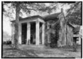
Many homes in the central part of modern Athens date to the antebellum period, and are part of historic preservation districts.[11]
On May 2, 1862, during the Civil War, Athens was seized by Union forces under the command of Col. John Basil Turchin.[12] After occupying the town on May 2, 1862 Turchin assembled his men and reportedly told them: "I shut my eyes for two hours. I see nothing." He did, in fact, leave the town to reconnoiter defensive positions, during which time his men ransacked the town. The incident was controversial, and Lost Cause supporters vilified Turchin.
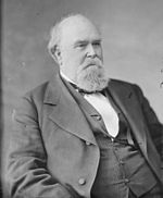
Athens was the home of Governor George S. Houston, Alabama's first post-Reconstruction Democratic governor, who served from 1874 through 1878. Houston was noted for reducing the debts incurred to benefit private railroad speculators and others by his Reconstruction Republican predecessors.[13] During Reconstruction, Athens was the home of the Trinity School, a school founded for the children of former slaves by Mary Fletcher Wells and funded by the American Missionary Association.[14]
Athens was traditionally a cotton and railroad town, but since the local aerospace boom of the 1950s and 1960s, it has increasingly entered the orbit of nearby industry center Huntsville as the area's cotton production has steadily declined.

Nuclear Regulatory Commission photo
Athens is the home of Browns Ferry Nuclear Power Plant, a Tennessee Valley Authority installation first operated in 1974, that was once the world's largest nuclear plant. It provides many jobs to the area and most of the electricity for the Huntsville-Decatur Metro Area. On March 22, 1975, the Browns Ferry plant became the scene of what was, with the exception of the Three Mile Island accident, the most serious nuclear accident in United States history. A worker using a candle to check for air leaks started a fire among control wires, causing a temporary threat to operational control of the reactor (see Browns Ferry Nuclear Power Plant article on Unit One Fire).[15]
Geography[]
Athens is midway between Nashville and Birmingham on Interstate 65. Athens shares a boundary with Huntsville.
According to the U.S. Census Bureau, the city has a total area of 39.4 square miles (102 km2), of which 39.3 square miles (102 km2) is land and 0.1 square miles (0.26 km2) (0.23%) is water.
Climate[]
The climate in this area is characterized by hot, humid summers and generally cool winters. According to the Köppen climate classification system, Athens has a humid subtropical climate, abbreviated "Cfa" on climate maps.[16]
| hideClimate data for Athens, Alabama (1991–2020, extremes 1991–present) | |||||||||||||
|---|---|---|---|---|---|---|---|---|---|---|---|---|---|
| Month | Jan | Feb | Mar | Apr | May | Jun | Jul | Aug | Sep | Oct | Nov | Dec | Year |
| Record high °F (°C) | 77 (25) |
82 (28) |
87 (31) |
91 (33) |
94 (34) |
104 (40) |
102 (39) |
104 (40) |
100 (38) |
102 (39) |
87 (31) |
78 (26) |
104 (40) |
| Average high °F (°C) | 51.3 (10.7) |
55.9 (13.3) |
64.5 (18.1) |
73.3 (22.9) |
80.4 (26.9) |
87.1 (30.6) |
89.9 (32.2) |
89.8 (32.1) |
84.9 (29.4) |
74.7 (23.7) |
63.0 (17.2) |
54.2 (12.3) |
72.4 (22.4) |
| Daily mean °F (°C) | 42.4 (5.8) |
46.3 (7.9) |
54.0 (12.2) |
62.3 (16.8) |
70.4 (21.3) |
77.8 (25.4) |
81.0 (27.2) |
80.3 (26.8) |
74.7 (23.7) |
63.7 (17.6) |
52.4 (11.3) |
45.4 (7.4) |
62.6 (17.0) |
| Average low °F (°C) | 33.5 (0.8) |
36.7 (2.6) |
43.5 (6.4) |
51.3 (10.7) |
60.4 (15.8) |
68.4 (20.2) |
72.1 (22.3) |
70.9 (21.6) |
64.5 (18.1) |
52.6 (11.4) |
41.9 (5.5) |
36.5 (2.5) |
52.7 (11.5) |
| Record low °F (°C) | 0 (−18) |
−1 (−18) |
12 (−11) |
23 (−5) |
37 (3) |
47 (8) |
57 (14) |
50 (10) |
39 (4) |
28 (−2) |
16 (−9) |
9 (−13) |
−1 (−18) |
| Average precipitation inches (mm) | 5.52 (140) |
5.43 (138) |
5.59 (142) |
5.40 (137) |
4.85 (123) |
4.76 (121) |
4.89 (124) |
3.93 (100) |
3.77 (96) |
4.02 (102) |
4.61 (117) |
6.29 (160) |
59.06 (1,500) |
| Average snowfall inches (cm) | 0.5 (1.3) |
0.5 (1.3) |
0.3 (0.76) |
0.0 (0.0) |
0.0 (0.0) |
0.0 (0.0) |
0.0 (0.0) |
0.0 (0.0) |
0.0 (0.0) |
0.0 (0.0) |
0.0 (0.0) |
0.0 (0.0) |
1.3 (3.3) |
| Average precipitation days (≥ 0.01 in) | 10.9 | 11.7 | 11.7 | 10.1 | 11.0 | 11.4 | 11.3 | 9.8 | 8.2 | 9.2 | 10.4 | 12.0 | 127.7 |
| Average snowy days (≥ 0.1 in) | 0.3 | 0.2 | 0.0 | 0.0 | 0.0 | 0.0 | 0.0 | 0.0 | 0.0 | 0.0 | 0.0 | 0.1 | 0.6 |
| Source: NOAA[17][18] | |||||||||||||
Demographics[]
Athens first appeared on the 1850 U.S. Census as an incorporated place.[19] It did not appear on the 1860 census, but returned again in 1870 and every census to date.
| Historical population | |||
|---|---|---|---|
| Census | Pop. | %± | |
| 1850 | 991 | — | |
| 1870 | 887 | — | |
| 1880 | 1,011 | 14.0% | |
| 1890 | 940 | −7.0% | |
| 1900 | 1,010 | 7.4% | |
| 1910 | 1,715 | 69.8% | |
| 1920 | 3,323 | 93.8% | |
| 1930 | 4,238 | 27.5% | |
| 1940 | 4,342 | 2.5% | |
| 1950 | 6,309 | 45.3% | |
| 1960 | 9,330 | 47.9% | |
| 1970 | 14,360 | 53.9% | |
| 1980 | 14,558 | 1.4% | |
| 1990 | 16,901 | 16.1% | |
| 2000 | 18,967 | 12.2% | |
| 2010 | 21,897 | 15.4% | |
| 2019 (est.) | 27,366 | [5] | 25.0% |
| Sources: 1850;[20] 1870 and 1880;[21] 1900, 1910, and 1920;[22] 1930, 1940, and 1950;[23] 1960, 1970, and 1980;[24] 1990;[4] 2000 and 2010[25] | |||
2000 Census data[]
As of the census of 2000, there were 18,967 people, 7,742 households, and 5,140 families residing in the city. The population density was 482.3 people per square mile (186.2/km2). There were 8,449 housing units at an average density of 214.8 per square mile (82.9/km2). The racial makeup of the city was 77.72% White, 18.26% Black or African American, 0.40% Native American, 0.71% Asian, 0.02% Pacific Islander, 1.92% from other races, and 0.97% from two or more races. 4.86% of the population were Hispanic or Latino of any race.
There were 7,742 households, of which 30.5% had children under the age of 18 living with them, 50.0% were married couples living together, 13.0% had a female householder with no husband present, and 33.6% were non-families. 31.0% of all households were made up of individuals, and 13.2% had someone living alone who was 65 years of age or older. The average household size was 2.37 and the average family size was 2.97.
In the city, the age distribution of the population showed 23.9% under the age of 18, 9.3% from 18 to 24, 28.4% from 25 to 44, 22.5% from 45 to 64, and 15.8% who were 65 years of age or older. The median age was 38 years. For every 100 females, there were 89.8 males. For every 100 females age 18 and over, there were 85.5 males.
The median income for a household in the city of Athens was $33,980, and the median income for a family was $44,544. Males had a median income of $37,191 versus $22,748 for females. The per capita income for the city was $19,315. About 13.7% of families and 16.3% of the population were below the poverty line, including 21.2% of those under age 45 and 10.8% of those age 65 or over.
2010 census[]
As of the census of 2010, there were 21,897 people, 9,038 households, and 5,881 families residing in the city. The population density was 557.2 people per square mile (214.9/km2). There were 9,862 housing units at an average density of 250.9 per square mile (96.8/km2). The racial makeup of the city was 73.0% White, 17.5% Black or African American, 0.6% Native American, 0.9% Asian, 0.1% Pacific Islander, 5.9% from other races, and 1.9% from two or more races. 8.8% of the population were Hispanic or Latino of any race.
There were 9,038 households, of which 27.7% had children under the age of 18 living with them, 47.5% were married couples living together, 13.7% had a female householder with no husband present, and 34.9% were non-families. 31.2% of all households were made up of individuals, and 12.4% had someone living alone who was 65 years of age or older. The average household size was 2.36 and the average family size was 2.96.
In the city, the age distribution of the population showed 22.8% under the age of 18, 8.8% from 18 to 24, 26.0% from 25 to 44, 26.2% from 45 to 64, and 16.2% who were 65 years of age or older. The median age was 39.2 years. For every 100 females, there were 91.4 males. For every 100 females age 18 and over, there were 95.7 males.
The median income for a household in the city of Athens was $42,127, and the median income for a family was $54,013. Males had a median income of $43,672 versus $31,601 for females. The per capita income for the city was $26,136. About 15.5% of families and 17.5% of the population were below the poverty line, including 26.4% of those under age 45 and 8.5% of those age 65 or over.
Athens Precinct/Division (1870-)[]
| Historical population | |||
|---|---|---|---|
| Census | Pop. | %± | |
| 1870 | 2,618 | — | |
| 1890 | 3,099 | — | |
| 1900 | 3,333 | 7.6% | |
| 1910 | 4,811 | 44.3% | |
| 1920 | 6,848 | 42.3% | |
| 1930 | 9,342 | 36.4% | |
| 1940 | 9,247 | −1.0% | |
| 1950 | 11,137 | 20.4% | |
| 1960 | 15,180 | 36.3% | |
| 1970 | 14,607 | −3.8% | |
| 1980 | 40,056 | 174.2% | |
| 1990 | 47,930 | 19.7% | |
| 2000 | 57,830 | 20.7% | |
| 2010 | 69,761 | 20.6% | |
| U.S. Decennial Census[26] | |||
Athens, the 1st Beat/Precinct of Limestone County first reported on the 1870 U.S. Census.[27] This included both the town/city of Athens and the surrounding area. It did not report a figure for 1880, but returned in 1890 and every census to date. In 1870, when racial demographics were reported, it had a Black majority in that beat. In 1960, Athens precinct was changed to a census division as part of a general reorganization of counties.[28]
Health care[]
- Athens-Limestone Hospital 101-bed facility
Transportation[]
 Interstate 65
 U.S. Highway 31
 U.S. Highway 72
- Norfolk Southern Railway
- CSX Transportation railroad
 Pryor Field Regional Airport (regional/municipal airport)
Intercity bus service is provided by Greyhound Lines.[29]
Education[]
Media[]
- The News Courier, daily newspaper
- WVNN 770 AM
- WKAC 1080 AM
- WQXD-LP 97.9 FM
- WZYP 104.3 FM
- WTZT-CD TV channel 11
Notable people[]
- Woody Abernathy, former professional baseball outfielder
- Sheila Andrews, country music singer
- Keith Askins, NBA Assistant coach, former player Miami Heat
- Don Black, KKK Grand Wizard, Neo Nazi, White Nationalist.
- Michael Boley, NFL Outside linebacker New York Giants
- Wally Bullington, head football coach for Abilene Christian University from 1968 to 1976
- Tom Calvin, former NFL halfback
- Dick Coffman, former Major League Baseball player
- Slick Coffman, former Major League Baseball player
- Billy Davis, former member of the Arizona State Senate
- P. O. Davis, early radio pioneer, agricultural editor and Alabama Cooperative Extension Service educator and administrator
- Anderson East, R&B singer that is featured on the Fifty Shades Darker soundtrack
- Richard Hendrix, Professional Basketball Player
- Jake Hess, Grammy Award-winning southern gospel singer
- Brittany Howard, singer and guitarist with Alabama Shakes
- C. Eric Lincoln, African-American scholar
- Patti J. Malone, noted African-American mezzo-soprano singer
- Bobby Marlow, former Canadian Football League running back
- John Mason Martin, U.S. Representative from 1885 to 1887
- Andy
- Mitch McConnell, U. S. Senator from Kentucky, lived in Athens from 1942 to 1950[30]
- Alfred McCullough, American football player
- Kevin Miller, radio talk show host
- Roger Murrah, songwriter
- Andy Nelson, former safety for the Baltimore Colts and New York Giants
- Edmund Pettus, lawyer, soldier, and U.S. Senator from 1897 to 1907
- Luke Pryor, served as a U.S. Senator in 1880, and as a U.S. Representative from 1883 to 1885
- Wayne Redmond, former baseball player for the Detroit Tigers
- William N. Richardson, U.S. Representative from 1900 to 1914
- Philip Rivers, NFL quarterback, San Diego Chargers
- Charles Henry Sykes, editorial cartoonist
- Charles Coleman Thach, president of Auburn University from 1902 to 1920
- Alice Vassar LaCour, Fisk Jubilee singer and teacher
- Lee Vickers, professional football player for the Omaha Nighthawks
- James C. Watkins, ceramic artist
- Quez Watkins, professional football player
- Henry A. White, Alabama educator and state representative; served on the Athens City Council
- Pryor Williams, former professional football player
Photo Gallery[]

Limestone County Courthouse, Athens

Downtown Athens
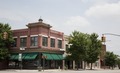
Downtown Athens

Downtown Athens

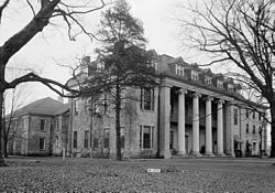
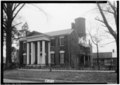
Governor George S. Houston House, Athens

Athens Masonic Hall
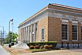
Athens Former Post Office

Confederate soldiers monument, Athens

Athens First Methodist Church

"Sacked and Plundered" historic sign, Athens

Presbyterian Church, Athens

Limestone Drug building, Athens

Frances Snow Pryor House, Athens
Vining-Wood-Vasser House, Athens

Judge William Harrison Walker House, Athens
Dr. R. H. Richardson House, Athens

Pryor Field Regional Airport, Athens

Father Robert Donnell House, Athens


References[]
- ^ "The Mayor's Office". City of Athens. Retrieved 7 July 2017.
- ^ City Council, City of Athens, retrieved 1 March 2018
- ^ Jump up to: a b A Digest of the Laws of the State of Alabama: Containing The Statutes and Resolutions in Force at the end of the General Assembly in January, 1823. Published by Ginn & Curtis, J. & J. Harper, Printers, New-York, 1828. Title 62. Chapter XXV. Page 803. "An Act to Incorporate the Town of Athens, in Limestone County.—Passed November 19, 1818." (Google Books)
- ^ Jump up to: a b "US Gazetteer files: 2010, 2000, and 1990". United States Census Bureau. 2011-02-12. Retrieved 2011-04-23.
- ^ Jump up to: a b "Population and Housing Unit Estimates". United States Census Bureau. May 24, 2020. Retrieved May 27, 2020.
- ^ "2019 U.S. Gazetteer Files". United States Census Bureau. Retrieved June 29, 2020.
- ^ Alabama State Archives: Limestone County
- ^ Foscue, Virginia (1989). Place Names in Alabama. University of Alabama Press. ISBN 081730410X.
- ^ Limestone County Historical Society: Belle Mina
- ^ Athens State University: History Archived 2008-08-03 at the Wayback Machine
- ^ City of Athens: Map of Historic Districts. Archived 2014-11-14 at the Wayback Machine
- ^ Limestone County Historical Society: Athens Sacked
- ^ "George Smith Houston". Alabama Governors. Alabama Department of Archives and History. August 5, 2009.
- ^ "Trinity Cistern." Limestone County Historical Society. Retrieved Nov-22-2009. Text of page: "Cistern: Last Remnant of Trinity School. Located in th[e] parking lot of the New [Clinton Street] Court House Annex. Picture of a historical marker inscribed as follows: 'This cistern is the last remnant of Trinity School located here 1865-1907. The cistern was used to store rainwater collected from the roof. No physical evidence remains of the Ross Hotel, the Chapman Quarters, and other buildings on this block, which played an important role in Athens history. Trinity, a school for the children of former slaves, was established here, on the old Richardson property, in 1865, primarily through the efforts of Miss Mary Frances Wells, the school's principal and chief proponent. Trinity Hall was built here 1881-82, as a joint effort by the American Missionary Association and local African Americans who hand made and laid the bricks for the building. It burned in 1907 and was rebuilt the following year on the old Civil War fort site west of town. ERECTED BY THE LIMESTONE COUNTY HISTORICAL SOCIETY 2005'"
- ^ Nuclear Regulatory Commission: Bulletin No. 75-04A: Cable Fire at Browns Ferry Nuclear Power Station
- ^ Climate Summary for Athens, Alabama
- ^ "NowData - NOAA Online Weather Data". National Oceanic and Atmospheric Administration. Retrieved June 7, 2021.
- ^ "Station: Athens, AL". U.S. Climate Normals 2020: U.S. Monthly Climate Normals (1991-2020). National Oceanic and Atmospheric Administration. Retrieved June 7, 2021.
- ^ http://www2.census.gov/prod2/decennial/documents/1850c-11.pdf, 1850 Census (places)
- ^ The Seventh Census of the United States: 1850. Alabama. Table II. Population of Towns and Cities. U.S. Census Bureau. Original Pagination 422. PDF Pagination 10.
- ^ Table III. Populations of Civil Divisions Less Than Counties. Alabama. Volume 1. Statistics of the Population of the United States. Tenth Census. 1880 Census. U.S. Census Bureau. Original Pagination 96. PDF Page 9.
- ^ Table 51. Population of Incorporated Places 1920, 1910, and 1900 and Population of Wards of Incorporated Places Having 5,000 Inhabitants or More. Alabama. Vol 1: Population 1920. Number and distribution of inhabitants. 1920 Census. U.S. Census Bureau.
- ^ Table 6. Population of Counties by Minor Civil Divisions 1930 to 1950. 1950 Census. Number of Inhabitants. Alabama. U.S. Census Bureau. Original Pagination 2-14. PDF Pagination 14.
- ^ Table 4. Populations of County Subdivisions 1960 to 1980. 1980 Census of Population. Alabama. Volume 1: Characteristics of the Population. Chapter A. Number of Inhabitants. Issued April 1982. U.S. Census Bureau. Original Pagination "Alabama 2-13." PDF Page 16.
- ^ "U.S. Census website". United States Census Bureau. Retrieved 2011-05-14.
- ^ "U.S. Decennial Census". Census.gov. Retrieved June 6, 2013.
- ^ http://www2.census.gov/prod2/decennial/documents/1870a-05.pdf, 1870 AL Census
- ^ http://www2.census.gov/prod2/decennial/documents/37721510v1p2ch2.pdf, 1960 AL Census
- ^ Athens, AL Greyhound Station Intercity Bus Service
- ^ ""Fact of the Week", The Tuscaloosa News July 16, 2000". July 16, 2000. Retrieved November 19, 2013.
External links[]
- Official website

- Athens-Limestone Public Library
- Institute of Southern Jewish Life's History of Athens
- Chamber of Commerce and tourism resource
- Built in America Collection from Library of Congress American Memory Collection contains historic drawings, photographs, and descriptions of homes and buildings in Athens.
- James Croley Smith Collection, The University of Alabama in Huntsville Archives and Special Collections contains sketches of historic buildings in Athens.
- Downtown Different | Athens, Alabama
| show Municipalities and communities of Limestone County, Alabama, United States |
|---|

| show Authority control |
|---|
- Populated places established in 1818
- Cities in Alabama
- Huntsville-Decatur-Albertville, AL Combined Statistical Area
- Cities in Limestone County, Alabama
- County seats in Alabama