Ardmore, Alabama
Ardmore, Alabama | |
|---|---|
Town | |
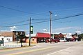
 View along Ardmore Avenue (SR 53); Town Hall on the left | |
 Location of Ardmore in Limestone County, Alabama. | |
| Coordinates: 34°59′13″N 86°50′35″W / 34.98694°N 86.84306°W | |
| Country | United States |
| State | Alabama |
| County | Limestone County, Alabama |
| Incorporation | 1922[1] |
| Government | |
| • Mayor | Billy Shannon |
| Area | |
| • Total | 2.05 sq mi (5.31 km2) |
| • Land | 2.04 sq mi (5.29 km2) |
| • Water | 0.01 sq mi (0.02 km2) |
| Elevation | 883 ft (269 m) |
| Population (2020) | |
| • Total | 1,321 |
| • Density | 646.91/sq mi (249.72/km2) |
| Time zone | UTC-6 (Central (CST)) |
| • Summer (DST) | UTC-5 (CDT) |
| ZIP code | 35739 |
| Area code(s) | 256 |
| FIPS code | 01-02260 |
| GNIS feature ID | 0113204 |
| Website | www |

Ardmore is a town in Limestone County, Alabama, United States, and is included in the Huntsville-Decatur Metro Area. It is home to the Saturn IB rocket at the Alabama Welcome Center, just south of the Tennessee border, on Interstate 65.[3] As of the 2010 census, the population of the town is 1,194. It borders its sister city Ardmore, Tennessee.
History[]
The settlement was originally named Austin, after Alex Austin, who selected the location as a site for a station along the Louisville and Nashville Railroad. The railroad company later renamed the town Ardmore, for the community of Ardmore, Pennsylvania. Ardmore, Alabama was incorporated in 1922.[4]
Geography[]
Ardmore is located at 34°59′13″N 86°50′36″W / 34.98694°N 86.84333°W (34.987052, -86.843228).[5] It is the northernmost settlement in the state of Alabama.[6] The town is concentrated along Alabama State Route 53, which runs south to north along Ardmore Avenue before veering east along the state line, where it runs congruent with Tennessee State Route 7 on Main Street. Interstate 65, which connects Nashville and Birmingham, passes just west of Ardmore.
Main Street is the state line. The road heading northbound/westbound is in Tennessee, while southbound/eastbound is in Alabama.
According to the U.S. Census Bureau, the town has a total area of 2.0 square miles (5.2 km2), all land.
Demographics[]
| Historical population | |||
|---|---|---|---|
| Census | Pop. | %± | |
| 1930 | 266 | — | |
| 1940 | 381 | 43.2% | |
| 1950 | 408 | 7.1% | |
| 1960 | 439 | 7.6% | |
| 1970 | 761 | 73.3% | |
| 1980 | 1,096 | 44.0% | |
| 1990 | 1,090 | −0.5% | |
| 2000 | 1,034 | −5.1% | |
| 2010 | 1,194 | 15.5% | |
| 2020 | 1,321 | 10.6% | |
| U.S. Decennial Census[7] | |||
Ardmore first appeared on the 1930 U.S. Census as an incorporated town.[8]
2000 Census data[]
At the 2000 census there were 1,034 people, 460 households, and 276 families in the town. The population density was 506.8 people per square mile (195.7/km2). There were 506 housing units at an average density of 248.0 per square mile (95.8/km2). The racial makeup of the town was 96.23% White, 0.87% Black or African American, 0.48% Native American, 0.77% Asian, 0.10% Pacific Islander, 1.16% from other races, and 0.39% from two or more races. 1.74%[9] were Hispanic or Latino of any race.
Of the 460 households 27.0% had children under the age of 18 living with them, 43.0% were married couples living together, 11.5% had a female householder with no husband present, and 39.8% were non-families. 36.5% of households were made up of individuals, and 21.1% were one person aged 65 or older. The average household size was 2.25, and the average family size was 2.96.
The age distribution was 25.0% under the age of 18, 8.3% from 18 to 24, 25.7% from 25 to 44, 24.6% from 45 to 64, and 16.4% 65 or older. The median age was 37 years. For every 100 females, there were 81.4 males. For every 100 females age 18 and over, there were 78.0 males.
The median household income was $28,352 and the median family income was $40,673. Males had a median income of $29,531 versus $19,875 for females. The per capita income for the town was $18,447. About 10.7% of families and 17.9% of the population were below the poverty line, including 20.2% of those under age 18 and 30.7% of those age 65 or over.
2010 census[]
At the 2010 census there were 1,194 people, 505 households, and 333 families in the town. The population density was 517 people per square mile (195.1/km2). There were 578 housing units at an average density of 289 per square mile (109.1/km2). The racial makeup of the town was 94.3% White, 1.9% Black or African American, 0.8% Native American, 0.9% Asian, 0.1% Pacific Islander, .6% from other races, and 1.4% from two or more races. 1.3%.[10] were Hispanic or Latino of any race.
Of the 505 households 28.1% had children under the age of 18 living with them, 44.8% were married couples living together, 15.4% had a female householder with no husband present, and 34.1% were non-families. 31.5% of households were made up of individuals, and 18.5% were one person aged 65 or older. The average household size was 2.36, and the average family size was 2.97.
The age distribution was 24.9% under the age of 18, 10.7% from 18 to 24, 25.7% from 25 to 44, 21.9% from 45 to 64, and 16.8% 65 or older. The median age was 37.1 years. For every 100 females, there were 82.3 males. For every 100 females age 18 and over, there were 90.7 males.
The median household income was $32,196 and the median family income was $36,779. Males had a median income of $31,600 versus $37,841 for females. The per capita income for the town was $18,931. About 13.0% of families and 18.8% of the population were below the poverty line, including 21.9% of those under age 18 and 19.2% of those age 65 or over.
2020 census[]
| Race | Num. | Perc. |
|---|---|---|
| White (non-Hispanic) | 1,144 | 86.6% |
| Black or African American (non-Hispanic) | 33 | 2.5% |
| Native American | 4 | 0.3% |
| Asian | 8 | 0.61% |
| Other/Mixed | 76 | 5.75% |
| Hispanic or Latino | 56 | 4.24% |
As of the 2020 United States census, there were 1,321 people, 520 households, and 321 families residing in the town.
Historic Demographics[]
| Census Year |
Population & Racial Majority[a] |
State Place Rank |
County Place Rank |
White (White, Non- Hispanic 1980- |
Black | Hispanic (1980- |
Native American |
Asian | Pacific Islander (1980- |
Other | 2 or More Races (2000- |
|---|---|---|---|---|---|---|---|---|---|---|---|
| 1930[b][8] | 266 (-)[c][d] | 248th (-) | 2nd (-) | ||||||||
| 1940[12] | 381 ↑ | 219th ↑ | 2nd X[e] | ||||||||
| 1950[13] | 408 ↑ | 260th[f] ↓ | 2nd X | ||||||||
| 1960[14] | 439 ↑ | 259th ↑ | 2nd X | ||||||||
| 1970[15] | 761 ↑ | 238th ↑ | 2nd X | ||||||||
| 1980[g][16] | 1,096 ↑ | 238th X | 2nd X | 1,073 ↑ 97.9%[h] | 8 (-) 0.7% | 10 (-) 0.9% | 2 (-) 0.2% | 2 (-) 0.2% | 1 (-) 0.1% | ||
| 1990[17] | 1,090 ↓ | 250th ↓ | 2nd X | 1,065 ↓ 97.7% | 18 ↑ 1.7% | 6 ↓ 0.6% | 1 ↓ 0.1% | ||||
| 2000[18] | 1,034 ↓ | 277th ↓ | 2nd X | 988 ↓ 95.6% | 9 ↓ 0.9% | 18 ↑ 1.7% | 5 ↑ 0.5% | 8 (-) 0.8% | 1 (-) 0.1% | 12 (-) 1.2% | 4 (-) 0.4% |
| 2010[19] | 1,194 ↑ | 282nd ↓ | 4th[i] ↓ | 1,119 ↑ 93.7% | 23 ↑ 1.9% | 16 ↓ 1.3% | 9 ↑ 0.8% | 11 ↑ 0.9% | 1 X 0.1% | 7 ↓ 0.6% | 17 ↑ 1.4% |
Education[]
There is a high school in Ardmore, Alabama called “Ardmore High School” and it has around 1,008 students.[20] The high school consists of two separate parts: the middle school, where grades six through eight attend, and the high school, where grades nine through twelve attend. The school was founded in 1915; the five acres of land cost a total of five dollars and was generously donated to the school. Residents of Ardmore helped construct the school building for an entire year. The original school building was only two stories tall. There were classrooms, a library, and a study hall area on the first floor, and they put a stage on the second floor of the building. In 1917, the doors of the school opened to welcome its first students. Ten years later, Ardmore High School received its accreditation. The school’s mission statement since its opening has been: "The mission and purpose of Ardmore High School is to provide appropriate learning opportunities that promote academic, physical, and ethical growth of students enabling them to become productive citizens in an ever-changing society."[21]
In popular culture[]
Ardmore is the setting of a song by Old Crow Medicine Show called "Alabama High-Test," on the album Tennessee Pusher.[22]
Notable person[]
- David Fanning, country music singer, songwriter, and record producer
Photo Gallery[]

Ardmore Road Signs at state line
Downtown Ardmore, AL
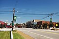
Downtown Ardmore, AL

Ardmore Town Hall

Ardmore Airport

Saturn 1B Rocket at AL Welcome Center, Ardmore

Saturn 1B Rocket at AL Welcome Center, Ardmore

Saturn 1B Rocket at AL Welcome Center, Ardmore


References[]
Notes[]
- ^ Note about colors: With the exception of Hispanic, Pacific Islander, Other, and 2 or More Races, the colors depicted refer to those historically ascribed to them (White (White/No background); Black (Brown); Native American (Red); Asian (Yellow)) and are there to be easily identified on said chart. No racism or malice of intent is meant to be implied by their usage.
- ^ 1st year Ardmore reported on census
- ^ (-)Indicates no immediate prior population figure or rank
- ^ Racial demographics not reported for places of less than 1,000 on the 1930-70 censuses.
- ^ X Indicates no change in rank
- ^ Tied for 260th place with Pine Hill
- ^ With addition of "Hispanic" to census, which could also be a person of any race, both population totals and percentages will add up to more than the total population.
- ^ From 1980 onwards, White population only reported on chart as "Non-Hispanic White/One Race", which will be less than the overall White population that would also include White Hispanics, which would be counted under Hispanic exclusively.
- ^ Lost 2nd place to Madison & Huntsville (3rd), both of which have annexed from the adjacent Madison County. Ardmore, however, remains 2nd largest place wholly within Limestone County.
References[]
- ^ Kaetz, James P., "Ardmore", Encyclopedia of Alabama, retrieved 2018-10-14
- ^ "2020 U.S. Gazetteer Files". United States Census Bureau. Retrieved October 29, 2021.
- ^ Hughes, Bayne (April 6, 2014). "Iconic rocket due for repair". The Decatur Daily. Retrieved April 8, 2014.
- ^ Foscue, Virginia. Place Names in Alabama. University: U of Alabama Press, 1989.
- ^ "US Gazetteer files: 2010, 2000, and 1990". United States Census Bureau. 2011-02-12. Retrieved 2011-04-23.
- ^ "EXTREME SETTLEMENTS: A COMPREHENSIVE LIST". Weekend Roady. 2013-05-02. Retrieved 2014-08-20.
- ^ "U.S. Decennial Census". Census.gov. Retrieved June 6, 2013.
- ^ a b http://www2.census.gov/prod2/decennial/documents/03815512v1ch02.pdf, 1930 AL Census
- ^ "U.S. Census website". United States Census Bureau. Retrieved 2008-01-31.
- ^ "U.S. Census website". United States Census Bureau. Retrieved 2015-08-01.
- ^ "Explore Census Data". data.census.gov. Retrieved 2021-12-16.
- ^ http://www2.census.gov/prod2/decennial/documents/33973538v1ch03.pdf, 1940 AL Census
- ^ http://www2.census.gov/prod2/decennial/documents/23761117v1ch04.pdf, 1950 AL Census
- ^ http://www2.census.gov/prod2/decennial/documents/37721510v1p2ch2.pdf, 1960 AL Census
- ^ http://www2.census.gov/prod2/decennial/documents/1970a_al-01.pdf, 1970 AL Census
- ^ http://www2.census.gov/prod2/decennial/documents/1980a_alABC-01.pdf, 1980 AL Census
- ^ http://www.census.gov/prod/cen1990/cph5/cph-5-2.pdf, 1990 AL Census
- ^ http://www.census.gov/prod/cen2000/phc-1-2.pdf, 2000 AL Census
- ^ http://www.census.gov/prod/cen2010/cph-1-2.pdf, 2010 AL Census
- ^ https://www.niche.com/k12/ardmore-high-school-ardmore-al/, Ardmore High School Niche
- ^ https://www.ardmorehigh.org/about, Ardmore High, About
- ^ "Old Crow has the ideal medicine for a bad case of glitz: great music". Huntsville Times. 2009-09-17. Archived from the original on 2011-06-09. Retrieved 2009-09-17.
External links[]
 Media related to Ardmore, Alabama at Wikimedia Commons
Coordinates: 34°59′13″N 86°50′36″W / 34.987052°N 86.843228°W
Municipalities and communities of Limestone County, Alabama, United States | ||
|---|---|---|
| Cities |  | |
| Towns | ||
| Unincorporated communities | ||
| Footnotes | ‡This populated place also has portions in an adjacent county or counties | |
| ||
| Authority control |
|
|---|
- 1922 establishments in Alabama
- Towns in Limestone County, Alabama
- Towns in Alabama
- Huntsville-Decatur-Albertville, AL Combined Statistical Area