Atmore, Alabama
Atmore | |
|---|---|
 Former Atmore Amtrak station | |
 Location of Atmore in Escambia County, Alabama. | |
 Atmore Location of Atmore in Alabama | |
| Coordinates: 31°1′23″N 87°29′31″W / 31.02306°N 87.49194°W | |
| Country | United States |
| State | Alabama |
| County | Escambia |
| Area | |
| • Total | 21.94 sq mi (56.82 km2) |
| • Land | 21.86 sq mi (56.62 km2) |
| • Water | 0.07 sq mi (0.20 km2) |
| Elevation | 282 ft (86 m) |
| Population (2010) | |
| • Total | 10,194 |
| • Estimate (2019)[1] | 9,107 |
| • Density | 416.57/sq mi (160.84/km2) |
| Time zone | UTC-6 (Central (CST)) |
| • Summer (DST) | UTC-5 (CDT) |
| ZIP code | 36502-36504 |
| Area code(s) | 251 |
| FIPS code | 01-03004 |
| GNIS feature ID | 0113272 |
| Website | cityofatmore |


Atmore is a city in Escambia County, Alabama, United States. It incorporated in 1907.[3] As of the 2010 census it had a population of 10,194,[4] with an estimated population of 9,107 in 2019.[1] Atmore is in the planning stages to increase its economic base with additions in its new Rivercane development along the I-65 corridor.
Atmore has completed requirements to be recognized as an Alabama Community of Excellence at the upcoming Alabama League of Municipalities Convention. City officials are also working with the Alabama Historical Commission to have the downtown district listed on the National Register of Historic Places.[5]
On May 23, 2007, Atmore celebrated its centenary.
The federally recognized Poarch Band of Creek Indians is headquartered in Atmore.
History[]
Atmore was first recorded as a stop (Williams Station)[6] on the Mobile and Great Northern Railroad. The town was named after C.P. Atmore, General Passenger Agent of the Louisville and Nashville Railroad, who was a friend of Mr. Carney, who owned a sawmill in town and was a prominent citizen. The town was originally going to be named "Carney", but Mr. Carney had a brother who had already established a town and named it Carney nearby. The town then decided to let Mr. Carney name the town. He named it after his close friend Mr. Atmore, who never visited Atmore.[7]
Geography[]
Atmore is located in western Escambia County at 31°1′23″N 87°29′31″W / 31.02306°N 87.49194°W (31.023183, -87.492067).[8] Its southern border is the Florida state line. The center of town is at the intersection of U.S. Route 31 and Alabama State Route 21, while a new section of the city has been incorporated 6 miles (10 km) to the north around Exit 57 of Interstate 65. US 31 leads southwest 20 miles (32 km) to Bay Minette and east 28 miles (45 km) to Brewton. Mobile is 51 miles (82 km) to the southwest via US 31 and I-65, while Pensacola, Florida, is 49 miles (79 km) south via AL 21, Florida State Road 97, and U.S. Route 29.
According to the U.S. Census Bureau, Atmore has a total area of 21.9 square miles (56.8 km2), of which 21.9 square miles (56.6 km2) is land and 0.077 square miles (0.2 km2), or 0.34%, is water.[4]
Demographics[]
| Historical population | |||
|---|---|---|---|
| Census | Pop. | %± | |
| 1910 | 1,060 | — | |
| 1920 | 1,775 | 67.5% | |
| 1930 | 3,035 | 71.0% | |
| 1940 | 3,200 | 5.4% | |
| 1950 | 5,720 | 78.8% | |
| 1960 | 8,173 | 42.9% | |
| 1970 | 8,293 | 1.5% | |
| 1980 | 8,789 | 6.0% | |
| 1990 | 8,046 | −8.5% | |
| 2000 | 7,676 | −4.6% | |
| 2010 | 10,194 | 32.8% | |
| 2019 (est.) | 9,107 | [1] | −10.7% |
| U.S. Decennial Census[9] | |||
Atmore first appeared on the 1910 U.S. Census as an incorporated town.[10] By 1930, it became the largest city in Escambia County, though lost the title to former holder Brewton in 1940. It became the largest city again in 1950 and has held the distinction to date (2010). In 2010, the city became majority Black for the first time.[11]
2010 census[]
As of the census of 2010, the population density was 1228 people per square mile (469.8/km2). There were 3,480 housing units at an average density of 419.3 per square mile (160.4/km2). The racial makeup of the city was 55.4% Black or African American, 39.3% White, 1.8% Native American, 0.3% Asian, 0.1% Pacific Islander, 0.1% from other races, and 1.3% from two or more races. 1.8% of the population were Hispanic or Latino of any race.[12][13]
There were 3,002 households, out of which 26.1% had children under the age of 18 living with them, 34.9% were married couples living together, 23.1% had a female householder with no husband present, and 37.1% were non-families. 33.4% of all households were made up of individuals, and 14.4% had someone living alone who was 65 years of age or older. The average household size was 2.43 and the average family size was 3.09.
In the city, the population was spread out, with 18.6% under the age of 18, 9.1% from 18 to 24, 34.5% from 25 to 44, 24.9% from 45 to 64, and 12.9% who were 65 years of age or older. The median age was 37.4 years. For every 100 females, there were 155.5 males. For every 100 females age 18 and over, there were 207.4 males.
2000 Census data[]
As of the census of 2000, the population density was 922.5 people per square mile (356.2/km2). There were 3,535 housing units at an average density of 424.9 per square mile (164.0/km2). The racial makeup of the city was 49.48% White, 46.31% Black or African American, 2.41% Native American, 0.47% Asian, 0.05% Pacific Islander, 0.36% from other races, and 0.91% from two or more races. 0.73% of the population were Hispanic or Latino of any race.[12]
There were 3,148 households, out of which 29.3% had children under the age of 18 living with them, 42.1% were married couples living together, 20.0% had a female householder with no husband present, and 34.2% were non-families. 30.8% of all households were made up of individuals, and 13.7% had someone living alone who was 65 years of age or older. The average household size was 2.40 and the average family size was 3.01.[12]
In the city, the population was spread out, with 26.4% under the age of 18, 9.0% from 18 to 24, 24.9% from 25 to 44, 22.6% from 45 to 64, and 17.0% who were 65 years of age or older. The median age was 37 years. For every 100 females, there were 79.1 males. For every 100 females age 18 and over, there were 74.7 males.[12]
Atmore Census Division (1960-)[]
| Historical population | |||
|---|---|---|---|
| Census | Pop. | %± | |
| 1960 | 12,373 | — | |
| 1970 | 12,221 | −1.2% | |
| 1980 | 13,672 | 11.9% | |
| 1990 | 12,645 | −7.5% | |
| 2000 | 12,980 | 2.6% | |
| 2010 | 12,372 | −4.7% | |
| U.S. Decennial Census[14] | |||
Atmore was created a census division in 1960 following the general reorganization of county precincts.[15] Prior to 1960, Atmore was within the former Escambia County 7th precinct of Canoe.[16]
Education[]
Atmore is home to various local schools within the Escambia County Public School System, including: Rachel Patterson Elementary School, Escambia County Middle School (the largest school in the system), and Escambia County High School (the first public county high school in the state of Alabama). It is also home to Escambia Academy and Atmore Christian School, as well as several other private schools and colleges including Reid state. Prior to 1970, African-American children were not allowed to attend schools with white children, and attended black schools such as the Escambia County Training School in Atmore.
Atmore is home to an adjunct campus of Coastal Alabama Community College Brewton based in Brewton, which offers associate degrees and technical school training.
Government and infrastructure[]
Atmore is governed by a mayor and members of a city council elected from five districts within the city.[5]
The Holman Correctional Facility, a prison of the Alabama Department of Corrections (ADOC), is within the city limits 9 miles (14 km) north of the center of Atmore.[17][18] Holman has a male death row and the State of Alabama execution chamber.[18] In addition Fountain Correctional Facility is 10 miles (16 km) north of Atmore, in a formerly unincorporated area that is now within the city limits.[19]
Atmore is close by Interstate 65. US Highway 31 and State Highway 21 pass through the center of the city. It is also home for major coast-to-coast freight haulers, including the Alabama and Gulf Coast Railway and CSX. In addition, Atmore has a municipal airport.[5]
Local economy[]
For most of the 20th century, the Atmore area was primarily a farming, timber, and light industry community. Major commercial industries have been Masland Carpets, Alto, and a local lumber company. For many years, the Vanity Fair lingerie company operated a manufacturing sewing plant in Atmore, offering employment to local citizens and surrounding communities.
With federal recognition and the founding of gaming casinos, the Poarch Band of Creek Indians near Exit 54 on I-65, 6 miles (10 km) northwest of the center of Atmore, has increased its relative economic contributions to the region. The tribe operates the Wind Creek Casino and Hotel, which provides for tourism and conferences, adjacent to I-65 Exit 57.[20] Wind Creek is one of just a few four-diamond hotels in the state.[21]
Health care and recreation[]
Atmore Community Hospital, an affiliate of Infirmary Health Systems of Mobile, offers full acute care in a two-story facility.[5]
Atmore has several recreational and sports facilities, including Atmore Heritage Park and Claude D. Kelley State Park.[22]
Local events[]
Mayfest — On the first Saturday in May at Tom Byrne Park, Atmore celebrates Mayfest with sports events, arts and crafts and a variety of food. There are many different forms of entertainment, including a Beautiful Baby Contest and a Pooch Parade.[23]
Old-Time Fiddlers' Convention — Musicians from across the state come to Atmore the third Saturday in July to compete for prizes in the fiddle, guitar, banjo, mandolin, and bands and vocals division.[24]
A Taste of the South — Held annually at Heritage Park in September, A Taste of the South is an evening of entertainment and local food from the area's best cooks.[25]
Williams Station Day — Held the fourth Saturday of October, Williams Station Day celebrates Atmore's history beginning in 1866 as Williams Station. The event includes an arts and crafts show, an old time fiddlers' tent, professional entertainment, a model train show, and sugar cane mill.[26]
Poarch Creek Indian Pow-wow — The local Poarch Creek Indians host an authentic Thanksgiving annually. Visitors enjoy turkey, dressing, and roasted corn as dancers from many tribes gather to compete. Over 100 booths display arts and crafts, quilts and other keepsakes of the Creek Indian culture.[27]
Notable people[]
- Paul Birch, actor and the original "Marlboro Man",[28] born in Atmore
- Bobby Brantley, 13th lieutenant governor of Florida
- Paul Crawford, jazz musician, music historian, and music arranger
- Glenn L. Emmons, commissioner of the Bureau of Indian Affairs from 1953 to 1961, native of Atmore[29]
- Evander Holyfield, four-time world heavyweight boxing champion, born in Atmore
- William C. Maxwell, namesake of Maxwell Air Force Base
- Don McNeal, star defensive back for Alabama and the Miami Dolphins, born and raised in Atmore
- Ron Middleton, former Auburn University and NFL tight end
- Michael Williams, NFL player
Climate[]
Climate is characterized by mild to high temperatures and evenly distributed precipitation throughout the year. The Köppen Climate Classification sub-type for this climate is "Cfa" (Humid Subtropical Climate).[30]
| hideClimate data for Atmore, Alabama | |||||||||||||
|---|---|---|---|---|---|---|---|---|---|---|---|---|---|
| Month | Jan | Feb | Mar | Apr | May | Jun | Jul | Aug | Sep | Oct | Nov | Dec | Year |
| Average high °C (°F) | 16 (61) |
18 (65) |
22 (71) |
26 (78) |
30 (86) |
32 (90) |
33 (91) |
33 (91) |
31 (87) |
27 (80) |
21 (70) |
17 (62) |
26 (78) |
| Average low °C (°F) | 4 (39) |
6 (42) |
8 (47) |
12 (54) |
17 (62) |
21 (69) |
22 (71) |
21 (70) |
19 (66) |
13 (55) |
8 (46) |
4 (40) |
13 (55) |
| Average precipitation mm (inches) | 140 (5.5) |
130 (5) |
170 (6.7) |
130 (5.2) |
120 (4.8) |
150 (5.8) |
190 (7.3) |
140 (5.7) |
130 (5) |
74 (2.9) |
120 (4.7) |
120 (4.8) |
1,610 (63.4) |
| Source: Weatherbase[31] | |||||||||||||
Photo Gallery[]

Main Street Atmore

Main Street Atmore
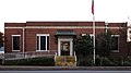
Atmore Post Office
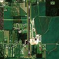
Atmore Municipal Airport

Atmore Library

Owen-Lufkin House
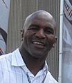
Evander Holyfield, Native Son of Atmore

Roadsigns in Atmore
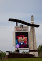
Wind Creek Casino sign, Atmore


References[]
- ^ Jump up to: a b c "Population and Housing Unit Estimates". Retrieved May 21, 2020.
- ^ "2019 U.S. Gazetteer Files". United States Census Bureau. Retrieved June 29, 2020.
- ^ "Atmore".
- ^ Jump up to: a b "Geographic Identifiers: 2010 Demographic Profile Data (G001): Atmore city, Alabama". American Factfinder. U.S. Census Bureau. Archived from the original on February 13, 2020. Retrieved January 21, 2016.
- ^ Jump up to: a b c d "City of Atmore.com".
- ^ Ettinger, Adrian B. "SiteFind, v. 3.0, CD and free online versions available". The Gold Bug. The Gold Bug.
- ^ C.P. ATMORE DROPS DEAD C.P. ATMORE (retrieved 16 August 2010)
- ^ "US Gazetteer files: 2010, 2000, and 1990". United States Census Bureau. 2011-02-12. Retrieved 2011-04-23.
- ^ "U.S. Decennial Census". Census.gov. Retrieved June 6, 2013.
- ^ http://www2.census.gov/prod2/decennial/documents/41033935v1-8ch1.pdf, 1910 AL Census
- ^ http://www.census.gov/prod/cen2010/cph-1-2.pdf, 2010 AL Census
- ^ Jump up to: a b c d "Data.com".
- ^ "Racial Makeup". Archived from the original on 2020-02-13. Retrieved 2017-08-30.
- ^ "U.S. Decennial Census". Census.gov. Retrieved June 6, 2013.
- ^ http://www2.census.gov/prod2/decennial/documents/37721510v1p2ch2.pdf, 1960 AL Census
- ^ http://www2.census.gov/prod2/decennial/documents/23761117v1ch04.pdf, 1950 AL Census
- ^ "Holman Correctional Facility Archived 2010-08-08 at the Wayback Machine." Alabama Department of Corrections. Retrieved on August 15, 2010.
- ^ Jump up to: a b "Annual Report Fiscal Year 2003." Alabama Department of Corrections. 33/84. Retrieved on August 15, 2010.
- ^ "Fountain / JO Davis Correctional Facility Archived 2011-06-16 at the Wayback Machine." Alabama Department of Corrections. Retrieved on July 4, 2011.
- ^ Alabama Casinos. 500 Nations. (retrieved 23 February 2009)
- ^ "Wind Creek Casino".
- ^ "City of Atmore.com".
- ^ "Cities and Towns". Sweet Home Alabama. Archived from the original on 28 May 2012. Retrieved 11 April 2012.
- ^ "Sweet Home Alabama". Retrieved 11 April 2012.
- ^ "Festival and Event Calendar". Retrieved 27 May 2013.
- ^ "Williams Station Day, 21st Annual". Alabama Department Tourism. Retrieved 11 April 2012.
- ^ "al.com". 19 November 2011. Retrieved 11 April 2012.
- ^ "Paul Birch".
- ^ The New York Times. "Indian Director Sworn In: Glenn L. Emmons Takes Office Succeeding Dillon S. Myer." August 11, 1953.
- ^ Climate Summary for Atmore, Alabama
- ^ "Weatherbase.com". Weatherbase. 2013. Retrieved on August 4, 2013.
External links[]
| Wikimedia Commons has media related to Atmore, Alabama. |
Coordinates: 31°01′23″N 87°29′31″W / 31.023183°N 87.492067°W
| show Municipalities and communities of Escambia County, Alabama, United States |
|---|

| show Authority control |
|---|
- Cities in Alabama
- Cities in Escambia County, Alabama
- 1907 establishments in Alabama
- Populated places established in 1907