Avon, North Carolina
Avon, North Carolina | |
|---|---|
 Sunset over the northern outskirts of Avon | |
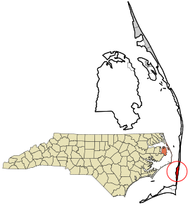 Location in Dare County and the state of North Carolina | |
| Coordinates: 35°21′7″N 75°30′39″W / 35.35194°N 75.51083°WCoordinates: 35°21′7″N 75°30′39″W / 35.35194°N 75.51083°W | |
| Country | United States |
| State | North Carolina |
| County | Dare |
| Named for | River Avon |
| Area | |
| • Total | 2.41 sq mi (6.24 km2) |
| • Land | 2.36 sq mi (6.10 km2) |
| • Water | 0.05 sq mi (0.14 km2) |
| Elevation | 20 ft (6 m) |
| Population (2010) | |
| • Total | 776 |
| • Density | 329/sq mi (127.2/km2) |
| Time zone | UTC-5 (Eastern (EST)) |
| • Summer (DST) | UTC-4 (EDT) |
| ZIP code | 27915 |
| Area code(s) | 252 |
| FIPS code | 37-02780[1] |
| GNIS feature ID | 1018881[2] |

Avon is an unincorporated community and census-designated place (CDP) in Dare County in the U.S. state of North Carolina. As of the 2010 census, it had a permanent population of 776.[1]
Geography[]
Avon is located on the North Carolina Outer Banks at latitude 35°21'7" North, longitude 75°30'39" West. The village is south of Salvo and north of Buxton on Hatteras Island. The United States Postal Service has assigned Avon the ZIP Code 27915.
According to the U.S. Census Bureau, the Avon CDP has a total area of 2.41 square miles (6.24 km2), of which 2.36 square miles (6.10 km2) is land and 0.05 square miles (0.14 km2), or 2.27%, is water. Avon is bordered to the east by the Atlantic Ocean and to the west by Pamlico Sound.
History[]
Historically named "Kinnakeet", the village was renamed "Avon" by the U.S. Postal Service when a post office was established there in 1883.[3] The U.S. Life-Saving Service constructed the Little Kinnakeet in 1874, remaining active, under the Coast Guard from 1915, until decommissioned in 1954. The building is now part of the Cape Hatteras National Seashore.[4]
Government[]
The residents of Avon are governed by the Dare County Board of Commissioners. Avon is part of District 4, along with Buxton, Frisco, Hatteras, Rodanthe, Waves and Salvo.
Climate[]
According to the Trewartha climate classification system, Avon, North Carolina has a humid subtropical climate with hot and humid summers, cool winters and year-around precipitation (Cfak). Cfak climates are characterized by all months having an average mean temperature > 32.0 °F (> 0.0 °C), at least eight months with an average mean temperature ≥ 50.0 °F (≥ 10.0 °C), at least one month with an average mean temperature ≥ 71.6 °F (≥ 22.0 °C) and no significant precipitation difference between seasons. During the summer months in Avon, a cooling afternoon sea breeze is present on most days, but episodes of extreme heat and humidity can occur with heat index values ≥ 100 °F (≥ 38 °C). Avon is prone to hurricane strikes, particularly during the Atlantic hurricane season which extends from June 1 through November 30, sharply peaking from late August through September. During the winter months, episodes of cold and wind can occur with wind chill values < 15 °F (< -9 °C). The plant hardiness zone in Avon is 8b with an average annual extreme minimum air temperature of 18.5 °F (-7.5 °C).[5] The average seasonal (Dec-Mar) snowfall total is < 2 inches (< 5 cm), and the average annual peak in nor'easter activity is in February.
| hideClimate data for Avon, NC (1981-2010 Averages) | |||||||||||||
|---|---|---|---|---|---|---|---|---|---|---|---|---|---|
| Month | Jan | Feb | Mar | Apr | May | Jun | Jul | Aug | Sep | Oct | Nov | Dec | Year |
| Average high °F (°C) | 52.8 (11.6) |
54.3 (12.4) |
59.1 (15.1) |
66.5 (19.2) |
73.5 (23.1) |
80.7 (27.1) |
84.3 (29.1) |
84.0 (28.9) |
80.2 (26.8) |
72.3 (22.4) |
64.5 (18.1) |
56.7 (13.7) |
69.1 (20.6) |
| Daily mean °F (°C) | 46.0 (7.8) |
47.4 (8.6) |
52.2 (11.2) |
59.9 (15.5) |
67.4 (19.7) |
75.4 (24.1) |
79.3 (26.3) |
78.9 (26.1) |
75.0 (23.9) |
66.6 (19.2) |
58.3 (14.6) |
50.1 (10.1) |
63.1 (17.3) |
| Average low °F (°C) | 39.2 (4.0) |
40.5 (4.7) |
45.3 (7.4) |
53.2 (11.8) |
61.3 (16.3) |
70.1 (21.2) |
74.3 (23.5) |
73.8 (23.2) |
69.9 (21.1) |
60.9 (16.1) |
52.2 (11.2) |
43.5 (6.4) |
57.1 (13.9) |
| Average precipitation inches (mm) | 5.00 (127) |
3.85 (98) |
4.53 (115) |
3.72 (94) |
3.65 (93) |
4.03 (102) |
4.94 (125) |
6.65 (169) |
6.13 (156) |
4.93 (125) |
4.64 (118) |
4.09 (104) |
56.16 (1,426) |
| Average relative humidity (%) | 71.5 | 71.1 | 69.7 | 70.3 | 73.4 | 77.0 | 79.2 | 77.3 | 75.2 | 71.5 | 73.0 | 71.7 | 73.4 |
| Average dew point °F (°C) | 37.3 (2.9) |
38.5 (3.6) |
42.6 (5.9) |
50.2 (10.1) |
58.6 (14.8) |
67.7 (19.8) |
72.3 (22.4) |
71.2 (21.8) |
66.6 (19.2) |
57.1 (13.9) |
49.7 (9.8) |
41.3 (5.2) |
54.5 (12.5) |
| Source: PRISM[6] | |||||||||||||
| hideClimate data for Cape Hatteras, NC Ocean Water Temperature (11 S Avon) | |||||||||||||
|---|---|---|---|---|---|---|---|---|---|---|---|---|---|
| Month | Jan | Feb | Mar | Apr | May | Jun | Jul | Aug | Sep | Oct | Nov | Dec | Year |
| Daily mean °F (°C) | 49 (9) |
46 (8) |
52 (11) |
59 (15) |
68 (20) |
74 (23) |
78 (26) |
80 (27) |
77 (25) |
70 (21) |
58 (14) |
55 (13) |
64 (18) |
| Source: NOAA[7] | |||||||||||||
Ecology[]
According to the A. W. Kuchler U.S. potential natural vegetation types, Avon, North Carolina would have a dominant vegetation type of Live oak/Sea Oats Uniola paniculata (90) with a dominant vegetation form of Coastal Prairie (20).[8]
Education[]
Residents are zoned to Dare County Schools. Zoned schools are Cape Hatteras Elementary School and Cape Hatteras Secondary School.[9]
References[]
- ^ Jump up to: a b "Geographic Identifiers: 2010 Demographic Profile Data (G001): Avon CDP, North Carolina". U.S. Census Bureau, American Factfinder. Archived from the original on February 13, 2020. Retrieved November 24, 2015.
- ^ U.S. Geological Survey Geographic Names Information System: Avon, North Carolina
- ^ Avon, North Carolina History Archived March 28, 2006, at the Wayback Machine
- ^ Little Kinnakeet Lifesaving Station: Home to Unsung Heroes Archived May 3, 2006, at the Wayback Machine
- ^ "USDA Interactive Plant Hardiness Map". United States Department of Agriculture. Retrieved August 6, 2019.
- ^ "PRISM Climate Group, Oregon State University". Retrieved August 6, 2019.
- ^ "Water Temperature Table of All Coastal Regions". Archived from the original on September 5, 2017. Retrieved August 6, 2019.
- ^ "U.S. Potential Natural Vegetation, Original Kuchler Types, v2.0 (Spatially Adjusted to Correct Geometric Distortions)". Retrieved August 6, 2019.
- ^ "Attendance Zone Information". Dare County Schools. Retrieved 2021-04-12.
Cape Hatteras Elementary School -- All areas South of the Oregon Inlet Bridge[...]Cape Hatteras Secondary School -- All areas South of the Oregon Inlet Bridge
External links[]
| Wikimedia Commons has media related to Avon, North Carolina. |
| show Municipalities and communities of Dare County, North Carolina, United States |
|---|

- Populated places established in 1883
- Census-designated places in North Carolina
- Census-designated places in Dare County, North Carolina
- Beaches of North Carolina
- Hatteras Island
- Beaches of Dare County, North Carolina
- Populated coastal places in North Carolina